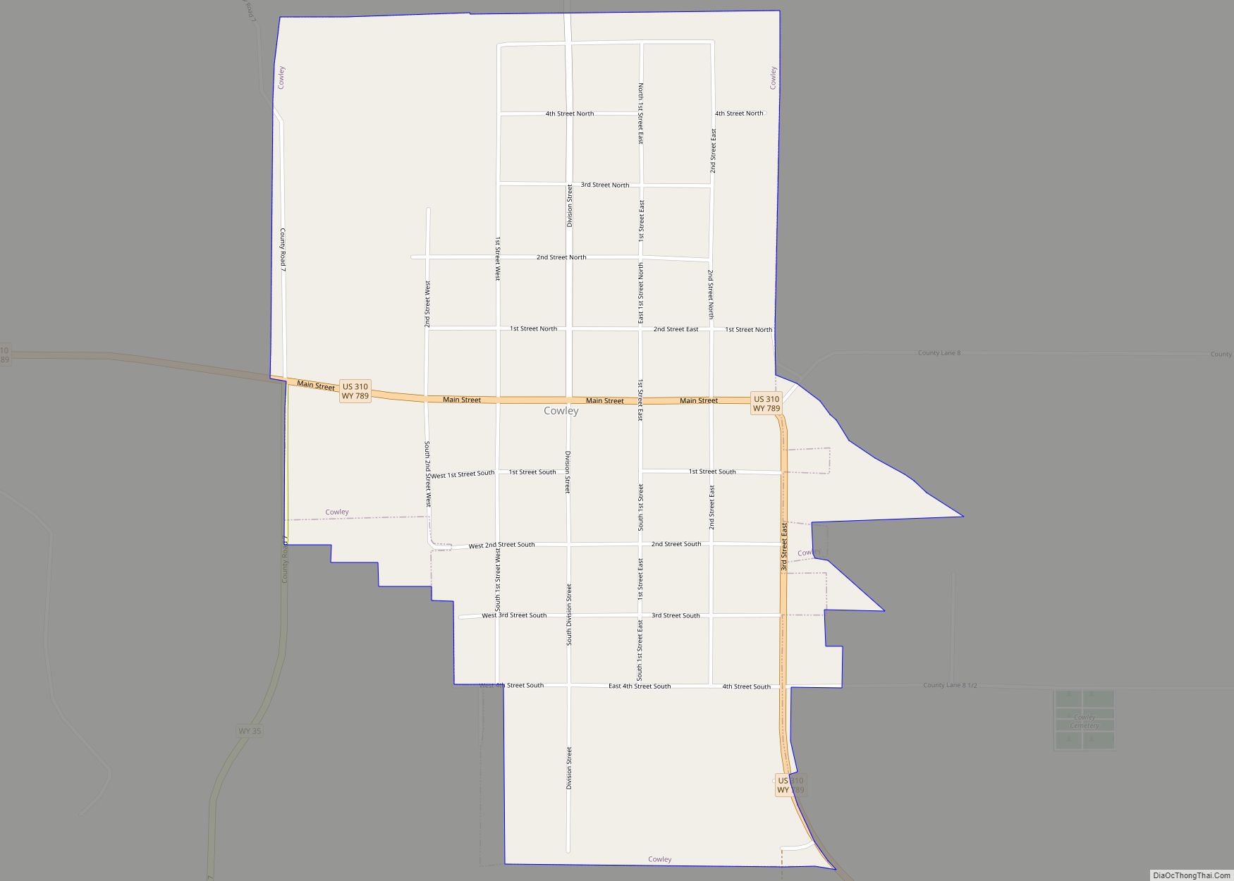
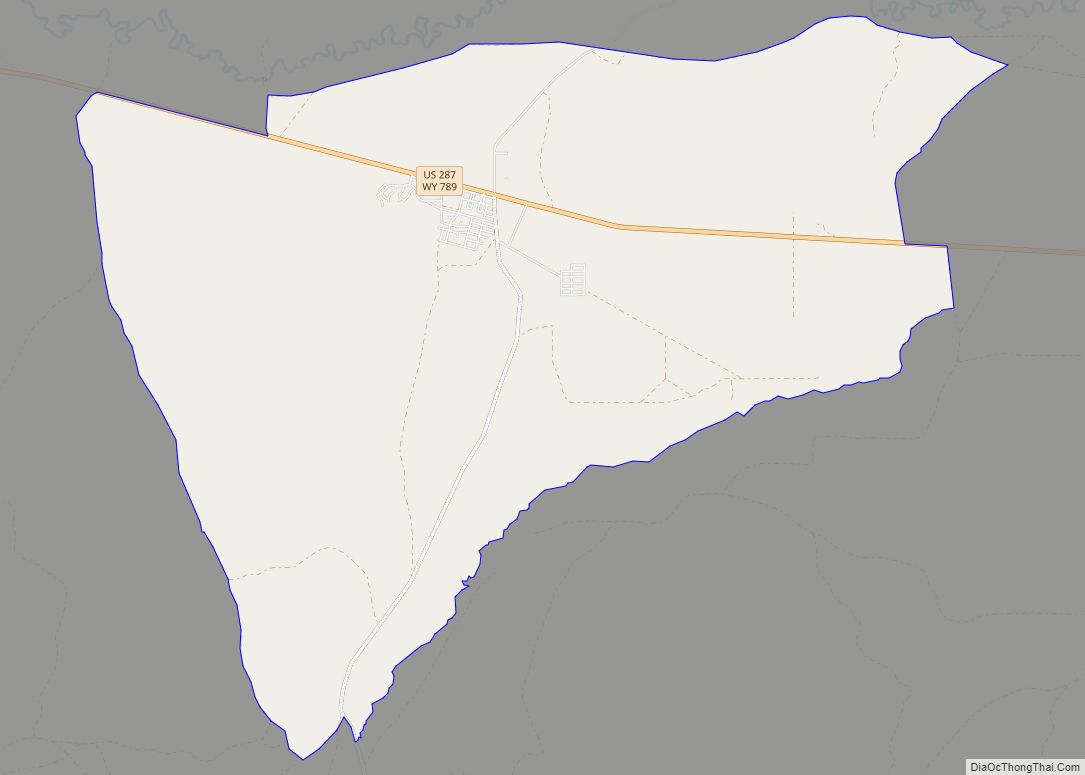
Map of Sundance town

Map of Sundance town

Sundance (Lakota: Owíwaŋyaŋg Wačhí; “Sun-watching Dance”) is a town in and the county seat of Crook County, Wyoming, United States. Its population was 1,032 at the 2020 census. The town is named after the Sun Dance ceremony practiced by several American Indian tribes. Sundance town overview: Name: Sundance town LSAD Code: 43 LSAD Description: town … Read more

Map of Wamsutter town

Map of Wamsutter town

Wamsutter is a town in Sweetwater County, Wyoming, United States. The population was 203 at the 2020 census. The original inhabitants of the area were the Shoshone and Ute tribes. Westerners only began to settle in the county with the coming of the railroad in the 1860s. Originally, the town was known as Washakie. Confusion … Read more

Map of Vista West CDP

Map of Vista West CDP

Vista West is a census-designated place (CDP) in Natrona County, Wyoming, United States. It is part of the Casper, Wyoming Metropolitan Statistical Area. The population was 951 at the 2010 census. Vista West CDP overview: Name: Vista West CDP LSAD Code: 57 LSAD Description: CDP (suffix) State: Wyoming County: Natrona County Total Area: 4.8 sq mi (12 km²) … Read more

Map of Veteran CDP

Map of Veteran CDP

Veteran is a census-designated place (CDP) located in Goshen County, Wyoming, United States. The population was 23 at the 2010 census. Veteran CDP overview: Name: Veteran CDP LSAD Code: 57 LSAD Description: CDP (suffix) State: Wyoming County: Goshen County Elevation: 4,239 ft (1,292 m) Total Area: 1.3 sq mi (3.5 km²) Land Area: 1.3 sq mi (3.5 km²) Water Area: 0.0 sq mi (0.0 km²) Total … Read more

Map of Van Tassell town

Map of Van Tassell town

Van Tassell is a town in Niobrara County, Wyoming, United States. The population was 15 at the 2010 census. It is the least populous town in the least populous county of the least populous state in the U.S. Van Tassell town overview: Name: Van Tassell town LSAD Code: 43 LSAD Description: town (suffix) State: Wyoming … Read more

Map of Urie CDP

Map of Urie CDP

Urie is a census-designated place in Uinta County, Wyoming, United States. The population was 262 at the 2010 census. The main roads that run through the community are Interstate 80 Business Loop and Wyoming Highway 414. Urie CDP overview: Name: Urie CDP LSAD Code: 57 LSAD Description: CDP (suffix) State: Wyoming County: Uinta County Elevation: … Read more

Map of Upton town, Wyoming

Map of Upton town, Wyoming

Upton is a town in Weston County, Wyoming, United States. The population was 898 at the 2020 census. The slogan of the town is: “The best town on earth”. Upton town overview: Name: Upton town LSAD Code: 43 LSAD Description: town (suffix) State: Wyoming County: Weston County Elevation: 4,239 ft (1,292 m) Total Area: 2.96 sq mi (7.68 km²) Land … Read more

Map of Turnerville CDP

Map of Turnerville CDP

Turnerville is a census-designated place (CDP) in Lincoln County, Wyoming, United States. The population was 192 at the 2010 census. Turnerville CDP overview: Name: Turnerville CDP LSAD Code: 57 LSAD Description: CDP (suffix) State: Wyoming County: Lincoln County Elevation: 6,407 ft (1,953 m) Total Area: 4.9 sq mi (13 km²) Land Area: 4.9 sq mi (13 km²) Water Area: 0.0 sq mi (0 km²) Total Population: … Read more

Map of Wright town, Wyoming

Map of Wright town, Wyoming

Wright is a town in Campbell County, Wyoming, United States. The population was 1,807 at the 2010 census. Wright town overview: Name: Wright town LSAD Code: 43 LSAD Description: town (suffix) State: Wyoming County: Campbell County Elevation: 5,122 ft (1,561 m) Total Area: 2.85 sq mi (7.39 km²) Land Area: 2.85 sq mi (7.39 km²) Water Area: 0.00 sq mi (0.00 km²) Total Population: 1,807 Population … Read more

Map of Torrington city, Wyoming

Map of Torrington city, Wyoming

Torrington is a city in, and the county seat of, Goshen County, Wyoming, United States. The population was 6,501 at the 2010 census. It is the home of Eastern Wyoming College, and is the surrounding region’s center of commercial activity. Within this primarily agricultural community, there are several fertilizer plants, a sugar beet factory, and … Read more

Map of Worland city

Map of Worland city

Worland is a city in Washakie County, Wyoming, United States. The population was 5,487 at the 2010 census. It is the county seat of Washakie County. It is located within the Big Horn Basin and along the Big Horn River in northwestern Wyoming. Worland city overview: Name: Worland city LSAD Code: 25 LSAD Description: city … Read more

Map of Thermopolis town

Map of Thermopolis town

Thermopolis is the county seat and largest town in Hot Springs County, Wyoming, United States. As of the 2020 U.S. Census, the town population was 2,725. Thermopolis is Greek for “hot city.” It is home to numerous natural hot springs, in which mineral-laden waters are heated by geothermal processes. The town is named for the … Read more