Map of Yoder town, Wyoming

Map of Yoder town, Wyoming

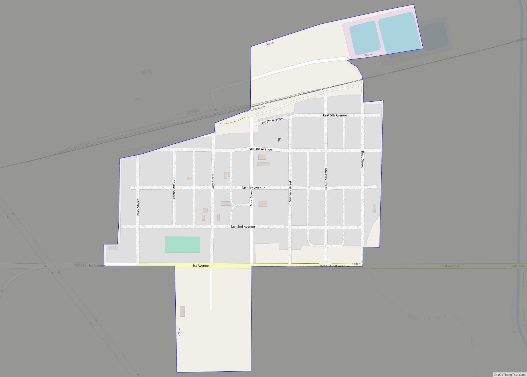
Yoder is a town in Goshen County, Wyoming, United States. The population was 151 at the 2010 census. Yoder town overview: Name: Yoder town LSAD Code: 43 LSAD Description: town (suffix) State: Wyoming County: Goshen County Elevation: 4,259 ft (1,298 m) Total Area: 0.21 sq mi (0.55 km²) Land Area: 0.21 sq mi (0.55 km²) Water Area: 0.00 sq mi (0.00 km²) Total Population: 151 Population … Read more

Map of Gillette city

Map of Gillette city

Gillette (/dʒɪˈlɛt/, jih-LET) is a city in and the county seat of Campbell County, Wyoming, United States. The town was founded in 1891 as a major railway town on the Chicago, Burlington and Quincy Railroad. The population was estimated at 32,030 as of July 1, 2019. Gillette’s population increased 48% in the ten years after … Read more

Map of Cheyenne city, Wyoming

Map of Cheyenne city, Wyoming

Cheyenne (/ʃaɪˈæn/ shy-AN or /ʃaɪˈɛn/ shy-EN) is the capital and most populous city of the U.S. state of Wyoming, as well as the county seat of Laramie County, with 65,132 residents, per the 2020 US Census. It is the principal city of the Cheyenne metropolitan statistical area which encompasses all of Laramie County and had … Read more

Map of Casper city

Map of Casper city

Casper is a city in, and the county seat of, Natrona County, Wyoming, United States. Casper is the second-largest city in the state, with the population at 59,038 as of the 2020 census. Only Cheyenne, the state capital, is larger. Casper is nicknamed “The Oil City” and has a long history of oil boomtown and … Read more

Map of Laramie city

Map of Laramie city

Laramie /ˈlærəmi/ is a city in and the county seat of Albany County, Wyoming, United States. The population was estimated 32,711 in 2019, making it the third-largest city in Wyoming after Cheyenne and Casper. Located on the Laramie River in southeastern Wyoming, the city is north west of Cheyenne, at the junction of Interstate 80 … Read more

Map of Alpine Northwest CDP

Map of Alpine Northwest CDP

Alpine Northwest is a census-designated place (CDP) in Lincoln County, Wyoming, United States. The population was 244 at the 2010 census. Alpine Northwest CDP overview: Name: Alpine Northwest CDP LSAD Code: 57 LSAD Description: CDP (suffix) State: Wyoming County: Lincoln County Total Area: 1.4 sq mi (3.7 km²) Land Area: 1.4 sq mi (3.7 km²) Water Area: 0.0 sq mi (0.0 km²) Total Population: … Read more

Map of Alpine Northeast CDP

Map of Alpine Northeast CDP

Alpine Northeast is a census-designated place in Lincoln County, Wyoming, United States. The population was 196 at the 2010 census. Alpine Northeast CDP overview: Name: Alpine Northeast CDP LSAD Code: 57 LSAD Description: CDP (suffix) State: Wyoming County: Lincoln County Total Area: 5.0 sq mi (13.1 km²) Land Area: 5.0 sq mi (13.1 km²) Water Area: 0.0 sq mi (0.0 km²) Total Population: 196 … Read more

Map of Alcova CDP

Map of Alcova CDP

Alcova is a census-designated place (CDP) in Natrona County, Wyoming, United States. It is part of the Casper, Wyoming Metropolitan Statistical Area. The population was 34 at the 2020 census. Wyoming’s center of population is located in the small Town of Alcova. Alcova and the nearby reservoir, Alcova Lake, are popular vacation spots with many … Read more

Map of Albin town

Map of Albin town

Albin is a town in Laramie County, Wyoming, United States. It is part of the Cheyenne Metropolitan Statistical Area. The population was 181 at the 2010 census. Albin town overview: Name: Albin town LSAD Code: 43 LSAD Description: town (suffix) State: Wyoming County: Laramie County Elevation: 5,338 ft (1,627 m) Total Area: 0.15 sq mi (0.38 km²) Land Area: 0.15 sq mi … Read more

Map of Albany CDP, Wyoming

Map of Albany CDP, Wyoming

Albany is a census-designated place (CDP) in Albany County, Wyoming, United States. The population was 55 at the 2010 census. Albany CDP overview: Name: Albany CDP LSAD Code: 57 LSAD Description: CDP (suffix) State: Wyoming County: Albany County Elevation: 8,327 ft (2,538 m) Total Area: 11.0 sq mi (28 km²) Land Area: 11.0 sq mi (28 km²) Water Area: 0 sq mi (0 km²) Total Population: … Read more

Map of Afton town, Wyoming

Map of Afton town, Wyoming

Afton is a town in Lincoln County, Wyoming, United States. The population was 1,911 at the 2010 census. Afton is home to the world’s largest arch made of elk antlers. Spanning 75 feet (23 m) across the four lanes of U.S. Highway 89, the arch consists of 3,011 elk antlers and weighs 15 tons. Afton town … Read more