Zambales, officially the Province of Zambales (Sambal: Probinsya nin Zambales; Ilocano: Probinsia ti Zambales; Pangasinan: Luyag/Probinsia na Zambales; Filipino: Lalawigan ng Zambales), is a province in the Philippines located in the Central Luzon region. Its capital is Iba, which is located in the middle of the province. Olongapo is the largest city of the province wherein it is geographically located but politically independent.
Zambales borders Pangasinan to the north and northeast, Tarlac to the east, Pampanga to the southeast, Bataan to the south and the South China Sea to the west. With a total land area of 3,830.83 square kilometres (1,479.09 sq mi) (including the independent city of Olongapo), Zambales is the second largest among the seven provinces of Central Luzon after Nueva Ecija. The province is noted for its mangoes, which are abundant from January to April.
Zambales does not have a functional airport; the closest functional airport is Clark International Airport in Angeles City in the neighbouring province of Pampanga. Subic Bay International Airport, which is located in Cubi Point (geographically located inside Morong, Bataan) in the Subic Bay Freeport Zone is no longer functional for domestic and international flights.
The Freeport Zone (SBFZ) is host to many tourist attractions which include casinos, parks, malls, beach-side huts, cottages and resorts, as well as historical sites.
| Type: | Province |
|---|---|
| Capital: | Iba |
| Area: | 3,645.83 km (1,407.66 sq mi) |
| Area Rank: | 35th out of 81 |
| Population: | 649,615 (excluding Olongapo City) 909,932 (including Olongapo City) |
| Population Rank: | 46th out of 81 |
| Density: | 0.83% |
| ISO 3166 code: | PH-ZMB |
| Website: | www.zambales.gov.ph |
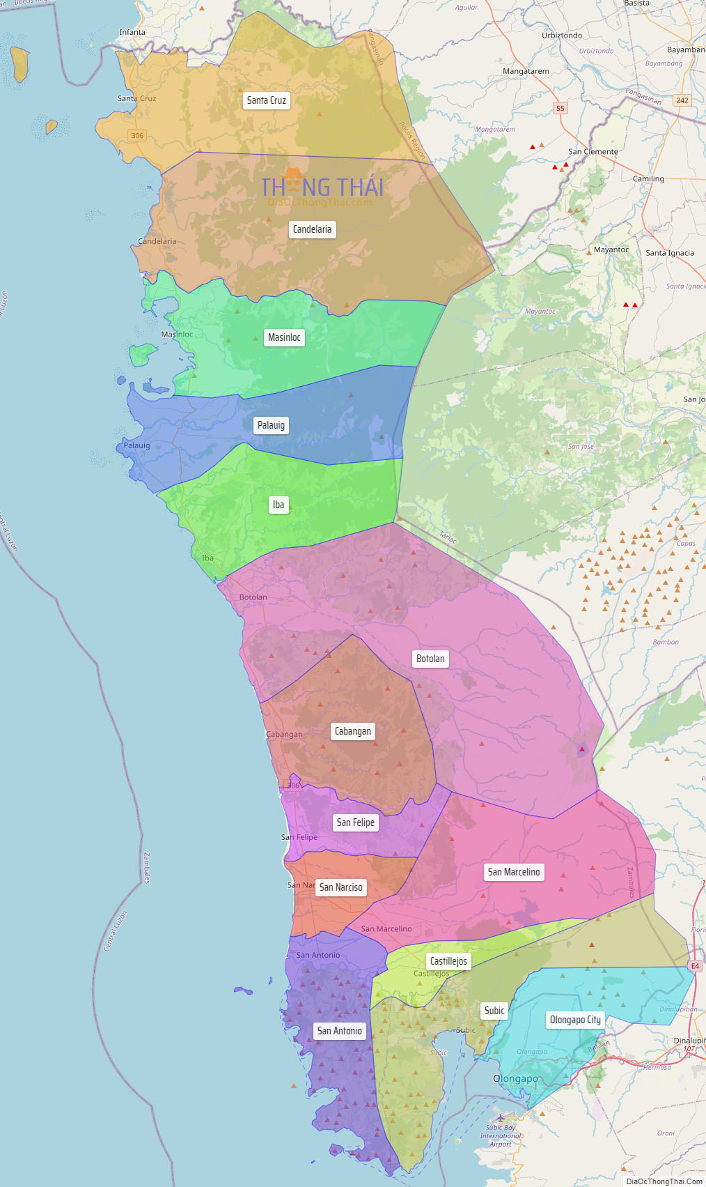
Online Interactive Map
Explore the interactive online map of Zambales, which highlights the administrative boundaries with each sub-administrative unit distinctly colored for easy identification. Just click on the map, and the name of the sub-unit will display, providing an intuitive and engaging way to navigate the area. Users can also view the map in full screen and switch between different map views, including OpenStreetMap, Google Maps, and satellite imagery.
Click on ![]() to view map in "full screen" mode.
to view map in "full screen" mode.
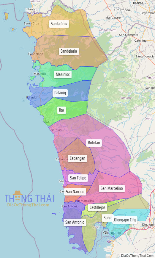
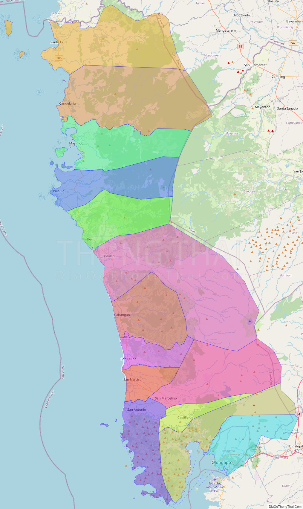
Zambales Political Map
Map of Zambales Province, Philippines the administrative divisions, provincial boundaries, along with detailed depictions of streets, roads, rivers, landmarks, and other geographical features.