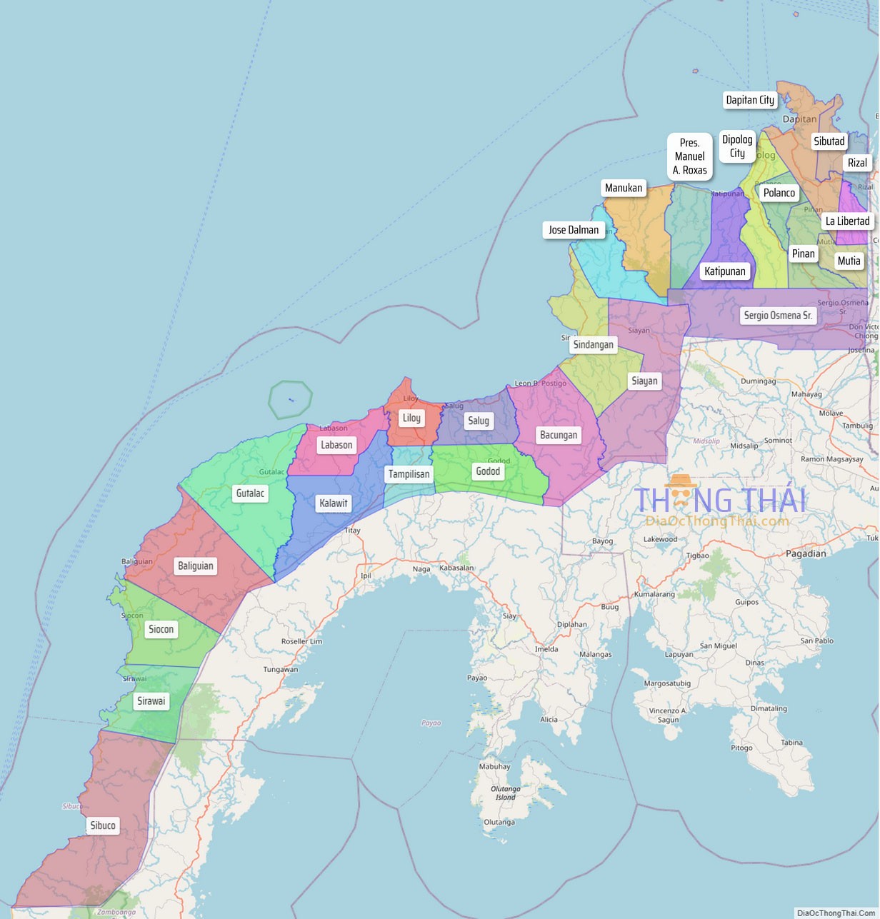
Zamboanga del Norte (Cebuano: Amihanang Zamboanga; Subanon: Utara Sembwangan; Filipino: Hilagang Zamboanga), officially the Province of Zamboanga del Norte, is a province in the Philippines situated within the Zamboanga Peninsula region in Mindanao. Its capital and largest city is Dipolog and the province borders Zamboanga del Sur and Zamboanga Sibugay to the south, Misamis Occidental to the east, and the Sulu Sea to the west.
Zamboanga del Norte is the largest province of the Zamboanga Peninsula region by land area covering 7,301.00 square kilometres (2,818.93 sq mi). Zamboanga del Norte is the 26th populous province in the Philippines.
| Type: | Province |
|---|---|
| Capital: | Dipolog |
| Area: | 7,301.00 km (2,818.93 sq mi) |
| Area Rank: | 9th out of 81 |
| Population: | 1,047,455 |
| Population Rank: | 27th out of 81 |
| Density: | 0.96% |
| ZIP code: | 7100–7124 |
| ISO 3166 code: | PH-ZAN |
| Website: | Province of Zamboanga del Norte Official Website |
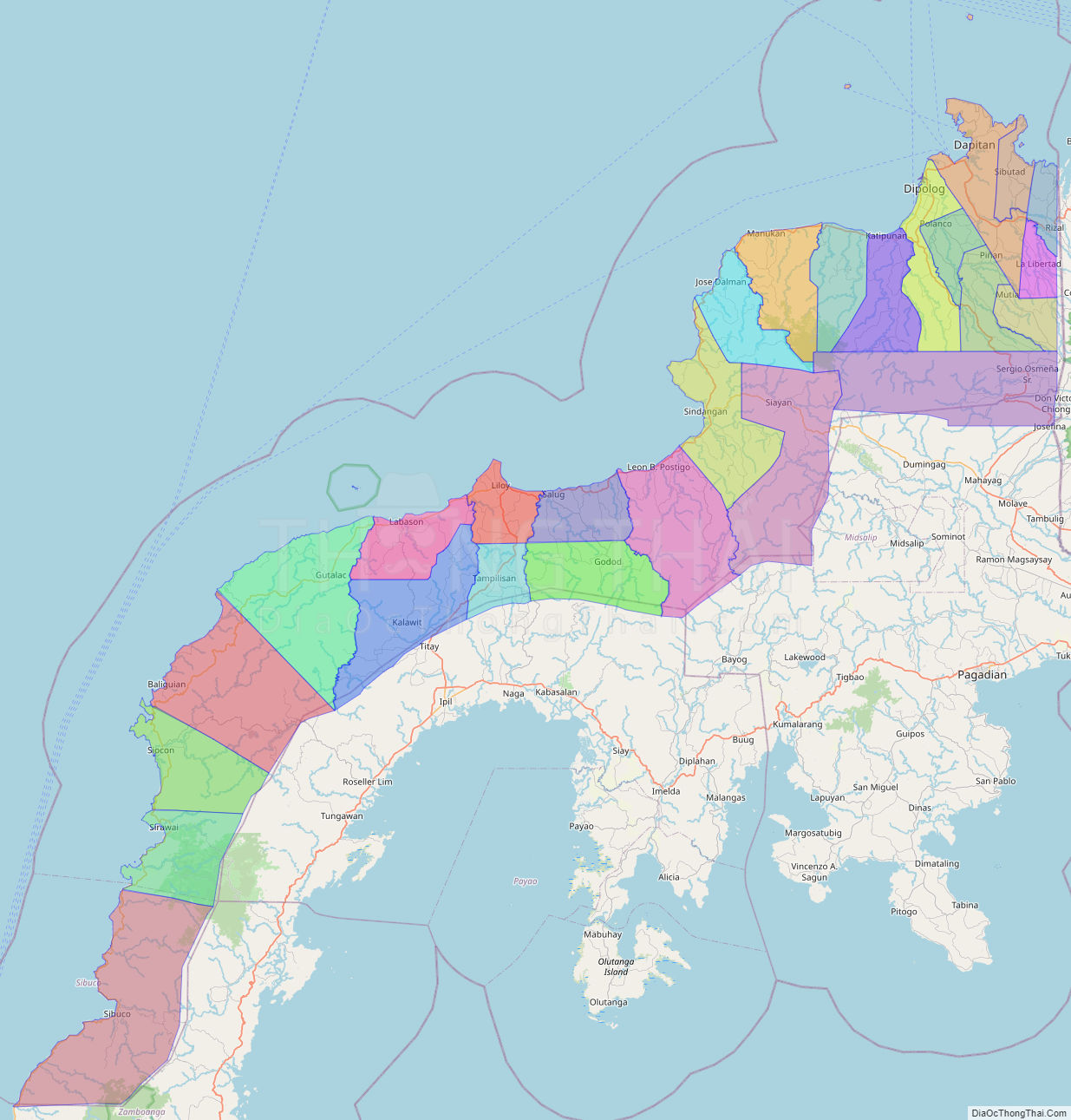
Online Interactive Map
Explore the interactive online map of Zamboanga del Norte, which highlights the administrative boundaries with each sub-administrative unit distinctly colored for easy identification. Just click on the map, and the name of the sub-unit will display, providing an intuitive and engaging way to navigate the area. Users can also view the map in full screen and switch between different map views, including OpenStreetMap, Google Maps, and satellite imagery.
Click on ![]() to view map in "full screen" mode.
to view map in "full screen" mode.
Zamboanga del Norte Political Map
Map of Zamboanga del Norte Province, Philippines the administrative divisions, provincial boundaries, along with detailed depictions of streets, roads, rivers, landmarks, and other geographical features.