Zamboanga del Sur (Cebuano: Habagatang Zamboanga; Subanen: S’helatan Sembwangan/Sembwangan dapit Shelatan; Maguindanaon: Salatan Sambuangan, Jawi: سلاتن سامبواڠن; Filipino: Katimugang Zamboanga), officially the Province of Zamboanga del Sur, is a province in the Philippines located in the Zamboanga Peninsula region in Mindanao. Its capital is the city of Pagadian.
Statistically grouped with Zamboanga del Sur is the highly urbanized City of Zamboanga, which is geographically separated and a chartered city and governed independently from the province and also its largest city.
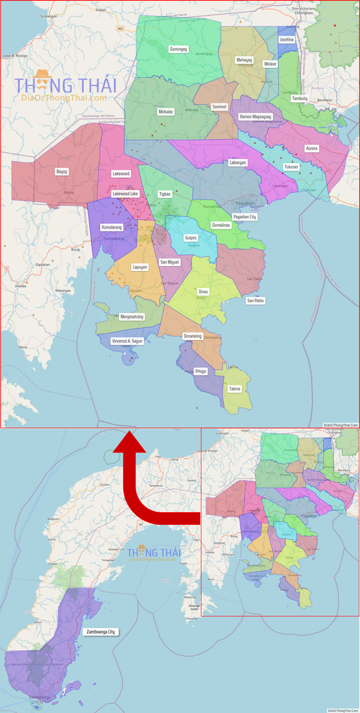
The province borders Zamboanga del Norte to the north, Zamboanga Sibugay to the west, Misamis Occidental to the northeast, and Lanao del Norte to the east. To the south is the Moro Gulf.
| Type: | Province |
|---|---|
| Capital: | Pagadian |
| Area: | 4,499.46 km (1,737.25 sq mi) |
| Area Rank: | 25th out of 81 |
| Population: | 1,050,668 |
| Population Rank: | 26th out of 81 |
| Density: | 1.86% |
| ZIP code: | 7000–7043 |
| ISO 3166 code: | PH-ZAS |
| Website: | www.zamboangadelsur.gov.ph |
Online Interactive Map
Explore the interactive online map of Zamboanga del Sur, which highlights the administrative boundaries with each sub-administrative unit distinctly colored for easy identification. Just click on the map, and the name of the sub-unit will display, providing an intuitive and engaging way to navigate the area. Users can also view the map in full screen and switch between different map views, including OpenStreetMap, Google Maps, and satellite imagery.
Click on ![]() to view map in "full screen" mode.
to view map in "full screen" mode.
Zamboanga del Sur Political Map
Map of Zamboanga del Sur Province, Philippines the administrative divisions, provincial boundaries, along with detailed depictions of streets, roads, rivers, landmarks, and other geographical features.