Zamboanga Sibugay, officially the Province of Zamboanga Sibugay (Cebuano: Lalawigan sa Zamboanga Sibugay; Filipino: Lalawigan ng Zamboanga Sibugay), is a province in the Philippines located in the Zamboanga Peninsula region in Mindanao. Its capital and largest town is Ipil and it borders Zamboanga del Norte to the north, Zamboanga del Sur to the east and Zamboanga City to the southwest. To the south lies Sibuguey Bay in the Moro Gulf.
Zamboanga Sibugay is the 79th province created in the Philippines, when its territories were carved out from the third district of Zamboanga del Sur in 2001.
| Type: | Province |
|---|---|
| Capital: | Ipil |
| Area: | 3,607.75 km (1,392.96 sq mi) |
| Area Rank: | 36th out of 81 |
| Population: | 669,840 |
| Population Rank: | 45th out of 81 |
| Density: | 0.61% |
| ZIP code: | 7001–7039 |
| ISO 3166 code: | PH-ZSI |
| Website: | www.sibugayprovince.com |
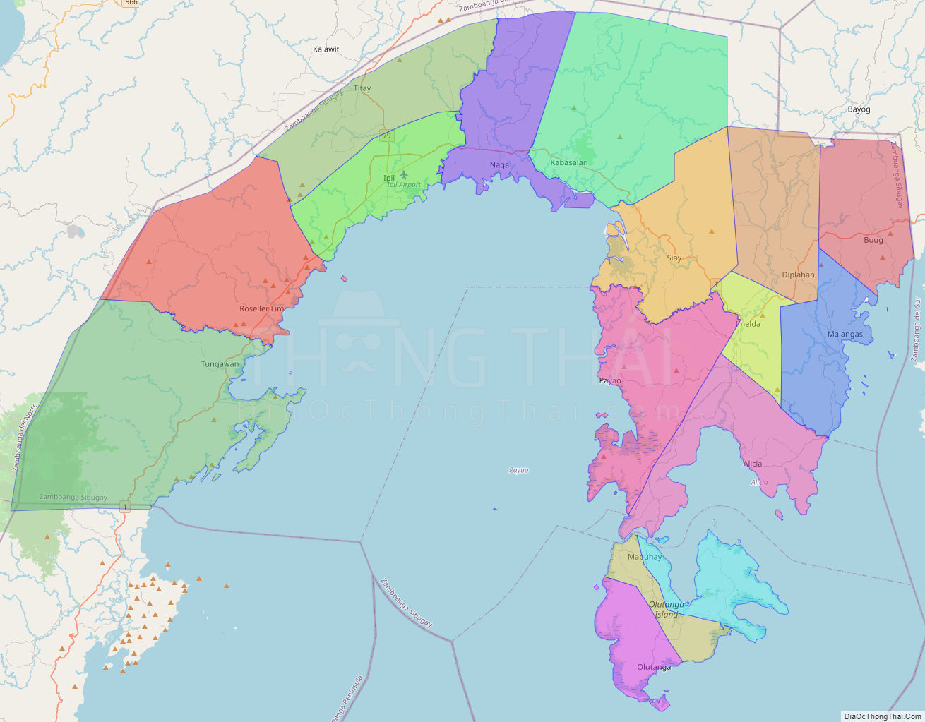
Online Interactive Map
Explore the interactive online map of Zamboanga Sibugay, which highlights the administrative boundaries with each sub-administrative unit distinctly colored for easy identification. Just click on the map, and the name of the sub-unit will display, providing an intuitive and engaging way to navigate the area. Users can also view the map in full screen and switch between different map views, including OpenStreetMap, Google Maps, and satellite imagery.
Click on ![]() to view map in "full screen" mode.
to view map in "full screen" mode.
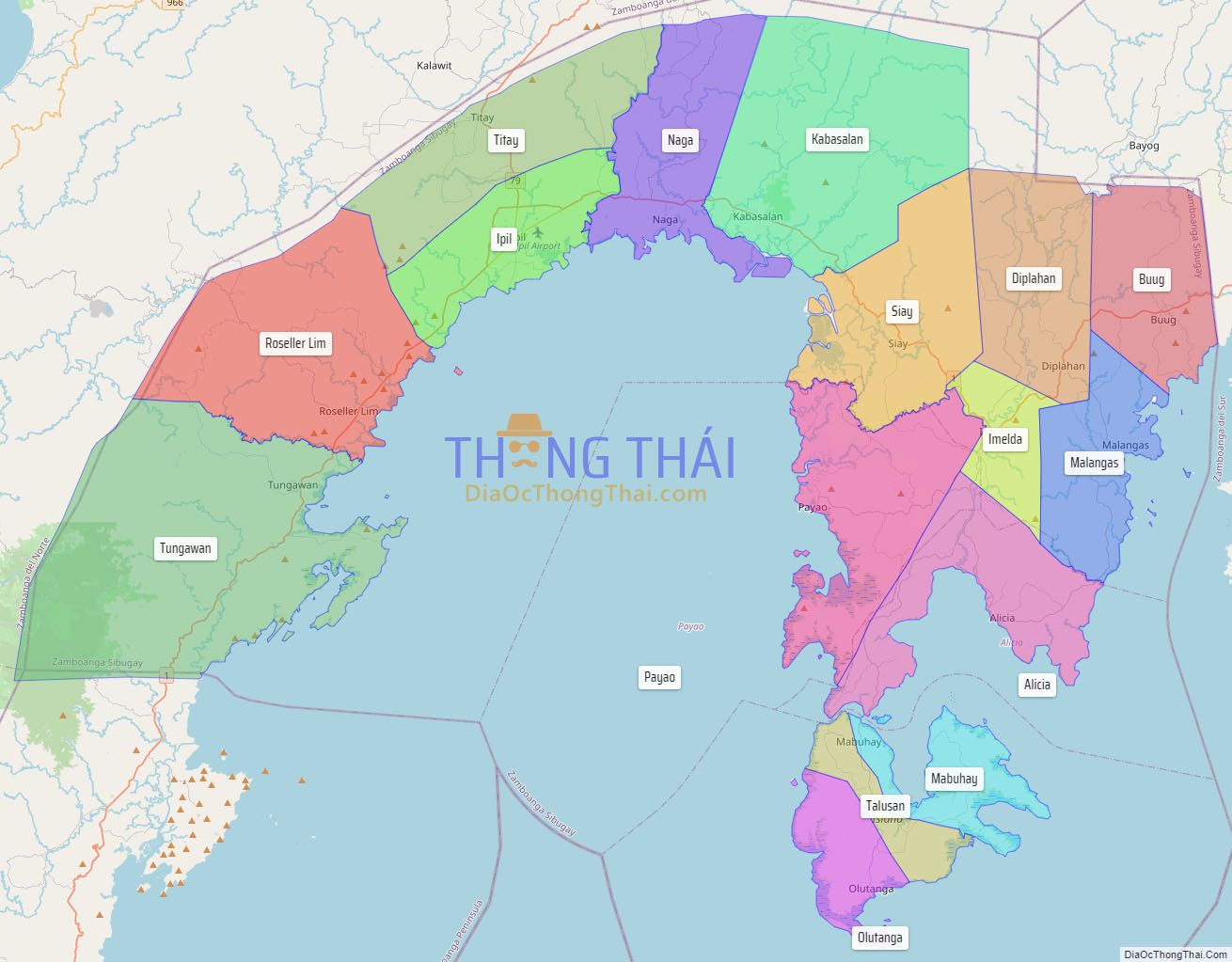
Zamboanga Sibugay Political Map
Map of Zamboanga Sibugay Province, Philippines the administrative divisions, provincial boundaries, along with detailed depictions of streets, roads, rivers, landmarks, and other geographical features.