Cao Bang is a province of the Northeast region of Vietnam. The province has borders with Ha Giang, Tuyen Quang, Bac Kan, and Lang Son provinces within Vietnam. It also has common international border with Guangxi Province of the People’s Republic of China. The province covers an area of 6724.6 square kilometres, and, as of 2008, its population was 528,100people.
The area has a rich history tracing to the Bronze Age of the Tay Au Kingdom in Vietnam. The dynasties which ruled the area were Tay lords, Be Khac Thieu and Nag Dac Thai. The province is in the region where the Vietnamese people lived thousands of years ago before their southwards expansion. Cao Bang has several points of historical interest as well as many natural features such as the Pac Bo (at the mouth of the confluence of two rivers, the Bang Giang and Hien rivers) where Ho Chi Minh in January 1941 established a revolutionary force at Coc Bo cave, the Mac King’s Temple, the Ky Sam Temple, Coi Bin Church, the Ban Gioc waterfall area at the international border between Vietnam and China, and the Thang Hen Mountain Lake.
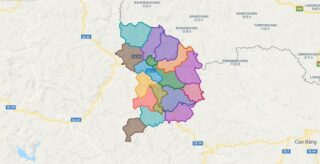
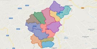
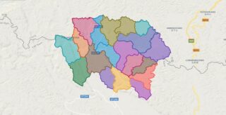
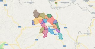
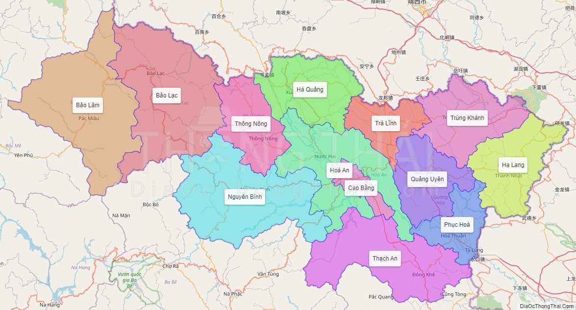
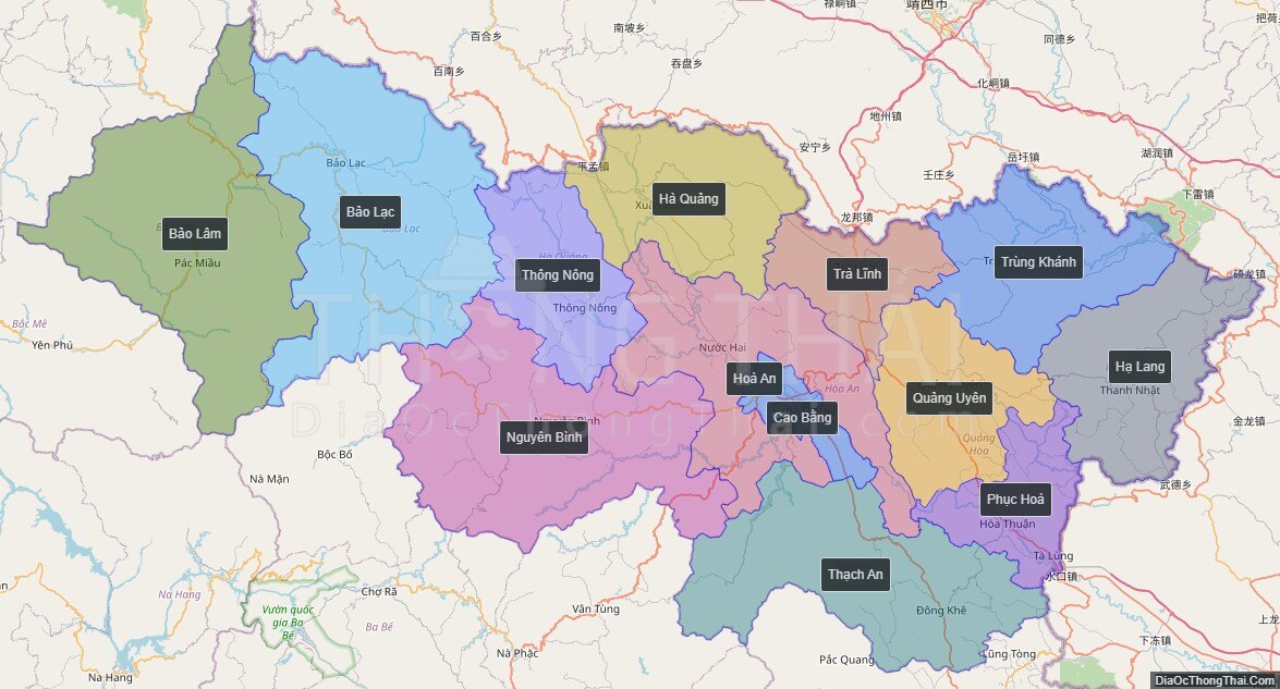
Political Map of Cao Bang province
Click on ![]() to view map in "full screen" mode.
to view map in "full screen" mode.
Base Map Layer: Open Street Map (OSM), Arcgisonline, Google Map, Wmflabs.
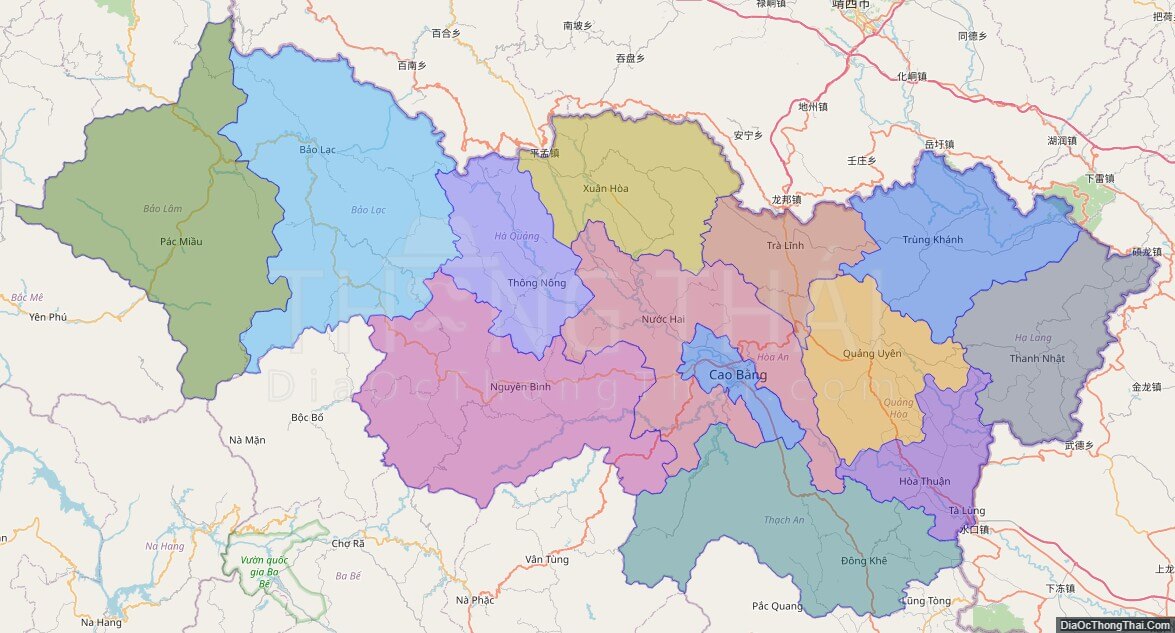
Large scale maps of Cao Bang province
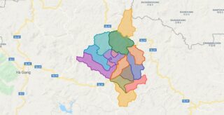
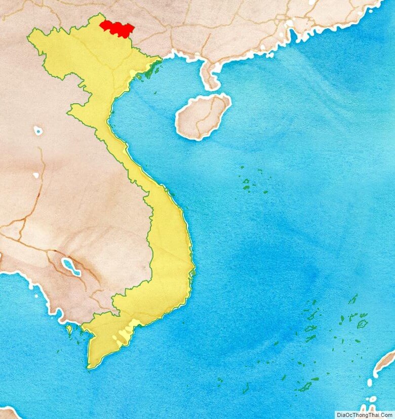
Cao Bang province location map
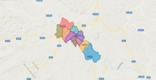
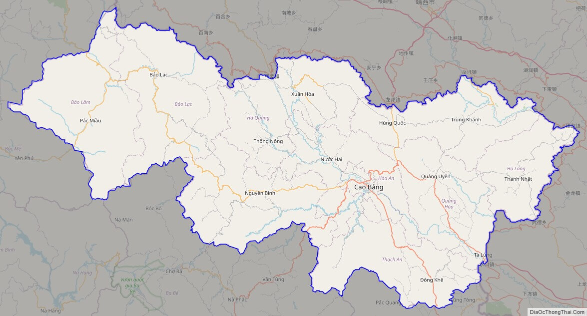
Cao Bang street map
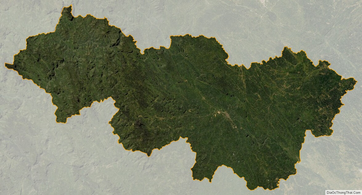
Cao Bang satellite map