Ho Chi Minh City, often referred to as Saigon, is a vibrant and bustling metropolis in southern Vietnam. As the country’s largest city, it serves as a major economic and cultural hub, offering a fascinating blend of historical charm and modern development. Navigating this dynamic urban landscape can be a thrilling adventure, and a well-detailed map of Ho Chi Minh City is an indispensable tool for exploring its many districts and landmarks.
From the historical French colonial architecture, such as the Notre-Dame Cathedral Basilica and the Central Post Office, to the lively markets like Ben Thanh Market, a map will guide you through the city’s rich history and contemporary attractions. Whether you are a visitor eager to explore the hidden gems and popular spots or a local discovering new corners of your hometown, having a comprehensive map of Ho Chi Minh City will enhance your experience, helping you uncover the unique blend of tradition and modernity that defines this captivating city.
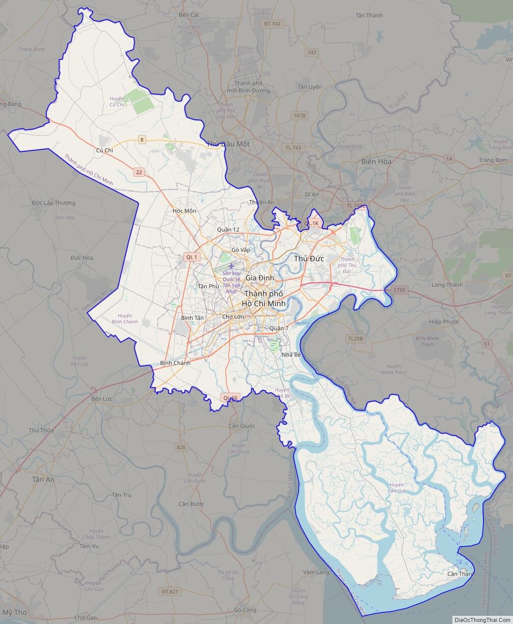
Political Map of Ho Chi Minh City
Click on ![]() to view map in "full screen" mode.
to view map in "full screen" mode.
Base Map Layer: Open Street Map (OSM), Arcgisonline, Google Map, Wmflabs.
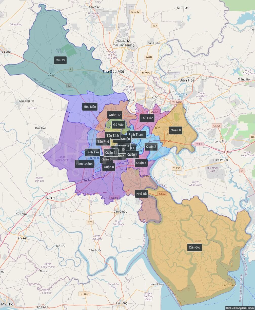
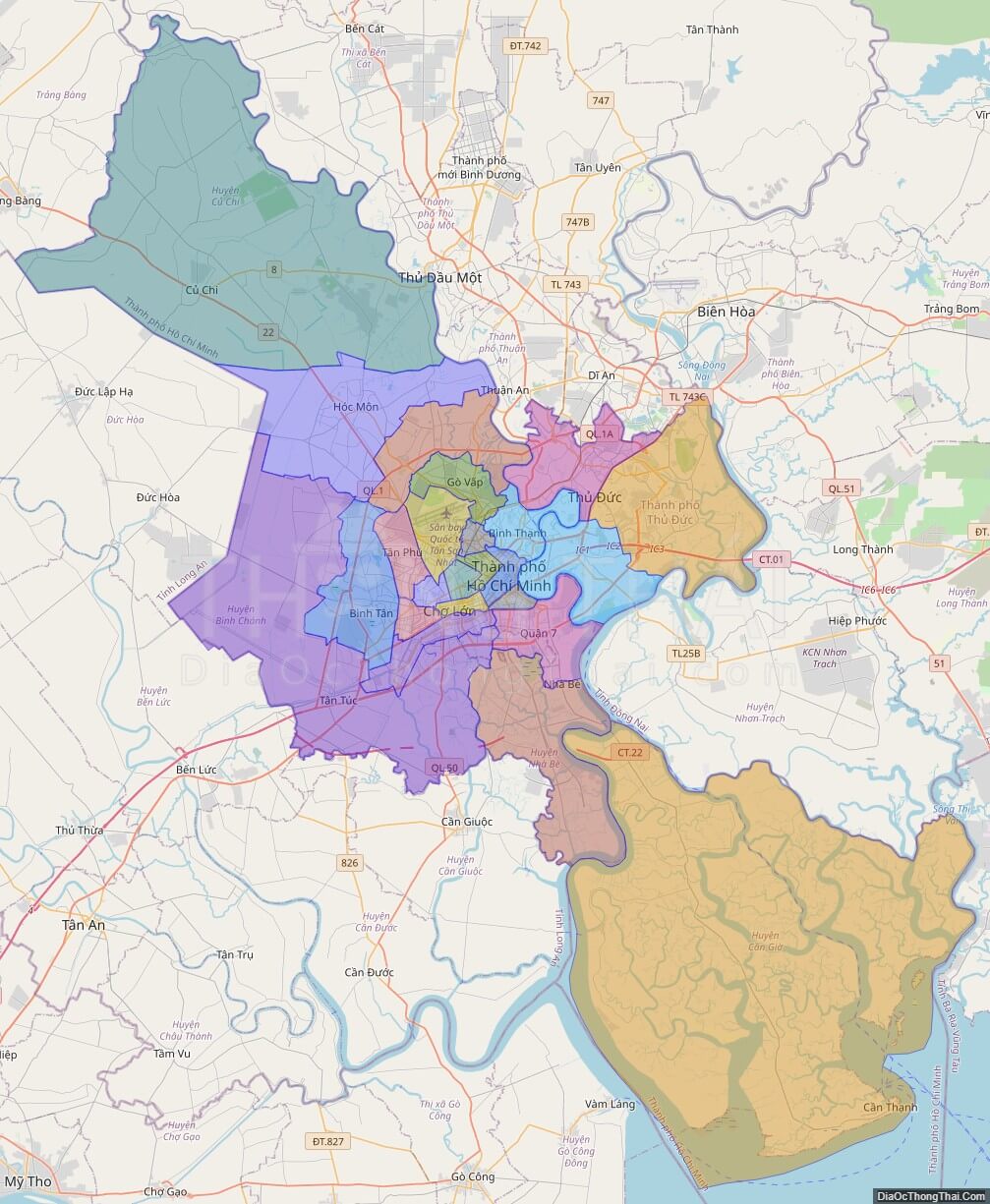
Large scale maps of Ho Chi Minh City
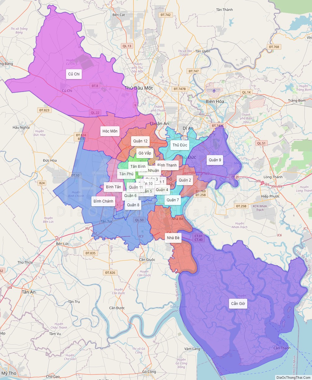
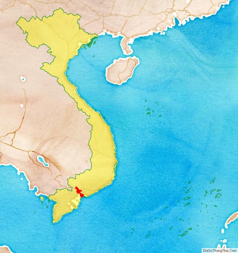
Ho Chi Minh City location map
Ho Chi Minh City street map
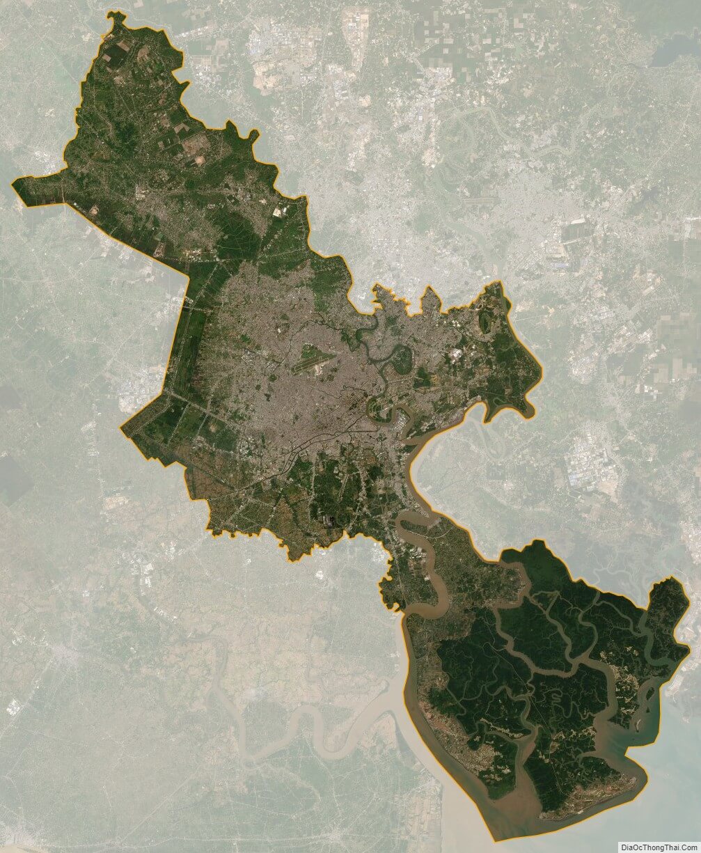
Ho Chi Minh City satellite map