Map of Ferry CDP

Map of Ferry CDP

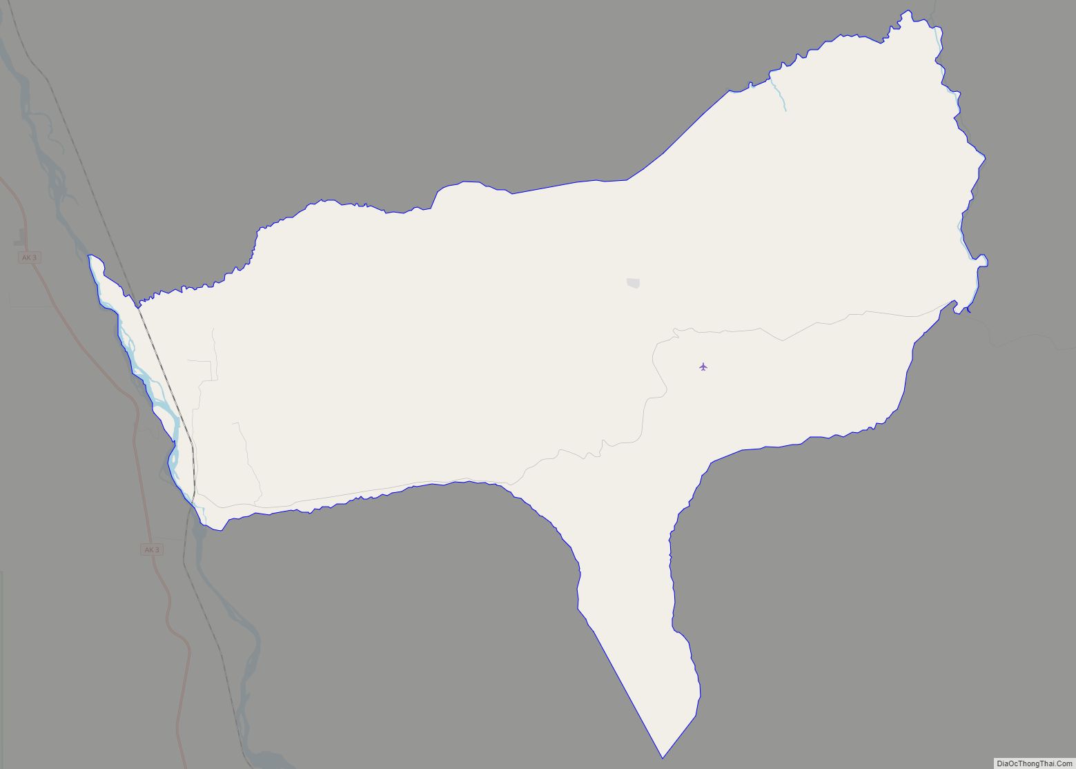
Ferry is a census-designated place (CDP) in Denali Borough, Alaska, United States. The population was 17 at the 2020 census, down from 33 in 2010. Ferry CDP overview: Name: Ferry CDP LSAD Code: 57 LSAD Description: CDP (suffix) State: Alaska County: Denali Borough Elevation: 1,932 ft (589 m) Total Area: 63.60 sq mi (164.73 km²) Land Area: 63.60 sq mi (164.73 km²) Water … Read more

Map of Farmers Loop CDP

Map of Farmers Loop CDP

Farmers Loop is a census-designated place in Fairbanks North Star Borough, Alaska, United States. One of several CDPs created out of various Fairbanks suburbs and outskirts during the 2010 census, at which time it had a population of 4,853. The CDP is located north of Fairbanks and is centered on and named for Farmers Loop … Read more

Map of Farm Loop CDP

Map of Farm Loop CDP

Farm Loop is a census-designated place (CDP) in Matanuska-Susitna Borough, Alaska, United States. It is part of the Anchorage, Alaska Metropolitan Statistical Area. At the 2020 census the population was 2,747, up from 1,028 in 2010. Farm Loop CDP overview: Name: Farm Loop CDP LSAD Code: 57 LSAD Description: CDP (suffix) State: Alaska County: Matanuska-Susitna … Read more

Map of Fort Greely CDP

Map of Fort Greely CDP

Fort Greely is a census-designated place (CDP) in Southeast Fairbanks Census Area, Alaska, United States. It is home to the Fort Greely military installation. At the 2010 census the population was 539, up from 461 in 2000. Fort Greely CDP overview: Name: Fort Greely CDP LSAD Code: 57 LSAD Description: CDP (suffix) State: Alaska County: … Read more

Map of Flat CDP

Map of Flat CDP

Flat is a census-designated place (CDP) in Yukon-Koyukuk Census Area, Alaska, United States. As of the 2010 Census, the population of the CDP was 0, down from 4 residents in 2000. Its post office closed in January 2004. Flat CDP overview: Name: Flat CDP LSAD Code: 57 LSAD Description: CDP (suffix) State: Alaska County: Yukon-Koyukuk … Read more

Map of Fishhook CDP

Map of Fishhook CDP

Fishhook is a census-designated place (CDP) in Matanuska-Susitna Borough, Alaska, United States. It is part of the Anchorage, Alaska Metropolitan Statistical Area. At the 2020 census the population was 5,048, up from 4,679 in 2010. Fishhook CDP overview: Name: Fishhook CDP LSAD Code: 57 LSAD Description: CDP (suffix) State: Alaska County: Matanuska-Susitna Borough Total Area: … Read more

Map of Fox River CDP

Map of Fox River CDP

Fox River is a census-designated place (CDP) in Kenai Peninsula Borough, Alaska, United States. At the 2010 census the population was 685, up from 616 in 2000. It was first reported by the U.S. Geological Survey in 1895. The Fox River, which flows by the CDP, might have been named for Theodore Fox, a local … Read more

Map of Four Mile Road CDP

Map of Four Mile Road CDP

Four Mile Road is a census-designated place (CDP) in Yukon-Koyukuk Census Area, Alaska, United States. The population was 43 at the 2010 census, up from 38 in 2000. Four Mile Road CDP overview: Name: Four Mile Road CDP LSAD Code: 57 LSAD Description: CDP (suffix) State: Alaska County: Yukon-Koyukuk Census Area Total Area: 1.16 sq mi (3.01 km²) … Read more

Map of Fort Yukon city

Map of Fort Yukon city

Fort Yukon (Gwichyaa Zheh in Gwich’in) is a city in the Yukon-Koyukuk Census Area in the U.S. state of Alaska, straddling the Arctic Circle. The population, predominantly Gwich’in Alaska Natives, was 583 at the 2010 census, down from 595 in 2000. Fort Yukon was the hometown of the late Alaska Congressman Don Young. Served by … Read more

Map of Fritz Creek CDP

Map of Fritz Creek CDP

Fritz Creek is a census-designated place (CDP) in the Kenai Peninsula Borough, Alaska, United States, northeast of Homer. At the 2020 census the population was 2,248, up from 1,932 in 2010. Fritz Creek CDP overview: Name: Fritz Creek CDP LSAD Code: 57 LSAD Description: CDP (suffix) State: Alaska County: Kenai Peninsula Borough Elevation: 1,198 ft (365 m) … Read more

Map of Fox CDP

Map of Fox CDP

Fox is a census-designated place (CDP) in Fairbanks North Star Borough, Alaska, United States. It is part of the Fairbanks, Alaska Metropolitan Statistical Area. At the 2010 census the population was 417, up from 300 in 2000. Fox CDP overview: Name: Fox CDP LSAD Code: 57 LSAD Description: CDP (suffix) State: Alaska County: Fairbanks North … Read more

Map of Funny River CDP

Map of Funny River CDP

Funny River is a census-designated place (CDP) in Kenai Peninsula Borough, Alaska, United States. At the 2010 census the population was 877, up from 636 in 2000. It is best known for the Funny River Fire in May 2014. Funny River CDP overview: Name: Funny River CDP LSAD Code: 57 LSAD Description: CDP (suffix) State: … Read more