Map of Junction City city

Map of Junction City, Arkansas

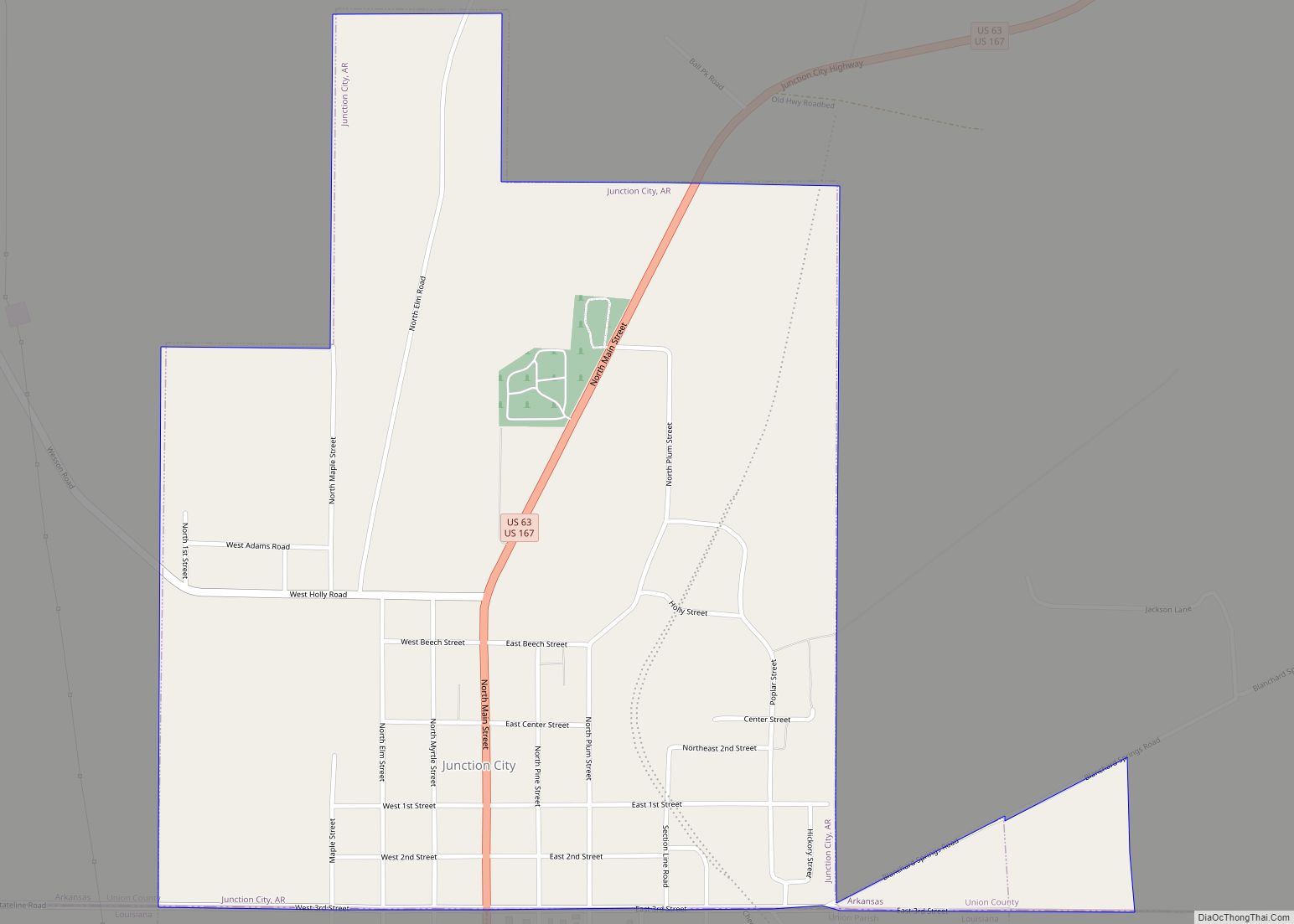
Junction City is a city in Union County, Arkansas, United States, and is the twin city of neighboring Junction City, Louisiana. The population was 581 at the 2010 census. Junction City overview: Name: Junction City LSAD Code: 25 LSAD Description: city (suffix) State: Arkansas County: Union County Elevation: 194 ft (59 m) Total Area: 1.14 sq mi (2.94 km²) Land … Read more

Map of Judsonia city

Map of Judsonia city

Judsonia is a city in White County, Arkansas, United States. Stan Robinson is the current mayor. The population was 2,019 at the 2010 census. Judsonia city overview: Name: Judsonia city LSAD Code: 25 LSAD Description: city (suffix) State: Arkansas County: White County Elevation: 213 ft (65 m) Total Area: 2.90 sq mi (7.52 km²) Land Area: 2.89 sq mi (7.48 km²) Water Area: … Read more

Map of Kibler city

Map of Kibler city

Kibler is a city in Crawford County, Arkansas, United States. It is part of the Fort Smith, Arkansas–Oklahoma Metropolitan Statistical Area. As of the 2010 Census the population was 961. Kibler city overview: Name: Kibler city LSAD Code: 25 LSAD Description: city (suffix) State: Arkansas County: Crawford County Elevation: 456 ft (139 m) Total Area: 5.00 sq mi (12.96 km²) … Read more

Map of Keo town

Map of Keo town

Keo is a town in southwest Lonoke County, Arkansas, United States. The population was 256 at the 2010 census. It is part of the Little Rock–North Little Rock–Conway Metropolitan Statistical Area. Keo town overview: Name: Keo town LSAD Code: 43 LSAD Description: town (suffix) State: Arkansas County: Lonoke County Elevation: 230 ft (70 m) Total Area: 4.96 sq mi … Read more

Map of Kensett city

Map of Kensett city, Arkansas

Kensett is a city in White County, Arkansas, United States. Located adjacent to the east side of Searcy, the city is the hometown of noted legislator Wilbur D. Mills, who was influential throughout the 1960s and 1970s in the United States House of Representatives. Allen Edge is the current mayor. The population was 1,648 at … Read more

Map of Knobel city

Map of Knobel city

Knobel (/ˈnoʊbəl/) is a city in Clay County, Arkansas, United States. The population was 147 at the 2020 census. Knobel city overview: Name: Knobel city LSAD Code: 25 LSAD Description: city (suffix) State: Arkansas County: Clay County Elevation: 279 ft (85 m) Total Area: 0.42 sq mi (1.09 km²) Land Area: 0.42 sq mi (1.09 km²) Water Area: 0.00 sq mi (0.00 km²) Total Population: 147 … Read more

Map of Kirby CDP

Map of Kirby CDP, Arkansas

Kirby is an unincorporated census-designated place in northern Pike County, Arkansas, United States. The community lies on U.S. Route 70; it is located halfway between Daisy and Glenwood. Per the 2020 census, the population was 721. Kirby CDP overview: Name: Kirby CDP LSAD Code: 57 LSAD Description: CDP (suffix) State: Arkansas County: Pike County Elevation: … Read more

Map of Kingsland city

Map of Kingsland city, Arkansas

Kingsland is a town in Cleveland County, south central Arkansas, United States. It is included in the Pine Bluff, Arkansas Metropolitan Statistical Area, and had a population of 447 at the 2010 U.S. census. It is known as the birthplace of musician Johnny Cash. His parents had a cotton farm there. Kingsland city overview: Name: … Read more

Map of LaGrange town

Map of LaGrange town, Arkansas

LaGrange is a town in Lee County, Arkansas, United States. The population was 89 at the 2010 census, down from 122 at the 2000 census. LaGrange town overview: Name: LaGrange town LSAD Code: 43 LSAD Description: town (suffix) State: Arkansas County: Lee County Elevation: 217 ft (66 m) Total Area: 0.15 sq mi (0.39 km²) Land Area: 0.15 sq mi (0.39 km²) Water … Read more

Map of Lafe town

Map of Lafe town

Lafe is a town in Greene County, Arkansas, United States on Crowley’s Ridge. The population was 448 at the 2010 census, up from 385 in 2000. Lafe town overview: Name: Lafe town LSAD Code: 43 LSAD Description: town (suffix) State: Arkansas County: Greene County Elevation: 335 ft (102 m) Total Area: 2.03 sq mi (5.26 km²) Land Area: 2.03 sq mi (5.26 km²) … Read more

Map of Knoxville city

Map of Knoxville town, Arkansas

Knoxville is a city in Johnson County, Arkansas, United States. The population was 731 at the 2010 census. Knoxville town overview: Name: Knoxville town LSAD Code: 43 LSAD Description: town (suffix) State: Arkansas County: Johnson County Elevation: 387 ft (118 m) Total Area: 3.19 sq mi (8.27 km²) Land Area: 3.18 sq mi (8.25 km²) Water Area: 0.01 sq mi (0.02 km²) Total Population: 660 Population … Read more

Map of Lake View city, Arkansas

Map of Lake View city, Arkansas

Lake View is a city in Phillips County, Arkansas, United States. The population was 443 at the 2010 census. Because there is also a Lakeview in Baxter County, many residents want to rename Lakeview to “Lake Helena”. The original settlement name was “Turkey Scratch” from the 1850s to the official declaration of the town’s namesake … Read more