Keo is a town in southwest Lonoke County, Arkansas, United States. The population was 256 at the 2010 census. It is part of the Little Rock–North Little Rock–Conway Metropolitan Statistical Area.
| Name: | Keo town |
|---|---|
| LSAD Code: | 43 |
| LSAD Description: | town (suffix) |
| State: | Arkansas |
| County: | Lonoke County |
| Elevation: | 230 ft (70 m) |
| Total Area: | 4.96 sq mi (12.85 km²) |
| Land Area: | 4.92 sq mi (12.75 km²) |
| Water Area: | 0.04 sq mi (0.10 km²) |
| Total Population: | 207 |
| Population Density: | 42.05/sq mi (16.23/km²) |
| ZIP code: | 72083 |
| Area code: | 501 |
| FIPS code: | 0536550 |
| GNISfeature ID: | 0050819 |
| Website: | www.keoar.com |
Online Interactive Map
Click on ![]() to view map in "full screen" mode.
to view map in "full screen" mode.
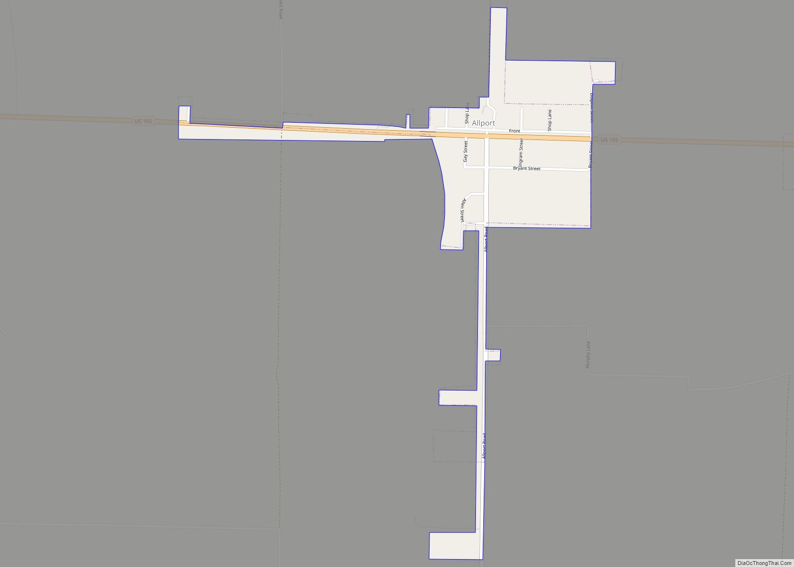
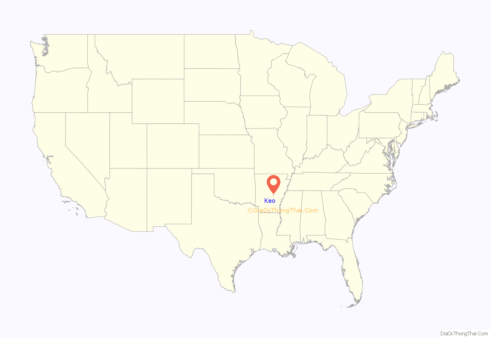
Keo location map. Where is Keo town?

History
Keo had its start as a shipping station when the railroad was extended to that point.
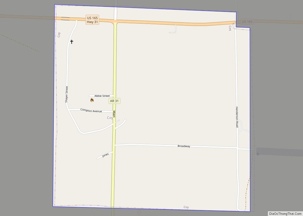
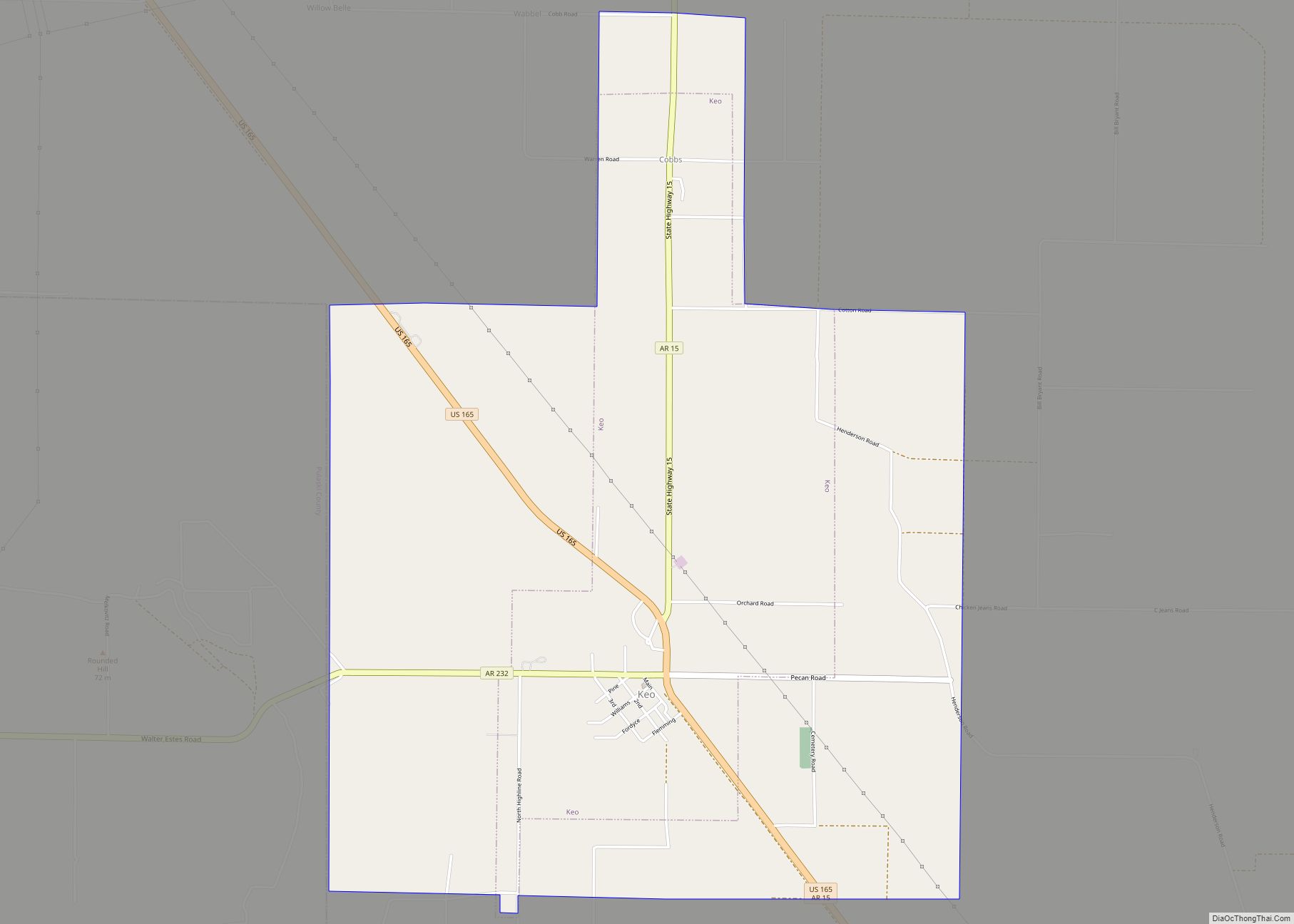
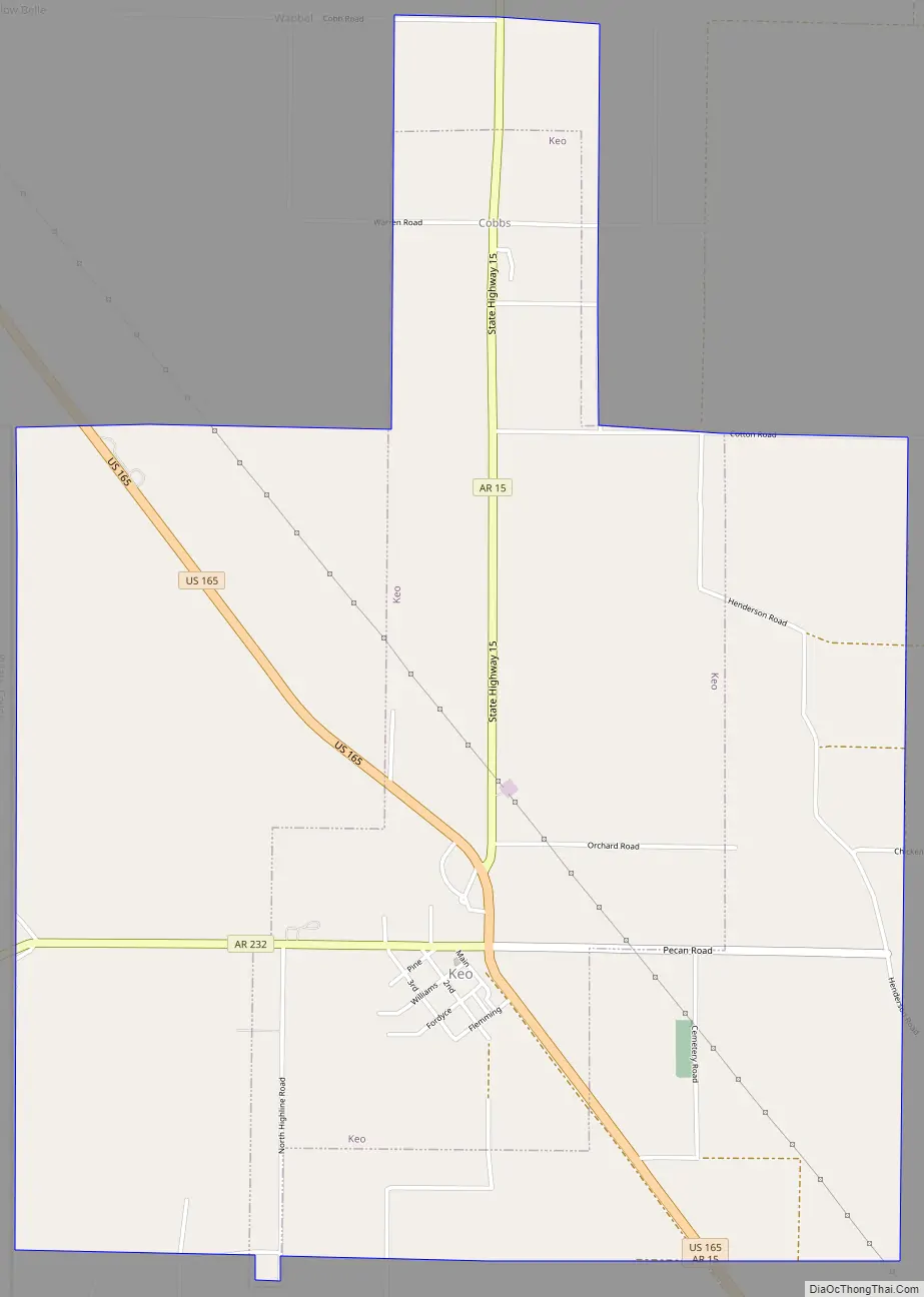
Keo Road Map
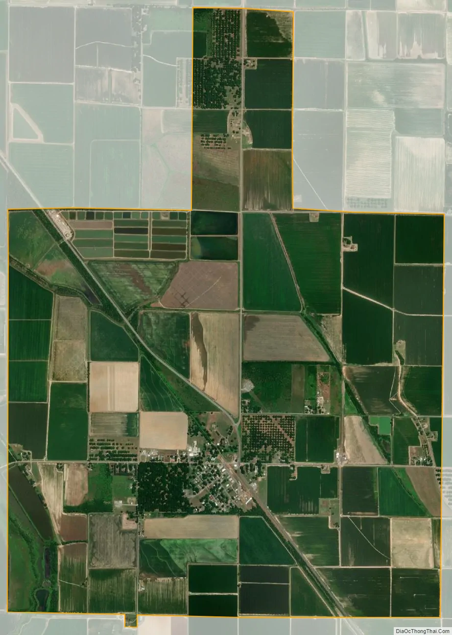
Keo city Satellite Map
Geography
Keo is located in southwestern Lonoke County at 34°36′19″N 92°0′36″W / 34.60528°N 92.01000°W / 34.60528; -92.01000 (34.605394, -92.010099). U.S. Route 165 passes through the town, leading northwest 19 miles (31 km) to North Little Rock and southeast 4 miles (6 km) to England. Arkansas Highway 15 leads north from Keo 16 miles (26 km) to Furlow and southeast with US 165 to England. Arkansas Highway 232 leads west from the center of Keo.
According to the United States Census Bureau, the town has a total area of 4.9 square miles (12.7 km), of which 0.04 square miles (0.1 km), or 0.70%, are water.
See also
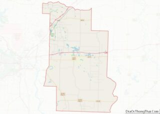
Map of Arkansas State and its subdivision:- Arkansas
- Ashley
- Baxter
- Benton
- Boone
- Bradley
- Calhoun
- Carroll
- Chicot
- Clark
- Clay
- Cleburne
- Cleveland
- Columbia
- Conway
- Craighead
- Crawford
- Crittenden
- Cross
- Dallas
- Desha
- Drew
- Faulkner
- Franklin
- Fulton
- Garland
- Grant
- Greene
- Hempstead
- Hot Spring
- Howard
- Independence
- Izard
- Jackson
- Jefferson
- Johnson
- Lafayette
- Lawrence
- Lee
- Lincoln
- Little River
- Logan
- Lonoke
- Madison
- Marion
- Miller
- Mississippi
- Monroe
- Montgomery
- Nevada
- Newton
- Ouachita
- Perry
- Phillips
- Pike
- Poinsett
- Polk
- Pope
- Prairie
- Pulaski
- Randolph
- Saint Francis
- Saline
- Scott
- Searcy
- Sebastian
- Sevier
- Sharp
- Stone
- Union
- Van Buren
- Washington
- White
- Woodruff
- Yell
- Alabama
- Alaska
- Arizona
- Arkansas
- California
- Colorado
- Connecticut
- Delaware
- District of Columbia
- Florida
- Georgia
- Hawaii
- Idaho
- Illinois
- Indiana
- Iowa
- Kansas
- Kentucky
- Louisiana
- Maine
- Maryland
- Massachusetts
- Michigan
- Minnesota
- Mississippi
- Missouri
- Montana
- Nebraska
- Nevada
- New Hampshire
- New Jersey
- New Mexico
- New York
- North Carolina
- North Dakota
- Ohio
- Oklahoma
- Oregon
- Pennsylvania
- Rhode Island
- South Carolina
- South Dakota
- Tennessee
- Texas
- Utah
- Vermont
- Virginia
- Washington
- West Virginia
- Wisconsin
- Wyoming