Map of Oil Trough town

Map of Oil Trough town

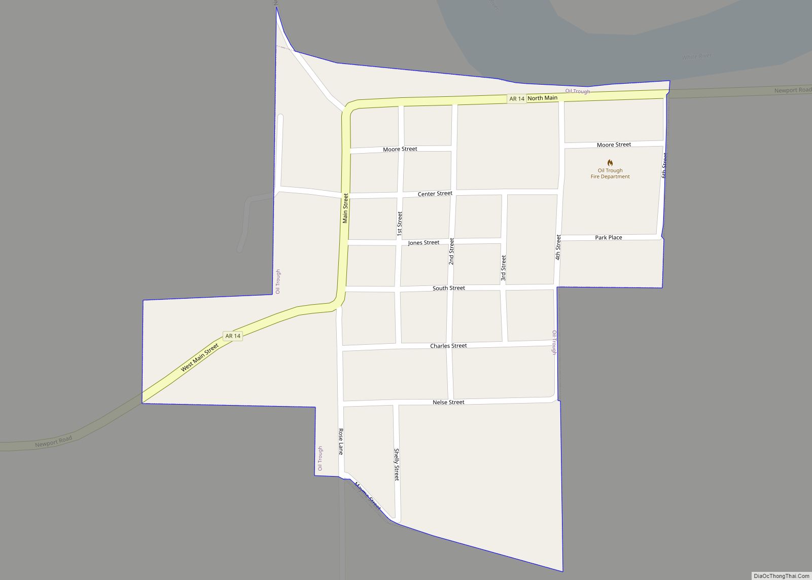
Oil Trough is a town in Independence County, Arkansas, United States. The population was 260 at the 2010 census. The town is believed to have acquired its name in the early 19th century from a trough used to render bear fat, which was sold to customers in New Orleans. Oil Trough town overview: Name: Oil … Read more

Map of Ogden city

Map of Ogden city, Arkansas

Ogden is a city in Little River County, Arkansas, United States. The population was 180 at the 2010 census, down from 214 at the 2000 census. Ogden city overview: Name: Ogden city LSAD Code: 25 LSAD Description: city (suffix) State: Arkansas County: Little River County Elevation: 315 ft (96 m) Total Area: 0.38 sq mi (0.99 km²) Land Area: 0.38 sq mi … Read more

Map of Oppelo city

Map of Oppelo city

Oppelo /ˈɑː.pəˌloʊ/ AH-pə-loh is a city in Conway County, Arkansas, United States. The population was 781 at the 2010 census. Oppelo city overview: Name: Oppelo city LSAD Code: 25 LSAD Description: city (suffix) State: Arkansas County: Conway County Elevation: 338 ft (103 m) Total Area: 2.48 sq mi (6.43 km²) Land Area: 2.43 sq mi (6.29 km²) Water Area: 0.05 sq mi (0.13 km²) Total Population: … Read more

Map of Omaha city

Map of Omaha town, Arkansas

Omaha is a town in Boone County, Arkansas, United States. As of the 2020 census the population stood at 128. It is a rural community located approximately 10 miles from Branson, Missouri and 15 miles from Harrison. The town is part of the Harrison Micropolitan Statistical Area. Omaha town overview: Name: Omaha town LSAD Code: … Read more

Map of Ola city

Map of Ola city, Arkansas

Ola is a city in Yell County, Arkansas, United States. The population was 1,281 at the 2010 census. It is part of the Russellville Micropolitan Statistical Area. As of 2004 it serves as a commercial center in Yell County. Ola city overview: Name: Ola city LSAD Code: 25 LSAD Description: city (suffix) State: Arkansas County: … Read more

Map of Ozan town

Map of Ozan town

Ozan is a town in Hempstead County, Arkansas, United States. The population was 85 at the 2010 census. It is part of the Hope Micropolitan Statistical Area. Ozan town overview: Name: Ozan town LSAD Code: 43 LSAD Description: town (suffix) State: Arkansas County: Hempstead County Elevation: 384 ft (117 m) Total Area: 0.33 sq mi (0.85 km²) Land Area: 0.33 sq mi … Read more

Map of Oxford city, Arkansas

Map of Oxford city, Arkansas

Oxford is a city in Izard County, Arkansas, United States. The population was 670 at the 2010 census. Oxford city overview: Name: Oxford city LSAD Code: 25 LSAD Description: city (suffix) State: Arkansas County: Izard County Elevation: 784 ft (239 m) Total Area: 6.54 sq mi (16.95 km²) Land Area: 6.54 sq mi (16.95 km²) Water Area: 0.00 sq mi (0.00 km²) Total Population: 573 Population … Read more

Map of Osceola city

Map of Osceola city, Arkansas

Osceola is a city in, and a dual county seat of, Mississippi County, Arkansas, United States. Located along the Mississippi River within the Arkansas Delta, the settlement was founded in 1837 and incorporated in 1853. Occupying an important location on the river, the city’s economy grew as steamboat traffic increased. Timber and cotton harvesting would … Read more

Map of Pangburn city

Map of Pangburn city

Pangburn is a city in White County, Arkansas, United States. The population was 500 at the 2020 census. Pangburn city overview: Name: Pangburn city LSAD Code: 25 LSAD Description: city (suffix) State: Arkansas County: White County Elevation: 348 ft (106 m) Total Area: 0.55 sq mi (1.41 km²) Land Area: 0.55 sq mi (1.41 km²) Water Area: 0.00 sq mi (0.00 km²) Total Population: 500 Population … Read more

Map of Palestine city

Map of Palestine city, Arkansas

Palestine is a town in St. Francis County, Arkansas, United States, along the L’Anguille River. The population was 681 at the 2010 census, a decline from 741 in 2000. Palestine city overview: Name: Palestine city LSAD Code: 25 LSAD Description: city (suffix) State: Arkansas County: St. Francis County Elevation: 207 ft (63 m) Total Area: 3.33 sq mi (8.62 km²) … Read more

Map of Ozark city, Arkansas

Map of Ozark city, Arkansas

Ozark is a city in Franklin County, Arkansas, United States and one of the county’s two seats of government. The community is located along the Arkansas River in the Arkansas River Valley on the southern edge of the Ozark Mountains. As of the 2010 census it had a population of 3,684. Incorporated in 1850, Ozark … Read more

Map of Parkdale city

Map of Parkdale city, Arkansas

Parkdale is a town in Ashley County, Arkansas, United States. The population was 277 at the 2010 census. Parkdale city overview: Name: Parkdale city LSAD Code: 25 LSAD Description: city (suffix) State: Arkansas County: Ashley County Elevation: 118 ft (36 m) Total Area: 1.02 sq mi (2.64 km²) Land Area: 1.02 sq mi (2.64 km²) Water Area: 0.00 sq mi (0.00 km²) Total Population: 172 Population … Read more