Ozark is a city in Franklin County, Arkansas, United States and one of the county’s two seats of government. The community is located along the Arkansas River in the Arkansas River Valley on the southern edge of the Ozark Mountains. As of the 2010 census it had a population of 3,684.
Incorporated in 1850, Ozark is adjacent to much of Arkansas wine country, and contains a bridge to cross the Arkansas River for travelers heading to points south. The city is also located on Arkansas Highway 23, nicknamed the Pig Trail Scenic Byway, known for its steep drops, sharp curves and scenic mountain views.
The name Aux Arcs, later simplified to “Ozark”, was given to this bend of the river by the French explorers when they were mapping out this land.
| Name: | Ozark city |
|---|---|
| LSAD Code: | 25 |
| LSAD Description: | city (suffix) |
| State: | Arkansas |
| County: | Franklin County |
| Elevation: | 476 ft (145 m) |
| Total Area: | 7.97 sq mi (20.66 km²) |
| Land Area: | 7.93 sq mi (20.54 km²) |
| Water Area: | 0.04 sq mi (0.11 km²) |
| Total Population: | 3,542 |
| Population Density: | 446.60/sq mi (172.43/km²) |
| ZIP code: | 72949 |
| Area code: | 479 |
| FIPS code: | 0552970 |
| GNISfeature ID: | 2404457 |
| Website: | www.cityofozarkar.com |
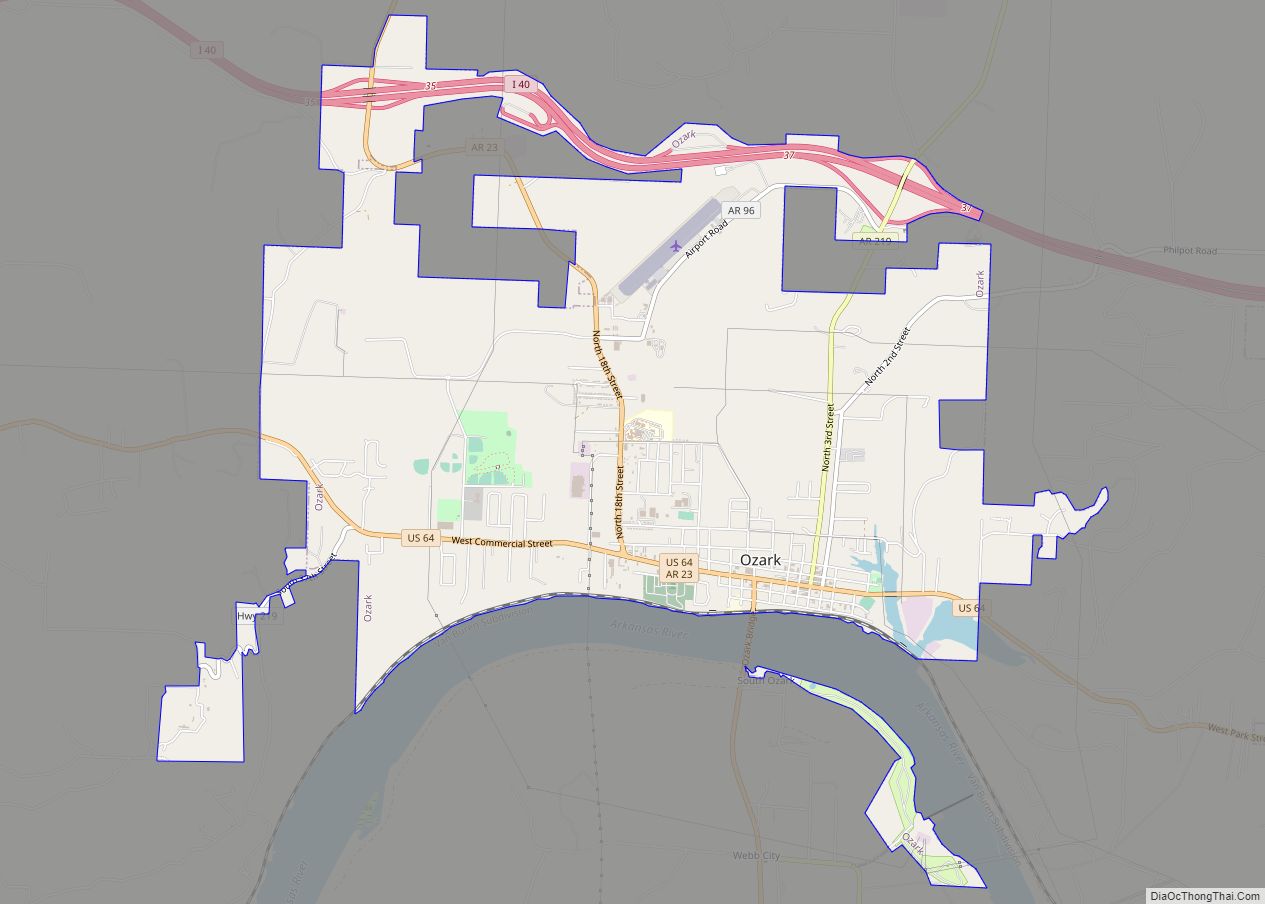
Online Interactive Map
Click on ![]() to view map in "full screen" mode.
to view map in "full screen" mode.
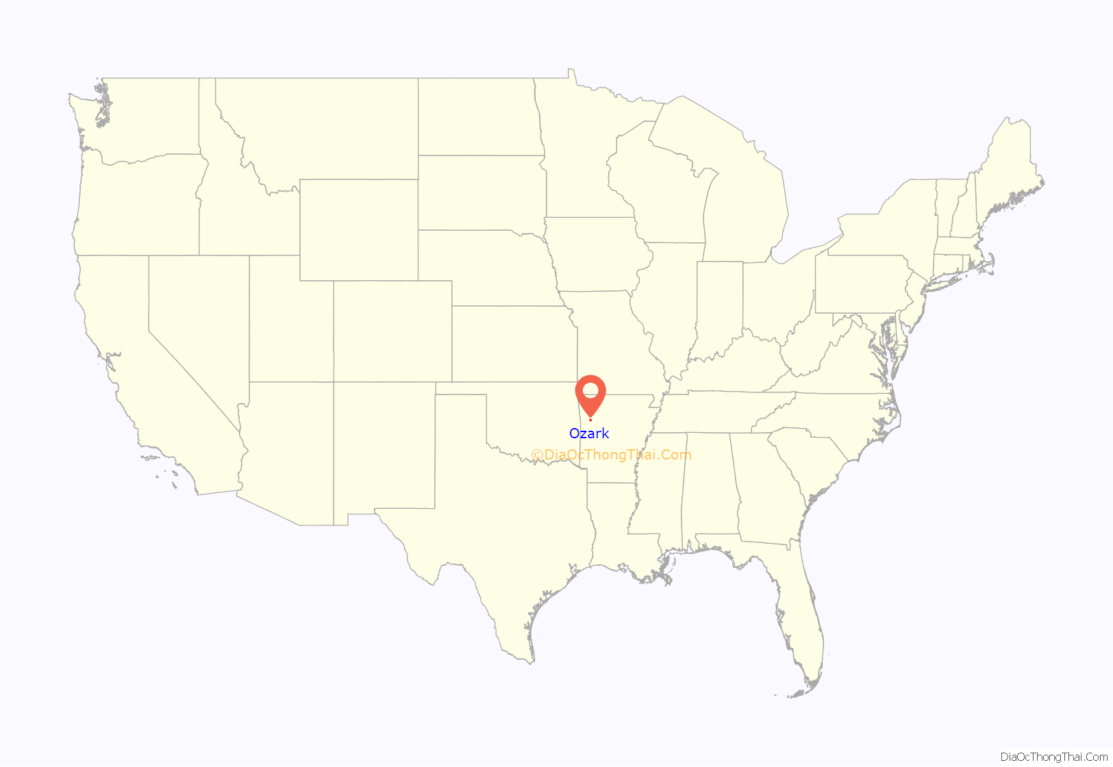
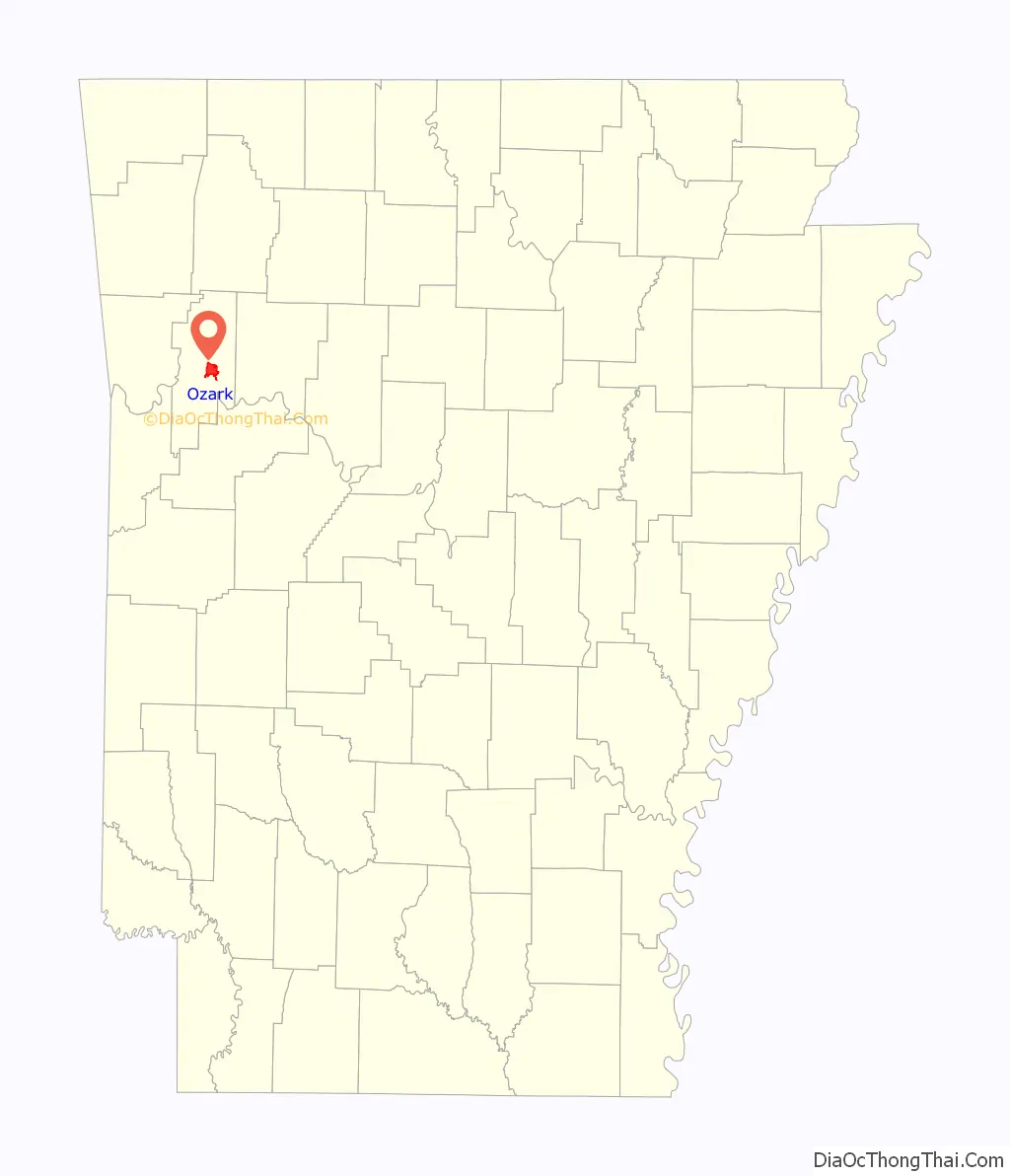
Ozark location map. Where is Ozark city?
History
Native Americans roamed the area freely before Arkansas was a territory. The Cherokee and Osage lived in this area that would later become attractive to settlers. The Ozark area was frequented by French fur trappers and served as a landmark during European exploration of the area. It was these adventurous souls who gave the area and the rolling mountains that rise there their name, Aux Arcs.
Included in the Louisiana Purchase of 1803, the vicinity became a stopping and crossing point along the Arkansas River. The modern settlement of Ozark was established here in the 1830s, and an important road grew connecting Ozark to Fayetteville, Arkansas, following the route of today’s Pig Trail Scenic Byway to connect Northwest Arkansas with the river.
Ozark played a role on the Trail of Tears. Steamboats would often stop here in times of low water and Native Americans camped in Ozark before moving to Oklahoma on foot. The waterfront is a designated stop on the trail of tears route.
Ozark’s population grew to about 100 people during the Civil War and served as a Confederate base after the battles of Pea Ridge and Prairie Grove in 1862. In April 1863, Brigadier General William L. Cabell led 900 men from Ozark on an expedition that ended at the Battle of Fayetteville. Ozark became the scene of fighting later that year and again in 1864, where many skirmishes were fought in the vicinity. A monument on the grounds of the Franklin County Courthouse pays tribute to an officer killed just north of town.
Although Ozark prospered over the years, it remained a small city on the river.
The name “Ozark” comes from Aux Arcs, the name given to the area and the mountains that rise there by early French settlers. Ozark, Arkansas, was the first community to be incorporated with that name.
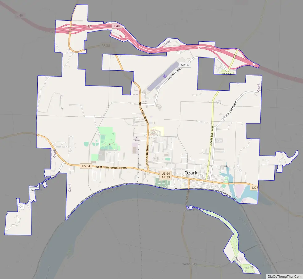
Ozark Road Map
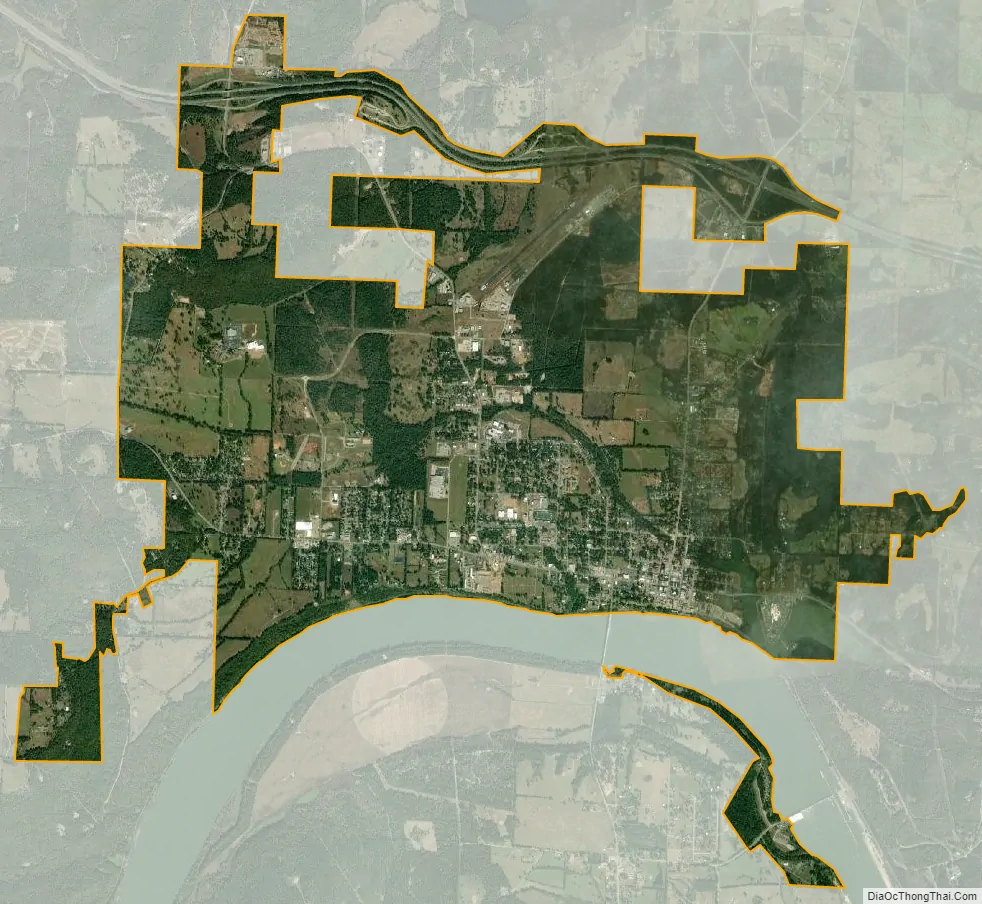
Ozark city Satellite Map
Geography
Ozark is located east of the center of Franklin County on the north side of the Arkansas River. It is 48 miles (77 km) west of Russellville and 38 miles (61 km) east of Fort Smith. The city limits extend north to Interstate 40, which has access from Exits 35 and 37. U.S. Route 64 passes through the center of Ozark, providing a local east-west route parallel to I-40. Arkansas Highway 23 leads north as the Pig Trail Scenic Byway into the Ozarks 28 miles (45 km) to Brashears, while to the south AR 23 crosses the Arkansas River and leads 28 miles (45 km) to Booneville.
According to the United States Census Bureau, Ozark has a total area of 7.3 square miles (19.0 km), of which 7.3 square miles (18.9 km) is land and 0.04 square miles (0.1 km), or 0.52%, is water. Ozark is the point at which the Arkansas River is farthest north in the state.
See also
Map of Arkansas State and its subdivision:- Arkansas
- Ashley
- Baxter
- Benton
- Boone
- Bradley
- Calhoun
- Carroll
- Chicot
- Clark
- Clay
- Cleburne
- Cleveland
- Columbia
- Conway
- Craighead
- Crawford
- Crittenden
- Cross
- Dallas
- Desha
- Drew
- Faulkner
- Franklin
- Fulton
- Garland
- Grant
- Greene
- Hempstead
- Hot Spring
- Howard
- Independence
- Izard
- Jackson
- Jefferson
- Johnson
- Lafayette
- Lawrence
- Lee
- Lincoln
- Little River
- Logan
- Lonoke
- Madison
- Marion
- Miller
- Mississippi
- Monroe
- Montgomery
- Nevada
- Newton
- Ouachita
- Perry
- Phillips
- Pike
- Poinsett
- Polk
- Pope
- Prairie
- Pulaski
- Randolph
- Saint Francis
- Saline
- Scott
- Searcy
- Sebastian
- Sevier
- Sharp
- Stone
- Union
- Van Buren
- Washington
- White
- Woodruff
- Yell
- Alabama
- Alaska
- Arizona
- Arkansas
- California
- Colorado
- Connecticut
- Delaware
- District of Columbia
- Florida
- Georgia
- Hawaii
- Idaho
- Illinois
- Indiana
- Iowa
- Kansas
- Kentucky
- Louisiana
- Maine
- Maryland
- Massachusetts
- Michigan
- Minnesota
- Mississippi
- Missouri
- Montana
- Nebraska
- Nevada
- New Hampshire
- New Jersey
- New Mexico
- New York
- North Carolina
- North Dakota
- Ohio
- Oklahoma
- Oregon
- Pennsylvania
- Rhode Island
- South Carolina
- South Dakota
- Tennessee
- Texas
- Utah
- Vermont
- Virginia
- Washington
- West Virginia
- Wisconsin
- Wyoming