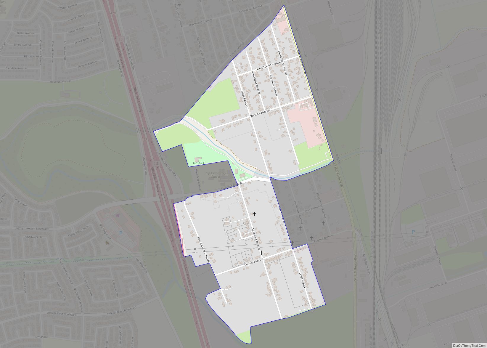
Map of Tamalpais-Homestead Valley CDP

Map of Tamalpais-Homestead Valley CDP

Tamalpais-Homestead Valley is a census-designated place (CDP) in Marin County, California, United States. The population was 11,492 at the 2020 census. Tamalpais-Homestead Valley CDP overview: Name: Tamalpais-Homestead Valley CDP LSAD Code: 57 LSAD Description: CDP (suffix) State: California County: Marin County Total Area: 4.747 sq mi (12.29 km²) Land Area: 4.685 sq mi (12.13 km²) Water Area: 0.062 sq mi (0.16 km²)  1.31% Total … Read more

Map of Talmage CDP

Map of Talmage CDP, California

Talmage (variant, Talmadge) is a census-designated place (CDP) in Mendocino County, California, United States. Talmage is located 2.5 miles (4 km) east-southeast of Ukiah, at an elevation of 627 feet (191 m). The population was 986 at the 2020 census, down from 1,130 in 2010. It lies in the southeastern part of the Ukiah Valley and is … Read more

Map of Tahoma CDP

Map of Tahoma CDP

Tahoma (formerly Chambers Lodge) is a census-designated place in Placer and El Dorado counties, California, United States. Tahoma is located along Lake Tahoe 2 miles (3.2 km) southeast of Homewood. Tahoma has a population of 1,191 (780 in El Dorado County and 411 in Placer County). Tahoma has a post office with ZIP code 96142, which … Read more

Map of Taylorsville CDP

Map of Taylorsville CDP, California

Taylorsville is a census-designated place (CDP) in Plumas County, California, United States. The population was 150 at the 2010 census, down from 154 at the 2000 census. The annual Stone Ranch Reunion is held in Taylorsville. Taylorsville CDP overview: Name: Taylorsville CDP LSAD Code: 57 LSAD Description: CDP (suffix) State: California County: Plumas County Elevation: … Read more

Map of Tarpey Village CDP

Map of Tarpey Village CDP

Tarpey Village is a census-designated place in Fresno County, California, between Fresno and Clovis, 2 miles (3.2 km) south of the latter, near Tarpey. Tarpey village falls within the Clovis Unified School District. It lies at an elevation of 351 ft (107 m). At the 2010 census, the population was 3,888. Tarpey Village CDP overview: Name: Tarpey Village … Read more

Map of Tara Hills CDP

Map of Tara Hills CDP

Tara Hills is a census-designated place (CDP) in Contra Costa County, California, United States. The population was 5,126 at the 2010 census. Tara Hills CDP overview: Name: Tara Hills CDP LSAD Code: 57 LSAD Description: CDP (suffix) State: California County: Contra Costa County Elevation: 92 ft (28 m) Total Area: 0.639 sq mi (1.66 km²) Land Area: 0.639 sq mi (1.66 km²) Water … Read more

Map of Tehachapi city

Map of Tehachapi city

Tehachapi (/təˈhætʃəpi/ (listen); Kawaiisu: Tihachipia, meaning “hard climb”) is a city in Kern County, California, United States, in the Tehachapi Mountains, at an elevation of 3,970 feet (1,210 m), between the San Joaquin Valley and the Mojave Desert. Tehachapi is 35 miles (56 km) east-southeast of Bakersfield, and 20 miles (32 km) west of Mojave. According to the … Read more

Map of Tecopa CDP

Map of Tecopa CDP

Tecopa (formerly Brownsville) is a census-designated place (CDP) in southeast Inyo County, California, United States. It was established in the late 19th century as mining town. It is now better known for the natural hot springs north of the current townsite. Tecopa was named after the Paiute leader Chief Tecopa. It was the subject of … Read more

Map of Tehama city

Map of Tehama city

Tehama (Wintun for “high water”) is a city in Tehama County, California, United States. The population was 418 at the 2010 census, down from 432 at the 2000 census. Tehama city overview: Name: Tehama city LSAD Code: 25 LSAD Description: city (suffix) State: California County: Tehama County Incorporated: July 5, 1906 Elevation: 210 ft (64 m) Total … Read more

Map of Temple City city

Map of Temple City

Temple City, officially the City of Temple City, is a city in Los Angeles County, California located northeast of downtown Los Angeles and at the base of the San Gabriel Mountains. Temple City is part of a cluster of cities, along with Pasadena, Arcadia, Alhambra, San Marino, and San Gabriel, in the west San Gabriel … Read more

Map of Temescal Valley CDP

Map of Temescal Valley CDP

Temescal Valley (Temescal, Spanish for “sweat lodge”) is a census-designated place in Riverside County, California. Temescal Valley sits at an elevation of 1,138 feet (347 m). The 2010 United States census reported Temescal Valley’s population was 22,535. Temescal Valley CDP overview: Name: Temescal Valley CDP LSAD Code: 57 LSAD Description: CDP (suffix) State: California County: Riverside … Read more

Map of Temelec CDP

Map of Temelec CDP

Temelec (Miwok: Tamuleko) is a census-designated place (CDP) in Sonoma County, California, United States. The population was 1,441 at the 2010 census. Temelec CDP overview: Name: Temelec CDP LSAD Code: 57 LSAD Description: CDP (suffix) State: California County: Sonoma County Elevation: 98 ft (30 m) Total Area: 1.588 sq mi (4.113 km²) Land Area: 1.588 sq mi (4.113 km²) Water Area: 0 sq mi (0 km²) … Read more