Tehachapi (/təˈhætʃəpi/ (listen); Kawaiisu: Tihachipia, meaning “hard climb”) is a city in Kern County, California, United States, in the Tehachapi Mountains, at an elevation of 3,970 feet (1,210 m), between the San Joaquin Valley and the Mojave Desert. Tehachapi is 35 miles (56 km) east-southeast of Bakersfield, and 20 miles (32 km) west of Mojave. According to the United States Census Bureau, the city has a total area of 10 square miles (26 km) and a population of 14,414. The Tehachapi area is known for the nearby Tehachapi Loop (a popular railfan site), the Pacific Crest Trail and for the excellent conditions for the aerial sport of gliding.
| Name: | Tehachapi city |
|---|---|
| LSAD Code: | 25 |
| LSAD Description: | city (suffix) |
| State: | California |
| County: | Kern County |
| Founded: | 1876 |
| Incorporated: | August 13, 1909 |
| Elevation: | 3,970 ft (1,210 m) |
| Total Area: | 10.25 sq mi (26.54 km²) |
| Land Area: | 10.15 sq mi (26.29 km²) |
| Water Area: | 0.10 sq mi (0.25 km²) 0.97% |
| Total Population: | 12,939 |
| Population Density: | 1,281.87/sq mi (494.92/km²) |
| ZIP code: | 93561 |
| Area code: | 661 |
| FIPS code: | 0678092 |
| Website: | www.liveuptehachapi.com |
Online Interactive Map
Click on ![]() to view map in "full screen" mode.
to view map in "full screen" mode.
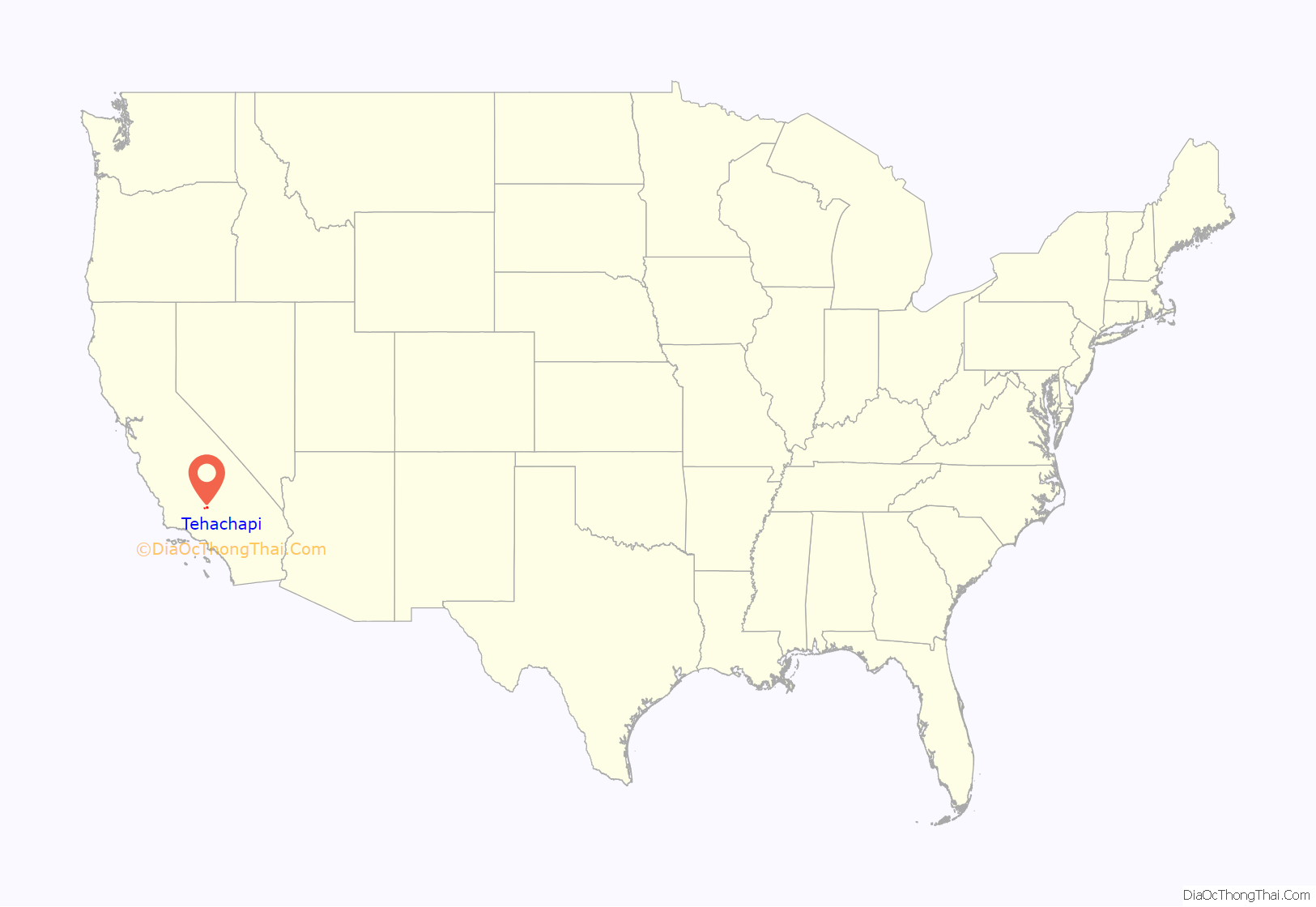
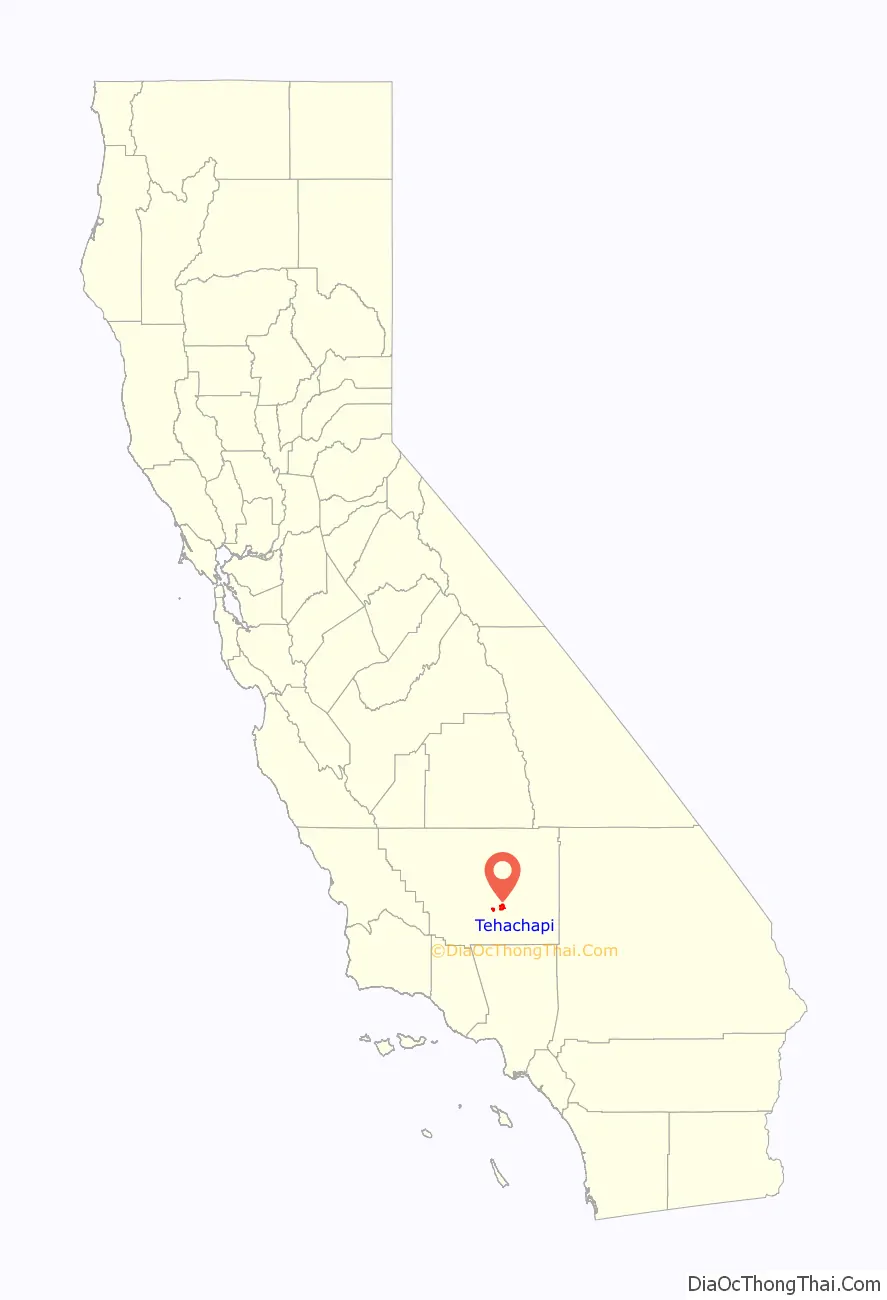
Tehachapi location map. Where is Tehachapi city?
History
The Kawaiisu people (also Nuwu (“people” in Kawaiisu), or Nuooah) are the Native American tribe whose homeland was the Tehachapi Valley, and seasonally the southern Sierra Nevada and Mojave Desert, for thousands of years.
One possibility for the origin of the name Tehachapi comes from the Kawaiisu language. It may be derived from the word for “hard climb” or tihachipia, according to the Tomi-Kahni Resource Center. The settlement has been formerly known and spelled as: Tehachapai; Tehachapa; Tehachepi; Tehachipi; and Summit Station. According to Yokuts informant Wahumchah, recorded by anthropologist Frank Forrest Latta, Tehachapi derives from a Yokuts-Ute amalgam, from Yokuts taheech[e] “oak-covered flat” + Ute pah’ “water” (cl. Pah-ute, lit. ‘Water Ute’). On an 1864 map of California, the name appears as Taheechepah.
Previously known as ‘Old Town’, Tehachapi was established in the 1860s. It was briefly known as Greenwich and Williamsburg prior to the name change in 1876. It is now registered as California Historical Landmark #643 for being the oldest settlement in the Tehachapi Valley.
Construction of the original Southern Pacific-SP railroad depot was the beginning of the downtown core. It is now on the National Register of Historic Places (NRHP)—and was the oldest building in downtown Tehachapi until it burned in June 2008. The building had been in the final stages of becoming a museum. It has since been rebuilt using the original plans with only minor modifications to meet modern building codes. The new depot was dedicated on June 5, 2010.
1952 Kern County earthquake
Tehachapi experienced the 7.3 magnitude 1952 Kern County earthquake on the White Wolf Fault. At the time, the earthquake was the largest in Southern California in the twentieth century and the largest since the 1872 Lone Pine earthquake. It was felt as far away as Reno, Nevada. Twelve people died in the quake and severe damage was done to buildings and rail lines in the area.
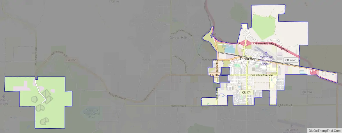
Tehachapi Road Map
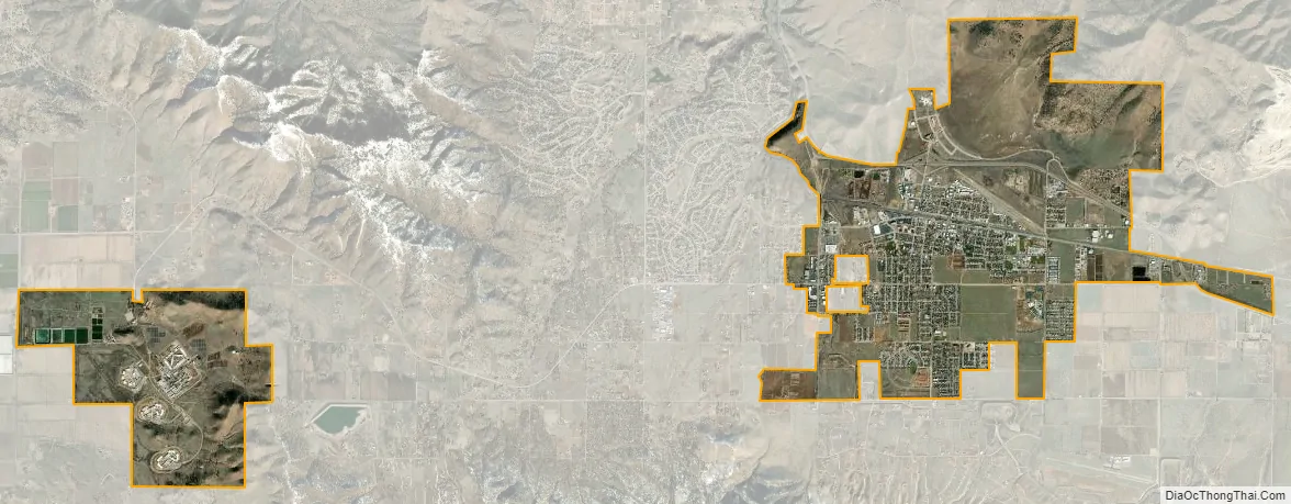
Tehachapi city Satellite Map
Geography
Faults
Downtown Tehachapi is approximately 15 miles (24 km) from the White Wolf Fault, 6 miles (10 km) from the Garlock Fault and 30 miles (50 km) from the San Andreas Fault. The 1857 Fort Tejon earthquake on the San Andreas Fault had an estimated magnitude of 7.9 but there is no record of the local effects of this quake. The Garlock Fault last ruptured approximately 500 years ago.
Climate
Tehachapi has a subtropical mediterranean climate (Köppen Csa).
Tehachapi is known for its four-season climate. The wet season is generally November through May, although thunderstorms are common during the summer, especially over the nearby mountain peaks. Average temperatures range from 88 to 58 °F (31 to 14 °C) in July to 52 to 29 °F (11 to −2 °C) in January. The area typically collects 15 to 20 inches (38 to 51 cm) of snow each winter. There are an average of 31.1 days with highs of 91 °F (32.78 °C) or higher and an average of 94.8 days with lows of 31 °F (−0.6 °C) or lower annually.
The highest recorded temperature was 105 °F (41 °C) on July 27, 1934. The lowest recorded temperature was −4 °F (−20 °C) on January 14, 1932, and December 21, 1967. Annual precipitation averages 11.08 inches (281 mm) and there is measurable precipitation on average of 42 days annually. The wettest year was 1983, with 27.77 inches (705 mm) and the driest year was 1989, with 4.3 inches (110 mm). The most precipitation in one month was 11.59 inches (294 mm) in March 1983. The most precipitation in 24 hours was 3.4 inches (86 mm) on March 1, 1983. The snowiest year was 1967, when 62 inches (160 cm) fell. The most snow in one month was 44 inches (110 cm) in January 1933.
See also
Map of California State and its subdivision:- Alameda
- Alpine
- Amador
- Butte
- Calaveras
- Colusa
- Contra Costa
- Del Norte
- El Dorado
- Fresno
- Glenn
- Humboldt
- Imperial
- Inyo
- Kern
- Kings
- Lake
- Lassen
- Los Angeles
- Madera
- Marin
- Mariposa
- Mendocino
- Merced
- Modoc
- Mono
- Monterey
- Napa
- Nevada
- Orange
- Placer
- Plumas
- Riverside
- Sacramento
- San Benito
- San Bernardino
- San Diego
- San Francisco
- San Joaquin
- San Luis Obispo
- San Mateo
- Santa Barbara
- Santa Clara
- Santa Cruz
- Shasta
- Sierra
- Siskiyou
- Solano
- Sonoma
- Stanislaus
- Sutter
- Tehama
- Trinity
- Tulare
- Tuolumne
- Ventura
- Yolo
- Yuba
- Alabama
- Alaska
- Arizona
- Arkansas
- California
- Colorado
- Connecticut
- Delaware
- District of Columbia
- Florida
- Georgia
- Hawaii
- Idaho
- Illinois
- Indiana
- Iowa
- Kansas
- Kentucky
- Louisiana
- Maine
- Maryland
- Massachusetts
- Michigan
- Minnesota
- Mississippi
- Missouri
- Montana
- Nebraska
- Nevada
- New Hampshire
- New Jersey
- New Mexico
- New York
- North Carolina
- North Dakota
- Ohio
- Oklahoma
- Oregon
- Pennsylvania
- Rhode Island
- South Carolina
- South Dakota
- Tennessee
- Texas
- Utah
- Vermont
- Virginia
- Washington
- West Virginia
- Wisconsin
- Wyoming


