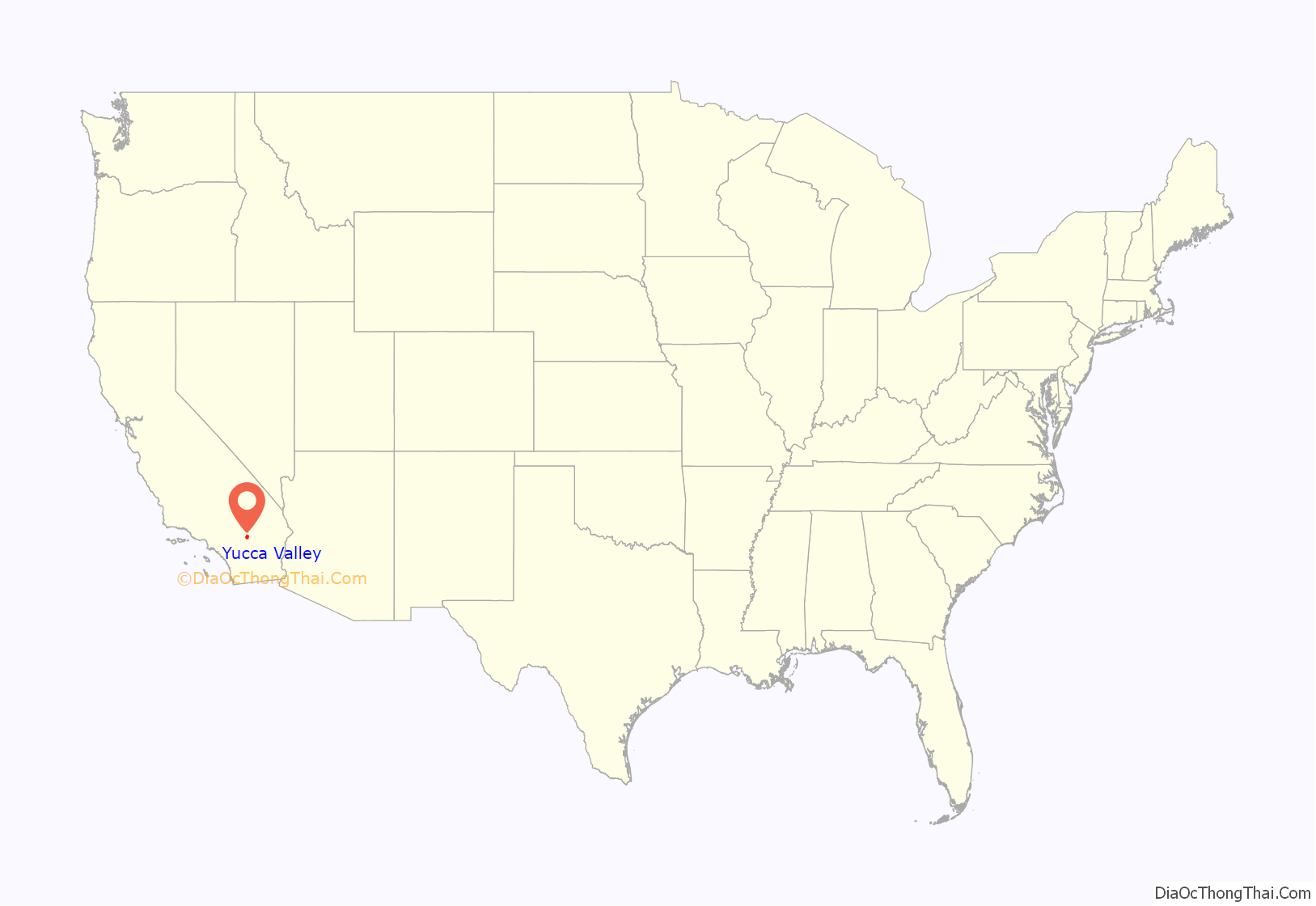
Yucca Valley is an incorporated town in San Bernardino County, California, United States. The population was 20,700 as of the 2010 census. Yucca Valley lies 17 miles (27 km) west of Twentynine Palms, 27 miles (43 km) north of Palm Springs, 62 miles (100 km) south of Barstow via State Route 247 and 55 miles (89 km) east of San Bernardino.
Bordered in the west by the San Bernardino Mountains and in the south by the Joshua Tree National Park, the town of Yucca Valley is located in the Mojave Desert at roughly 3,300 feet (1,000 m) above sea level.
| Name: | Yucca Valley town |
|---|---|
| LSAD Code: | 43 |
| LSAD Description: | town (suffix) |
| State: | California |
| County: | San Bernardino County |
| Incorporated: | November 27, 1991 |
| Elevation: | 3,258 ft (993 m) |
| Total Area: | 39.83 sq mi (103.16 km²) |
| Land Area: | 39.83 sq mi (103.16 km²) |
| Water Area: | 0.00 sq mi (0.00 km²) 0% |
| Total Population: | 21,701 |
| Population Density: | 546.73/sq mi (211.10/km²) |
| ZIP code: | 92284–92286 |
| FIPS code: | 0687056 |
| Website: | www.yucca-valley.org |
Online Interactive Map
Click on ![]() to view map in "full screen" mode.
to view map in "full screen" mode.
Yucca Valley location map. Where is Yucca Valley town?

History
Norman J. Essig was a key player in the late 1950s in working toward establishing Yucca Valley as a place for entertainment celebrities to come and live in privacy. He personally acquired hundreds of acres of land during this time and owned and ran Glenn Realty. He helped to put in the main roads that are running throughout the town off of Hwy 62. He was personal friends with Jimmy Van Heusen the composer and gave him prime real estate in Yucca Valley to build his house which can still be seen atop the highest hill in the center of the town.
In 1992, three large earthquakes occurred near the city, the magnitude 6.1 Joshua Tree earthquake on April 22, and on June 28 the 7.3 Landers and 6.5 Big Bear earthquakes.
The 7.1 magnitude Hector Mine earthquake on October 16, 1999, had an epicenter 30 miles (48 km) north of town.
On July 11, 2006, a wildfire started by lightning raced through neighboring Pioneertown. The blaze, named the Sawtooth Complex fire, also burned into Yucca Valley and nearby Morongo Valley and destroyed roughly 64,000 acres (26,000 ha) of desert landscape.
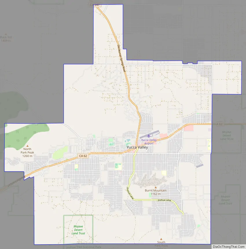
Yucca Valley Road Map
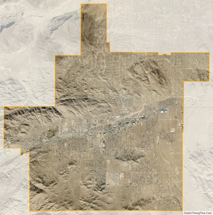
Yucca Valley city Satellite Map
Geography
Yucca Valley lies in the middle of the Morongo Basin at a base elevation of 3,300 feet. Joshua Tree National Park is adjacent to its southern border.
According to the United States Census Bureau, the town has a total area of 40.0 square miles (104 km). All of it is land and none of it is covered in water. Yucca Valley is located north of the Joshua Tree National Park, while the Little San Bernardino Mountains and many hills cover a large percentage of city area.
This High Desert community has an elevation (city hall) at 3,224 feet (983 m) above sea level. Snowfall occurs almost annually whenever the snow level drops to elevations under 4,000 feet (1,200 m). The area’s terrain is prone to wildfires (such as the Pioneertown fire in July 2006), resulting from plant growth during the rainy seasons and flash floods. The plants within the town and among the chaparral in the mountains outside of the San Bernardino National Forest wilt and perish from the summer heat, providing ample fuel during a fire.
Geology
Yucca Valley has experienced high levels of seismic activity. Fault lines criss-cross the town and the Morongo basin.
Climate
According to the Köppen Climate Classification system, Yucca Valley has a cold desert climate, abbreviated “BWk” on climate maps.
See also
Map of California State and its subdivision:- Alameda
- Alpine
- Amador
- Butte
- Calaveras
- Colusa
- Contra Costa
- Del Norte
- El Dorado
- Fresno
- Glenn
- Humboldt
- Imperial
- Inyo
- Kern
- Kings
- Lake
- Lassen
- Los Angeles
- Madera
- Marin
- Mariposa
- Mendocino
- Merced
- Modoc
- Mono
- Monterey
- Napa
- Nevada
- Orange
- Placer
- Plumas
- Riverside
- Sacramento
- San Benito
- San Bernardino
- San Diego
- San Francisco
- San Joaquin
- San Luis Obispo
- San Mateo
- Santa Barbara
- Santa Clara
- Santa Cruz
- Shasta
- Sierra
- Siskiyou
- Solano
- Sonoma
- Stanislaus
- Sutter
- Tehama
- Trinity
- Tulare
- Tuolumne
- Ventura
- Yolo
- Yuba
- Alabama
- Alaska
- Arizona
- Arkansas
- California
- Colorado
- Connecticut
- Delaware
- District of Columbia
- Florida
- Georgia
- Hawaii
- Idaho
- Illinois
- Indiana
- Iowa
- Kansas
- Kentucky
- Louisiana
- Maine
- Maryland
- Massachusetts
- Michigan
- Minnesota
- Mississippi
- Missouri
- Montana
- Nebraska
- Nevada
- New Hampshire
- New Jersey
- New Mexico
- New York
- North Carolina
- North Dakota
- Ohio
- Oklahoma
- Oregon
- Pennsylvania
- Rhode Island
- South Carolina
- South Dakota
- Tennessee
- Texas
- Utah
- Vermont
- Virginia
- Washington
- West Virginia
- Wisconsin
- Wyoming


