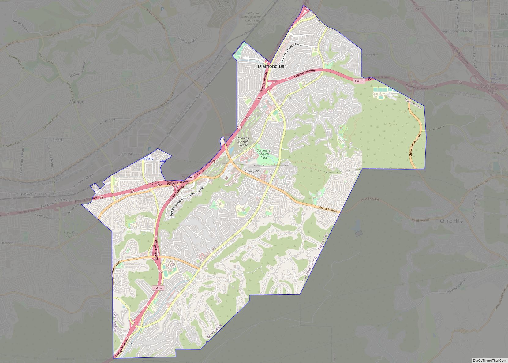
Map of Dixon Lane-Meadow Creek CDP

Map of Dixon Lane-Meadow Creek CDP

Dixon Lane-Meadow Creek is a census-designated place (CDP) in Inyo County, California, United States. The population was 2,645 at the 2010 census, down from 2,702 at the 2000 census. Dixon Lane-Meadow Creek CDP overview: Name: Dixon Lane-Meadow Creek CDP LSAD Code: 57 LSAD Description: CDP (suffix) State: California County: Inyo County Total Area: 3.36 sq mi (8.70 km²) … Read more

Map of Discovery Bay CDP

Map of Discovery Bay CDP

Discovery Bay is a census-designated place (CDP) in eastern Contra Costa County, California in the United States, about 60 miles (97 km) from San Francisco. It is located in the San Francisco Bay Area. As of 2020, its population was 15,358, a 15% percent gain from 13,352 at the 2010 census. Discovery Bay was originally a … Read more

Map of Dinuba city

Map of Dinuba city

Dinuba is a city in Tulare County, California, United States. The population was 24,563 at the 2020 census, up from 21,453 at the 2010 census. It is part of the Visalia-Porterville metropolitan statistical area. The Alta District Museum is located in Dinuba in a restored railroad station; the museum has a collection of materials that … Read more

Map of Dogtown CDP

Map of Dogtown CDP

Dogtown is a census-designated place in San Joaquin County, California. Dogtown sits at an elevation of 115 feet (35 m). The 2020 United States census reported Dogtown’s population was 2,643, which is up from 2,506 in the 2010 United States census. Dogtown CDP overview: Name: Dogtown CDP LSAD Code: 57 LSAD Description: CDP (suffix) State: California … Read more

Map of Dobbins CDP

Map of Dobbins CDP

Dobbins (formerly, Dobbin, Dobbins Ranche, Dobbins Ranch, and Dobbin’s Ranche) is a census-designated place in Yuba County, California. Dobbins CDP overview: Name: Dobbins CDP LSAD Code: 57 LSAD Description: CDP (suffix) State: California County: Yuba County Elevation: 1,742 ft (531 m) Total Area: 7.81 sq mi (20.24 km²) Land Area: 7.74 sq mi (20.05 km²) Water Area: 0.07 sq mi (0.19 km²)  0.92% Total Population: 551 … Read more

Map of Dixon city

Map of Dixon city, California

Dixon is a city in northern Solano County, California, United States, located 23 miles (37 km) from the state capital, Sacramento. It has a hot-summer mediterranean climate on the Köppen climate classification scale. Its population was 18,988 at the 2020 census. Other nearby cities include Vacaville, Winters, Davis, Woodland, and Rio Vista. Dixon city overview: Name: … Read more

Map of Dorris city

Map of Dorris city

Dorris is a city in Siskiyou County, California, United States. Its population is 860 as of the 2020 census, down from 939 from the 2010 census. The town being small, the only attractions are the flagpole and county library. The most notable people who have been residents of Dorris are two athletes who were born … Read more

Map of Dorrington CDP

Map of Dorrington CDP

Dorrington is a census-designated place (CDP) in Calaveras County, California, United States. The population was 609 at the 2010 census, down from 727 at the 2000 census. Originally known as Cold Spring Ranch until 1902 (because of an icy spring), the town sits on State Route 4 and historically was a stopping point along the … Read more

Map of Dollar Point CDP

Map of Dollar Point CDP

Dollar Point is a census-designated place (CDP) in Placer County, California, United States, along the northwest shore of Lake Tahoe. It is part of the Sacramento–Arden-Arcade–Roseville Metropolitan Statistical Area. The population was 1,215 at the 2010 census down from 1,539 at the 2000 census. Dollar Point CDP overview: Name: Dollar Point CDP LSAD Code: 57 … Read more

Map of Douglas City CDP

Map of Douglas City CDP

Douglas City is a unincorporated community in Trinity County, California first settled during the California Gold Rush. Douglas City sits at an elevation of 2,152 feet (656 m). The ZIP Code is 96024. The community is inside area code 530. Its population is 868 as of the 2020 census, up from 713 from the 2010 census. … Read more

Map of Dos Palos city

Map of Dos Palos city

Dos Palos (Spanish for “Two Timbers”) is a city in Merced County, California, United States. Dos Palos is located 27 miles (43 km) south-southwest of Merced, the county seat, at an elevation of 118 feet (36 m). The population was 5,798 at the 2020 census, up from 4,950 at the 2010 census. Dos Palos city overview: Name: … Read more

Map of Dos Palos Y CDP

Map of Dos Palos Y CDP

Dos Palos Y (Dos Palos, Spanish for “Two Timbers”) is a census-designated place at the “Y” intersection of California SR 152 and Highway 33 in Merced County, California. It is located 11.5 miles (19 km) east of Los Banos and 4.8 miles (7.7 km) north of Dos Palos proper. As of the 2020 census, the population was … Read more