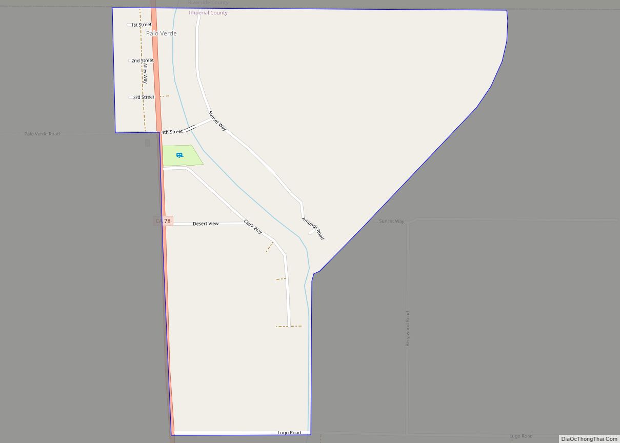
Map of Palos Verdes Estates city

Map of Palos Verdes Estates city

Palos Verdes Estates (Palos Verdes, Spanish for “Green Sticks”) is a city in Los Angeles County, California, United States, situated on the Palos Verdes Peninsula. The city was master-planned by the noted American landscape architect and planner Frederick Law Olmsted Jr. The city is located along the Southern California coastline of the Pacific Ocean. The … Read more

Map of Paradise Park CDP

Map of Paradise Park CDP

Paradise Park is a census-designated place (CDP) in Santa Cruz County, California. Paradise Park sits at an elevation of 92 feet (28 m). The 2020 United States census reported Paradise Park’s population was 550, which is up from 389 people in the 2010 census. Paradise Park is separated from the University of California, Santa Cruz campus … Read more

Map of Panorama Heights CDP

Map of Panorama Heights CDP

Panorama Heights is a census-designated place (CDP) in Tulare County, California. Panorama Heights sits at an elevation of 5,043 feet (1,537 m). The 2020 United States census reported Panorama Heights’s population was 44, up from 41 at the 2010 census. Panorama Heights CDP overview: Name: Panorama Heights CDP LSAD Code: 57 LSAD Description: CDP (suffix) State: … Read more

Map of Parklawn CDP

Map of Parklawn CDP

Parklawn is a census-designated place (CDP) in Stanislaus County, California. Parklawn sits at an elevation of 92 feet (28 m). The 2010 United States census reported Parklawn’s population was 1,337. Parklawn CDP overview: Name: Parklawn CDP LSAD Code: 57 LSAD Description: CDP (suffix) State: California County: Stanislaus County Elevation: 92 ft (28 m) Total Area: 0.166 sq mi (0.430 km²) Land … Read more

Map of Paramount city

Map of Paramount city

Paramount is a city in Los Angeles County, California, United States. According to the 2010 census, the city had a total population of 54,098, down from 55,266 at the 2000 census. Paramount is part of the Greater Los Angeles Area and is bordered by Compton and Lynwood to the west, South Gate and Downey to … Read more

Map of Paradise CDP

Map of Paradise CDP, California

Paradise is an unincorporated community and census-designated place (CDP) that is the southernmost community in Mono County, California, United States. The population was 174 at the 2020 census. Paradise CDP overview: Name: Paradise CDP LSAD Code: 57 LSAD Description: CDP (suffix) State: California County: Mono County Elevation: 5,230 ft (1,590 m) Total Area: 4.352 sq mi (11.272 km²) Land Area: … Read more

Map of Parkwood CDP

Map of Parkwood CDP, California

Parkwood is a census-designated place (CDP) in Madera County, California, United States. It is part of the Madera Metropolitan Statistical Area. The population was 2,307 at the 2020 census. Parkwood CDP overview: Name: Parkwood CDP LSAD Code: 57 LSAD Description: CDP (suffix) State: California County: Madera County Elevation: 262 ft (80 m) Total Area: 0.697 sq mi (1.81 km²) Land … Read more

Map of Parkway CDP

Map of Parkway CDP, California

Parkway is a Census-designated place in Sacramento County, California. Parkway sits at an elevation of 20 feet (6.1 m). The 2010 United States census reported Parkway’s population was 14,670. Prior to the 2010 United States census, Parkway was grouped with Fruitridge Pocket and Lemon Hill in the Parkway-South Sacramento, California CDP. Parkway CDP overview: Name: Parkway … Read more

Map of Parksdale CDP

Map of Parksdale CDP

Parksdale is a census-designated place (CDP) in Madera County, California, United States. It is part of the Madera Metropolitan Statistical Area. The population was 3,234 at the 2020 census, up from 2,621 in 2010. Parksdale CDP overview: Name: Parksdale CDP LSAD Code: 57 LSAD Description: CDP (suffix) State: California County: Madera County Elevation: 279 ft (85 m) … Read more

Map of Paskenta CDP

Map of Paskenta CDP

Paskenta (Wintun: Paskenti) is a small unincorporated town in Tehama County, California. Historically, it had greater local importance due to the presence of an active lumber mill. The ZIP Code is 96074. The community is inside area code 530 and the Paskenta CDP. Paskenta sits at an elevation of 725 feet (221 m). The 2010 United … Read more

Map of Pasatiempo CDP

Map of Pasatiempo CDP

Pasatiempo (Spanish for “Pastime”) is an unincorporated community and census-designated place (CDP) in Santa Cruz County, California, United States, located along State Route 17 between Scotts Valley and Santa Cruz. Bus service is provided by Santa Cruz Metro and the Highway 17 Express. Pasatiempo sits at an elevation of 394 feet (120 m). The 2020 United … Read more

Map of Parlier city

Map of Parlier city

Parlier is a city in Fresno County, California, United States. As of the 2020 census, the city had a total population of 18,494, up from 11,145 in 2000. The city has one of the state’s highest percentage of Latinos, a large majority of whom are seasonal migrant laborers who arrive and temporarily work in the … Read more