Paramount is a city in Los Angeles County, California, United States. According to the 2010 census, the city had a total population of 54,098, down from 55,266 at the 2000 census. Paramount is part of the Greater Los Angeles Area and is bordered by Compton and Lynwood to the west, South Gate and Downey to the north, Bellflower to the east and south, and Long Beach to the south.
| Name: | Paramount city |
|---|---|
| LSAD Code: | 25 |
| LSAD Description: | city (suffix) |
| State: | California |
| County: | Los Angeles County |
| Incorporated: | January 30, 1957 |
| Elevation: | 69 ft (21 m) |
| Total Area: | 4.84 sq mi (12.54 km²) |
| Land Area: | 4.73 sq mi (12.25 km²) |
| Water Area: | 0.11 sq mi (0.29 km²) 2.28% |
| Total Population: | 54,098 |
| Population Density: | 11,406.98/sq mi (4,404.16/km²) |
| ZIP code: | 90723 |
| Area code: | 562 |
| FIPS code: | 0655618 |
| GNISfeature ID: | 1652771 |
| Website: | www.paramountcity.com |
Online Interactive Map
Click on ![]() to view map in "full screen" mode.
to view map in "full screen" mode.
Paramount location map. Where is Paramount city?


History
The city today known as Paramount was originally identified in 1781 by Mexican settlers of New Spain. It was organized under two old Spanish Ranchos; on the west, Rancho San Pedro, and on the east, Rancho Los Nietos (now portions of the cities of Santa Fe Springs and Whittier). These ranchos were established under the Spanish Empire and granted by King Carlos III in 1784. In 1834, Rancho Los Nietos was partitioned into five smaller ranchos including Rancho Los Cerritos and Rancho Los Alamitos, which both encompassed parts of Paramount.
After the Mexican–American War California was ceded to the United States. The then-unincorporated community of Paramount was created in 1948 when the United States Postmaster General ordered the merger of the post offices of Hynes and Clearwater (Pitt 1997:381). The name was taken from Paramount Boulevard, the main north-to-south surface street extending through the city. The city officially incorporated January 30, 1957 following a successful “Save Paramount for Paramount” campaign to fight annexation by Long Beach, Bellflower, and South Gate.
While the Paramount economy was based largely on the hay and dairy industries, the high cost of land led to their local demise. The last Paramount dairy closed in 1977.
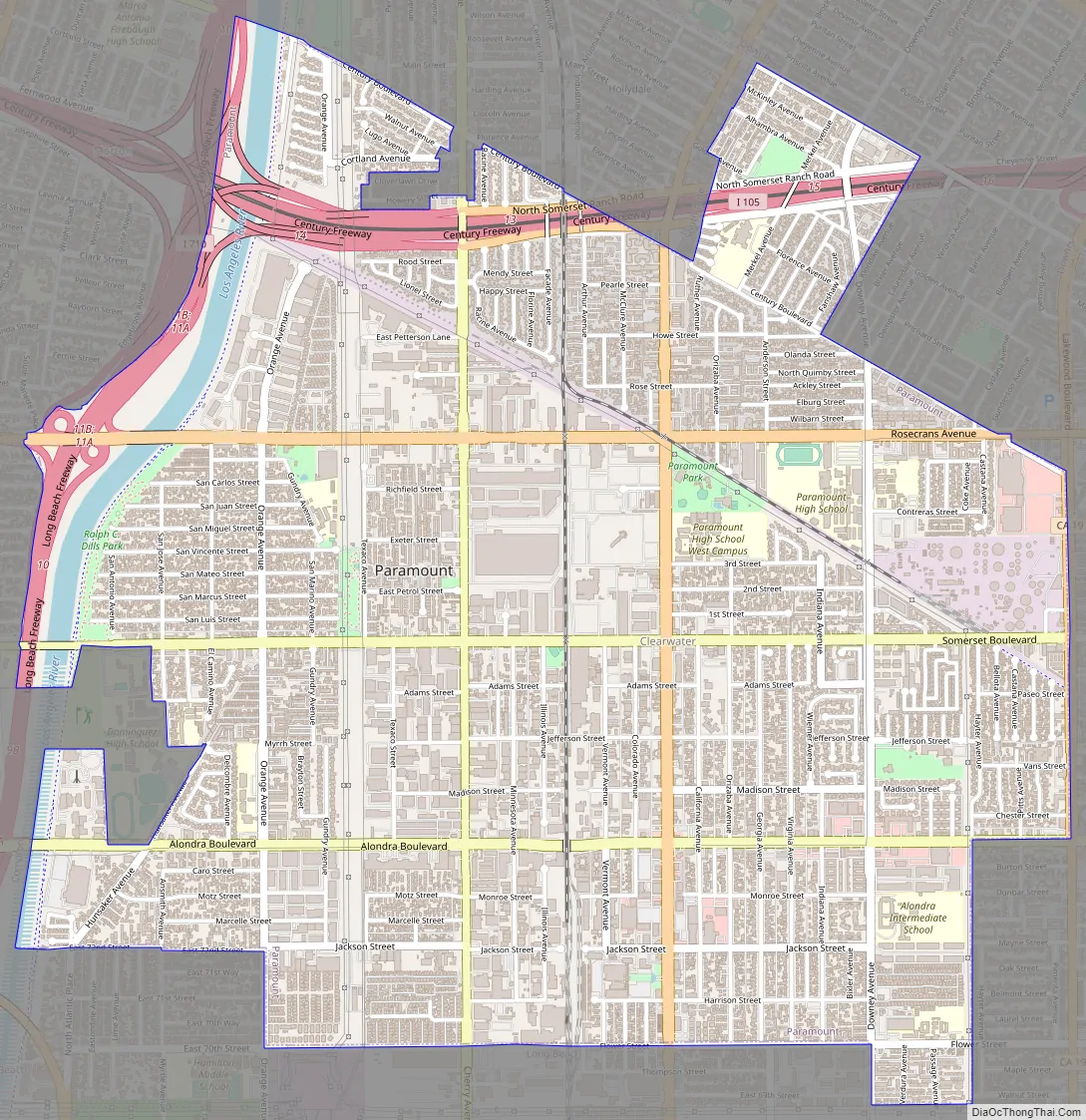
Paramount Road Map
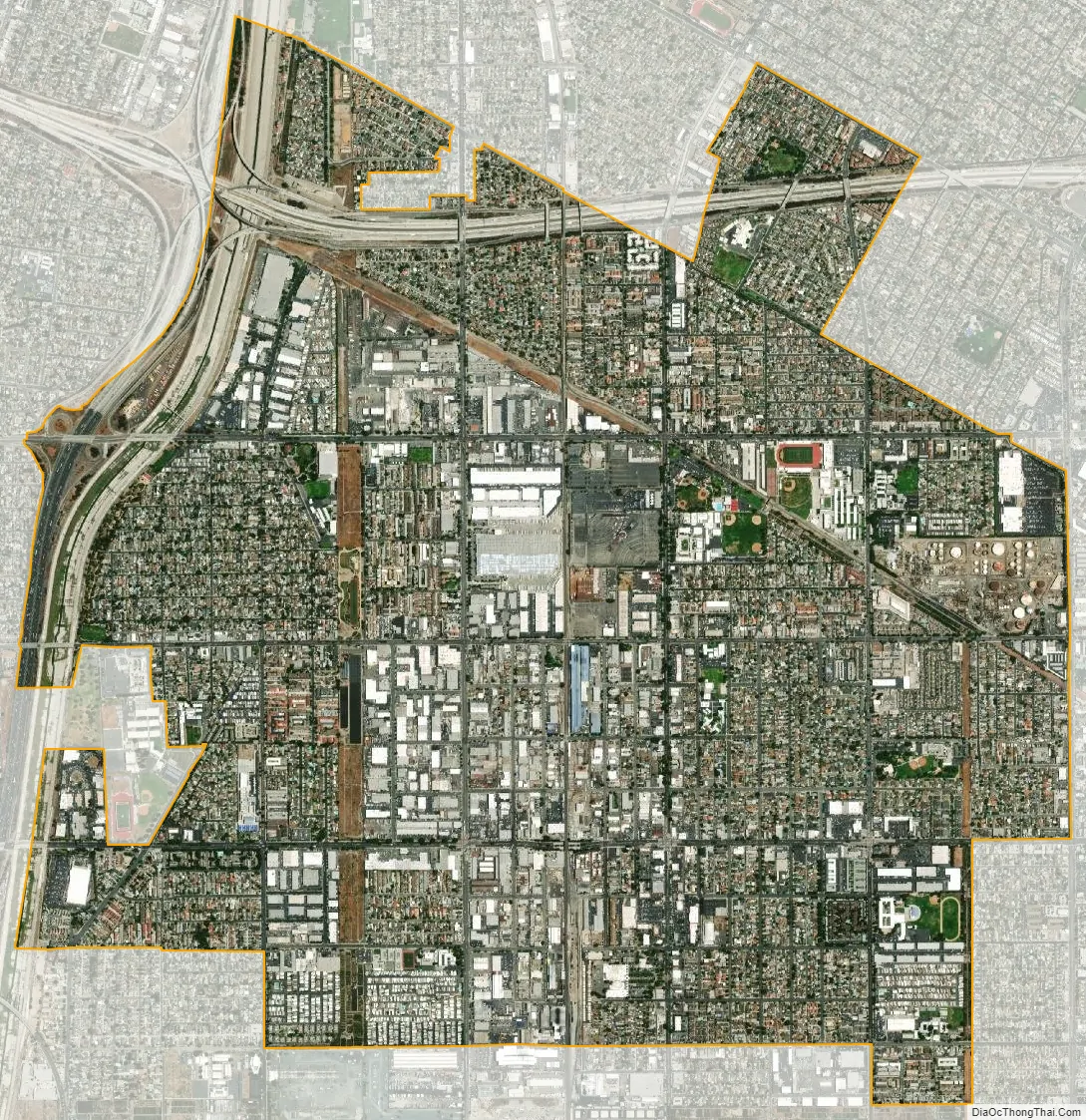
Paramount city Satellite Map
Geography
According to the United States Census Bureau, Paramount has a total area of 4.8 square miles (12 km), of which 4.7 square miles (12 km) is land and 0.1 square miles (0.26 km) (2.28%) is water.
See also
Map of California State and its subdivision:- Alameda
- Alpine
- Amador
- Butte
- Calaveras
- Colusa
- Contra Costa
- Del Norte
- El Dorado
- Fresno
- Glenn
- Humboldt
- Imperial
- Inyo
- Kern
- Kings
- Lake
- Lassen
- Los Angeles
- Madera
- Marin
- Mariposa
- Mendocino
- Merced
- Modoc
- Mono
- Monterey
- Napa
- Nevada
- Orange
- Placer
- Plumas
- Riverside
- Sacramento
- San Benito
- San Bernardino
- San Diego
- San Francisco
- San Joaquin
- San Luis Obispo
- San Mateo
- Santa Barbara
- Santa Clara
- Santa Cruz
- Shasta
- Sierra
- Siskiyou
- Solano
- Sonoma
- Stanislaus
- Sutter
- Tehama
- Trinity
- Tulare
- Tuolumne
- Ventura
- Yolo
- Yuba
- Alabama
- Alaska
- Arizona
- Arkansas
- California
- Colorado
- Connecticut
- Delaware
- District of Columbia
- Florida
- Georgia
- Hawaii
- Idaho
- Illinois
- Indiana
- Iowa
- Kansas
- Kentucky
- Louisiana
- Maine
- Maryland
- Massachusetts
- Michigan
- Minnesota
- Mississippi
- Missouri
- Montana
- Nebraska
- Nevada
- New Hampshire
- New Jersey
- New Mexico
- New York
- North Carolina
- North Dakota
- Ohio
- Oklahoma
- Oregon
- Pennsylvania
- Rhode Island
- South Carolina
- South Dakota
- Tennessee
- Texas
- Utah
- Vermont
- Virginia
- Washington
- West Virginia
- Wisconsin
- Wyoming


