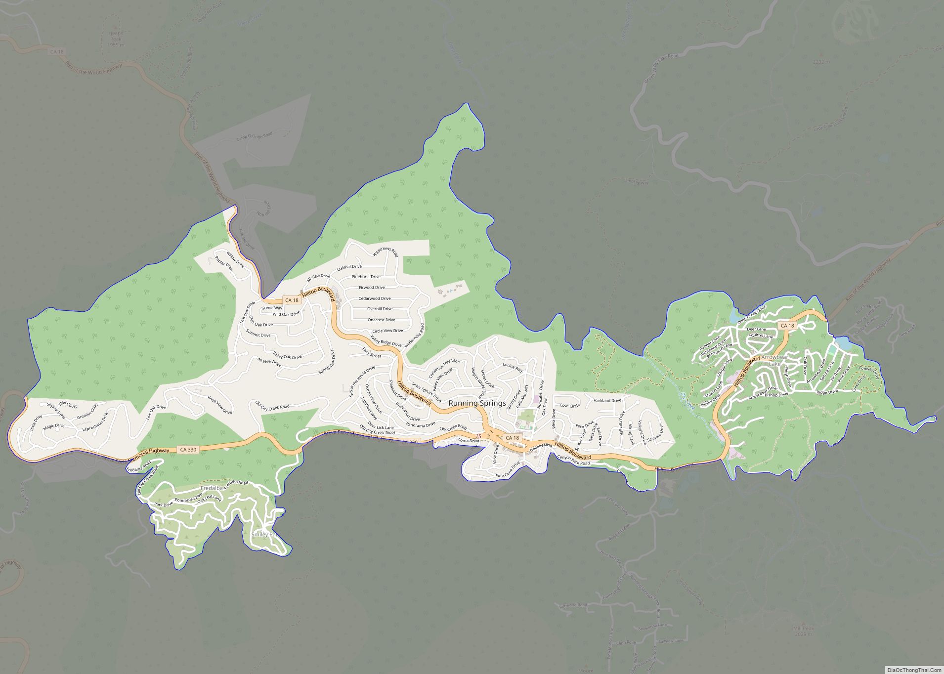
Map of Salida CDP

Map of Salida CDP, California

Salida (Spanish for “Exit”) is a census-designated place (CDP) in Stanislaus County, California, in the United States. As of the 2010 census, the CDP population was 13,722. It is part of the Modesto Metropolitan Statistical Area. Cultivation of almonds has historically been a significant activity in the vicinity, including a major Blue Diamond processing facility … Read more

Map of Rutherford CDP

Map of Rutherford CDP, California

Rutherford is a census-designated place (CDP) in Napa County, California, United States. The population was 164 at the 2010 census. Rutherford is located in the Rutherford AVA (American Viticultural Area) which is located in the larger Napa Valley AVA. The Robert Mondavi Winery is located between Rutherford and neighboring Oakville (though its corporate headquarters are … Read more

Map of Ruth CDP

Map of Ruth CDP, California

Ruth is a census-designated place (CDP) in Trinity County, California. Ruth is located in the southern portion of the county. The community – and adjacent Ruth Lake – was named after Ruth McKnight, daughter of settlers. The ZIP code is 95526. The community is inside area code 707. It is located near the headwaters of … Read more

Map of Salton Sea Beach CDP

Map of Salton Sea Beach CDP

Salton Sea Beach is a census-designated place (CDP) in Imperial County, California, located 2.5 miles (4 km) southeast of Desert Shores. The population was 508 at the 2020 census, up from 422 at the 2010 census, up from 392 at the 2000 census. It is part of the El Centro, California Metropolitan Statistical Area. It was … Read more

Map of Salton City CDP

Map of Salton City CDP

Salton City is a census-designated place (CDP) in Imperial County, California. It is the largest Imperial County development on the Salton Sea coast. It is part of the El Centro, California Metropolitan Statistical Area. The population was 3,763 at the 2010 census, up from 978 in 2000. The reported population for 2020 was 5,155. Although … Read more

Map of Salmon Creek CDP

Map of Salmon Creek CDP, California

Salmon Creek is an unincorporated community settlement and census-designated place (CDP) in Sonoma County, California, U.S. It is located on the Pacific coast about 90 minutes drive north of San Francisco, between the towns of Jenner and Bodega Bay, California. The population was 86 at the 2010 census. The settlement is bounded to the north … Read more

Map of San Anselmo town

Map of San Anselmo town

San Anselmo (Spanish for ‘Saint Anselm’) is an incorporated town in Marin County, California, United States. San Anselmo is located 1.5 miles (2.4 km) west of San Rafael, at an elevation of 46 feet (14 m). It is located about 20 miles (32 km) north of San Francisco. The town is bordered by San Rafael to the … Read more

Map of San Andreas CDP

Map of San Andreas CDP

San Andreas (Spanish for “St. Andrew”) is an unincorporated census-designated place and the county seat of Calaveras County, California. The population was 2,783 at the 2010 census, up from 2,615 at the 2000 census. Like most towns in the region, it was founded during the California Gold Rush. The town is located on State Route … Read more

Map of Samoa CDP

Map of Samoa CDP

Samoa (formerly Brownsville) is a census-designated place in Humboldt County, California. It is located 1.5 miles (2.4 km) northwest of Eureka, at an elevation of 23 feet (7 m). Samoa is located in the northern peninsula of Humboldt Bay and is the site of the Samoa Cookhouse, one of the last remaining original, lumber-camp style cookhouses. … Read more

Map of San Bruno city

Map of San Bruno city

San Bruno (Spanish for “St. Bruno”) is a city in San Mateo County, California, United States, incorporated in 1914. The population was 43,908 at the 2020 United States Census. The city is between South San Francisco and Millbrae, adjacent to San Francisco International Airport and Golden Gate National Cemetery; it is approximately 12 miles (19 km) … Read more

Map of San Ardo CDP

Map of San Ardo CDP

San Ardo, formerly known as San Bernardo (Spanish for “St. Bernard”), is an unincorporated community and census-designated place (CDP) in Monterey County, California, United States. San Ardo is located 18 miles (29 km) southeast of King City at an elevation of 449 feet (137 m). The population was 392 at the 2020 census, down from 517 in … Read more

Map of San Antonio Heights CDP

Map of San Antonio Heights CDP

San Antonio Heights is a census-designated place (CDP) in the San Bernardino County, California. It is in the northern Pomona Valley and the foothills of the San Gabriel Mountains. The population was 3,371 at the 2010 census, up from 3,122 at the 2000 census. San Antonio Heights CDP overview: Name: San Antonio Heights CDP LSAD … Read more