Map of Rehoboth Beach city

Map of Rehoboth Beach city

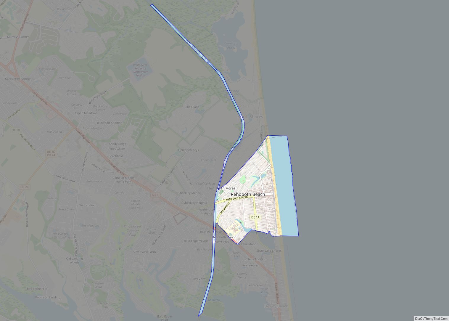
Rehoboth Beach (/rəˈhoʊbəθ/ rə-HOH-bəth) is a city on the Atlantic Ocean along the Delaware Beaches in eastern Sussex County, Delaware. As of 2020, its population was 1,108. Along with the neighboring coastal town of Lewes, Rehoboth Beach is one of the principal cities of Delaware’s rapidly growing Cape Region. Rehoboth Beach lies within the Salisbury … Read more

Map of Pike Creek CDP

Map of Pike Creek CDP

Pike Creek is a census-designated place (CDP) in New Castle County, Delaware, United States and is part of the Philadelphia-Camden-Wilmington, PA-NJ-DE-MD Metropolitan statistical area. In 2007, CNN’s Money Magazine ranked Pike Creek number 79 on its list of the 100 Best Places to Live in the United States. Pike Creek was the only community in … Read more

Map of Pike Creek Valley CDP

Map of Pike Creek Valley CDP

Pike Creek Valley is a census-designated place in New Castle County, Delaware, United States. Its population was 11,217 as of the 2010 census. Pike Creek Valley CDP overview: Name: Pike Creek Valley CDP LSAD Code: 57 LSAD Description: CDP (suffix) State: Delaware County: New Castle County Elevation: 239 ft (73 m) Total Area: 2.87 sq mi (7.44 km²) Land Area: … Read more

Map of Rodney Village CDP

Map of Rodney Village CDP

Rodney Village is a census-designated place (CDP) in Kent County, Delaware, United States. It is part of the Dover, Delaware Metropolitan Statistical Area. The population was 1,487 at the 2010 census. Rodney Village CDP overview: Name: Rodney Village CDP LSAD Code: 57 LSAD Description: CDP (suffix) State: Delaware County: Kent County Elevation: 36 ft (11 m) Total … Read more

Map of Riverview CDP, Delaware

Map of Riverview CDP, Delaware

Riverview is a census-designated place (CDP) in Kent County, Delaware, United States. It is part of the Dover, Delaware Metropolitan Statistical Area. The population was 2,456 at the 2010 census. Riverview CDP overview: Name: Riverview CDP LSAD Code: 57 LSAD Description: CDP (suffix) State: Delaware County: Kent County Elevation: 30 ft (9 m) Total Area: 3.69 sq mi (9.56 km²) … Read more

Map of Rising Sun-Lebanon CDP

Map of Rising Sun-Lebanon CDP

Rising Sun-Lebanon is a census-designated place (CDP) in Kent County, Delaware, United States. It is part of the Dover, Delaware Metropolitan Statistical Area. The population was 3,391 at the 2010 census. Rising Sun-Lebanon CDP overview: Name: Rising Sun-Lebanon CDP LSAD Code: 57 LSAD Description: CDP (suffix) State: Delaware County: Kent County Elevation: 26 ft (8 m) Total … Read more

Map of Slaughter Beach town

Map of Slaughter Beach town

Slaughter Beach is a town in Sussex County, Delaware, United States, located on the southwest shore of Delaware Bay. The population was 207 at the 2010 census, an increase of 4.5% over the past decade. It is part of the Salisbury, Maryland-Delaware Metropolitan Statistical Area. Slaughter Beach town overview: Name: Slaughter Beach town LSAD Code: … Read more

Map of Selbyville town

Map of Selbyville town

Selbyville is a town in Sussex County, Delaware, United States. Its population was 2,167 at the 2010 census, an increase of 31.7% over the previous decade. It is part of the Salisbury, Maryland-Delaware Metropolitan Statistical Area. Selbyville town overview: Name: Selbyville town LSAD Code: 43 LSAD Description: town (suffix) State: Delaware County: Sussex County Founded: … Read more

Map of Seaford city

Map of Seaford city, Delaware

Seaford is a city located along the Nanticoke River in Sussex County, Delaware, United States. According to the 2010 Census Bureau figures, the population of the city is 6,928, an increase of 3.4% from the 2000 census. It is part of the Salisbury, Maryland-Delaware Metropolitan Statistical Area. It is the largest city fully within Sussex … Read more

Map of South Bethany town

Map of South Bethany town

South Bethany is an incorporated town in Sussex County, Delaware, United States. According to the 2010 census, the population of the town is 449, a decrease of 8.7% over the previous decade. It is part of the Salisbury, Maryland-Delaware Metropolitan Statistical Area. South Bethany is popularly considered one of “The Quiet Resorts”, along with its … Read more

Map of Townsend town

Map of Townsend town, Delaware

Townsend is a town in New Castle County, Delaware, United States. The population was 2,049 at the 2010 census, an increase of 492.2% from 2000. The center of population of Delaware is located in Townsend. Townsend town overview: Name: Townsend town LSAD Code: 43 LSAD Description: town (suffix) State: Delaware County: New Castle County Incorporated: … Read more

Map of St. Georges CDP

Map of St. Georges CDP

Saint Georges is an unincorporated town and former municipality situated on the Chesapeake and Delaware Canal in New Castle County, Delaware, United States, approximately midway between the Delaware River and Chesapeake Bay. St. Georges CDP overview: Name: St. Georges CDP LSAD Code: 57 LSAD Description: CDP (suffix) State: Delaware County: New Castle County Elevation: 16 ft … Read more