Rehoboth Beach (/rəˈhoʊbəθ/ rə-HOH-bəth) is a city on the Atlantic Ocean along the Delaware Beaches in eastern Sussex County, Delaware. As of 2020, its population was 1,108. Along with the neighboring coastal town of Lewes, Rehoboth Beach is one of the principal cities of Delaware’s rapidly growing Cape Region. Rehoboth Beach lies within the Salisbury metropolitan area.
A popular, affluent vacation destination, many individuals maintain summer homes in Rehoboth Beach, including current U.S. President Joe Biden. During on-season, Rehoboth Beach’s population expands to over 25,000 within the city limits and thousands more in the surrounding area in the summer.
In 2011, the NRDC awarded Rehoboth Beach with a 5-Star rating in water quality. This award was given only to 12 other locations, one being neighboring Dewey Beach. Out of the 30 states with coastline, the Delaware Beaches ranked number one for water quality in 2011.
| Name: | Rehoboth Beach city |
|---|---|
| LSAD Code: | 25 |
| LSAD Description: | city (suffix) |
| State: | Delaware |
| County: | Sussex County |
| Founded: | 1873 |
| Incorporated: | March 19, 1891 |
| Elevation: | 7 ft (2 m) |
| Total Area: | 1.64 sq mi (4.26 km²) |
| Land Area: | 1.18 sq mi (3.04 km²) |
| Water Area: | 0.47 sq mi (1.22 km²) |
| Total Population: | 1,108 |
| Population Density: | 942.98/sq mi (363.95/km²) |
| ZIP code: | 19971 |
| Area code: | 302 |
| FIPS code: | 1060290 |
| GNISfeature ID: | 214535 |
| Website: | www.cityofrehoboth.com |
Online Interactive Map
Click on ![]() to view map in "full screen" mode.
to view map in "full screen" mode.
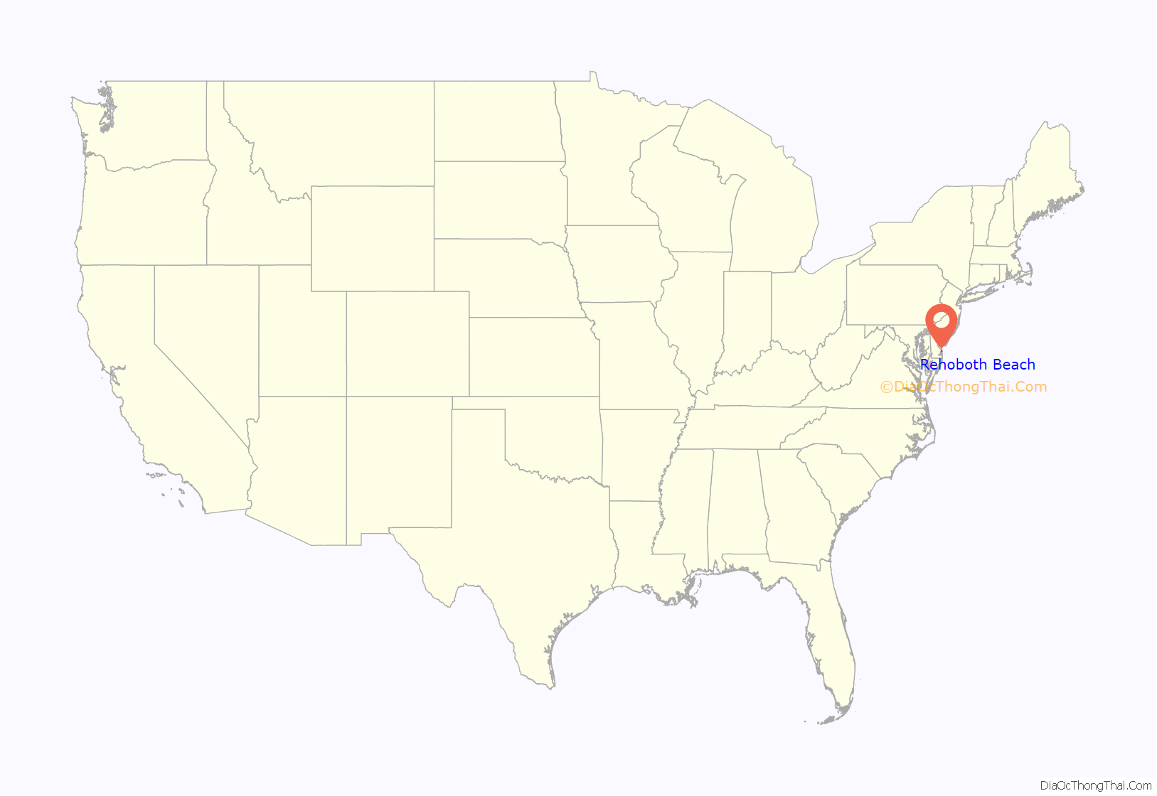
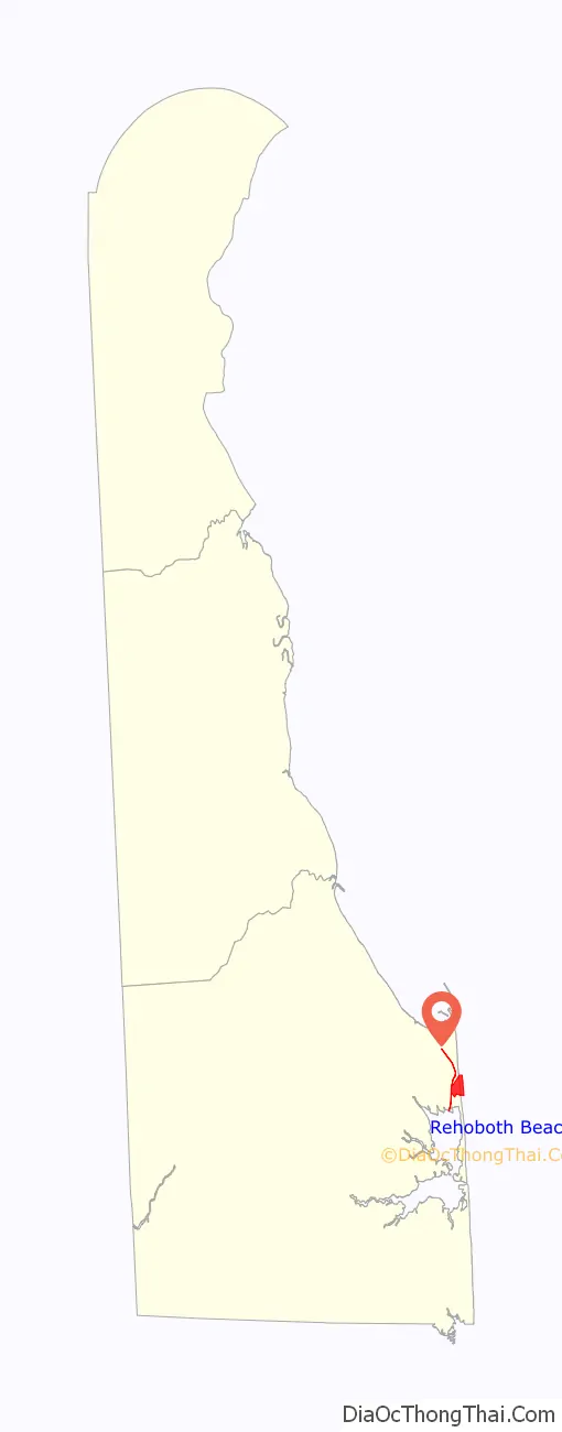
Rehoboth Beach location map. Where is Rehoboth Beach city?
History
Many centuries ago, sea levels were lower, and the Atlantic Coast lay about 30 miles (50 km) farther east than it does today. At the time, the area would have resembled inland portions of southern Delaware today. By the time the first Europeans arrived in the area in the 17th century, the coastline was at its present location and several Native American Indian tribes lived in the area, including the Lenape (or Delaware), the Sikkonese, the Assateagues, and the Nanticoke. The site was the location of what may have been the most important Native American fishing village on the Middle Atlantic coast (the evidence has been obliterated by development, such as the Wilgus Site a prehistoric shell midden archeological location which is now inundated). Pressure from English and Dutch settlers radiating outward from Cape Henlopen near Lewes, Delaware at the entrance to Delaware Bay forced the Lenape to migrate to upper New York state, eastern Canada, and eventually to the west in Indian Territory (later formed Oklahoma, Kansas, parts of Arkansas) while the Sikkonese and Assateagues were extirpated; the Nanticoke, however, still exist in the general area today. The land later came under the control of the Duke of York, younger brother of King Charles II who also seized and occupied in 1664 the Dutch colony further north at the mouth of the Hudson River on Manhattan Island and adjacent Long Island as New Netherland with Fort Amsterdam and the village of New Amsterdam. Followed by the previous Swedish colony on the upper Delaware River at Fort Christina and New Sweden (which the Dutch had attacked and occupied several years earlier). These later became part of the English and later British America colonies/provinces of New York state and New York town along with renamed Wilmington and New Castle along the Delaware River as part of the colonial Province of Pennsylvania and later in the future state of Delaware. Later the Duke himself granted holdings to various landholders who endured into the 18th century. The duke later ascended to the English throne himself as King James II of England and also James VII of Scotland.
By the mid-19th century, the descendants of these landholders were farmers attempting to make a living off the relatively poor sandy infertile land.
The town was founded in 1873 as the Rehoboth Beach Camp Meeting Association by the Rev. Robert W. Todd, of St. Paul’s Methodist Episcopal Church of Wilmington, Delaware, as a site for Methodist (Methodist Episcopal Church) camp meetings in the spirit of similar resorts further north on the New Jersey shore, such as Ocean Grove. The Camp Meeting Association disbanded in 1881, and in 1891, the location was incorporated by the General Assembly of Delaware (state legislature) as “Cape Henlopen City”. In 1893, it was renamed to Rehoboth Beach.
Rehoboth (Hebrew: רְחוֹבוֹת) means “broad spaces.” It appears three times in the Old Testament as a place name: a well dug by Isaac (at modern Wadi er-Ruheibeh) (Genesis 26:22), a city on the Euphrates River (Genesis 36:37; I Chronicles 1:48), and one of the cities of Asshur (Genesis 10:11) in Mesopotamia (modern Iraq). Hence the name may have had a special appeal for the religious founders of the city, although the adjacent bay had already borne the name Rehoboth for at least a century before the town was founded.
The first boardwalk in Rehoboth Beach was constructed in 1873 and has seen changes in configuration from weather and storms over the years. The Junction and Breakwater Railroad constructed a line from Lewes south to Rehoboth Beach in 1878, running down the center of today’s Rehoboth Avenue. The arrival of the railroad allowed visitors to come in from northern Delaware and Pennsylvania and its cities and towns, leading to the beginning of Rehoboth Beach as a tourist destination. After the railroad came to Rehoboth Beach, the center of camp meetings and city life moved to nearby Baltimore Avenue. The original Henlopen Hotel opened in 1879, being replaced with another hotel of the same name on the current site. A paved highway was built by the state between Georgetown and Rehoboth Beach in 1925, which helped bring in travelers from the west in the metropolitan areas of Washington, D.C., Baltimore and other parts of Maryland and northern Virginia.
From 1942 to 1943, Rehoboth Beach Airport served as a base, designated as Coastal Patrol Base 2, for volunteers with the Civil Air Patrol, who flew aerial patrols using civilian aircraft in support of Army and Navy anti-submarine operations during the Battle of the Atlantic. Two CAP airmen, Captain Hugh R. Sharp of Greenville, Delaware and First Lieutenant Edmond Edwards of Newark Delaware, would go on to be the first civilians to receive the Air Medal after a search and rescue mission on 21 July, 1942 where they rescued one crewmember of another CAP aircraft which crashed at sea. Rehoboth Beach Airport shut down in 1987 and Rehoboth Shores Estates Community now stands on the former grounds. The Delaware Public Archives placed a historical marker on the site of the former airport commemorating Coastal Patrol Base 2 in 2006.
The Avery’s Rest Site, Dodd Homestead, Peter Marsh House, Thompson’s Loss and Gain Site, Thompsons Island Site, Warrington Site, and Woman’s Christian Temperance Union Fountain are listed on the National Register of Historic Places, maintained by the National Park Service of the United States Department of the Interior.
Modern resort town
The town often bills itself as “The Nation’s Summer Capital” because it is a frequent summer vacation destination for Washington, D.C., residents as well as visitors from Maryland, Virginia, and Pennsylvania. Vacationers are drawn for many reasons, including the town’s charm and the absence of a sales tax in Delaware. The Rehoboth Beach Boardwalk is a 1-mile (1.6 km) long wooden boardwalk adjacent to the beach with restaurants, shops, amusements, and attractions. The Funland amusement park, which opened in 1962, is located along the boardwalk between Delaware and Brooklyn avenues. Several restaurants and shops are located along the town’s main street, Rehoboth Avenue. Outside of Rehoboth Beach along Delaware Route 1, are the Tanger Outlets, which operate three locations along the highway with over 130 outlet stores.
Due to its proximity to Washington, D.C., Rehoboth Beach is a popular summer destination among members of the United States Congress. Joe Biden, the current President of the United States, and current First Lady, Jill Biden, have a beach house outside the corporate limits of Rehoboth Beach in the North Shores neighborhood. This beach house serves as their “Summer White House”.
Rehoboth Beach is also known as one of the mid-Atlantic coast’s popular LGBT-friendly getaways due to the large number of LGBT-owned and operated businesses, and because of the LGBT-frequented stretch of beach near Queen Street at the south end of the boardwalk, known as Poodle Beach. Poodle Beach tends to attract gay men while North Shore Beach within Cape Henlopen State Park tends to attract lesbian women.
Rehoboth Beach has a seasonal beach patrol who is in charge of lifeguarding the one and a half miles that make up the town’s beachfront. They operate from Memorial Day weekend into the following fall season. The beach patrol is on duty every day between Memorial Day until Labor Day from 10 am until 5 pm on weekdays, and 10 am until 5:30 pm on weekends.
The Rehoboth Beach Bandstand is located on Rehoboth Avenue near the boardwalk and serves as a free open-air music and entertainment venue in the summer months, with performances from over 50 bands during the season. Performances have been held at the Rehoboth Beach Bandstand since 1963.
Reader’s Digest named the Rehoboth Beach Boardwalk as “Best of America” and featured it in the May 2006 issue. Additionally, AARP has named Rehoboth Beach as one of five dream towns as “Best Places to Retire”.
The town has several festivals including the Sea Witch Festival, the Rehoboth Beach Independent Film Festival, and the Rehoboth Beach Autumn Jazz Festival every year.
The Clear Space Theatre Company, a professional theater company, offers a year-round schedule of musical and dramatic productions in the Rehoboth Theatre of the Arts.
Dogfish Head Brewery’s original brewpub is located on the town’s main strip Rehoboth Avenue. The location has grown in years as a popular destination for American craft beer enthusiasts. Grotto Pizza was founded in Rehoboth Beach in 1960 and has grown to 23 locations throughout the state of Delaware along with parts of Maryland and Pennsylvania. Grotto Pizza has three locations in Rehoboth Beach, of which two are along the boardwalk while the other is along Rehoboth Avenue. Nicola Pizza is a well-known business in Rehoboth Beach that opened in 1971, with two locations in the town. In 2022, Nicola Pizza has relocated to Lewes.
The restaurant scene in Rehoboth Beach was traditionally centered in the downtown area, which remains competitive. In the 21st century, a restaurant scene has begun to develop along the Delaware Route 1 corridor, where parking is more available and accessible.
In 2011, the city passed a smoking ban covering parks and playgrounds, but sparing the beach and boardwalk. The smoking ban was extended to the beach, boardwalk, and adjacent public areas in 2014. In 2017, the city implemented a ban on tents, canopies, and large umbrellas on the beach, the first such ban in Delaware.
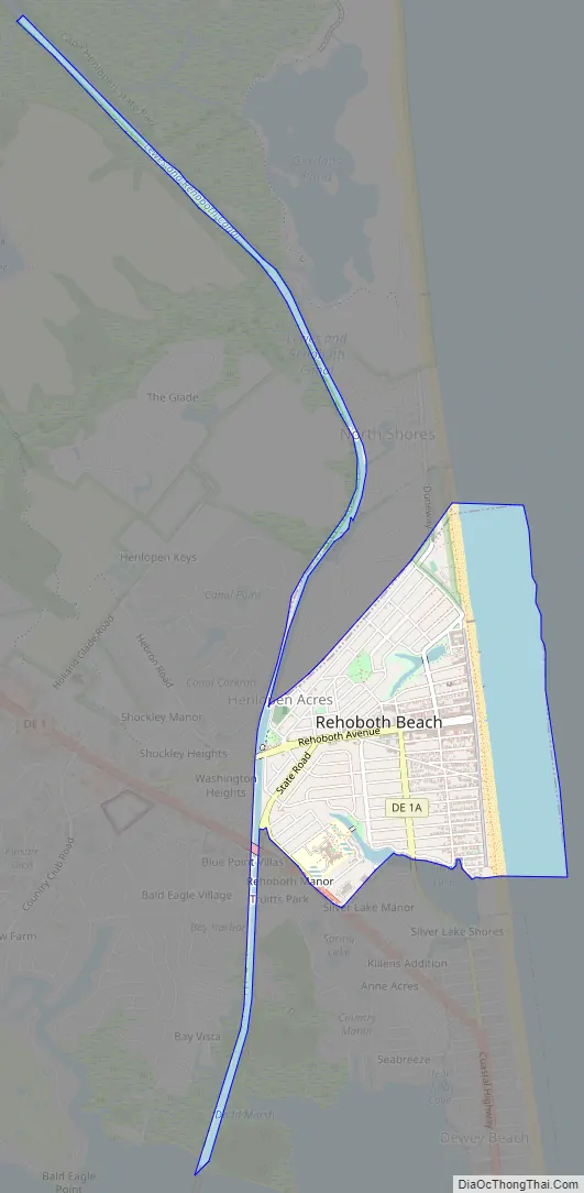
Rehoboth Beach Road Map
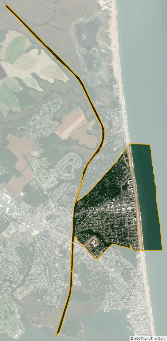
Rehoboth Beach city Satellite Map
Geography
According to the United States Census Bureau, the city has a total area of 1.6 square miles (4.1 km), of which 1.2 square miles (3.1 km) is land and 0.5 square miles (1.3 km) (28.48%) is water. Rehoboth Beach is bordered on the east by the Atlantic Ocean, on the north by the town of Henlopen Acres, and on the west and south by unincorporated portions of Sussex County. Cape Henlopen State Park lies just to the north of Rehoboth Beach, and Dewey Beach is just to its south.
See also
Map of Delaware State and its subdivision: Map of other states:- Alabama
- Alaska
- Arizona
- Arkansas
- California
- Colorado
- Connecticut
- Delaware
- District of Columbia
- Florida
- Georgia
- Hawaii
- Idaho
- Illinois
- Indiana
- Iowa
- Kansas
- Kentucky
- Louisiana
- Maine
- Maryland
- Massachusetts
- Michigan
- Minnesota
- Mississippi
- Missouri
- Montana
- Nebraska
- Nevada
- New Hampshire
- New Jersey
- New Mexico
- New York
- North Carolina
- North Dakota
- Ohio
- Oklahoma
- Oregon
- Pennsylvania
- Rhode Island
- South Carolina
- South Dakota
- Tennessee
- Texas
- Utah
- Vermont
- Virginia
- Washington
- West Virginia
- Wisconsin
- Wyoming


