Map of Indian Shores town

Map of Indian Shores town

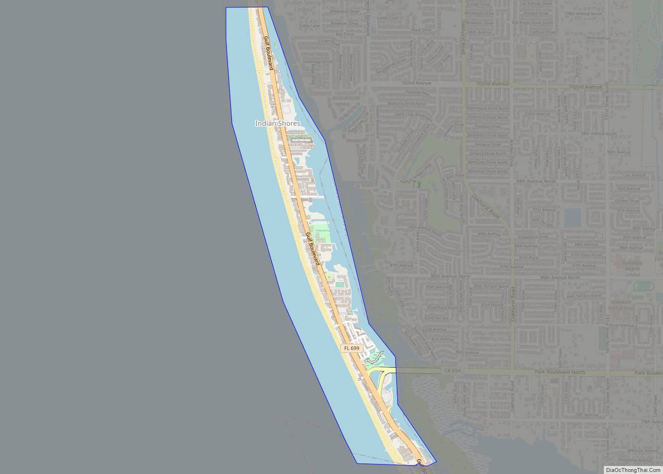
Indian Shores is a town in Pinellas County, Florida, United States. The town is a beach-front community situated on a barrier island west of Seminole. The population was 1,420 at the 2010 census. Indian Shores town overview: Name: Indian Shores town LSAD Code: 43 LSAD Description: town (suffix) State: Florida County: Pinellas County Elevation: 3 ft … Read more

Map of Indian Rocks Beach city

Map of Indian Rocks Beach city

Indian Rocks Beach, or IRB, is a city in Pinellas County, Florida, United States. The population was 4,286 at the 2018 census. Indian Rocks Beach is part of the Tampa-St. Petersburg-Clearwater, FL Metropolitan Statistical Area. Located on the barrier island Sand Key, it has over two miles of beach along the Gulf of Mexico, with … Read more

Map of Indian River Shores town

Map of Indian River Shores town

Indian River Shores is a resort town on Orchid Island, in Indian River County, Florida, United States. Surrounded by water, the town is bordered by the Indian River to the west and the Atlantic Ocean to the east. The population was 3,901 at the 2010 census, up from 3,448 at the 2000 census. It was … Read more

Map of Interlachen town

Map of Interlachen town

Interlachen is a town in Putnam County, Florida, United States. The population was 1,403 at the 2010 census. The town is part of the Palatka Micropolitan Statistical Area and was named by a gentleman named Mr. Berkelmann from Germany who lived in Interlachen when the town was being incorporated. He said that since the town … Read more

Map of Inglis town

Map of Inglis town

Inglis is a town in Levy County, Florida, United States. It is on U.S. Highway 19 near the Cross Florida Greenway. As of the 2010 census, the town had a population of 1,325. Inglis town overview: Name: Inglis town LSAD Code: 43 LSAD Description: town (suffix) State: Florida County: Levy County Elevation: 16 ft (5 m) Total … Read more

Map of Indiantown village

Map of Indiantown village

Indiantown is a village in Martin County, Florida, United States. The population was 6,560 at the 2020 census. It is a rural community in the interior of Florida’s Treasure Coast region, first established in the early 1900s, then incorporated on December 31, 2017. The village is governed by a mayor and council elected at-large, while … Read more

Map of Inverness city, Florida

Map of Inverness city, Florida

Inverness is a city and the county seat of Citrus County, Florida, United States. As of the 2020 census, the population was 7,543. 10,950-acre (4,430 ha) It is near the Flying Eagle Preserve. Inverness city overview: Name: Inverness city LSAD Code: 25 LSAD Description: city (suffix) State: Florida County: Citrus County Elevation: 49 ft (15 m) Total Area: … Read more

Map of Inverness Highlands South CDP

Map of Inverness Highlands South CDP

Inverness Highlands South is a census-designated place (CDP) in Citrus County, Florida, United States. As of the 2010 census, the population was 6,542, up from 5,781 in 2000. Inverness Highlands South CDP overview: Name: Inverness Highlands South CDP LSAD Code: 57 LSAD Description: CDP (suffix) State: Florida County: Citrus County Total Area: 5.61 sq mi (14.54 km²) Land … Read more

Map of Inverness Highlands North CDP

Map of Inverness Highlands North CDP

Inverness Highlands North CDP overview: Name: Inverness Highlands North CDP LSAD Code: 57 LSAD Description: CDP (suffix) State: Florida County: Citrus County FIPS code: 1233958 Online Interactive Map Inverness Highlands North online map. Source: Basemap layers from Google Map, Open Street Map (OSM), Arcgisonline, Wmflabs. Boundary Data from Database of Global Administrative Areas. Inverness Highlands … Read more

Map of Islamorada

Map of Islamorada, Village of Islands village

Islamorada (also sometimes Islas Morada) is an incorporated village in Monroe County, Florida, United States. It is located directly between Miami and Key West on five islands—Tea Table Key, Lower Matecumbe Key, Upper Matecumbe Key, Windley Key and Plantation Key—in the Florida Keys. As of the 2020 census, the village had a population of 7,107, … Read more

Map of Iona CDP

Map of Iona CDP, Florida

Iona is an unincorporated community and census-designated place (CDP) in Lee County, Florida, United States. The population was 16,908 at the 2020 census, up from 15,404 at the 2010 census. It is part of the Cape Coral-Fort Myers, Florida Metropolitan Statistical Area. A strong EF2 tornado struck the town on January 16, 2022, causing major … Read more

Map of Inwood CDP

Map of Inwood CDP, Florida

Inwood is a census-designated place (CDP) in Polk County, Florida, United States. The population was 6,925 at the time of the 2000 United States Census. It is part of the Lakeland–Winter Haven Metropolitan Statistical Area. Inwood CDP overview: Name: Inwood CDP LSAD Code: 57 LSAD Description: CDP (suffix) State: Florida County: Polk County Elevation: 144 ft … Read more