Map of Bardmoor CDP

Map of Bardmoor CDP

Bardmoor is a census-designated place (CDP) in Pinellas County, Florida, United States. The population was 9,732 at the 2010 census. Bardmoor CDP overview: Name: Bardmoor CDP LSAD Code: 57 LSAD Description: CDP (suffix) State: Florida County: Pinellas County Elevation: 15 ft (5 m) Total Area: 2.27 sq mi (5.88 km²) Land Area: 2.19 sq mi (5.68 km²) Water Area: 0.08 sq mi (0.21 km²) Total Population: … Read more

Map of Bascom town

Map of Bascom town, Florida

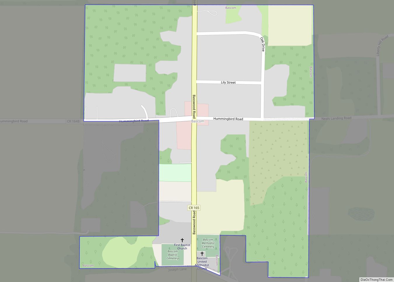
Bascom is a town in Jackson County, Florida, United States, located 5 miles (8 km) south of the Alabama border. The population was 121 at the 2010 census. Bascom town overview: Name: Bascom town LSAD Code: 43 LSAD Description: town (suffix) State: Florida County: Jackson County Elevation: 141 ft (43 m) Total Area: 0.24 sq mi (0.62 km²) Land Area: 0.24 sq mi … Read more

Map of Bartow city

Map of Bartow city, Florida

Bartow (/ˈbɑːrtoʊ/ BAR-toh) is the county seat of Polk County, Florida, United States. Founded in 1851 as Fort Blount, the city was renamed in honor of Francis S. Bartow, the first brigade commander of the Confederate Army to die in combat during the American Civil War. According to the 2010 Census, the city had a … Read more

Map of Bay Lake city

Map of Bay Lake city

Bay Lake is a city in Orange County, Florida, United States. The population was 29 at the 2020 census. It is named after a lake that lies east of the Magic Kingdom. All four of the Walt Disney World Resort theme parks, and one of Walt Disney World’s two water parks, are in Bay Lake, … Read more

Map of Bay Hill CDP

Map of Bay Hill CDP

Bay Hill is a census-designated place (CDP) in Orange County, Florida, United States. The population was 4,884 at the 2010 census. It is part of the Orlando–Kissimmee Metropolitan Statistical Area. The Bay Hill area is generally located on either side of Apopka-Vineland Road in southwest Orange County, north of Lake Buena Vista and south of … Read more

Map of Bay Harbor Islands town

Map of Bay Harbor Islands town

Bay Harbor Islands is a town in Miami-Dade County, Florida, United States. The population was 5,922 at the 2020 census. It is separated from the mainland by Biscayne Bay. Bay Harbor Islands town overview: Name: Bay Harbor Islands town LSAD Code: 43 LSAD Description: town (suffix) State: Florida County: Miami-Dade County Incorporated: April 28, 1947 … Read more

Map of Bayport CDP

Map of Bayport CDP, Florida

Bayport is an unincorporated community and census-designated place (CDP) in Hernando County, Florida, United States. The population was 43 at the 2010 census. Bayport CDP overview: Name: Bayport CDP LSAD Code: 57 LSAD Description: CDP (suffix) State: Florida County: Hernando County Elevation: 3 ft (1 m) Total Area: 0.64 sq mi (1.67 km²) Land Area: 0.57 sq mi (1.49 km²) Water Area: 0.07 sq mi … Read more

Map of Bayonet Point CDP

Map of Bayonet Point CDP

Bayonet Point is a census-designated place (CDP) in Pasco County, Florida, United States. As of the 2010 Census, the population was 23,467. Bayonet Point CDP overview: Name: Bayonet Point CDP LSAD Code: 57 LSAD Description: CDP (suffix) State: Florida County: Pasco County Elevation: 30 ft (9 m) Total Area: 5.73 sq mi (14.83 km²) Land Area: 5.68 sq mi (14.71 km²) Water Area: … Read more

Map of Bay Pines CDP

Map of Bay Pines CDP

Bay Pines is a census-designated place (CDP) in Pinellas County, Florida, United States. The population was 2,931 at the 2010 census. The community is home to Bay Pines Veterans Hospital and Bay Pines National Cemetery. Bay Pines CDP overview: Name: Bay Pines CDP LSAD Code: 57 LSAD Description: CDP (suffix) State: Florida County: Pinellas County … Read more

Map of Bear Creek CDP, Florida

Map of Bear Creek CDP, Florida

Bear Creek is an unincorporated community and census-designated place (CDP) in Pinellas County, Florida, United States. The population was 1,948 at the 2010 census. Bear Creek CDP overview: Name: Bear Creek CDP LSAD Code: 57 LSAD Description: CDP (suffix) State: Florida County: Pinellas County Elevation: 8 ft (2 m) Total Area: 0.54 sq mi (1.40 km²) Land Area: 0.39 sq mi (1.00 km²) … Read more

Map of Beacon Square CDP

Map of Beacon Square CDP

Beacon Square is a census-designated place (CDP) in Pasco County, Florida, United States. The population was 7,263 at the 2000 census. Beacon Square CDP overview: Name: Beacon Square CDP LSAD Code: 57 LSAD Description: CDP (suffix) State: Florida County: Pasco County Elevation: 7 ft (2 m) Total Area: 2.06 sq mi (5.33 km²) Land Area: 2.02 sq mi (5.24 km²) Water Area: 0.04 sq mi … Read more

Map of Bayshore Gardens CDP

Map of Bayshore Gardens CDP

Bayshore Gardens is a census-designated place (CDP) and planned community in Manatee County, Florida, United States. The population was 19,904 at the 2020 census, up from 16,323 in 2010. It is part of the Bradenton-Sarasota-Venice, Florida Metropolitan Statistical Area. Bayshore Gardens CDP overview: Name: Bayshore Gardens CDP LSAD Code: 57 LSAD Description: CDP (suffix) State: … Read more