Bartow (/ˈbɑːrtoʊ/ BAR-toh) is the county seat of Polk County, Florida, United States. Founded in 1851 as Fort Blount, the city was renamed in honor of Francis S. Bartow, the first brigade commander of the Confederate Army to die in combat during the American Civil War. According to the 2010 Census, the city had a population of 17,298 and an estimated population of 20,147 in 2019. It is part of the Lakeland−Winter Haven Metropolitan Statistical Area, which had an estimated population of 584,383 in 2009. As of 2023, the mayor of Bartow is Steve Githens.
Located near the source of the Peace River, Bartow is approximately 39 miles (63 km) east of Tampa, Florida and 50 miles (80 km) southwest of the Greater Orlando area. The city is near the center of “Lightning Alley” and has frequent afternoon thunderstorms in the summer, but typically has sunny and mild winters. Government, mining, and agriculture are the major sectors of the area’s economy. The primary roads in the Bartow area are U.S. Route 17, U.S. Route 98 and State Road 60, which provide access to locations throughout Central Florida.
The official city nickname is the “City of Oaks and Azaleas”. Three districts within the city are on the National Register of Historic Places. Other historic landmarks include the Old Polk County Courthouse built in 1909 and Bartow High School, formerly Summerlin Institute, the oldest high school in the county. Summerlin Academy now uses the space and was named for the historic school. Although Bartow has been eclipsed in population, importance and name recognition by other cities in the county, particularly Lakeland and Winter Haven, the city has retained its small city heritage and its distinctive Southern culture. With the annexation of 18,000 acres (73 km) of former phosphate mining land owned by the Clear Springs Land Company, Bartow’s population is projected to increase to over 25,000 by 2025 and over 45,000 by 2030.
| Name: | Bartow city |
|---|---|
| LSAD Code: | 25 |
| LSAD Description: | city (suffix) |
| State: | Florida |
| County: | Polk County |
| Incorporated: | July 1, 1882 |
| Elevation: | 118 ft (36 m) |
| Land Area: | 46.42 sq mi (120.23 km²) |
| Water Area: | 6.36 sq mi (16.48 km²) |
| Population Density: | 415.95/sq mi (160.60/km²) |
| ZIP code: | 33830-33831 |
| Area code: | 863 |
| FIPS code: | 1203675 |
| GNISfeature ID: | 2403163 |
| Website: | www.cityofbartow.net |
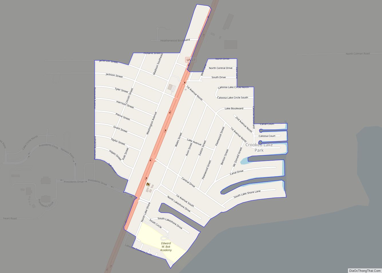
Online Interactive Map
Click on ![]() to view map in "full screen" mode.
to view map in "full screen" mode.
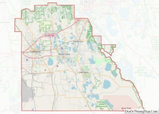
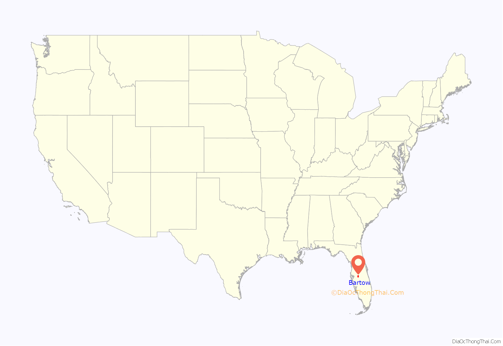
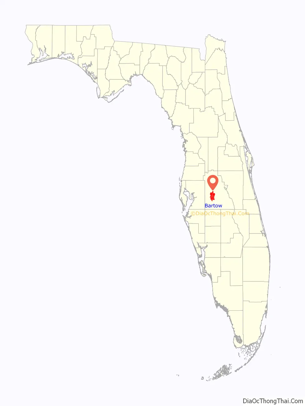
Bartow location map. Where is Bartow city?
History
A Spanish map of the Florida peninsula drawn in 1527 shows a native settlement called Rio de la Paz near present-day Bartow. Little is known about these Native Americans who made their home near present-day Bartow. It is likely that their population suffered high mortality from European diseases, such as smallpox and measles. The remnants of these pre-Columbian peoples probably joined the Creek Indians who migrated from the north to become the Seminole Indian tribe.
The first non-Indian settlement in the area was a colony of Black Seminole, free blacks and escaped slaves who established Minatti south of Lake Hancock in the late 1810s. These “maroons”, as they were commonly called, were slaves who escaped from Georgia and the Carolinas. The Black Seminole of Minatti were allies of the Red Stick Creek in Talakchopko, a village that preceded present-day Fort Meade. The Seminole leader Osceola had strong ties to Talakchopko. Many of the events leading up to the Second Seminole War were associated with Osceola and the Minatti war chief Harry. By the end of the Second Seminole War in 1842, both Minatti and Talakchopko had been destroyed by US forces.
The Armed Occupation Act of 1842 facilitated European-American settlement of the Florida peninsula in the 1840s, although the act prohibited settlement near the Peace River, as this was considered Seminole land. Enforcement of that part of the act was not strictly enforced; however, and settlers eventually moved into the area. As the settlement grew, the residents began to plant citrus trees and build one-room school houses and churches. In 1851, Fort Blount was established by Redding Blount. Bartow developed east of this site. At some point in the 1850s, Fort Blount was renamed as Peace Creek or Peas Creek, which was a translation of the Spanish Rio de la Paz of early maps.
About a month after the secession of Florida in 1861, the state established Polk County from the eastern portion of Hillsborough County. A few months later, the American Civil War began with the Battle of Fort Sumter. Because of the turmoil of secession and the war, the county had no official county seat for its first six years. The state legislature had directed the voters of Polk County to choose a site for the county seat and mandated that the site be named “Reidsville.” During the war, the area’s major contribution to the Confederacy was supplying food, particularly cattle and beef. The Union army and navy had effective control of the west coast of Florida, and many cattlemen retreated inland and formed the “Cow Cavalry” as a defense against Union troops. One of the wealthiest members of the Cow Cavalry was Jacob Summerlin. After Summerlin purchased the Blount property in 1862, he donated a large parcel of land to build a county courthouse, two churches and a school. Later that year, the town which had been known as Fort Blount, Peace Creek, Peas Creek, and briefly Reidsville, was permanently renamed Bartow in honor of Francis S. Bartow, the first Confederate brigade commander to die during the war.
Bartow recovered slowly from the war. The first Polk County Courthouse was built in 1867, which firmly established the city as county seat. Although Florida formally rejoined the union in 1868, the Reconstruction era did not end in Florida until 1877.
The 1880s and 1890s were a period of growth for the city of Bartow; from 1880 to 1900, the city would grow from 386 residents to 1,983. On July 1, 1882 the town was incorporated as a city. In 1885, the Florida Southern Railroad, a north-south route from North Florida to Southwest Florida opened in Bartow. A year later, the Bartow Branch of the South Florida Railroad, connecting Tampa and Orlando, was completed. The railroads were catalysts for growth of the area; during the Spanish–American War, the Bartow rail yards became a crucial part of the supply line directed at US troops in Cuba. In 1887, Summerlin Institute, the first brick schoolhouse south of Jacksonville, was built.
By the turn of the century, Bartow had become the most populous city south of Tampa on the Florida peninsula – larger than Miami or West Palm Beach.
As the city grew, a number of industries moved into the Bartow area. In the first few decades of the 1900s, thousands of acres of land around the city were purchased by the phosphate industry. Bartow would become the hub of the largest phosphate industry in the United States.
Polk County was the leading citrus county in the United States for much of the 20th century and the city has several large groves. In 1941, the city built an airport northeast of town. The airport was taken over by the federal government during World War II and was the training location for many Army Air Corps pilots during the war. The airport was returned to the city in 1967 and renamed as Bartow Municipal Airport.
For most of the 20th century, Bartow’s growth was modest, especially in comparison to the rest of the county and state. While other cities in Polk County aggressively annexed adjacent land and allowed rapid growth, the government of Bartow generally took a more cautious approach. Bartow’s growth was also limited because most of the land surrounding the city was owned by phosphate mining companies, making residential growth impractical. Although Bartow had been the largest city in Polk county in 1900, by the 1910 U.S. Census, Lakeland had surpassed it in population. Bartow remained the second largest city in the county until sometime in the 1950s, when Winter Haven superseded it.
In the late 1990s phosphate operations in the area moved southward, and much of the former phosphate land became available for sale. In 1999, Connecticut financier Stanford Phelps purchased the former Clear Springs phosphate lands east and south of city limits; he announced plans for an 18,000-acre development, the largest project in Polk County history. After nearly a decade of delays, the plan received final approval in 2009. The Clear Springs Development includes plans for more than 11,000 new homes, 1,000,000 square feet (93,000 m) of commercial space, three schools, and a golf course. According to the Central Florida Regional Planning Council, Bartow’s population is projected to grow to over 25,000 people by 2015. When buildout of the Clear Springs Development is completed by 2030, the population of the city is projected to be over 45,000 residents.
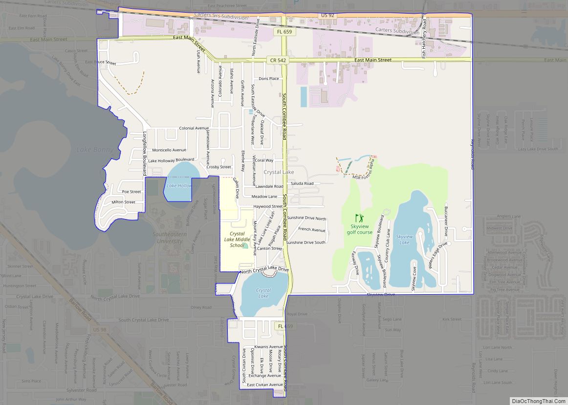
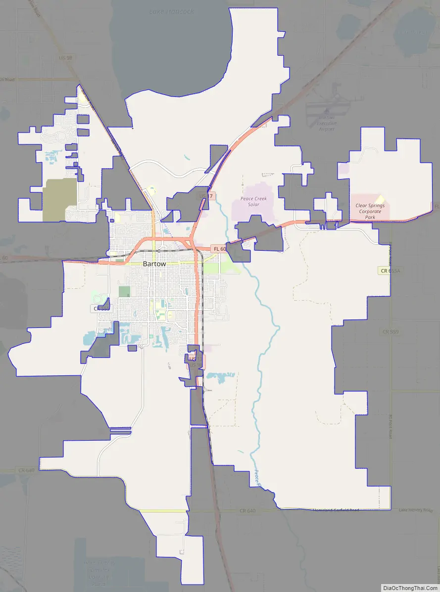
Bartow Road Map
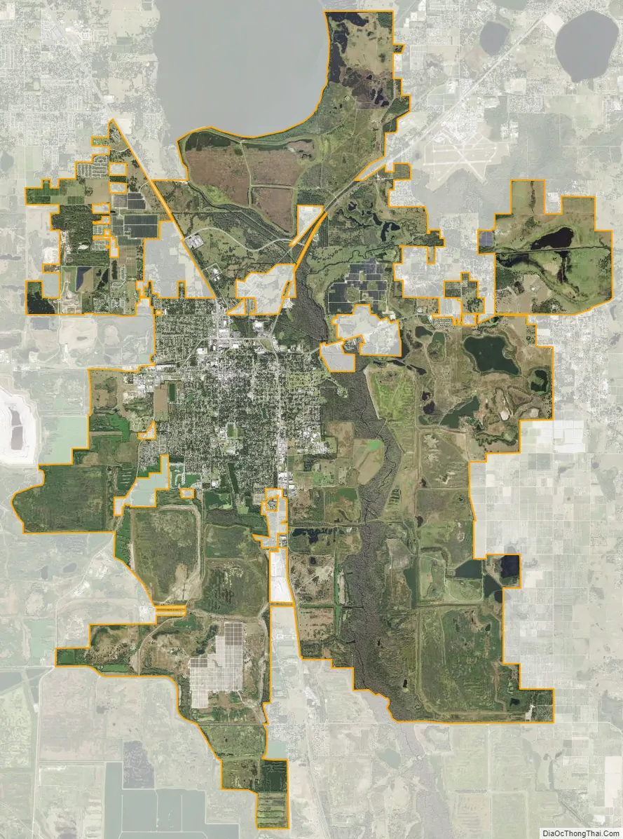
Bartow city Satellite Map
Geography
Geography
Bartow is located slightly southwest of the geographical centers of both Polk County and peninsular Florida. The city is approximately 39 miles (63 km) east of Tampa and 51 miles (82 km) southwest of Orlando. The cities of Bartow, Lakeland, and Winter Haven form a roughly equilateral triangle pointed southward, with Bartow being the south point, Lakeland the west point, and Winter Haven the east point. The city is located near the headwaters of the Peace River at Lake Hancock. Bartow is located within the Central Florida Highlands area of the Atlantic coastal plain with a terrain consisting of flatland interspersed with gently rolling hills.
According to the United States Census Bureau, in 2000 the city had a total area of 11.4 square miles (30 km), of which 11.2 square miles (29 km) is land and 0.1 square miles (0.26 km) (1.23%) is water. As a result of the annexation of over 26,000 acres (110 km) of undeveloped land, primarily the Clear Springs land, the area of the city has quadrupled to over 52 square miles (130 km) with more annexation still pending.
Physiography and soils
Bartow is located on the South Central Florida Ridge, as classified by the USDA. Most soils in the Bartow area are sandy; other soils have sandy surface layers and clay subsoils, and the eastern outskirts of town have a clay-rich floodplain through which the Peace River flows. Drainage outside of the floodplain ranges from good to excessive for the most part except for a poorly drained band which cuts across the northern part of town. Much of Bartow is built on the Fort Meade soil series, which is well drained, high in organic matter, and rich in phosphorus, an uncommon combination in Florida, much appreciated by area gardeners.
Climate
Bartow, like most of Florida, is located in the humid subtropical zone (Köppen climate classification: Cfa). The climate of Bartow and other inland cities is slightly different than those cities on the coasts of Florida. Typically, the ocean or gulf tends to moderate the climate of cities on the coast. As Bartow is further from the coast than almost any other city in Florida, it tends to have higher daytime temperatures cooler temperatures at night. Regardless, the climate pattern prevalent throughout central Florida is evident in Bartow: hot, humid summers with frequent afternoon thunderstorms and relatively drier and milder winters.
On average, a tropical system brings hurricane-force winds to the Polk County area less than once every ten years, although the 2004 hurricane season in which three hurricanes hit within 44 days was a case study in the law of averages. Until 2004, the most recent storm to bring hurricane-force winds to the Bartow area had been Hurricane Donna in 1960. While Florida’s vulnerability to hurricanes is well known, hurricanes are not the most common severe weather threat seen in the Polk County area. The area is in the center of “lightning alley”, the most concentrated lightning strike area in the United States. Lightning is not the only threat from central Florida thunderstorms. The more severe storms bring the threat of tornadoes, although Florida tornadoes very rarely reach the size of those elsewhere in the United States. Even hail is not out of the question; one storm in March 1996 caused a one-foot accumulation of hail in areas of Bartow.
Freezes are an occasional occurrence in the Bartow area and can be a problem if temperatures remain below freezing for a sustained period of time. On average, the area can expect an annual minimum temperature of 32 °F (0 °C), putting it in plant hardiness zone 10a. Snow is a rare phenomenon in the area, perhaps a few times every century.
See also
Map of Florida State and its subdivision:- Alachua
- Baker
- Bay
- Bradford
- Brevard
- Broward
- Calhoun
- Charlotte
- Citrus
- Clay
- Collier
- Columbia
- Desoto
- Dixie
- Duval
- Escambia
- Flagler
- Franklin
- Gadsden
- Gilchrist
- Glades
- Gulf
- Hamilton
- Hardee
- Hendry
- Hernando
- Highlands
- Hillsborough
- Holmes
- Indian River
- Jackson
- Jefferson
- Lafayette
- Lake
- Lee
- Leon
- Levy
- Liberty
- Madison
- Manatee
- Marion
- Martin
- Miami-Dade
- Monroe
- Nassau
- Okaloosa
- Okeechobee
- Orange
- Osceola
- Palm Beach
- Pasco
- Pinellas
- Polk
- Putnam
- Saint Johns
- Saint Lucie
- Santa Rosa
- Sarasota
- Seminole
- Sumter
- Suwannee
- Taylor
- Union
- Volusia
- Wakulla
- Walton
- Washington
- Alabama
- Alaska
- Arizona
- Arkansas
- California
- Colorado
- Connecticut
- Delaware
- District of Columbia
- Florida
- Georgia
- Hawaii
- Idaho
- Illinois
- Indiana
- Iowa
- Kansas
- Kentucky
- Louisiana
- Maine
- Maryland
- Massachusetts
- Michigan
- Minnesota
- Mississippi
- Missouri
- Montana
- Nebraska
- Nevada
- New Hampshire
- New Jersey
- New Mexico
- New York
- North Carolina
- North Dakota
- Ohio
- Oklahoma
- Oregon
- Pennsylvania
- Rhode Island
- South Carolina
- South Dakota
- Tennessee
- Texas
- Utah
- Vermont
- Virginia
- Washington
- West Virginia
- Wisconsin
- Wyoming