Map of West Perrine CDP

Map of West Perrine CDP

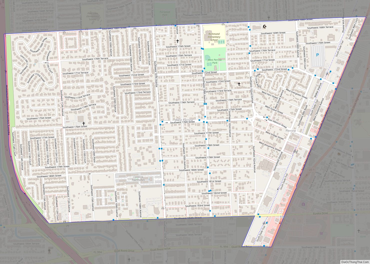
West Perrine is a census-designated place (CDP) in Miami-Dade County, Florida, United States. Prior to the 2000 census it was part of Perrine. The other part of Perrine became the East Perrine CDP for the 2000 census and is now part of the incorporated Village of Palmetto Bay. West Perrine is still an unincorporated area, … Read more

Map of West Pensacola CDP

Map of West Pensacola CDP

West Pensacola is a census-designated place (CDP) in Escambia County, Florida. It is considered to be a community within Pensacola. The population was 21,339 at the 2010 census. It is part of the Pensacola–Ferry Pass–Brent Metropolitan Statistical Area. The CDP area includes the community of Brownsville. West Pensacola CDP overview: Name: West Pensacola CDP LSAD … Read more

Map of West Park city, Florida

Map of West Park city, Florida

West Park, officially the City of West Park, is a municipality in Broward County, Florida, United States. It was created on March 1, 2005. It is located in the southeastern part of the county and consists of the neighborhoods of Carver Ranches, Lake Forest, Miami Gardens (Broward County), and Utopia. A large portion of the … Read more

Map of Westchase CDP

Map of Westchase CDP

Westchase is a census-designated place (CDP) in Hillsborough County, Florida, United States. The population was 21,747 at the 2010 census, up from 11,116 at the 2000 census. The census area encompasses most of the 33626 ZIP code area. Westchase CDP overview: Name: Westchase CDP LSAD Code: 57 LSAD Description: CDP (suffix) State: Florida County: Hillsborough … Read more

Map of West Vero Corridor CDP

Map of West Vero Corridor CDP

West Vero Corridor is a census-designated place (CDP) in Indian River County, Florida, United States. The population was 7,138 at the 2010 census, down from 7,695 at the 2000 census. It is part of the Sebastian–Vero Beach Metropolitan Statistical Area. West Vero Corridor CDP overview: Name: West Vero Corridor CDP LSAD Code: 57 LSAD Description: … Read more

Map of West Samoset CDP

Map of West Samoset CDP

West Samoset is an unincorporated area and census-designated place (CDP) in Manatee County, Florida, United States. The population was 6,482 at the 2020 census, up from 5,583 in 2010. It is part of the Bradenton–Sarasota–Venice Metropolitan Statistical Area. West Samoset CDP overview: Name: West Samoset CDP LSAD Code: 57 LSAD Description: CDP (suffix) State: Florida … Read more

Map of Westlake city

Map of Westlake city, Florida

Westlake is a city and the 39th municipality in Palm Beach County, Florida, United States. The population was 906 at the 2020 census. It is one of the newest municipalities in the South Florida area. The Incorporated City of Westlake is located west of Royal Palm Beach and north of Loxahatchee Groves. Westlake city overview: … Read more

Map of Westgate CDP

Map of Westgate CDP, Florida

Westgate is an unincorporated census-designated place (CDP) in Palm Beach County, Florida, United States. The population was 8,435 at the 2020 census. Prior to the 2010 census, it was listed as the Westgate-Belvedere Homes CDP. Westgate CDP overview: Name: Westgate CDP LSAD Code: 57 LSAD Description: CDP (suffix) State: Florida County: Palm Beach County Total … Read more

Map of Westchester CDP

Map of Westchester CDP, Florida

Westchester is a census-designated place (CDP) and neighborhood in Miami-Dade County, Florida. Prior to the 2020 U.S. Census, the neighboring University Park CDP was merged into Westchester CDP, effectively doubling its geography and population. Per the 2020 census, the population was 56,384. Westchester CDP overview: Name: Westchester CDP LSAD Code: 57 LSAD Description: CDP (suffix) … Read more

Map of Westville town

Map of Westville town, Florida

Westville is a town in Holmes County, Florida, United States. As of the 2010 census, the town had a population of 289, up from 221 at the 2000 census. From 2000 to 2010, the Westville town population growth percentage was 30.8%. Westville town overview: Name: Westville town LSAD Code: 43 LSAD Description: town (suffix) State: … Read more

Map of Westview CDP

Map of Westview CDP

Westview is a census-designated place (CDP) in Miami-Dade County, Florida, United States. The population was 9,923 at the 2020 census. Westview CDP overview: Name: Westview CDP LSAD Code: 57 LSAD Description: CDP (suffix) State: Florida County: Miami-Dade County Elevation: 8 ft (2 m) Total Area: 3.19 sq mi (8.25 km²) Land Area: 3.03 sq mi (7.84 km²) Water Area: 0.16 sq mi (0.41 km²) Total Population: … Read more

Map of Weston city, Florida

Map of Weston city, Florida

Weston is a city in Broward County, Florida, United States, just west of Fort Lauderdale. It is part of the Miami metropolitan area, which is anchored by Miami. The population was 68,107 at the 2020 census. Weston is 30 miles northwest of Miami, Florida. Weston city overview: Name: Weston city LSAD Code: 25 LSAD Description: … Read more