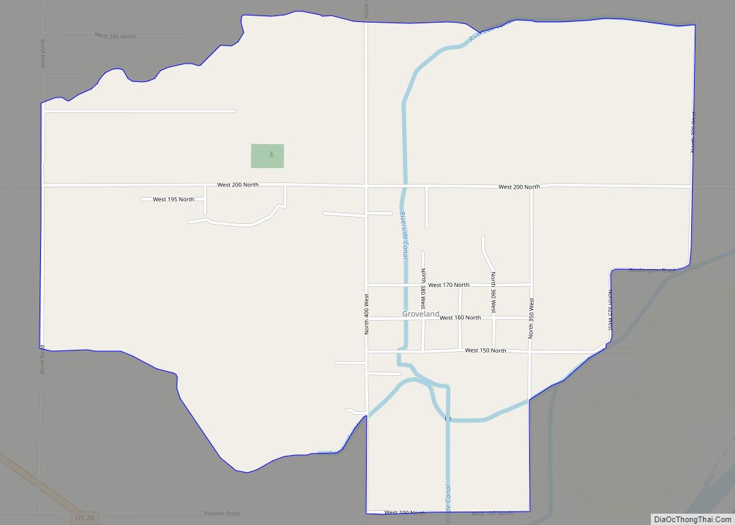
Map of Hagerman city

Map of Hagerman city, Idaho

Hagerman is a city in Gooding County, Idaho, United States. The population was 872 at the 2010 census, up from 656 in 2000. The area is noted for its fossil beds and the Thousand Springs of the Eastern Snake Plain Aquifer. Hagerman is home to a national fish hatchery, a university research station, and extensive … Read more

Map of Harrison city, Idaho

Map of Harrison city, Idaho

Harrison is a city in Kootenai County, Idaho, United States. The population was 203 at the 2010 census. Harrison is located on the eastern shore of Lake Coeur d’Alene, immediately south of where the Coeur d’Alene River flows into the lake. Harrison city overview: Name: Harrison city LSAD Code: 25 LSAD Description: city (suffix) State: … Read more

Map of Hansen city

Map of Hansen city

Hansen is a city in Twin Falls County, Idaho, United States. The population was 1,144 at the 2010 census. It is part of the Twin Falls, Idaho Micropolitan Statistical Area. Hansen city overview: Name: Hansen city LSAD Code: 25 LSAD Description: city (suffix) State: Idaho County: Twin Falls County Elevation: 4,026 ft (1,227 m) Total Area: 0.35 sq mi … Read more

Map of Hamer city

Map of Hamer city

Hamer is a city in Jefferson County, Idaho, United States. It is part of the Idaho Falls Metropolitan Statistical Area. The population was 48 at the 2010 census. The city was named after Thomas Ray Hamer (1864–1950), a United States Representative from Idaho. Hamer city overview: Name: Hamer city LSAD Code: 25 LSAD Description: city … Read more

Map of Hayden city, Idaho

Map of Hayden city, Idaho

Hayden is a city in Kootenai County, Idaho, United States. Located in the northern portion of the state, it is a suburb of nearby Coeur d’Alene and its population was 15,570 at the 2020 census. Hayden city overview: Name: Hayden city LSAD Code: 25 LSAD Description: city (suffix) State: Idaho County: Kootenai County Elevation: 2,287 ft … Read more

Map of Hayden Lake city

Map of Hayden Lake city

Hayden Lake is a city in Kootenai County, Idaho, United States. Located in the northern portion of the state, it is considered a suburb of the city of Coeur d’Alene. Its population was 574 at the 2010 census. The city was named after the nearby Lake Hayden, which is now more commonly also known as … Read more

Map of Hauser city

Map of Hauser city

Hauser is a city in Kootenai County, Idaho, United States. The population was 678 at the 2010 census. The city is located on the southern end of Hauser Lake. Hauser city overview: Name: Hauser city LSAD Code: 25 LSAD Description: city (suffix) State: Idaho County: Kootenai County Elevation: 2,215 ft (675 m) Total Area: 0.99 sq mi (2.56 km²) Land … Read more

Map of Hidden Springs CDP

Map of Hidden Springs CDP

Hidden Springs is a master-planned community and census-designated place in the Dry Creek Valley of Ada County, Idaho. Its population was 2,280 as of the 2010 census. The community manages more than 800 acres of permanently preserved open space and its own wastewater treatment facility. Architecture is primarily in a neo-traditional style, with many homes … Read more

Map of Heyburn city

Map of Heyburn city

Heyburn is a city in Minidoka County, Idaho, United States. The population was 3,700 at the 2020 census, up from 3,089 in 2010. It is part of the Burley micropolitan area. The city was named after Weldon B. Heyburn, a U.S. senator for Idaho from 1903 to 1912. Heyburn city overview: Name: Heyburn city LSAD … Read more

Map of Hazelton city

Map of Hazelton city, Idaho

Hazelton is a city in Jerome County, Idaho, United States. The population was 753 at the 2010 census. It is part of the Twin Falls, Idaho Micropolitan Statistical Area. Hazelton city overview: Name: Hazelton city LSAD Code: 25 LSAD Description: city (suffix) State: Idaho County: Jerome County Elevation: 4,075 ft (1,242 m) Total Area: 0.37 sq mi (0.96 km²) Land … Read more

Map of Hope city, Idaho

Map of Hope city, Idaho

Hope is a city in Bonner County, Idaho, United States. The population was 86 at the 2010 census. Hope city overview: Name: Hope city LSAD Code: 25 LSAD Description: city (suffix) State: Idaho County: Bonner County Elevation: 2,192 ft (668 m) Total Area: 0.47 sq mi (1.22 km²) Land Area: 0.46 sq mi (1.19 km²) Water Area: 0.01 sq mi (0.03 km²) Total Population: 86 Population … Read more

Map of Homedale city

Map of Homedale city

Homedale is a city in Owyhee County Idaho. The population was 2,633 at the time of the 2010 census. The town name was chosen by drawing names from a hat during a community picnic. Homedale is part of the Boise metropolitan area. It was, at one time, the terminus of a branch of the Oregon … Read more