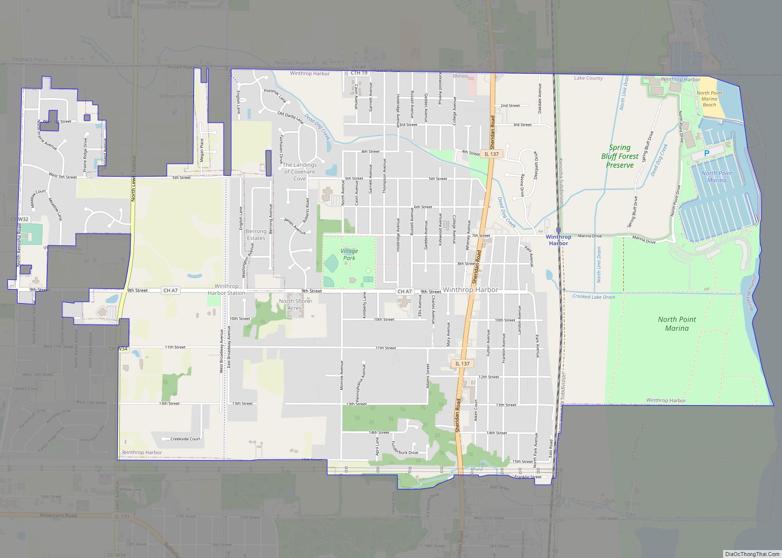
Map of Winslow village, Illinois
Winslow is a village in Stephenson County, Illinois. The population was 338 at the 2010 census, down from 345 in 2000. Winslow village overview: Name: Winslow village LSAD Code: 47 LSAD Description: village (suffix) State: Illinois County: Stephenson County Elevation: 774 ft (236 m) Total Area: 0.46 sq mi (1.19 km²) Land Area: 0.46 sq mi (1.19 km²) Water Area: 0.00 sq mi (0.00 km²) Total ... Read more
Map of Winslow village, Illinois
Map of Witt city
Witt is a city in Montgomery County, Illinois, United States. The population was 785 at the 2020 census, down from 903 in 2010. Witt city overview: Name: Witt city LSAD Code: 25 LSAD Description: city (suffix) State: Illinois County: Montgomery County Elevation: 663 ft (202 m) Total Area: 1.24 sq mi (3.21 km²) Land Area: 1.24 sq mi (3.21 km²) Water Area: 0.00 sq mi ... Read more
Map of Witt city
Map of Wood River city, Illinois
Wood River is a city in Madison County, Illinois. The population was 10,464 as of the 2020 census. Wood River city overview: Name: Wood River city LSAD Code: 25 LSAD Description: city (suffix) State: Illinois County: Madison County Elevation: 436 ft (133 m) Total Area: 7.23 sq mi (18.72 km²) Land Area: 6.97 sq mi (18.06 km²) Water Area: 0.25 sq mi (0.65 km²) Total Population: ... Read more
Map of Wood River city, Illinois
Map of Wood Dale city
Wood Dale is a city in Addison Township, DuPage County, Illinois, United States. Per the 2020 census, the population was 14,012. Wood Dale city overview: Name: Wood Dale city LSAD Code: 25 LSAD Description: city (suffix) State: Illinois County: DuPage County Founded: 1928 Elevation: 686 ft (209 m) Total Area: 4.85 sq mi (12.55 km²) Land Area: 4.74 sq mi (12.29 km²) Water ... Read more
Map of Wood Dale city
Map of Wonder Lake village
Wonder Lake is a village in McHenry County, Illinois, United States. It is a commuter village in the Chicago metropolitan area. The population was 3,973 at the 2020 census. However including surrounding unincorporated subdivisions, the population is estimated at 10,000. Wonder Lake village overview: Name: Wonder Lake village LSAD Code: 47 LSAD Description: village (suffix) ... Read more
Map of Wonder Lake village
Map of Woodlawn village, Illinois
Woodlawn is a village in Jefferson County, Illinois, United States. The population was 698 at the 2010 census. It is part of the Mount Vernon Micropolitan Statistical Area. Woodlawn village overview: Name: Woodlawn village LSAD Code: 47 LSAD Description: village (suffix) State: Illinois County: Jefferson County Elevation: 492 ft (150 m) Total Area: 0.85 sq mi (2.21 km²) Land Area: ... Read more
Map of Woodlawn village, Illinois
Map of Woodland village, Illinois
Woodland is a village in Belmont Township, Iroquois County, Illinois, United States. The population was 324 as of the 2010 census. Woodland village overview: Name: Woodland village LSAD Code: 47 LSAD Description: village (suffix) State: Illinois County: Iroquois County Elevation: 633 ft (193 m) Total Area: 0.49 sq mi (1.27 km²) Land Area: 0.49 sq mi (1.27 km²) Water Area: 0.00 sq mi (0.00 km²) Total ... Read more
Map of Woodland village, Illinois
Map of Woodhull village
Woodhull is a village in Henry County, Illinois. As of the 2010 census, the village had a population of 811, up from 809 in 2000. Woodhull village overview: Name: Woodhull village LSAD Code: 47 LSAD Description: village (suffix) State: Illinois County: Henry County Incorporated: 1870 Elevation: 810 ft (250 m) Total Area: 0.88 sq mi (2.29 km²) Land Area: 0.88 sq mi ... Read more
Map of Woodhull village
Map of Woodstock city, Illinois
Woodstock is a city in (and the county seat of) McHenry County, Illinois, United States. It is located 45 miles northwest of Chicago, making it one of the city’s outer-most suburbs. Per the 2020 census, the population was 25,630. The city’s historic downtown district and turn-of-the-century town square is anchored by the landmark Woodstock Opera ... Read more
Map of Woodstock city, Illinois
Map of Woodson village, Illinois
Woodson is a village in Morgan County, Illinois, United States. The population was 498 at the 2020 census. It is part of the Jacksonville Micropolitan Statistical Area. Woodson village overview: Name: Woodson village LSAD Code: 47 LSAD Description: village (suffix) State: Illinois County: Morgan County Incorporated: April 9, 1894 Elevation: 673 ft (205 m) Total Area: 0.39 sq mi ... Read more
Map of Woodson village, Illinois
Map of Woodridge village, Illinois
Woodridge is a village in DuPage County, Illinois, with small portions in Will and Cook counties, and a southwestern suburb of Chicago. Per the 2020 census, the population was 34,158. The village is just north of the I-55 junction with IL-53. It uses the 630 and 331 area codes. Woodridge is the home of the ... Read more
Map of Woodridge village, Illinois
Map of Wyanet village
Wyanet is a village in Bureau County, Illinois, United States. The population was 886 at the 2020 census. It is part of the Ottawa Micropolitan Statistical Area. Wyanet village overview: Name: Wyanet village LSAD Code: 47 LSAD Description: village (suffix) State: Illinois County: Bureau County Total Area: 0.946 sq mi (2.45 km²) Land Area: 0.946 sq mi (2.45 km²) Water Area: ... Read more
Map of Wyanet village