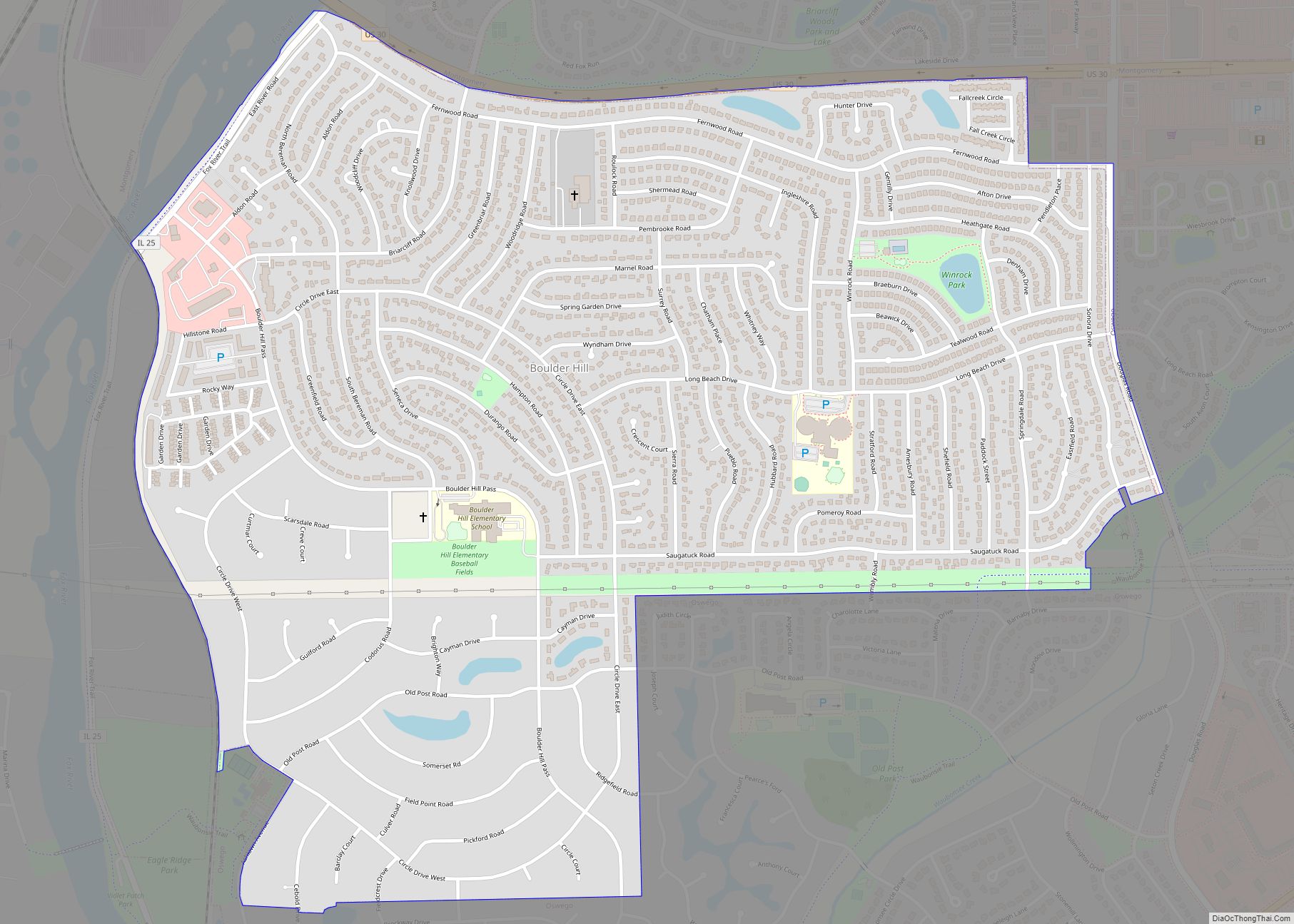
Map of Bone Gap village
Bone Gap is a village in Edwards County, Illinois, United States. The population was 181 at the 2020 census, down from 246 at the 2010 census. Bone Gap village overview: Name: Bone Gap village LSAD Code: 47 LSAD Description: village (suffix) State: Illinois County: Edwards County Elevation: 469 ft (143 m) Total Area: 0.58 sq mi (1.51 km²) Land Area: ... Read more
Map of Bone Gap village
Map of Bradley village, Illinois
Bradley (formerly North Kankakee) is a village in Kankakee County, Illinois, United States. It is a suburb of the city of Kankakee. The population was 15,895 at the 2010 census, up from 12,784 at the 2000 census. Bradley is a principal city of the Kankakee–Bradley Metropolitan Statistical Area, which includes all of Kankakee County. The ... Read more
Map of Bradley village, Illinois
Map of Bradford village, Illinois
Bradford is a village in Stark County, Illinois, United States. The population was 768 at the 2010 census. Bradford is part of the Peoria, Illinois Metropolitan Statistical Area. Bradford village overview: Name: Bradford village LSAD Code: 47 LSAD Description: village (suffix) State: Illinois County: Stark County, Bureau County Total Area: 0.40 sq mi (1.03 km²) Land Area: 0.40 sq mi ... Read more
Map of Bradford village, Illinois
Map of Braceville village
Braceville is a village in Will County, Illinois, United States, with a portion in Grundy County. The population was 793 at the 2010 census. Braceville village overview: Name: Braceville village LSAD Code: 47 LSAD Description: village (suffix) State: Illinois County: Grundy County, Will County Total Area: 3.34 sq mi (8.65 km²) Land Area: 3.11 sq mi (8.06 km²) Water Area: 0.23 sq mi ... Read more
Map of Braceville village
Map of Bowen village
Bowen (formerly Bowensburg) is a village in southeast Hancock County, Illinois, United States. The population was 494 at the 2010 census. Bowen village overview: Name: Bowen village LSAD Code: 47 LSAD Description: village (suffix) State: Illinois County: Hancock County Elevation: 686 ft (209 m) Total Area: 0.43 sq mi (1.11 km²) Land Area: 0.43 sq mi (1.11 km²) Water Area: 0.00 sq mi (0.00 km²) Total ... Read more
Map of Bowen village
Map of Brocton village, Illinois
Brocton is a village in Embarrass Township, Edgar County, Illinois, United States. The population was 273 at the 2020 census. Brocton village overview: Name: Brocton village LSAD Code: 47 LSAD Description: village (suffix) State: Illinois County: Edgar County Elevation: 663 ft (202 m) Total Area: 0.57 sq mi (1.48 km²) Land Area: 0.57 sq mi (1.48 km²) Water Area: 0.00 sq mi (0.00 km²) Total Population: ... Read more
Map of Brocton village, Illinois
Map of Broadwell village
Broadwell is a village in Logan County, Illinois, United States. The population was 136 at the 2020 census. Broadwell village overview: Name: Broadwell village LSAD Code: 47 LSAD Description: village (suffix) State: Illinois County: Logan County Elevation: 587 ft (179 m) Total Area: 0.18 sq mi (0.47 km²) Land Area: 0.18 sq mi (0.47 km²) Water Area: 0.00 sq mi (0.00 km²) Total Population: 136 Population ... Read more
Map of Broadwell village
Map of Broadview village, Illinois
Broadview is a village in Cook County, Illinois, 12 miles (19 km) west of downtown Chicago. As of the 2020 census it had a population of 7,998. Broadview village overview: Name: Broadview village LSAD Code: 47 LSAD Description: village (suffix) State: Illinois County: Cook County Incorporated: 1914 Total Area: 1.78 sq mi (4.60 km²) Land Area: 1.78 sq mi (4.60 km²) Water ... Read more
Map of Broadview village, Illinois
Map of Broadlands village, Illinois
Broadlands is a village in Champaign County, Illinois, along the East Branch of the Embarras River. The population was 316 at the 2020 census. Originally owned by the Sullivant family, Broadlands was, at over 70,000 acres (280 km), one of the world’s largest farms in the late 1860s. Broadlands was sold to John T. Alexander in ... Read more
Map of Broadlands village, Illinois
Map of Brimfield village, Illinois
Brimfield (formerly Charleston) is a village in Peoria County, Illinois, United States. The population was 868 at the 2010 census. Brimfield is part of the Peoria, Illinois Metropolitan Statistical Area. Brimfield village overview: Name: Brimfield village LSAD Code: 47 LSAD Description: village (suffix) State: Illinois County: Peoria County Total Area: 0.83 sq mi (2.14 km²) Land Area: 0.82 sq mi ... Read more
Map of Brimfield village, Illinois
Map of Brighton village, Illinois
Brighton is a village located mostly in Macoupin County and partially in Jersey County, Illinois, United States. As of the 2020 census, the village had a population of 2,221. The village’s current mayor is Matthew P. Kasten. Brighton is a part of the Metro East region of the St. Louis Metropolitan Statistical Area. Brighton village ... Read more
Map of Brighton village, Illinois
Map of Bridgeview village
Bridgeview is a village in Cook County, Illinois, United States. It is located approximately 15 miles (24 km) southwest of the Chicago Loop. As of the 2020 census, the village population was 17,027. Bridgeview village overview: Name: Bridgeview village LSAD Code: 47 LSAD Description: village (suffix) State: Illinois County: Cook County Incorporated: 1947 Total Area: 4.13 sq mi ... Read more
Map of Bridgeview village