Map of Arrowsmith village

Map of Arrowsmith village

Arrowsmith is a village in McLean County, Illinois, United States. The population was 276 at the 2020 census. It is part of the Bloomington–Normal Metropolitan Statistical Area. Arrowsmith village overview: Name: Arrowsmith village LSAD Code: 47 LSAD Description: village (suffix) State: Illinois County: McLean County Elevation: 883 ft (269 m) Total Area: 0.20 sq mi (0.51 km²) Land Area: 0.20 sq mi … Read more

Map of Aroma Park village

Map of Aroma Park village

Aroma Park (formerly Waldron) is a village in Kankakee County, Illinois, United States, along the Kankakee River opposite the mouth of the Iroquois River. Aroma Park is a suburb of the city of Kankakee. Aroma Park’s population was 743 at the 2010 census, down from 821 at the 2000 census. It is included in the … Read more

Map of Armington village

Map of Armington village

Armington is a village in Tazewell County, Illinois, United States. The population was 368 at the 2000 census. It is part of the Peoria, Illinois Metropolitan Statistical Area. Armington village overview: Name: Armington village LSAD Code: 47 LSAD Description: village (suffix) State: Illinois County: Tazewell County Elevation: 627 ft (191 m) Total Area: 0.28 sq mi (0.74 km²) Land Area: … Read more

Map of Arlington village, Illinois

Map of Arlington village, Illinois

Arlington is a village in Bureau County, Illinois, United States. The population was 169 at the 2020 census. It is part of the Ottawa Micropolitan Statistical Area, located east of the Quad Cities, north of Peoria and Galesburg, west of LaSalle and Peru, and southwest of Rockford and Chicago. Arlington village overview: Name: Arlington village … Read more

Map of Ashton village, Illinois

Map of Ashton village, Illinois

Ashton is a village in Lee County, Illinois, United States. The population was 972 at the 2010 census, down from 1,142 in 2000. Ashton village overview: Name: Ashton village LSAD Code: 47 LSAD Description: village (suffix) State: Illinois County: Lee County Total Area: 0.67 sq mi (1.74 km²) Land Area: 0.67 sq mi (1.74 km²) Water Area: 0.00 sq mi (0.00 km²) Total Population: … Read more

Map of Ashmore village

Map of Ashmore village

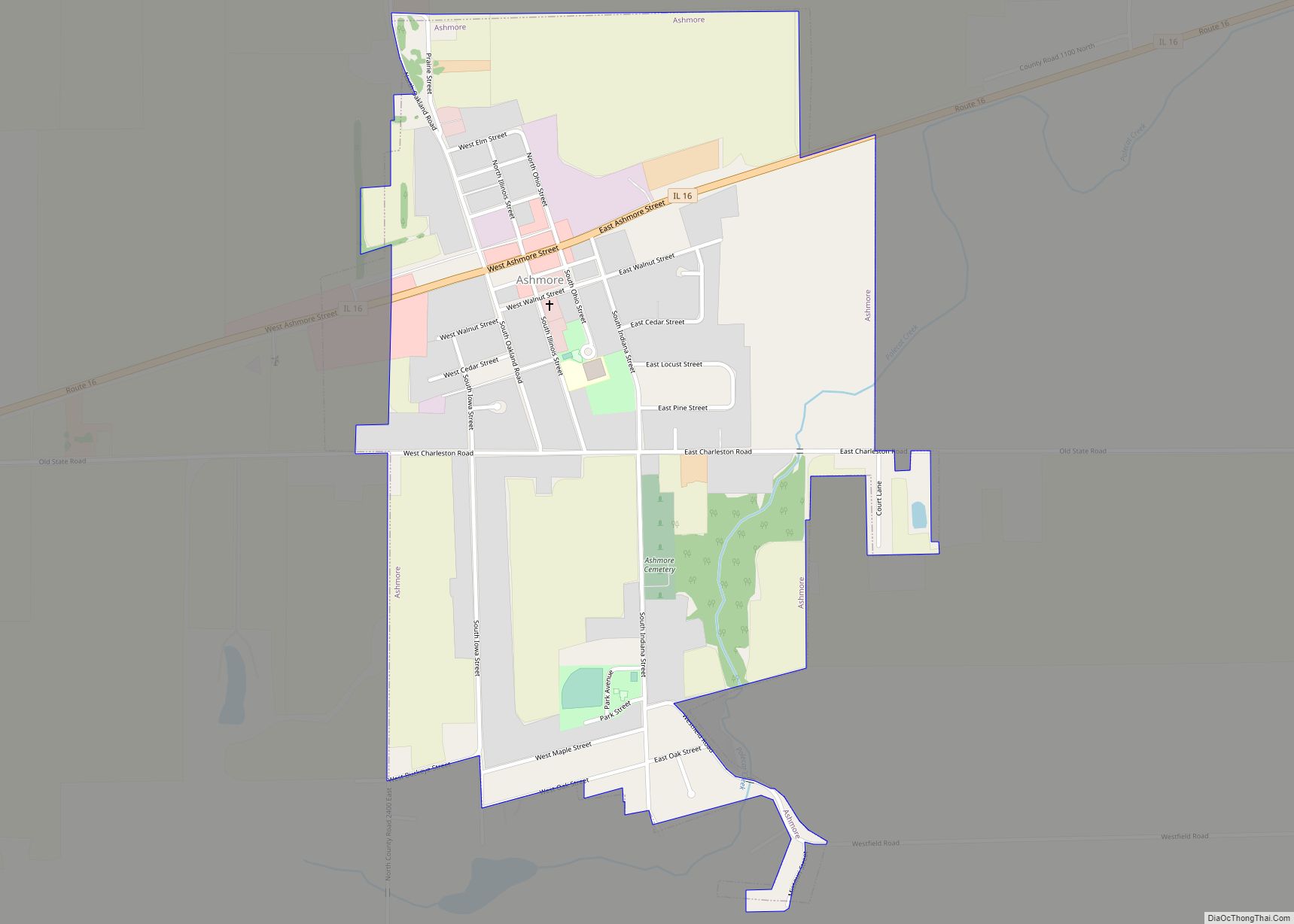
Ashmore is a village in Coles County, Illinois, United States. The population was 637 at the 2020 census. It is part of the Charleston–Mattoon Micropolitan Statistical Area. Ashmore village overview: Name: Ashmore village LSAD Code: 47 LSAD Description: village (suffix) State: Illinois County: Coles County Elevation: 696 ft (212 m) Total Area: 0.81 sq mi (2.08 km²) Land Area: 0.81 sq mi … Read more

Map of Ashley city

Map of Ashley city, Illinois

Ashley is a city in Washington County, Illinois, United States. The population was 536 at the 2010 census. The village was named after Colonel L. W. Ashley, a railroad division engineer. Ashley city overview: Name: Ashley city LSAD Code: 25 LSAD Description: city (suffix) State: Illinois County: Washington County Elevation: 554 ft (169 m) Total Area: 1.15 sq mi … Read more

Map of Ashland village, Illinois

Map of Ashland village, Illinois

Ashland is a village in Cass County, Illinois, United States. The population was 1,218 at the 2020 census. Ashland village overview: Name: Ashland village LSAD Code: 47 LSAD Description: village (suffix) State: Illinois County: Cass County Elevation: 630 ft (190 m) Total Area: 0.75 sq mi (1.94 km²) Land Area: 0.75 sq mi (1.94 km²) Water Area: 0.00 sq mi (0.00 km²) Total Population: 1,218 Area … Read more

Map of Ashkum village

Map of Ashkum village

Ashkum is a village in Ashkum Township, Iroquois County, Illinois, United States. The population was 761 at the 2010 census. Ashkum village overview: Name: Ashkum village LSAD Code: 47 LSAD Description: village (suffix) State: Illinois County: Iroquois County Elevation: 669 ft (204 m) Total Area: 0.83 sq mi (2.16 km²) Land Area: 0.83 sq mi (2.16 km²) Water Area: 0.00 sq mi (0.00 km²) Total Population: … Read more

Map of Aviston village

Map of Aviston village

Aviston is a village in Clinton County, Illinois, United States. The population was 2,340 at the 2020 census, up from 1,945 at the 2010 census. Aviston village overview: Name: Aviston village LSAD Code: 47 LSAD Description: village (suffix) State: Illinois County: Clinton County Elevation: 466 ft (142 m) Total Area: 1.60 sq mi (4.14 km²) Land Area: 1.60 sq mi (4.14 km²) Water … Read more

Map of Ava city

Map of Ava city, Illinois

Ava is a city in northwest Jackson County, Illinois, United States. The population was 654 at the 2010 census. Ava city overview: Name: Ava city LSAD Code: 25 LSAD Description: city (suffix) State: Illinois County: Jackson County Elevation: 610 ft (190 m) Total Area: 1.07 sq mi (2.76 km²) Land Area: 1.06 sq mi (2.74 km²) Water Area: 0.01 sq mi (0.02 km²) Total Population: 553 … Read more

Map of Augusta village, Illinois

Map of Augusta village, Illinois

Augusta is a village in southeast Hancock County, Illinois, United States. The population was 587 at the 2010 census, down from 657 at the 2000 census. It is located near Weinberg-King State Park. Augusta village overview: Name: Augusta village LSAD Code: 47 LSAD Description: village (suffix) State: Illinois County: Hancock County Elevation: 666 ft (203 m) Total … Read more