Map of Iroquois village

Map of Iroquois village, Illinois

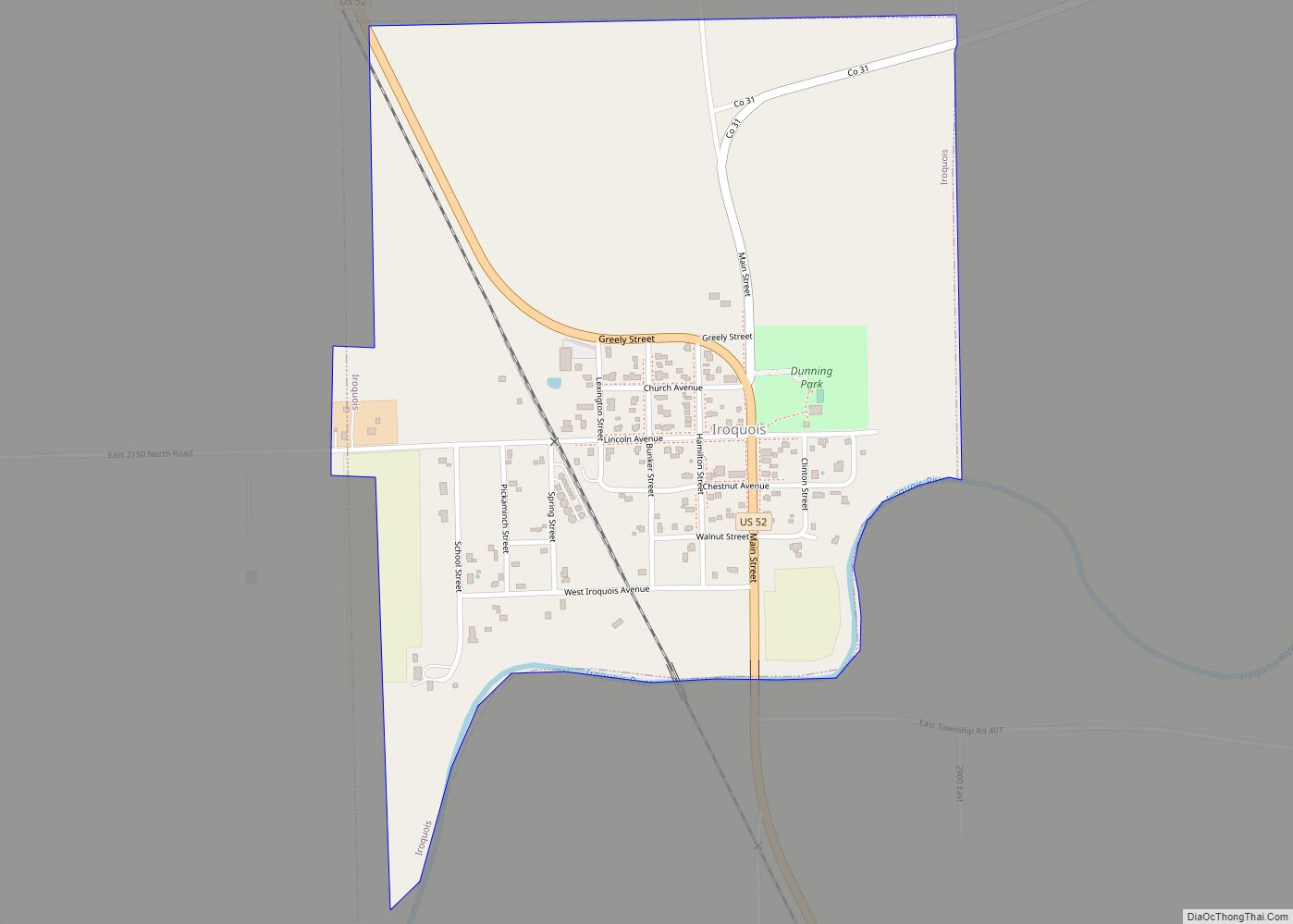
Iroquois is a village in Concord Township, Iroquois County, Illinois, United States, along the Iroquois River. As of the 2010 census the population was 154, down from 207 at the 2000 census. Iroquois village overview: Name: Iroquois village LSAD Code: 47 LSAD Description: village (suffix) State: Illinois County: Iroquois County Elevation: 659 ft (201 m) Total Area: … Read more

Map of Irwin village, Illinois

Map of Irwin village, Illinois

Irwin is a village in Kankakee County, Illinois, United States. The population was 74 at the 2010 census, down from 92 at the 2000 census. It is included in the Kankakee–Bradley, Illinois Metropolitan Statistical Area. Irwin village overview: Name: Irwin village LSAD Code: 47 LSAD Description: village (suffix) State: Illinois County: Kankakee County Elevation: 659 ft … Read more

Map of Irvington village, Illinois

Map of Irvington village, Illinois

Irvington is a village in Washington County, Illinois, United States. The population was 659 at the 2010 census. Irvington village overview: Name: Irvington village LSAD Code: 47 LSAD Description: village (suffix) State: Illinois County: Washington County Elevation: 545 ft (166 m) Total Area: 1.02 sq mi (2.63 km²) Land Area: 1.01 sq mi (2.61 km²) Water Area: 0.01 sq mi (0.02 km²) Total Population: 581 Population … Read more

Map of Itasca village

Map of Itasca village, Illinois

Itasca (/aɪˈtæskə/) is a village in DuPage County, Illinois, United States. Per the 2020 Census, the population was 9,543. Located approximately 25 miles northwest of downtown Chicago, Itasca is close to O’Hare International Airport, major expressways and rail transportation. Itasca is home to a country club, a resort and shares a border with Medinah’s legendary … Read more

Map of Island Lake village

Map of Island Lake village

Island Lake is a village in Lake and McHenry counties in the U.S. state of Illinois. Per the 2020 census, the population was 8,051. The village surrounds Island Lake, a lake which contains a small island. Island Lake village overview: Name: Island Lake village LSAD Code: 47 LSAD Description: village (suffix) State: Illinois County: Lake … Read more

Map of Ivesdale village

Map of Ivesdale village

Ivesdale is a village in Champaign County, Illinois, United States; a very small portion of the village extends into Piatt County, Illinois. The population was 265 at the 2020 census. Ivesdale village overview: Name: Ivesdale village LSAD Code: 47 LSAD Description: village (suffix) State: Illinois County: Champaign County, Piatt County Elevation: 682 ft (208 m) Total Area: … Read more

Map of Iuka village

Map of Iuka village, Illinois

Iuka is a village in Marion County, Illinois, United States. The population was 512 at the 2020 census. Iuka village overview: Name: Iuka village LSAD Code: 47 LSAD Description: village (suffix) State: Illinois County: Marion County Elevation: 515 ft (157 m) Total Area: 0.73 sq mi (1.90 km²) Land Area: 0.73 sq mi (1.90 km²) Water Area: 0.00 sq mi (0.00 km²) Total Population: 512 Population … Read more

Map of Jeffersonville village, Illinois

Map of Jeffersonville village, Illinois

Jeffersonville is a village in Wayne County, Illinois, United States. The population was 366 at the 2000 census. Although its official name is Jeffersonville, the village is known locally as Geff, with that spelling appearing on local road signs, the US Post office, and many official documents. “Geff” is pronounced as though it were spelled … Read more

Map of Jacksonville city, Illinois

Map of Jacksonville city, Illinois

Jacksonville is a city in Morgan County, Illinois, United States. The population was 17,616 at the 2020 census, down from 19,446 in 2010. It is the county seat of Morgan County. It is home to Illinois College, Illinois School for the Deaf, and the Illinois School for the Visually Impaired. Jacksonville is the principal city … Read more

Map of Jerome village, Illinois

Map of Jerome village, Illinois

Jerome is a village in Sangamon County, Illinois, United States. The population was 1,656 at the 2010 census. It is part of the Springfield, Illinois Metropolitan Statistical Area. Jerome village overview: Name: Jerome village LSAD Code: 47 LSAD Description: village (suffix) State: Illinois County: Sangamon County Total Area: 0.46 sq mi (1.20 km²) Land Area: 0.46 sq mi (1.20 km²) Water … Read more

Map of Jeisyville village

Map of Jeisyville village

Jeisyville is a small village in Christian County, Illinois, United States. The population was 102 at the 2020 census. Jeisyville village overview: Name: Jeisyville village LSAD Code: 47 LSAD Description: village (suffix) State: Illinois County: Christian County Elevation: 604 ft (184 m) Total Area: 0.12 sq mi (0.31 km²) Land Area: 0.12 sq mi (0.31 km²) Water Area: 0.00 sq mi (0.00 km²) Total Population: 102 … Read more

Map of Jewett village

Map of Jewett village, Illinois

Jewett is a village in Cumberland County, Illinois, United States. The population was 223 at the 2010 census. It is part of the Charleston–Mattoon Micropolitan Statistical Area. Jewett village overview: Name: Jewett village LSAD Code: 47 LSAD Description: village (suffix) State: Illinois County: Cumberland County Elevation: 584 ft (178 m) Total Area: 1.00 sq mi (2.60 km²) Land Area: 1.00 sq mi … Read more