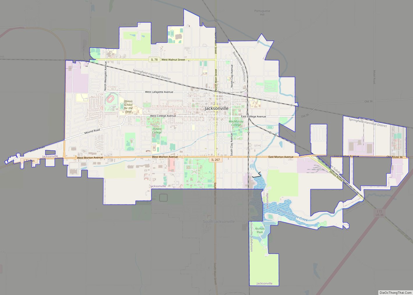
Jacksonville is a city in Morgan County, Illinois, United States. The population was 17,616 at the 2020 census, down from 19,446 in 2010. It is the county seat of Morgan County. It is home to Illinois College, Illinois School for the Deaf, and the Illinois School for the Visually Impaired. Jacksonville is the principal city of the Jacksonville Micropolitan Statistical Area, which includes all of Morgan and Scott counties.
| Name: | Jacksonville city |
|---|---|
| LSAD Code: | 25 |
| LSAD Description: | city (suffix) |
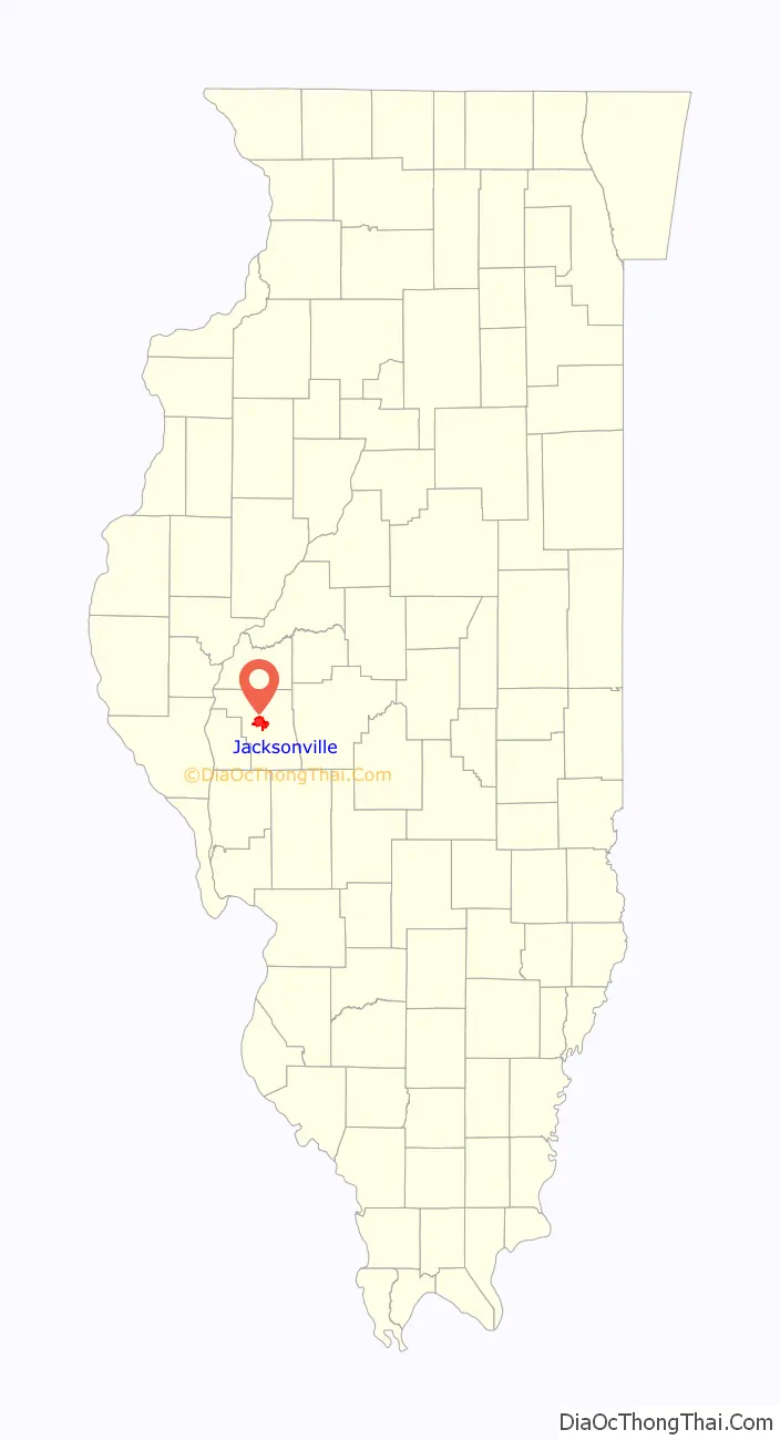
| State: | Illinois |
| County: | Morgan County |
| Elevation: | 587 ft (179 m) |
| Total Area: | 10.76 sq mi (27.87 km²) |
| Land Area: | 10.56 sq mi (27.36 km²) |
| Water Area: | 0.20 sq mi (0.51 km²) |
| Total Population: | 17,616 |
| Population Density: | 1,667.71/sq mi (643.94/km²) |
| ZIP code: | 62650 |
| FIPS code: | 1738115 |
| GNISfeature ID: | 2395451= |
| Website: | www.jacksonvilleil.com |
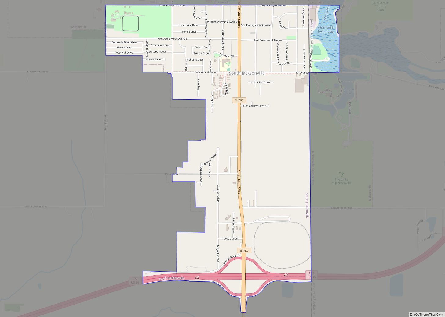
Online Interactive Map
Click on ![]() to view map in "full screen" mode.
to view map in "full screen" mode.
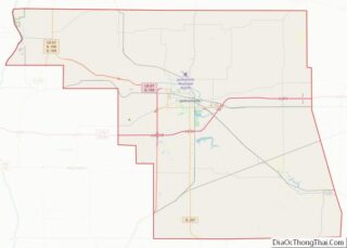
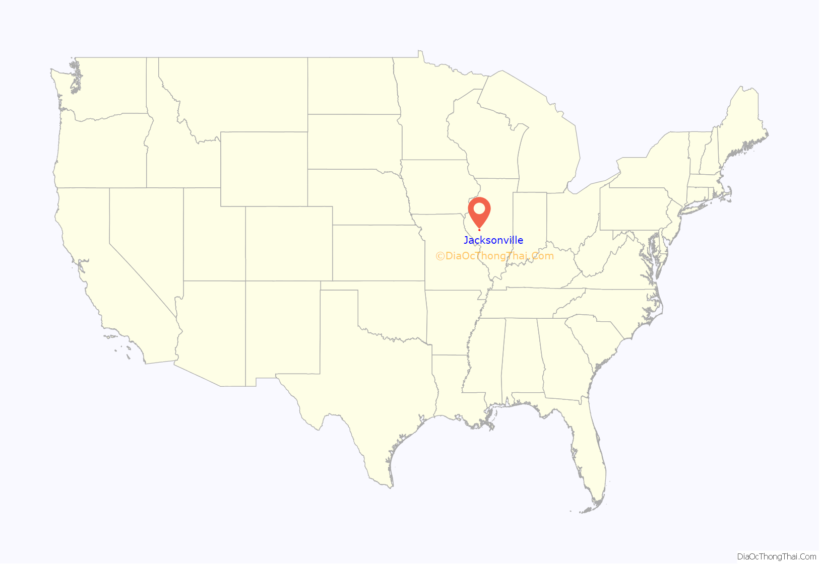
Jacksonville location map. Where is Jacksonville city?
History
Jacksonville was established by European Americans on a 160-acre (65 ha) tract of land in the center of Morgan County in 1825, two years after the county was founded. The founders of Jacksonville were settlers from New England. They were descended from the English Puritans who had settled New England in the 1600s and were part of a wave of New England farmers who headed west into what was then the wilds of the Northwest Territory during the early 1800s. Most of them arrived as a result of the completion of the Erie Canal and the end of the Black Hawk War. When they arrived in what is now Jacksonville, there was nothing but dense virgin forest and wild prairie. the “Yankee” New Englanders laid out farms, constructed roads, erected government buildings and established post routes. They brought with them values such as a passion for education, establishing many schools, as well as staunch support for abolitionism. They were mostly members of the Congregationalist Church, though some were Episcopalian. Due to the Second Great Awakening, some of them had converted to Methodism and Presbyterianism, while some others became Baptist, before moving to what is now Jacksonville. Jacksonville, like some other parts of Illinois, would be culturally very continuous with early New England culture for most of its early history.
The town was laid out on a treeless prairie and along a state road that ran from Springfield to the Illinois River.
The town grew at a rapid rate, and a town square was quickly developed. In 1829, the Presbyterian Reverend John M. Ellis worked to found a new “seminary of learning” in the new state of Illinois. A group of Congregational students at Yale College heard about his plans and headed westward to establish the new school. These students were a part of the famous “Yale Bands”, groups of students who established several colleges in the frontier, what is now the Midwest. Illinois College was one of the first institutions of higher learning in the Midwest. A new courthouse was built on the square, churches were constructed, railroads were planned, and stores and taverns were built. By 1834, Jacksonville had the largest population of any city in the state of Illinois, vastly outnumbering Chicago (only founded the year before). In the 1830s, the town was on the path of Native Americans who were being forcibly removed by the federal government to west of the Mississippi. The Potawatomi passed through here in 1838 on what they called their Trail of Death as they were forced from their traditional homelands to the dry and barren Indian Territory to the west.
Jacksonville’s education complex and standing in the state were developed by the establishment of state institutions: the Illinois School for the Deaf and what is now called the Illinois School for the Visually Impaired. The Illinois Conference Female Academy was founded for education for girls; it later developed as MacMurray College. By 1850, Illinois College had issued Illinois’ first college degrees and opened the first medical school in the state. Because of this, Jacksonville earned the nickname of “Athens of the West”.
In 1851, Illinois opened its first state mental hospital in Jacksonville; it became a major employer for the area.
The attorney Abraham Lincoln occasionally had legal business in Jacksonville, frequently acting either as co-counsel or opposing counsel with David A. Smith, a Jacksonville resident. In what is now Central Park, Lincoln delivered a strong antislavery speech on September 6, 1856, in support of the presidential campaign of John C. Frémont, lasting over two hours. A mural depicting the event has been painted on the side of a building at the southwest corner of the square. During the antebellum years, Jacksonville was a stopping point on the historic Underground Railroad, as refugee slaves moved north to freedom, many going into Canada.
1900 to present
Between 1892 and 1910, Jacksonville was home to minor league baseball, as the Jacksonville Jacks and Jacksonville Lunatics played in eight different minor leagues. Jacksonville teams played at League Park on Finley Street.
In 1911 as part of the progressive movement, Jacksonville adopted the city commission form of government, the first mayor being George W. Davis.
In the summer of 1965, in order to keep up with customer demand for records by the Beatles, the wildly popular English band, Capitol Records opened a vinyl record pressing plant on the western outskirts of Jacksonville, at 1 Capitol Way. The plant produced a number of highly collectible pressings. This plant eventually served the Capitol Records Club, producing vinyl LPs and later audiocassettes, CDs, and DVDs of a number of artists.
At its peak, operating as EMI Records (owner of Capitol), the plant employed over 1,000 workers. It was a significant location in the music industry. For example, all seven albums released by country western artist Garth Brooks sold more than 50 million copies. EMI held a “thank-you” luncheon for 1,000 workers at the Jacksonville plant on March 10, 1995. A decade later, in 2004 EMI ceased manufacturing operations at Jacksonville.
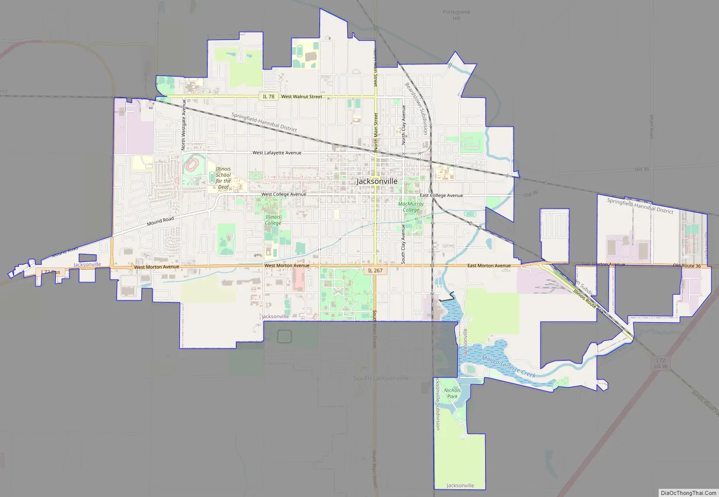
Jacksonville Road Map
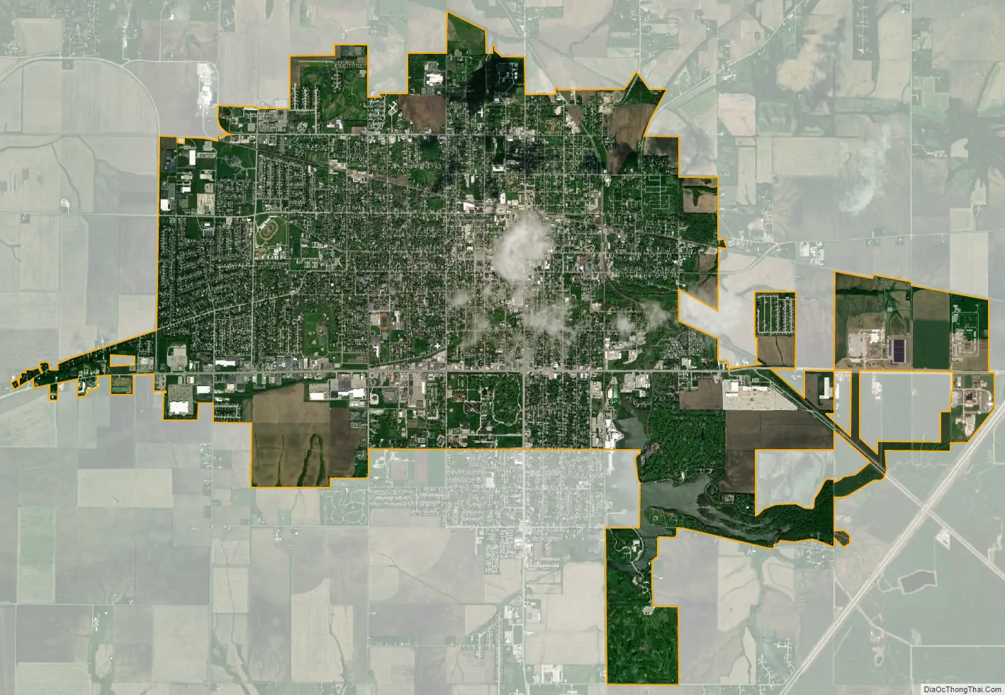
Jacksonville city Satellite Map
Geography
Jacksonville is located at 39°43′55″N 90°14′4″W / 39.73194°N 90.23444°W / 39.73194; -90.23444 (39.731936, −90.234394). It is 32 miles (51 km) west of Springfield, the state capital, and 70 miles (110 km) east of Hannibal, Missouri.
Interstate 72 passes to the south of the city, with access from Exits 64 and 68. U.S. Route 67 passes just west of the city limits, leading south 64 miles (103 km) to Alton and north 66 miles (106 km) to Macomb. Illinois Route 104 passes through Jacksonville as Morton Avenue, leading southeast 18 miles (29 km) to Waverly, while Illinois Route 267 runs south from Jacksonville, leading 27 miles (43 km) to Greenfield. Illinois Route 78 leads north from Jacksonville 16 miles (26 km) to Virginia.
According to the U.S. Census Bureau, Jacksonville has a total area of 10.76 square miles (27.87 km), of which 0.20 square miles (0.52 km), or 1.83%, are water. The city sits in the middle of mostly flat, fertile farmland. One branch of Mauvaisterre Creek empties into Lake Mauvaisterre, a small reservoir surrounded on three sides by parkland. 4 miles (6 km) south of the city lies Lake Jacksonville, a 476-acre (193 ha) lake with 18.6 miles (29.9 km) of shoreline. Lake Jacksonville was named the “Number One Fishing Spot in Illinois” by Field & Stream magazine.
Climate
See also
Map of Illinois State and its subdivision:- Adams
- Alexander
- Bond
- Boone
- Brown
- Bureau
- Calhoun
- Carroll
- Cass
- Champaign
- Christian
- Clark
- Clay
- Clinton
- Coles
- Cook
- Crawford
- Cumberland
- De Kalb
- De Witt
- Douglas
- Dupage
- Edgar
- Edwards
- Effingham
- Fayette
- Ford
- Franklin
- Fulton
- Gallatin
- Greene
- Grundy
- Hamilton
- Hancock
- Hardin
- Henderson
- Henry
- Iroquois
- Jackson
- Jasper
- Jefferson
- Jersey
- Jo Daviess
- Johnson
- Kane
- Kankakee
- Kendall
- Knox
- La Salle
- Lake
- Lake Michigan
- Lawrence
- Lee
- Livingston
- Logan
- Macon
- Macoupin
- Madison
- Marion
- Marshall
- Mason
- Massac
- McDonough
- McHenry
- McLean
- Menard
- Mercer
- Monroe
- Montgomery
- Morgan
- Moultrie
- Ogle
- Peoria
- Perry
- Piatt
- Pike
- Pope
- Pulaski
- Putnam
- Randolph
- Richland
- Rock Island
- Saint Clair
- Saline
- Sangamon
- Schuyler
- Scott
- Shelby
- Stark
- Stephenson
- Tazewell
- Union
- Vermilion
- Wabash
- Warren
- Washington
- Wayne
- White
- Whiteside
- Will
- Williamson
- Winnebago
- Woodford
- Alabama
- Alaska
- Arizona
- Arkansas
- California
- Colorado
- Connecticut
- Delaware
- District of Columbia
- Florida
- Georgia
- Hawaii
- Idaho
- Illinois
- Indiana
- Iowa
- Kansas
- Kentucky
- Louisiana
- Maine
- Maryland
- Massachusetts
- Michigan
- Minnesota
- Mississippi
- Missouri
- Montana
- Nebraska
- Nevada
- New Hampshire
- New Jersey
- New Mexico
- New York
- North Carolina
- North Dakota
- Ohio
- Oklahoma
- Oregon
- Pennsylvania
- Rhode Island
- South Carolina
- South Dakota
- Tennessee
- Texas
- Utah
- Vermont
- Virginia
- Washington
- West Virginia
- Wisconsin
- Wyoming