Map of Lisle village

Map of Lisle village, Illinois

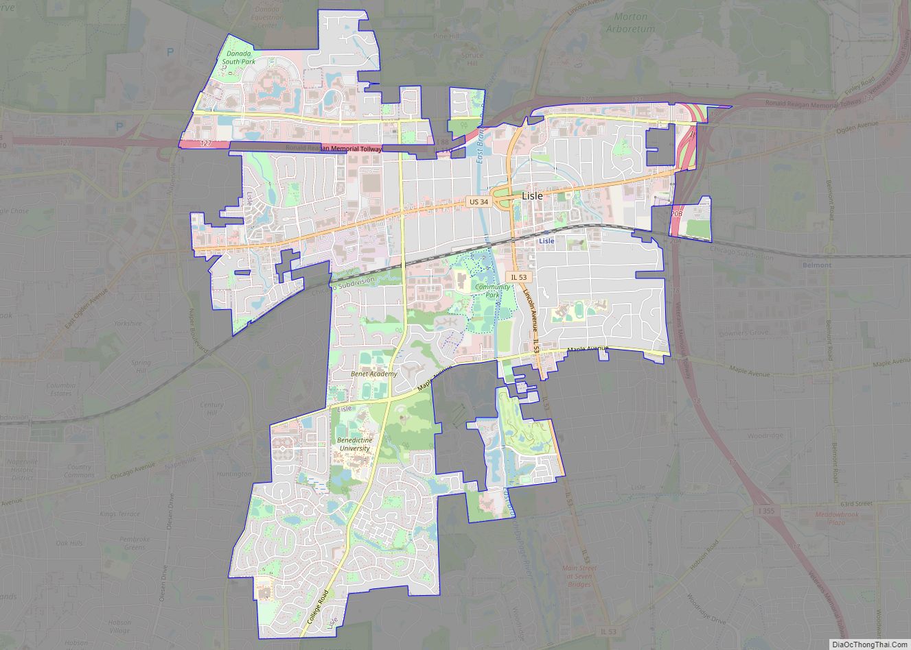
Lisle (/ˈlaɪəl/ LY-əl) is a village in DuPage County, Illinois, United States. The population was 22,390 at the 2010 census, and in 2019 the population was recorded to be 23,270. It is part of the Chicago metropolitan area and the Illinois Technology and Research Corridor. It is also the headquarters of the Nuclear Regulatory Commission … Read more

Map of Littleton village, Illinois

Map of Littleton village, Illinois

Littleton is a village in Schuyler County, Illinois, United States. The population was 197 at the 2000 census. Littleton village overview: Name: Littleton village LSAD Code: 47 LSAD Description: village (suffix) State: Illinois County: Schuyler County Elevation: 679 ft (207 m) Total Area: 1.17 sq mi (3.02 km²) Land Area: 1.17 sq mi (3.02 km²) Water Area: 0.00 sq mi (0.00 km²) Total Population: 139 Population … Read more

Map of Little York village

Map of Little York village, Illinois

Little York is a village in Warren County, Illinois, United States. The population was 269 at the 2000 census. It is part of the Galesburg Micropolitan Statistical Area. Little York village overview: Name: Little York village LSAD Code: 47 LSAD Description: village (suffix) State: Illinois County: Warren County Elevation: 617 ft (188 m) Total Area: 0.22 sq mi (0.58 km²) … Read more

Map of Livingston village, Illinois

Map of Livingston village, Illinois

Livingston is a village in Madison County, Illinois, United States. The population was 763 at the 2020 census, down from 858 in 2010. Livingston village overview: Name: Livingston village LSAD Code: 47 LSAD Description: village (suffix) State: Illinois County: Madison County Elevation: 591 ft (180 m) Total Area: 1.05 sq mi (2.73 km²) Land Area: 1.04 sq mi (2.69 km²) Water Area: 0.01 sq mi … Read more

Map of Liverpool village

Map of Liverpool village, Illinois

Liverpool is a village in Fulton County, Illinois, United States. The population was 129 at the 2010 census. Liverpool village overview: Name: Liverpool village LSAD Code: 47 LSAD Description: village (suffix) State: Illinois County: Fulton County Elevation: 449 ft (137 m) Total Area: 0.09 sq mi (0.22 km²) Land Area: 0.08 sq mi (0.22 km²) Water Area: 0.00 sq mi (0.00 km²) Total Population: 94 Population … Read more

Map of Lockport city

Map of Lockport city, Illinois

Lockport is a city in Will County, Illinois, United States, located 30 miles southwest of Chicago. Per the 2020 census, the population was 26,094. The city was incorporated in 1853. It is situated along the Illinois and Michigan (I&M) Canal, and was the headquarters of the canal when the canal was operating. A section of … Read more

Map of Loami village

Map of Loami village

Loami is a village in Sangamon County, Illinois, United States. The population was 745 at the 2010 census. It is part of the Springfield, Illinois Metropolitan Statistical Area. It is adjacent to the Nipper Wildlife Sanctuary, a parcel of tallgrass prairie replanted on the loam soil after which the village is named. Loami village overview: … Read more

Map of Lomax village

Map of Lomax village

Lomax is a village in Henderson County, Illinois, United States. The population was 454 at the 2010 census, a decline from 477 in 2000. It is part of the Burlington, IA–IL Micropolitan Statistical Area. Lomax village overview: Name: Lomax village LSAD Code: 47 LSAD Description: village (suffix) State: Illinois County: Henderson County Elevation: 545 ft (166 m) … Read more

Map of Loda village

Map of Loda village

Loda is a village in Loda Township, Iroquois County, Illinois, United States. As of the 2010 census its population was 407. Loda village overview: Name: Loda village LSAD Code: 47 LSAD Description: village (suffix) State: Illinois County: Iroquois County Elevation: 778 ft (237 m) Total Area: 1.48 sq mi (3.82 km²) Land Area: 1.47 sq mi (3.80 km²) Water Area: 0.01 sq mi (0.02 km²) Total … Read more

Map of London Mills village

Map of London Mills village

London Mills is a village in Fulton and Knox counties in the U.S. state of Illinois. The population was 392 at the 2010 census, down from 447 at the 2000 census. The Fulton County portion of London Mills is part of the Canton Micropolitan Statistical Area and the wider Peoria Consolidated Statistical Area, while the … Read more

Map of Lombard village

Map of Lombard village

Lombard is a village in DuPage County, Illinois, United States, and a suburb of Chicago. The population was 44,476 at the 2020 census. Lombard village overview: Name: Lombard village LSAD Code: 47 LSAD Description: village (suffix) State: Illinois County: DuPage County Incorporated: 1869 Total Area: 10.41 sq mi (26.95 km²) Land Area: 10.22 sq mi (26.47 km²) Water Area: 0.19 sq mi (0.48 km²) … Read more

Map of Long Grove village, Illinois

Map of Long Grove village, Illinois

Long Grove is a village in Lake County, Illinois, United States, approximately 35 miles (56 km) away from and a northwest suburb of Chicago. Per the 2020 census, the population was 8,366. The village has strict building ordinances to preserve its “country atmosphere”. Long Grove village overview: Name: Long Grove village LSAD Code: 47 LSAD Description: … Read more