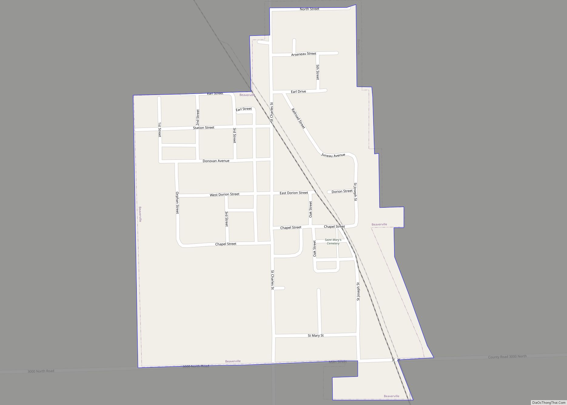
Map of Beckemeyer village

Map of Beckemeyer village

Beckemeyer is a village in Wade Township, Clinton County, Illinois, United States. The population was 923 as of the 2020 census. Beckemeyer village overview: Name: Beckemeyer village LSAD Code: 47 LSAD Description: village (suffix) State: Illinois County: Clinton County Elevation: 456 ft (139 m) Total Area: 0.62 sq mi (1.60 km²) Land Area: 0.62 sq mi (1.60 km²) Water Area: 0.00 sq mi (0.00 km²) Total … Read more

Map of Benld city

Map of Benld city

Benld /bəˈnɛld/ is a city in Macoupin County, Illinois, United States. The population was 1,464 at the 2020 census, down from 1,556 in 2010. It is located in the Metro-East portion of the Greater St. Louis metropolitan area. Benld was declared the “most difficult to pronounce” place name in the state of Illinois by Reader’s … Read more

Map of Bement village

Map of Bement village

Bement is a village in Piatt County, Illinois, United States. Its population was 1,484 at the 2020 census. Bement village overview: Name: Bement village LSAD Code: 47 LSAD Description: village (suffix) State: Illinois County: Piatt County Elevation: 689 ft (210 m) Total Area: 0.78 sq mi (2.01 km²) Land Area: 0.78 sq mi (2.01 km²) Water Area: 0.00 sq mi (0.00 km²) Total Population: 1,484 Population … Read more

Map of Belvidere city

Map of Belvidere city, Illinois

Belvidere /ˈbɛlvɪdɪər/ is a city in Boone County, settled on the Kishwaukee River in far northern Illinois, United States. Known as the ‘City of Murals’, Belvidere is home to several public art installations throughout the North and South State Street historic districts, which are on the national register of historic places. These historic districts are … Read more

Map of Bellwood village

Map of Bellwood village, Illinois

Bellwood is a village in Proviso Township, Cook County, Illinois, United States. Located 13 miles (21 km) west of Chicago’s downtown Loop, the Village of Bellwood is bounded by the Eisenhower Expressway (south), the Proviso yards of the former Chicago & Northwestern, now Union Pacific Railroad (north), and the suburbs of Maywood (east) and Hillside and … Read more

Map of Bellmont village

Map of Bellmont village

Bellmont is a village in Bellmont Precinct, Wabash County, Illinois, United States. The population was 297 at the 2000 census. Bellmont village overview: Name: Bellmont village LSAD Code: 47 LSAD Description: village (suffix) State: Illinois County: Wabash County Elevation: 436 ft (133 m) Total Area: 0.33 sq mi (0.84 km²) Land Area: 0.33 sq mi (0.84 km²) Water Area: 0.00 sq mi (0.00 km²) Total Population: … Read more

Map of Bellflower village, Illinois

Map of Bellflower village, Illinois

Bellflower is a village in McLean County, Illinois, United States. The population was 346 at the 2020 census. It is part of the Bloomington–Normal Metropolitan Statistical Area. Bellflower village overview: Name: Bellflower village LSAD Code: 47 LSAD Description: village (suffix) State: Illinois County: McLean County Elevation: 787 ft (240 m) Total Area: 0.36 sq mi (0.93 km²) Land Area: 0.36 sq mi … Read more

Map of Bellevue village, Illinois

Map of Bellevue village, Illinois

Bellevue is a village in Peoria County, Illinois, United States. The population was 1,978 at the 2010 census. Bellevue is a suburb of Peoria and is part of the Peoria, Illinois Metropolitan Statistical Area. Bellevue village overview: Name: Bellevue village LSAD Code: 47 LSAD Description: village (suffix) State: Illinois County: Peoria County Total Area: 2.22 sq mi … Read more

Map of Bentley town, Illinois

Map of Bentley town, Illinois

Bentley (formerly Sutton) is an incorporated town in southeast Hancock County, Illinois, United States. The population was 35 at the 2010 census. Bentley town overview: Name: Bentley town LSAD Code: 43 LSAD Description: town (suffix) State: Illinois County: Hancock County Incorporated: March 25, 1869 (1869-03-25) Elevation: 679 ft (207 m) Total Area: 0.14 sq mi (0.37 km²) Land Area: 0.14 sq mi (0.37 km²) Water Area: … Read more

Map of Benson village, Illinois

Map of Benson village, Illinois

Benson is a village in Woodford County, Illinois, United States. The population was 423 at the 2010 census, up from 408 in 2000. It is part of the Peoria, Illinois Metropolitan Statistical Area. The village was established in 1874 with the construction of the Chicago, Pekin and Southwestern Railroad. The town was named after S.H. … Read more

Map of Bensenville village

Map of Bensenville village

Bensenville is a village located near O’Hare International Airport in DuPage County, Illinois, with a portion of the town in Cook County. As of the 2020 census, the village population was 18,813. First known as Tioga, it was formally established as Bensenville in 1873 along the Milwaukee Road (now Canadian Pacific) right-of-way. The community is … Read more

Map of Bishop Hill village

Map of Bishop Hill village

Bishop Hill is a village in Henry County, Illinois, United States, along the South Edwards River. The population was 128 at the 2010 census, up from 125 in 2000. It is the home of the Bishop Hill State Historic Site, a park operated by the Illinois Historic Preservation Agency. Bishop Hill village overview: Name: Bishop … Read more