Belvidere /ˈbɛlvɪdɪər/ is a city in Boone County, settled on the Kishwaukee River in far northern Illinois, United States. Known as the ‘City of Murals’, Belvidere is home to several public art installations throughout the North and South State Street historic districts, which are on the national register of historic places. These historic districts are home to places like the Boone County Museum of History, The Funderburg Museum, several restaurants and bars, antique stores and Boutique stores. Popular festivities like Heritage Days are held yearly. The population was 25,339 as of the 2020 census. It is the county seat of Boone County. Belvidere is part of the Rockford, Illinois Metropolitan Statistical Area.
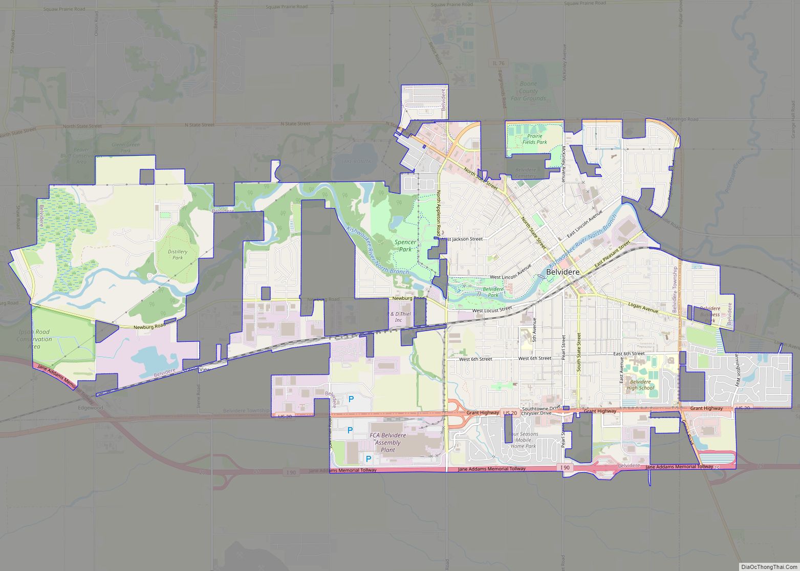
| Name: | Belvidere city |
|---|---|
| LSAD Code: | 25 |
| LSAD Description: | city (suffix) |
| State: | Illinois |
| County: | Boone County |
| Total Area: | 12.38 sq mi (32.06 km²) |
| Land Area: | 12.14 sq mi (31.44 km²) |
| Water Area: | 0.24 sq mi (0.61 km²) |
| Total Population: | 25,339 |
| Population Density: | 2,087.06/sq mi (805.85/km²) |
| Area code: | 815 |
| FIPS code: | 1705092 |
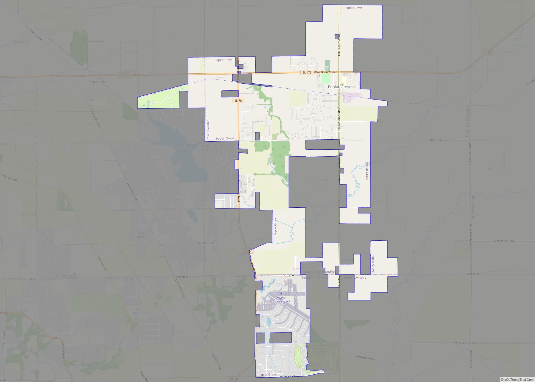
Online Interactive Map
Click on ![]() to view map in "full screen" mode.
to view map in "full screen" mode.
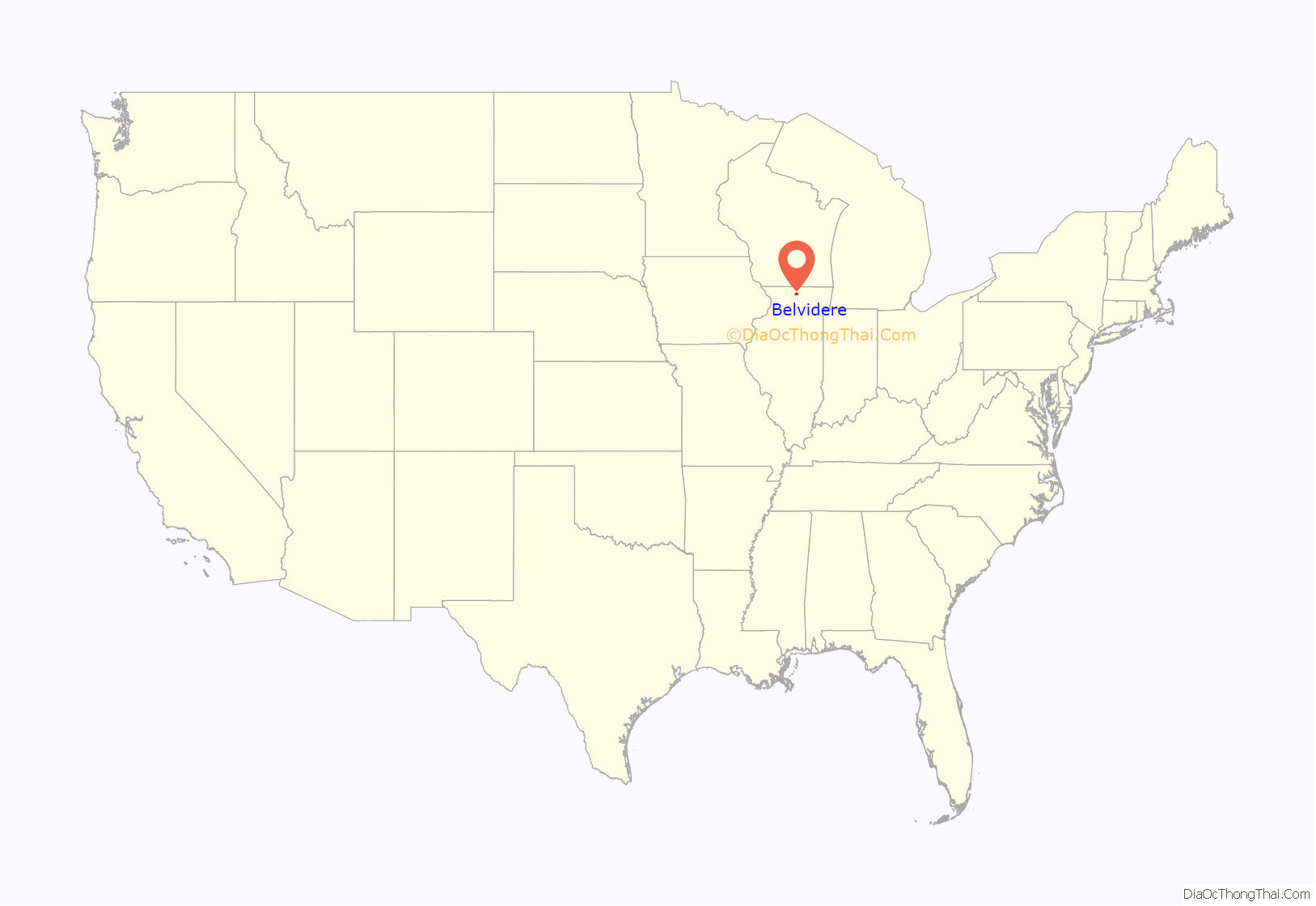
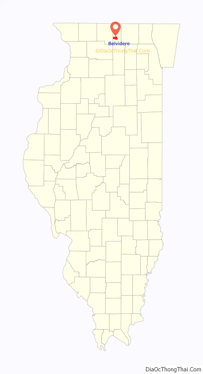
Belvidere location map. Where is Belvidere city?
History
Before the arrival of the mostly Anglo-Americans in the 19th century, this area was long occupied by the Illinois Confederation, a loose grouping of up to 12 to 15 Native American tribes. The main tribes were the Cahokia, Kaskaskia, Michigamea, Peoria, and Tamaroa. After trading, warfare and other encounters with French traders, who entered this area before the Anglo-Americans, their numbers declined. In large part that was due to the high mortality from new infectious diseases, which adversely affected Native Americans across the continent.
The area that developed as Belvidere was first permanently settled by European Americans in 1835: Simon P. Doty and Daniel Hilton Whitney. They named this location next to the Kishwaukee River as “Elysian Fields” from Greek mythology. As many new residents could not pronounce or spell the proposed name, the city was eventually named after Belvidere, Virginia, the former home of Ebenezer Polk, a railroad lawyer and major financial founder in the city.
Belvidere originally developed on the north side of the Kishwaukee River. In 1851 the Galena and Chicago Union Railroad was built south of the river, stimulating relocation of much of the business section to the south side of the river, for access to the railway transportion. Belvidere’s downtown is now on the south side.
Major industries developed along the river and railroad, including the National Sewing Machine Company, which operated here from 1886 to the 1940s. In 1906, former female sheriff Sarah Ames moved to South Dakota; she named the area where she settled after her home town. Belvidere, South Dakota still operates as a small town in Jackson County.
1967 tornado
On April 21, 1967, a devastating tornado struck Belvidere. Twenty-four people died as a result, many of them schoolchildren. The F4 tornado struck at the end of the school day of Belvidere High School, when many children, including those who attended area grade schools, were waiting outside the high school for school buses. Of the sixteen school buses outside the high school, twelve were overturned or thrown by the tornado. The tornado did $22 million in damage, demolished over 100 homes, and injured 500 people. In 2007 a statue was erected in front of Belvidere High School in memorial of the lives lost.
To this date, the Belvidere tornado remains the 6th worst weather disaster to happen at an American School. [1]
2009 explosion
On December 7, 2009 an explosion occurred at an NDK America building, when a large pressure vessel ruptured during a crystal-growing process. Pieces of debris, some weighing several tons, were flung over a wide area. One piece struck an automotive supply building and injured an employee inside. Chesterfield native Ronald Greenfield, a truck driver refueling at the nearby Belvidere Oasis truck stop, was struck and killed by a 7-foot support beam. The shockwave was felt over a wide area. No NDK employees were injured in the incident.
The Chemical Safety Board investigated the incident, issuing their final report in 2013. The CSB found that stress corrosion cracking had occurred, unnoticed, in one of the crystal-growing autoclaves, leading to the catastrophic failure. They also found that NDK management had been warned multiple times over the years that the dangerous levels of hot sodium hydroxide inside the vessels would corrode the steel walls. However, NDK management insisted buildup of byproducts from the crystal-growing process would form a protective layer against the corrosion. Furthermore, during the factory’s construction, the local government had been made aware that NDK’s crystal-growing vessels were in violation of several state codes; when confronted, NDK had persuaded them to grant a special exception, and to hitherto allow them to conduct their own onsite inspections without outside interference. However, the vessel that ruptured had never been internally inspected to test the “byproduct buildup” theory, during its many years of service. After a smaller leak occurred in January 2007, NDK was warned about safety concerns again, this time by insurance investigators, who were ultimately ignored. Finally, the CSB determined the method for growing crystals used at NDK’s Belvidere facility was prohibitively dangerous in the first place, pointing out such methods had been already abandoned by other crystal-growing facilities in favor of safer, lower-pressure and lower temperature processes.
Following their own 2010 investigation, the Occupational Safety and Health Administration fined NDK more than half a million dollars for willful disregard for legal requirements, and “unacceptable” indifference to safety and health. The NDK facility was demolished in 2015, with no plans to rebuild.
2023 tornado
On March 31, 2023, an EF1 tornado struck Belvidere. It caused the Apollo Theatre to collapse during a concert for the Floridian Death Metal band Morbid Angel and Brazilian Death Metal band Crypta. Although the Storm Prediction Center had issued a moderate risk for severe weather, including tornadoes, and an official Tornado Watch was issued at 2:35 pm, the concert proceeded. A Tornado Warning was issued at 7:24 pm and the storm hit Belvidere at 7:44 pm. The collapse led to over 40 injuries; leaving at least four in critical condition and one fatality.
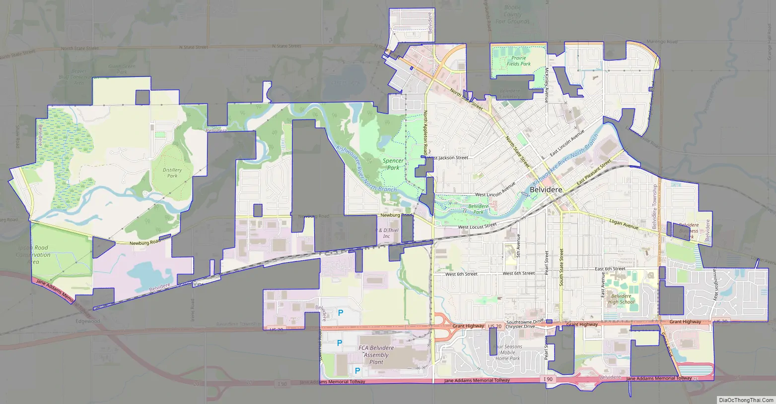
Belvidere Road Map
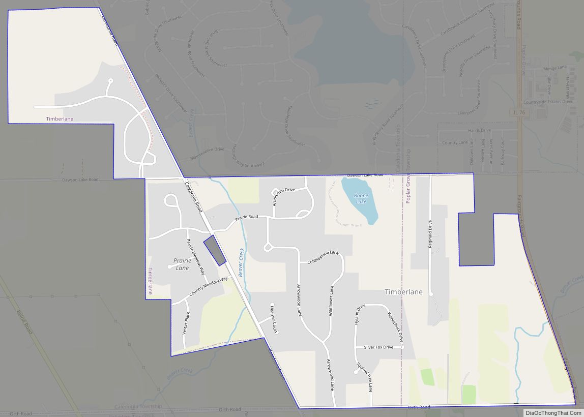
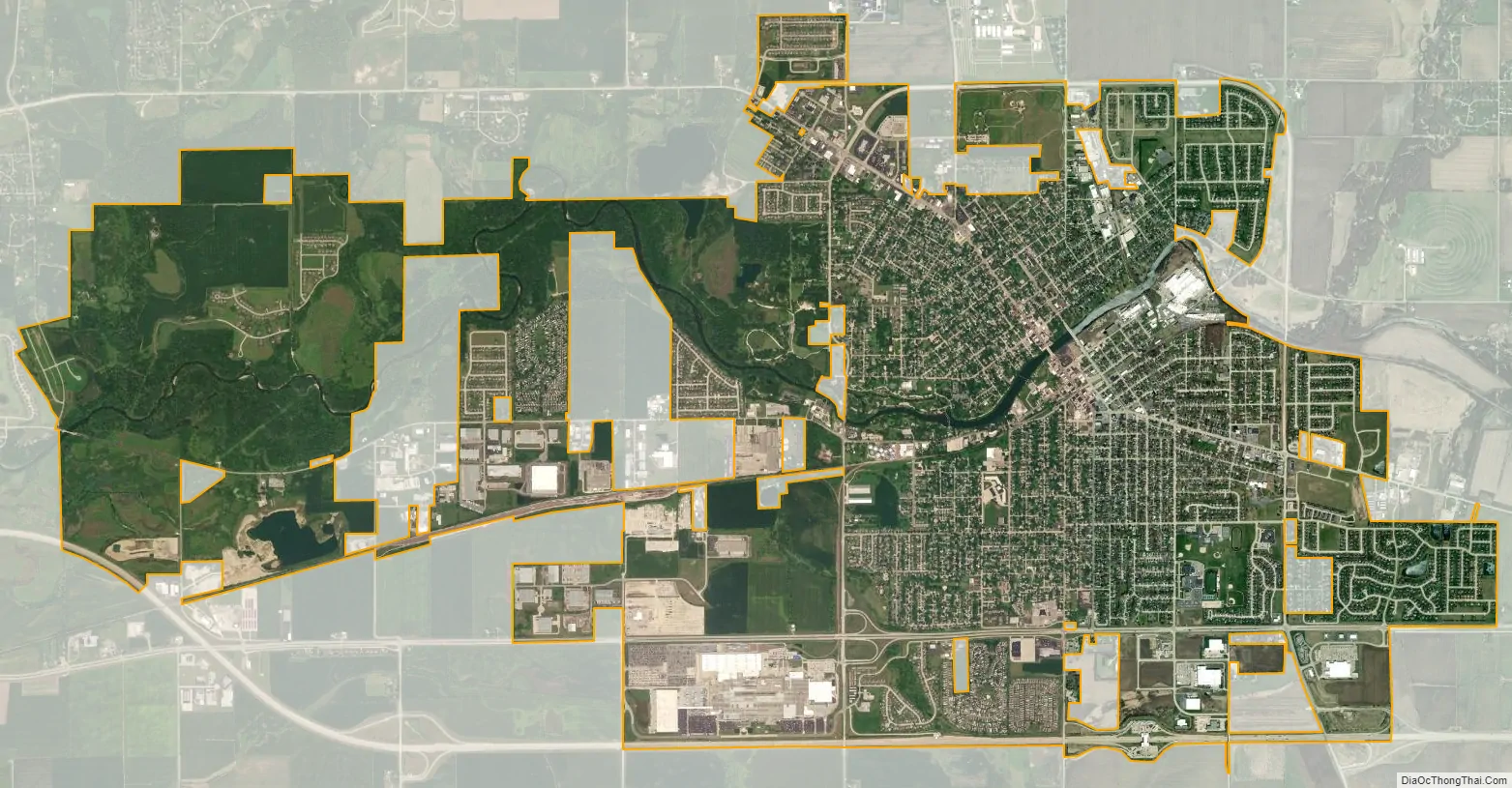
Belvidere city Satellite Map
Geography
Belvidere is located at 42°15′17″N 88°50′39″W / 42.25472°N 88.84417°W / 42.25472; -88.84417 (42.254758, -88.844093), and sits approximately 800 feet (240 m) above sea level. According to the 2021 census gazetteer files, Belvidere has a total area of 12.30 square miles (31.86 km), of which 12.06 square miles (31.24 km) (or 98.08%) is land and 0.24 square miles (0.62 km) (or 1.92%) is water.
Located in north central Illinois, on a county on the northern border of the state, Belvidere is approximately 75 miles (121 km) northwest of the downtown of Chicago, and approximately 12 miles (19 km) east of Rockford.
Belvidere developed on both sides of the Kishwaukee River in north central Illinois. It is 76 miles from downtown Chicago on Routes 20, 76 and the Northern Illinois Toll road. Belvidere is an industrial community surrounded by prosperous farms. It is the County Seat with an estimated 2006 county population of over 52,000. The altitude is 800 feet above sea level, average temperatures are: 73 degrees F in the summer; 24 degrees F in the winter, and the average rainfall is 33.3 inches, and the average annual snowfall is 35.3 inches.
See also
Map of Illinois State and its subdivision:- Adams
- Alexander
- Bond
- Boone
- Brown
- Bureau
- Calhoun
- Carroll
- Cass
- Champaign
- Christian
- Clark
- Clay
- Clinton
- Coles
- Cook
- Crawford
- Cumberland
- De Kalb
- De Witt
- Douglas
- Dupage
- Edgar
- Edwards
- Effingham
- Fayette
- Ford
- Franklin
- Fulton
- Gallatin
- Greene
- Grundy
- Hamilton
- Hancock
- Hardin
- Henderson
- Henry
- Iroquois
- Jackson
- Jasper
- Jefferson
- Jersey
- Jo Daviess
- Johnson
- Kane
- Kankakee
- Kendall
- Knox
- La Salle
- Lake
- Lake Michigan
- Lawrence
- Lee
- Livingston
- Logan
- Macon
- Macoupin
- Madison
- Marion
- Marshall
- Mason
- Massac
- McDonough
- McHenry
- McLean
- Menard
- Mercer
- Monroe
- Montgomery
- Morgan
- Moultrie
- Ogle
- Peoria
- Perry
- Piatt
- Pike
- Pope
- Pulaski
- Putnam
- Randolph
- Richland
- Rock Island
- Saint Clair
- Saline
- Sangamon
- Schuyler
- Scott
- Shelby
- Stark
- Stephenson
- Tazewell
- Union
- Vermilion
- Wabash
- Warren
- Washington
- Wayne
- White
- Whiteside
- Will
- Williamson
- Winnebago
- Woodford
- Alabama
- Alaska
- Arizona
- Arkansas
- California
- Colorado
- Connecticut
- Delaware
- District of Columbia
- Florida
- Georgia
- Hawaii
- Idaho
- Illinois
- Indiana
- Iowa
- Kansas
- Kentucky
- Louisiana
- Maine
- Maryland
- Massachusetts
- Michigan
- Minnesota
- Mississippi
- Missouri
- Montana
- Nebraska
- Nevada
- New Hampshire
- New Jersey
- New Mexico
- New York
- North Carolina
- North Dakota
- Ohio
- Oklahoma
- Oregon
- Pennsylvania
- Rhode Island
- South Carolina
- South Dakota
- Tennessee
- Texas
- Utah
- Vermont
- Virginia
- Washington
- West Virginia
- Wisconsin
- Wyoming