Map of Shumway village

Map of Shumway village

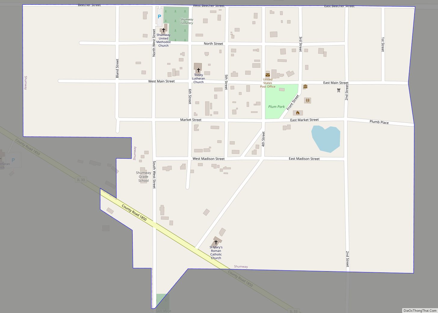
Shumway is a village in Effingham County, Illinois, United States. As of the 2020 census, the village population was 188. Shumway is part of the Effingham, IL Micropolitan Statistical Area. Shumway village overview: Name: Shumway village LSAD Code: 47 LSAD Description: village (suffix) State: Illinois County: Effingham County Elevation: 656 ft (200 m) Total Area: 0.33 sq mi (0.86 km²) … Read more

Map of Sidney village, Illinois

Map of Sidney village, Illinois

Sidney is a village in Champaign County, Illinois, United States. The population was 1,208 at the 2020 census. Sidney village overview: Name: Sidney village LSAD Code: 47 LSAD Description: village (suffix) State: Illinois County: Champaign County Total Area: 0.63 sq mi (1.63 km²) Land Area: 0.62 sq mi (1.62 km²) Water Area: 0.01 sq mi (0.01 km²) Total Population: 1,208 Population Density: 1,935.90/sq mi (747.71/km²) … Read more

Map of Sidell village

Map of Sidell village

Sidell is a village in Sidell Township, Vermilion County, Illinois, United States. It is part of the Danville, Illinois Metropolitan Statistical Area. The population was 617 at the 2010 census. Sidell village overview: Name: Sidell village LSAD Code: 47 LSAD Description: village (suffix) State: Illinois County: Vermilion County Elevation: 679 ft (207 m) Total Area: 0.93 sq mi (2.40 km²) … Read more

Map of Silvis city

Map of Silvis city

Silvis is a city in Rock Island County, Illinois, United States. It is part of a larger metropolitan area known as the Quad Cities. The Quad Cities Metropolitan Area is situated across four counties in Illinois and Iowa. It is located four miles from the intersection of Interstate 80 and Interstate 88, 165 miles west … Read more

Map of Sigel town

Map of Sigel town

Sigel is an incorporated town in Shelby County, Illinois, United States. The population was 329 at the 2020 census. The town was named after Franz Sigel, (1824–1902), a Union general in the American Civil War. Sigel town overview: Name: Sigel town LSAD Code: 43 LSAD Description: town (suffix) State: Illinois County: Shelby County Incorporated: March 7, 1867 (1867-03-07) … Read more

Map of Sims village

Map of Sims village, Illinois

Sims is a village in Wayne County, Illinois, United States. The population was 166 at the 2020 census. Sims village overview: Name: Sims village LSAD Code: 47 LSAD Description: village (suffix) State: Illinois County: Wayne County Elevation: 423 ft (129 m) Total Area: 1.18 sq mi (3.06 km²) Land Area: 1.18 sq mi (3.06 km²) Water Area: 0.00 sq mi (0.00 km²) Total Population: 166 Population … Read more

Map of Simpson village

Map of Simpson village, Illinois

Simpson is a village in Johnson County, Illinois, United States. The population was 60 at the 2010 census. Simpson village overview: Name: Simpson village LSAD Code: 47 LSAD Description: village (suffix) State: Illinois County: Johnson County Elevation: 387 ft (118 m) Total Area: 0.53 sq mi (1.36 km²) Land Area: 0.53 sq mi (1.36 km²) Water Area: 0.00 sq mi (0.00 km²) Total Population: 44 Population … Read more

Map of Sleepy Hollow village, Illinois

Map of Sleepy Hollow village, Illinois

Sleepy Hollow is a village in Kane County, Illinois, United States. The population was 3,214 at the 2020 census. Sleepy Hollow village overview: Name: Sleepy Hollow village LSAD Code: 47 LSAD Description: village (suffix) State: Illinois County: Kane County Total Area: 2.04 sq mi (5.29 km²) Land Area: 2.02 sq mi (5.23 km²) Water Area: 0.02 sq mi (0.06 km²) Total Population: 3,214 Population … Read more

Map of Skokie village

Map of Skokie village

Skokie (/ˈskoʊki/; formerly Niles Center) is a village in Cook County, Illinois, United States, neighboring the City of Chicago’s northern border. Skokie’s population, according to the 2020 census, is 67,824. Skokie lies approximately 15 miles (24 km) north of Chicago’s downtown Loop. The name Chicago comes from a Potawatomi word for “marsh”. For many years, Skokie … Read more

Map of Smithfield village

Map of Smithfield village, Illinois

Smithfield is a village in Fulton County, Illinois, United States. The population was 230 at the 2010 census. The village is named in honor of Dr. Joseph N. Smith. Smithfield village overview: Name: Smithfield village LSAD Code: 47 LSAD Description: village (suffix) State: Illinois County: Fulton County Elevation: 630 ft (190 m) Total Area: 0.47 sq mi (1.20 km²) Land … Read more

Map of Smithboro village

Map of Smithboro village

Smithboro is a village in Bond County, Illinois, United States. The population was 154 at the 2020 census. Smithboro village overview: Name: Smithboro village LSAD Code: 47 LSAD Description: village (suffix) State: Illinois County: Bond County Elevation: 551 ft (168 m) Total Area: 0.93 sq mi (2.41 km²) Land Area: 0.93 sq mi (2.41 km²) Water Area: 0.00 sq mi (0.00 km²)  0% Total Population: 154 … Read more

Map of Somonauk village

Map of Somonauk village

Somonauk is a village in DeKalb and LaSalle Counties in the U.S. state of Illinois. The population was 1,786 at the 2020 Census, down from 1,893 at the 2010 Census. The DeKalb County portion of Somonauk is part of the Chicago-Naperville-Elgin, IL-IN-WI Metropolitan Statistical Area, while the small portion that lies in LaSalle County is … Read more