Map of Southern View village

Map of Southern View village

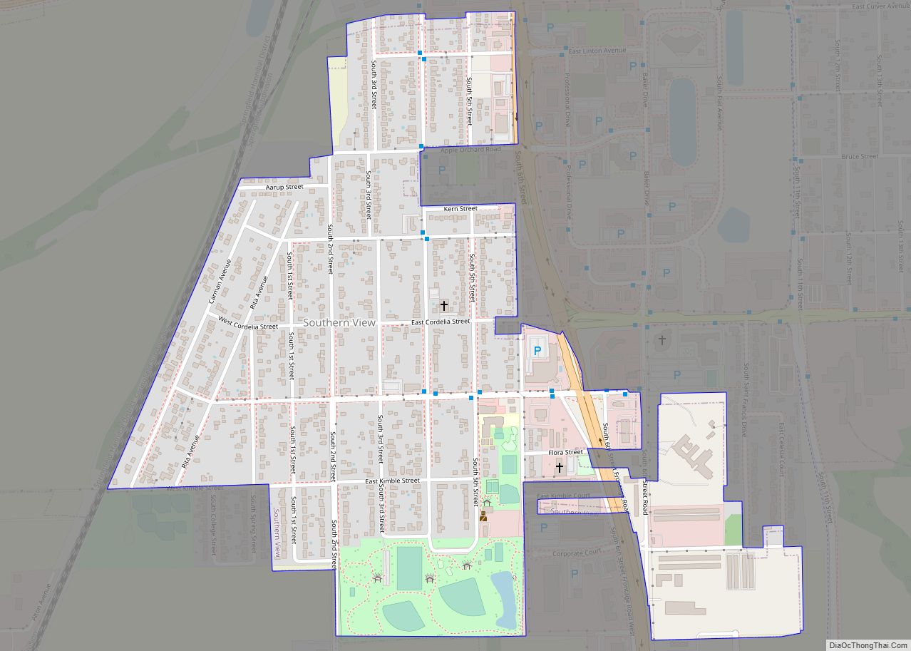
Southern View is a village in Sangamon County, Illinois, United States. The population was 1,642 at the 2010 census. It is part of the Springfield, Illinois Metropolitan Statistical Area. Southern View village overview: Name: Southern View village LSAD Code: 47 LSAD Description: village (suffix) State: Illinois County: Sangamon County Total Area: 0.67 sq mi (1.73 km²) Land Area: … Read more

Map of Sparta city, Illinois

Map of Sparta city, Illinois

Sparta is a city in Randolph County, Illinois, United States. The population was 4,095 at the 2020 census. The city was the principal filming location for the 1967 film In the Heat of the Night. Consumer ammunition manufacturer Underwood Ammo is headquartered and solely based in Sparta. Sparta city overview: Name: Sparta city LSAD Code: … Read more

Map of Spaulding village, Illinois

Map of Spaulding village, Illinois

Spaulding is a village in Sangamon County, Illinois, United States. The population was 873 at the 2010 census. It is part of the Springfield, Illinois Metropolitan Statistical Area. Spaulding is in the Riverton School District #14. Spaulding village overview: Name: Spaulding village LSAD Code: 47 LSAD Description: village (suffix) State: Illinois County: Sangamon County Total … Read more

Map of Spring Bay village

Map of Spring Bay village

Spring Bay is a village in Woodford County, Illinois, United States. As of the 2010 United States census, the village population was 452, up from 436 in 2000. The village is part of the Peoria, Illinois Metropolitan Statistical Area. Spring Bay village overview: Name: Spring Bay village LSAD Code: 47 LSAD Description: village (suffix) State: … Read more

Map of Spillertown village

Map of Spillertown village

Spillertown is a village in Williamson County, Illinois, United States. The population was 203 at the 2010 census and as of 2018, the population has grown to an estimated 272. Spillertown village overview: Name: Spillertown village LSAD Code: 47 LSAD Description: village (suffix) State: Illinois County: Williamson County Elevation: 486 ft (148 m) Total Area: 0.33 sq mi (0.85 km²) … Read more

Map of Spring Valley city, Illinois

Map of Spring Valley city, Illinois

Spring Valley is a city situated on the Illinois River in Bureau County, Illinois, United States. The population was 5,582 at the 2020 census, up from 5,558 in 2010. It is part of the Ottawa Micropolitan Statistical Area. Spring Valley city overview: Name: Spring Valley city LSAD Code: 25 LSAD Description: city (suffix) State: Illinois … Read more

Map of Spring Grove village

Map of Spring Grove village, Illinois

Spring Grove is a village in McHenry County. Portions of unincorporated Lake County, Illinois also utilize Spring Grove postal addresses. It is a commuter village within the Chicago metropolitan area. Per the 2020 census, the population was 5,487. It is also home to Chain O’Lakes State Park. The current village president is Mark Eisenberg. The … Read more

Map of St. Anne village

Map of St. Anne village

St. Anne (sometimes spelled Saint Anne) is a village in Kankakee County, Illinois, United States. The population was 1,161 at the 2020 census. It is part of the Kankakee–Bourbonnais–Bradley Metropolitan Statistical Area. It was founded in 1851 by Charles Chiniquy, a French-Canadian Roman Catholic priest and friend of the 16th U.S. President Abraham Lincoln who … Read more

Map of Springerton village

Map of Springerton village

Springerton is a village in White County, Illinois, United States. The population was 134 at the 2000 census. Springerton village overview: Name: Springerton village LSAD Code: 47 LSAD Description: village (suffix) State: Illinois County: White County Elevation: 417 ft (127 m) Total Area: 0.14 sq mi (0.36 km²) Land Area: 0.14 sq mi (0.36 km²) Water Area: 0.00 sq mi (0.00 km²) Total Population: 101 Population … Read more

Map of St. Charles city, Illinois

Map of St. Charles city, Illinois

St. Charles is a city in DuPage and Kane counties in the U.S. state of Illinois. It lies roughly 40 miles (64 km) west of Chicago on Illinois Route 64. Per the 2020 census, the population was 33,081. The official city slogan is “Pride of the Fox”, after the Fox River that runs through the center … Read more

Map of St. Augustine village, Illinois

Map of St. Augustine village, Illinois

St. Augustine or Saint Augustine is a village in Knox County, Illinois, United States. The population was 120 at the 2010 census, down from 152 at the 2000 census. It is part of the Galesburg Micropolitan Statistical Area. St. Augustine village overview: Name: St. Augustine village LSAD Code: 47 LSAD Description: village (suffix) State: Illinois … Read more

Map of St. Elmo city

Map of St. Elmo city

St. Elmo is a city in Fayette County, Illinois, United States. The population was 1,254 at the 2020 census. St. Elmo was established in 1871. St. Elmo city overview: Name: St. Elmo city LSAD Code: 25 LSAD Description: city (suffix) State: Illinois County: Fayette County Elevation: 614 ft (187 m) Total Area: 1.51 sq mi (3.90 km²) Land Area: 1.48 sq mi … Read more