Map of Sloan city

Map of Sloan city, Iowa

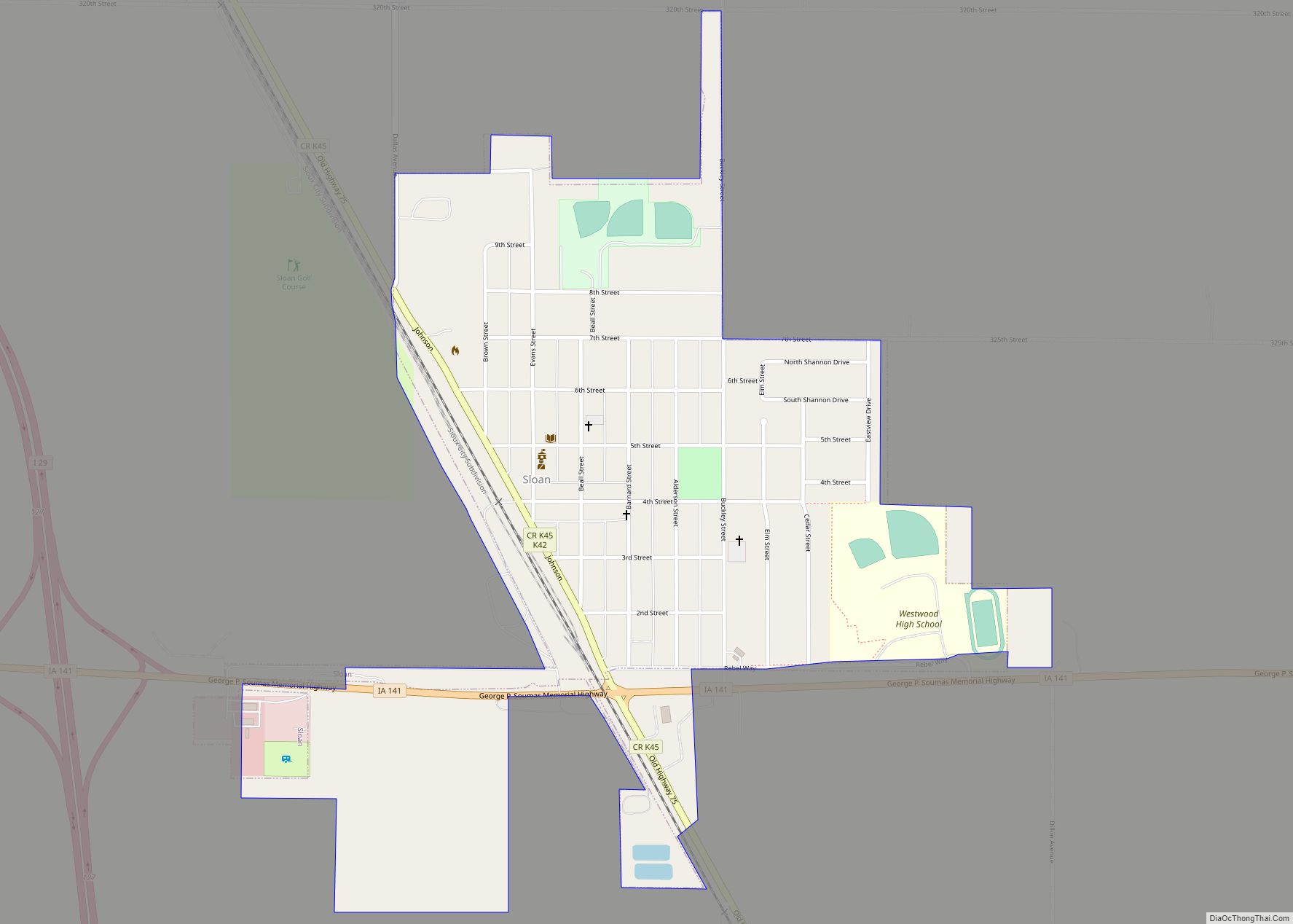
Sloan is a city in Woodbury County, Iowa, United States. It is part of the Sioux City, IA–NE–SD Metropolitan Statistical Area. The population was 1,042 at the time of the 2020 census. Sloan city overview: Name: Sloan city LSAD Code: 25 LSAD Description: city (suffix) State: Iowa County: Woodbury County Elevation: 1,076 ft (328 m) Total Area: … Read more

Map of Slater city

Map of Slater city, Iowa

Slater is a city in Story County, Iowa, United States. The population was 1,543 at the time of the 2020 census. Slater city overview: Name: Slater city LSAD Code: 25 LSAD Description: city (suffix) State: Iowa County: Story County Elevation: 1,037 ft (316 m) Total Area: 1.91 sq mi (4.95 km²) Land Area: 1.91 sq mi (4.95 km²) Water Area: 0.00 sq mi (0.00 km²) Total … Read more

Map of Somers city, Iowa

Map of Somers city, Iowa

Somers is a city in Calhoun County, Iowa, United States. The population was 128 at the time of the 2020 census. Somers city overview: Name: Somers city LSAD Code: 25 LSAD Description: city (suffix) State: Iowa County: Calhoun County Elevation: 1,155 ft (352 m) Total Area: 0.34 sq mi (0.88 km²) Land Area: 0.34 sq mi (0.88 km²) Water Area: 0.00 sq mi (0.00 km²) Total … Read more

Map of Solon city

Map of Solon city, Iowa

Solon is a city located in Johnson County, Iowa, United States. Part of the Iowa City, Iowa Metropolitan Statistical Area, it is located a few miles from Lake MacBride State Park and the larger cities of Coralville and Iowa City. The population was 3,018 at the time of the 2020 census. Solon city overview: Name: … Read more

Map of Soldier city

Map of Soldier city, Iowa

Soldier is a city in Monona County, Iowa, United States, along the Soldier River. The population was 184 at the time of the 2020 census. Soldier was so named from a nearby unmarked grave of a soldier. Soldier city overview: Name: Soldier city LSAD Code: 25 LSAD Description: city (suffix) State: Iowa County: Monona County … Read more

Map of Spencer city

Map of Spencer city, Iowa

Spencer is a city in the state of Iowa, United States, and the county seat of Clay County. It is located at the confluence of the Little Sioux and Ocheyedan rivers. The population was 11,325 in the 2020 census, an increase from 11,317 in 2000. Spencer hosts the Clay County Fair, held annually in September … Read more

Map of South English city

Map of South English city

South English is a city in Keokuk County, Iowa, United States. The population was 202 at the time of the 2020 census. It is named for the English River. South English city overview: Name: South English city LSAD Code: 25 LSAD Description: city (suffix) State: Iowa County: Keokuk County Elevation: 840 ft (256 m) Total Area: 0.31 sq mi … Read more

Map of South Amana CDP

Map of South Amana CDP

South Amana is an unincorporated community and census-designated place (CDP) in northern Iowa County, Iowa, United States, and is part of the “seven villages” of the Amana Colonies. As of the 2010 census, it had a population of 159. It lies along U.S. Route 6, east of the city of Marengo, the county seat of … Read more

Map of Spragueville city

Map of Spragueville city

Spragueville is a city in Jackson County, Iowa, United States. The population was 92 at the time of the 2020 census. Spragueville city overview: Name: Spragueville city LSAD Code: 25 LSAD Description: city (suffix) State: Iowa County: Jackson County Incorporated: May 18, 1912 Elevation: 663 ft (202 m) Total Area: 0.74 sq mi (1.93 km²) Land Area: 0.74 sq mi (1.93 km²) Water … Read more

Map of Spirit Lake city

Map of Spirit Lake city, Iowa

Spirit Lake is a city in Dickinson County, Iowa, United States. The population was 5,439 at the 2020 census. It is the county seat of Dickinson County. The town is located along the western shore of East Okoboji Lake, in the Iowa Great Lakes region. Spirit Lake city overview: Name: Spirit Lake city LSAD Code: … Read more

Map of Spillville city

Map of Spillville city

Spillville is a city in Winneshiek County, Iowa, United States. The population was 385 at the time of the 2020 census. It is located in Calmar Township, approximately 4 mi (6.4 km) west of Calmar and about 12 miles (19 km) southwest of Decorah, the county seat. Spillville is known for its Independence Day fireworks display, held the … Read more

Map of Springville city, Iowa

Map of Springville city, Iowa

Springville is a city in Linn County, Iowa, United States. The population was 1,154 at the time of the 2020 census. It is part of the Cedar Rapids Metropolitan Statistical Area. Springville city overview: Name: Springville city LSAD Code: 25 LSAD Description: city (suffix) State: Iowa County: Linn County Elevation: 833 ft (254 m) Total Area: 1.46 sq mi … Read more