Map of Carlton city, Kansas

Map of Carlton city, Kansas

Carlton is a city in Dickinson County, Kansas, United States. As of the 2020 census, the population of the city was 40. Carlton city overview: Name: Carlton city LSAD Code: 25 LSAD Description: city (suffix) State: Kansas County: Dickinson County Elevation: 1,316 ft (401 m) Total Area: 0.17 sq mi (0.44 km²) Land Area: 0.17 sq mi (0.44 km²) Water Area: 0.00 sq mi (0.00 km²) … Read more

Map of Catharine CDP

Map of Catharine CDP

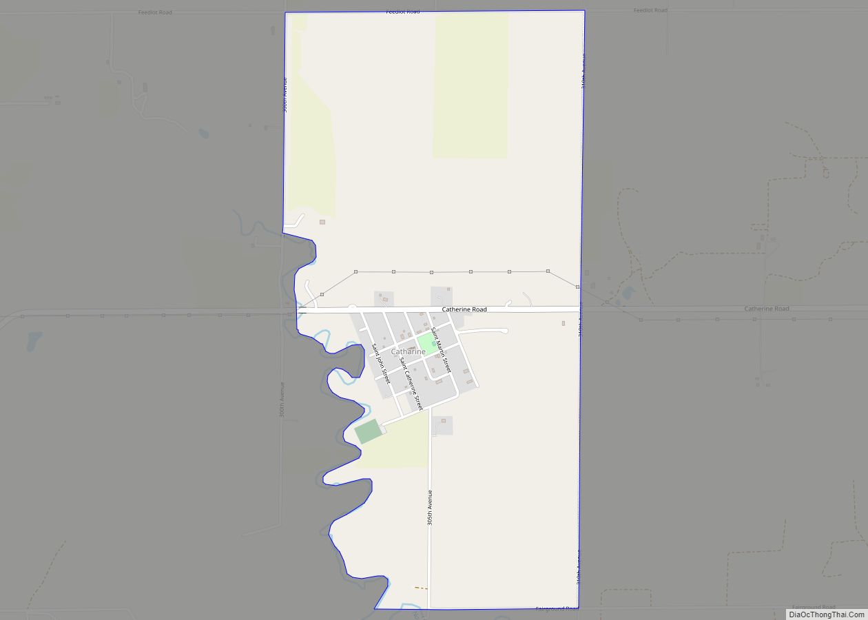
Catharine is an unincorporated community in Catherine Township, Ellis County, Kansas, United States. As of the 2020 census, the population of the community and nearby areas was 113. Catharine CDP overview: Name: Catharine CDP LSAD Code: 57 LSAD Description: CDP (suffix) State: Kansas County: Ellis County Founded: 1876 Elevation: 2,018 ft (615 m) Total Area: 1.77 sq mi (4.58 km²) … Read more

Map of Cassoday city

Map of Cassoday city

Cassoday is a city in Butler County, Kansas, United States. It is known as the “Prairie Chicken Capital of the World”. As of the 2020 census, the population of the city was 113. Cassoday city overview: Name: Cassoday city LSAD Code: 25 LSAD Description: city (suffix) State: Kansas County: Butler County Incorporated: 1960 Elevation: 1,473 ft … Read more

Map of Cedar Vale city

Map of Cedar Vale city

Cedar Vale is a city in Chautauqua County, Kansas, United States. As of the 2020 census, the population of the city was 476. Cedar Vale city overview: Name: Cedar Vale city LSAD Code: 25 LSAD Description: city (suffix) State: Kansas County: Chautauqua County Founded: 1870 Incorporated: 1884 Elevation: 951 ft (290 m) Total Area: 0.76 sq mi (1.95 km²) Land … Read more

Map of Cedar Point city, Kansas

Map of Cedar Point city, Kansas

Cedar Point is a city in Chase County, Kansas, United States. As of the 2020 census, the population of the city was 22. It is about 5 miles east of Florence and 0.5 miles south of U.S. Route 50 highway. Cedar Point city overview: Name: Cedar Point city LSAD Code: 25 LSAD Description: city (suffix) … Read more

Map of Cawker City city

Map of Cawker City

Cawker City is a city in Mitchell County, Kansas, United States. As of the 2020 census, the population of the city was 457. The city is located along the north shore of Waconda Lake and Glen Elder State Park. It is one of several places claiming to be home of the largest ball of twine … Read more

Map of Chanute city

Map of Chanute city

Chanute (/ʃəˈnuːt/) is a city in Neosho County, Kansas, United States. Founded on January 1, 1873, it was named after railroad engineer and aviation pioneer Octave Chanute. As of the 2020 census, the population of the city was 8,722. Chanute is home of Neosho County Community College. Chanute city overview: Name: Chanute city LSAD Code: … Read more

Map of Centralia city, Kansas

Map of Centralia city, Kansas

Centralia is a city in Nemaha County, Kansas, United States. As of the 2020 census, the population of the city was 485. Centralia city overview: Name: Centralia city LSAD Code: 25 LSAD Description: city (suffix) State: Kansas County: Nemaha County Founded: 1859 Incorporated: 1882 Elevation: 1,280 ft (390 m) Total Area: 0.45 sq mi (1.17 km²) Land Area: 0.45 sq mi (1.17 km²) … Read more

Map of Cedar city

Map of Cedar city, Kansas

Cedar is a city in Smith County, Kansas, United States. As of the 2020 census, the population of the city was 11. Cedar city overview: Name: Cedar city LSAD Code: 25 LSAD Description: city (suffix) State: Kansas County: Smith County Founded: 1870s Incorporated: 1916 Elevation: 1,631 ft (497 m) Total Area: 0.18 sq mi (0.46 km²) Land Area: 0.18 sq mi (0.46 km²) … Read more

Map of Chautauqua city

Map of Chautauqua city, Kansas

Chautauqua is a city in Chautauqua County, Kansas, United States. As of the 2020 census, the population of the city was 108. Chautauqua city overview: Name: Chautauqua city LSAD Code: 25 LSAD Description: city (suffix) State: Kansas County: Chautauqua County Founded: 1881 Incorporated: 1882 Elevation: 906 ft (276 m) Total Area: 0.42 sq mi (1.10 km²) Land Area: 0.42 sq mi (1.10 km²) … Read more

Map of Chase city, Kansas

Map of Chase city, Kansas

Chase is a city in Rice County, Kansas, United States. As of the 2020 census, the population of the city was 396. Chase city overview: Name: Chase city LSAD Code: 25 LSAD Description: city (suffix) State: Kansas County: Rice County Founded: 1880 Incorporated: 1902 Elevation: 1,716 ft (523 m) Total Area: 0.28 sq mi (0.72 km²) Land Area: 0.28 sq mi (0.72 km²) … Read more

Map of Chapman city

Map of Chapman city, Kansas

Chapman is a city in Dickinson County, Kansas, United States. As of the 2020 census, the population of the city was 1,377. Chapman city overview: Name: Chapman city LSAD Code: 25 LSAD Description: city (suffix) State: Kansas County: Dickinson County Founded: 1868 Elevation: 1,112 ft (339 m) Total Area: 0.94 sq mi (2.42 km²) Land Area: 0.93 sq mi (2.42 km²) Water Area: … Read more