Map of Clarksburg CDP, Maryland

Map of Clarksburg CDP, Maryland

Clarksburg is a census-designated place and an unincorporated area in northern Montgomery County, Maryland, United States. It is located at the northern end of the Interstate 270 technology corridor, approximately four miles north of Germantown. As of the 2020 census, Clarksburg had a population of 29,051. Clarksburg CDP overview: Name: Clarksburg CDP LSAD Code: 57 … Read more

Map of Church Hill town

Map of Church Hill town, Maryland

Church Hill is a town in Queen Anne’s County, Maryland, United States. The population was 745 at the 2010 census. Church Hill town overview: Name: Church Hill town LSAD Code: 43 LSAD Description: town (suffix) State: Maryland County: Queen Anne’s County Incorporated: 1876 Elevation: 39 ft (12 m) Total Area: 0.72 sq mi (1.86 km²) Land Area: 0.72 sq mi (1.86 km²) Water … Read more

Map of Church Creek town

Map of Church Creek town

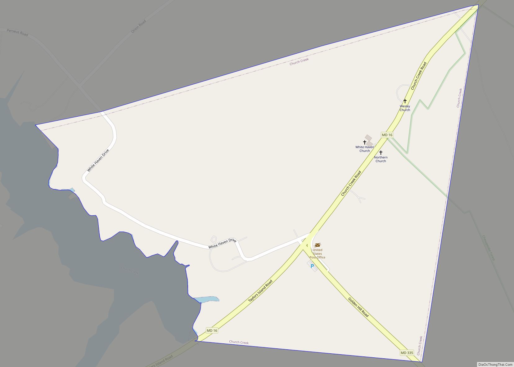
Church Creek is a town in Dorchester County, Maryland, United States, part of the state’s Eastern Shore. The population was 125 at the 2010 census. Church Creek is located approximately six miles south of Cambridge. Old Trinity Church is located here. An Anglican (now Episcopal) brick church built in 1675, it is the oldest church … Read more

Map of Clinton CDP, Maryland

Map of Clinton CDP, Maryland

Clinton is an unincorporated census-designated place (CDP) in Prince George’s County, Maryland, United States. Clinton was formerly known as Surrattsville until after the time of the Civil War. The population of Clinton was 38,760 at the 2020 census. Clinton is historically known for its role in the American Civil War concerning the Abraham Lincoln assassination. … Read more

Map of Clear Spring town

Map of Clear Spring town

Clear Spring is a town in Washington County, Maryland, United States. The population was 358 at the 2010 census. Clear Spring town overview: Name: Clear Spring town LSAD Code: 43 LSAD Description: town (suffix) State: Maryland County: Washington County Incorporated: 1836 Elevation: 571 ft (174 m) Total Area: 0.12 sq mi (0.30 km²) Land Area: 0.12 sq mi (0.30 km²) Water Area: 0.00 sq mi … Read more

Map of Clarysville CDP

Map of Clarysville CDP

Clarysville is an unincorporated community and census-designated place (CDP) in Allegany County, Maryland, United States. As of the 2010 census it had a population of 73. It is located along U.S. Route 40 Alternate at its intersection with Maryland Route 55. Frostburg is 2 miles (3 km) to the west, and Cumberland is 7 miles (11 km) … Read more

Map of Cockeysville CDP

Map of Cockeysville CDP

Cockeysville is a census-designated place (CDP) in Baltimore County, Maryland, United States. The population was 20,776 at the 2010 census. Cockeysville CDP overview: Name: Cockeysville CDP LSAD Code: 57 LSAD Description: CDP (suffix) State: Maryland County: Baltimore County Elevation: 308 ft (94 m) Total Area: 12.38 sq mi (32.06 km²) Land Area: 11.97 sq mi (31.01 km²) Water Area: 0.40 sq mi (1.04 km²) Total Population: … Read more

Map of Cobb Island CDP

Map of Cobb Island CDP

Cobb Island is a small island located at the confluence of the Potomac and Wicomico rivers in southern Charles County, Maryland, United States. It is located approximately 45 miles (72 km) south of Washington, and is considered to be within the Washington, D.C. MSA. Cobb Island is separated from the mainland by Neale Sound and connected … Read more

Map of Cloverly CDP

Map of Cloverly CDP

Cloverly is an unincorporated town and census-designated place in Montgomery County, Maryland, United States. Its population was 15,285 as of the 2020 census. Cloverly CDP overview: Name: Cloverly CDP LSAD Code: 57 LSAD Description: CDP (suffix) State: Maryland County: Montgomery County Elevation: 522 ft (159 m) Total Area: 10.10 sq mi (26.16 km²) Land Area: 10.06 sq mi (26.07 km²) Water Area: 0.04 sq mi … Read more

Map of Colmar Manor town

Map of Colmar Manor town

Colmar Manor is a town located in Prince George’s County, Maryland, United States. As of the 2010 census, the town had a population of 1,404. As the town developed at the beginning of the 20th century, it assumed a name derived from its proximity to the District of Columbia—the first syllable of Columbia and that … Read more

Map of College Park city, Maryland

Map of College Park city, Maryland

College Park is a city in Prince George’s County, Maryland, United States, and is approximately four miles (6.4 km) from the northeast border of Washington, D.C. The population was 34,740 at the 2020 United States census. College Park is best known as the home of the University of Maryland, College Park. Since 1994, the city has … Read more

Map of Colesville CDP

Map of Colesville CDP

Colesville is a census-designated place and an unincorporated area in Montgomery County, Maryland, United States. It had a population of 15,421 as of the 2020 census. Colesville CDP overview: Name: Colesville CDP LSAD Code: 57 LSAD Description: CDP (suffix) State: Maryland County: Montgomery County Elevation: 436 ft (133 m) Total Area: 5.13 sq mi (13.28 km²) Land Area: 5.12 sq mi (13.25 km²) … Read more