Map of Baltimore city

Map of Baltimore city, Maryland

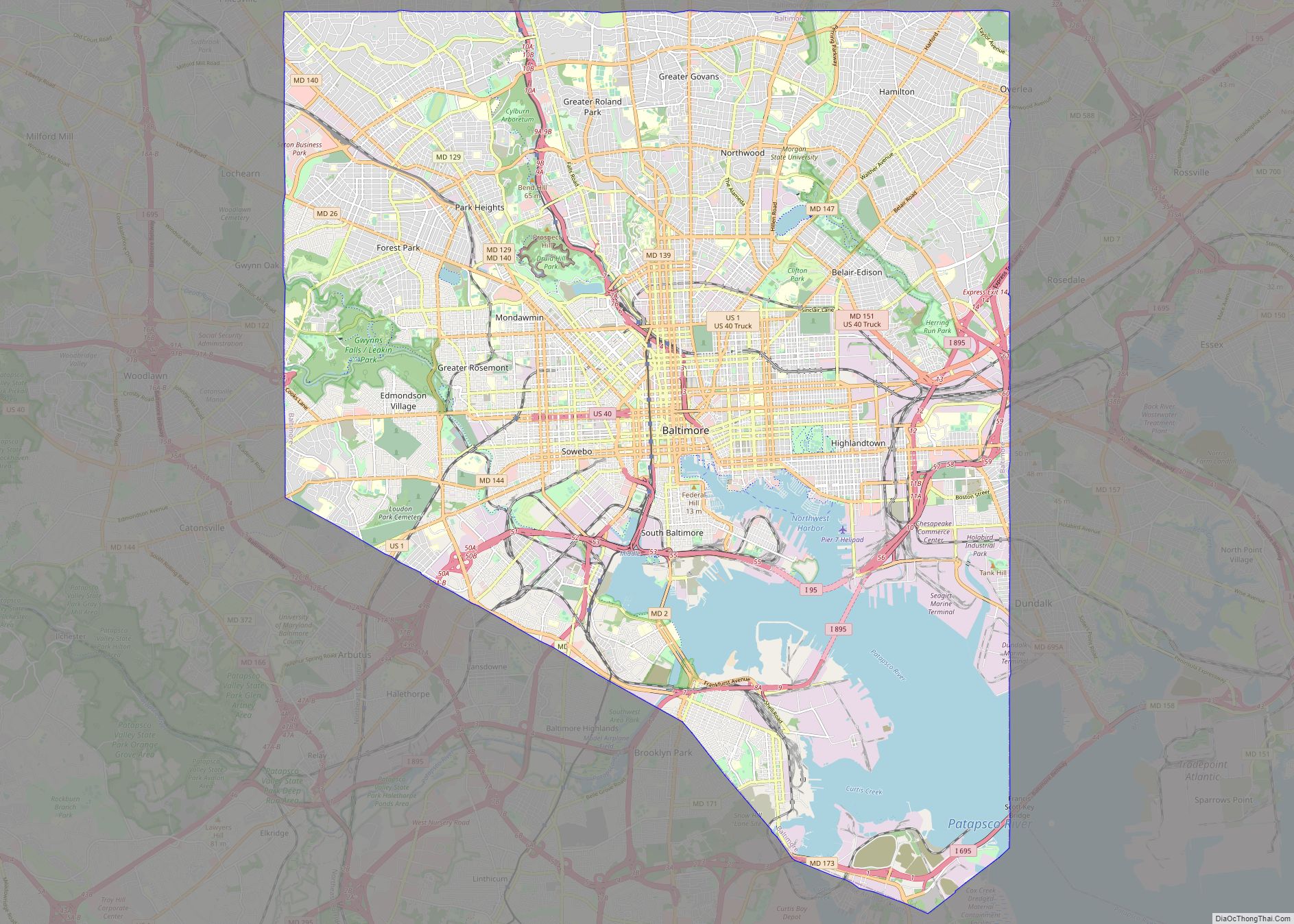
Baltimore city overview: Name: Baltimore city LSAD Code: 25 LSAD Description: city (suffix) State: Maryland County: Baltimore city FIPS code: 2404000 When it comes to getting around Baltimore, public transportation is the way to go. The city is served by the Maryland Transit Administration (MTA), which operates light rail, subway, and bus systems. If you’re … Read more

Map of Germantown CDP, Maryland

Map of Germantown CDP, Maryland

Germantown is an urbanized census-designated place in Montgomery County, Maryland, United States. With a population of 91,249 as of the 2020 census, it is the third most populous place in Maryland, after Baltimore and Columbia. Germantown is located approximately 28 miles (45 km) outside the U.S. capital of Washington, D.C., and is an important part of … Read more

Map of Columbia CDP, Maryland

Map of Columbia CDP, Maryland

Columbia is a census-designated place in Howard County, Maryland, United States. It is a planned community consisting of 10 self-contained villages. The census-designated place had a population of 104,681 at the 2020 census, making it the second most populous community in Maryland after Baltimore. Columbia, located between Baltimore and Washington, D.C., is officially part of … Read more

Map of Annapolis city, Maryland

Map of Annapolis city, Maryland

Annapolis (/əˈnæpəlɪs/ (listen) ə-NAP-ə-lis) is the capital city of the U.S. state of Maryland and the county seat of, and only incorporated city in, Anne Arundel County. Situated on the Chesapeake Bay at the mouth of the Severn River, 25 miles (40 km) south of Baltimore and about 30 miles (50 km) east of Washington, D.C., Annapolis … Read more

Map of Waldorf CDP

Map of Waldorf CDP, Maryland

Waldorf is a census-designated place in Charles County, Maryland, United States. Located 23 miles (37 km) south-southeast of Washington, D.C., Waldorf is part of Southern Maryland. Its population was 81,410 at the 2020 census, making it the fourth-most populous community in the state. Waldorf has experienced dramatic growth, increasing its population 16-fold from fewer than 5,000 … Read more

Map of Silver Spring CDP

Map of Silver Spring CDP

Silver Spring is a census-designated place (CDP) in southeastern Montgomery County, Maryland, United States, near Washington, D.C. Although officially unincorporated, in practice it is an edge city, with a population of 81,015 at the 2020 census, making it the fifth-most populous place in Maryland after Baltimore, Columbia, Germantown, and Waldorf. Downtown, next to the northern … Read more

Map of Accident town

Map of Accident town

Accident is a town in Garrett County, Maryland, United States. The population was 338 at the 2020 United States census. Accident has been noted for its unusual place name. A person from Accident is called an “Accidental”. Accident town overview: Name: Accident town LSAD Code: 43 LSAD Description: town (suffix) State: Maryland County: Garrett County … Read more

Map of Aberdeen city, Maryland

Map of Aberdeen city, Maryland

Aberdeen is a city located in Harford County, Maryland, United States, 26 miles (42 km) northeast of Baltimore. The population was 16,254 at the 2020 United States Census. Aberdeen is the largest municipality in Harford County. Aberdeen is part of the Baltimore-Towson Metropolitan Statistical Area (MSA), which is the 20th-largest United States metropolitan area. The nearest … Read more

Map of Aberdeen Proving Ground CDP

Map of Aberdeen Proving Ground CDP

Aberdeen Proving Ground is a census-designated place (CDP) covering the residential population of the Aberdeen Proving Ground in Harford County, Maryland, United States. The population at the 2020 Census was 1,668. Aberdeen Proving Ground CDP overview: Name: Aberdeen Proving Ground CDP LSAD Code: 57 LSAD Description: CDP (suffix) State: Maryland County: Harford County Total Area: … Read more

Map of Adelphi CDP

Map of Adelphi CDP, Maryland

Adelphi is an unincorporated area and census-designated place in Prince George’s County, Maryland, United States. Per the 2020 Census, the population was 16,823. Adelphi includes the following subdivisions; Adelphi, Adelphi Park, Adelphi Hills, Adelphi Terrace, Adelphi Village, Buck Lodge, Chatham, Cool Spring Terrace, Hillandale Forest, Holly Hill Manor, Knollwood, Lewisdale, and White Oak Manor. Adelphi … Read more

Map of Adamstown CDP

Map of Adamstown CDP, Maryland

Adamstown is an unincorporated community and census-designated place (CDP) in Frederick County, Maryland, United States. It is named for Adam Kohlenberg (March 11, 1819 – January 1, 1868), a station agent and first town merchant who owned much of present-day Adamstown. As of the 2010 census, the Adamstown CDP had a population of 2,372. Adamstown … Read more

Map of Accokeek CDP

Map of Accokeek CDP

Accokeek (/ˈækəkiːk/), “at the edge of the hill” in Algonquin, is a census-designated place (CDP) located in Prince George’s County, Maryland, United States. The CDP is located on the Potomac River, borders Charles County and is approximately 17 miles from Washington. It is a part of the Washington metropolitan area. The population of the CDP, … Read more