Map of Bloomington CDP, Maryland

Map of Bloomington CDP, Maryland

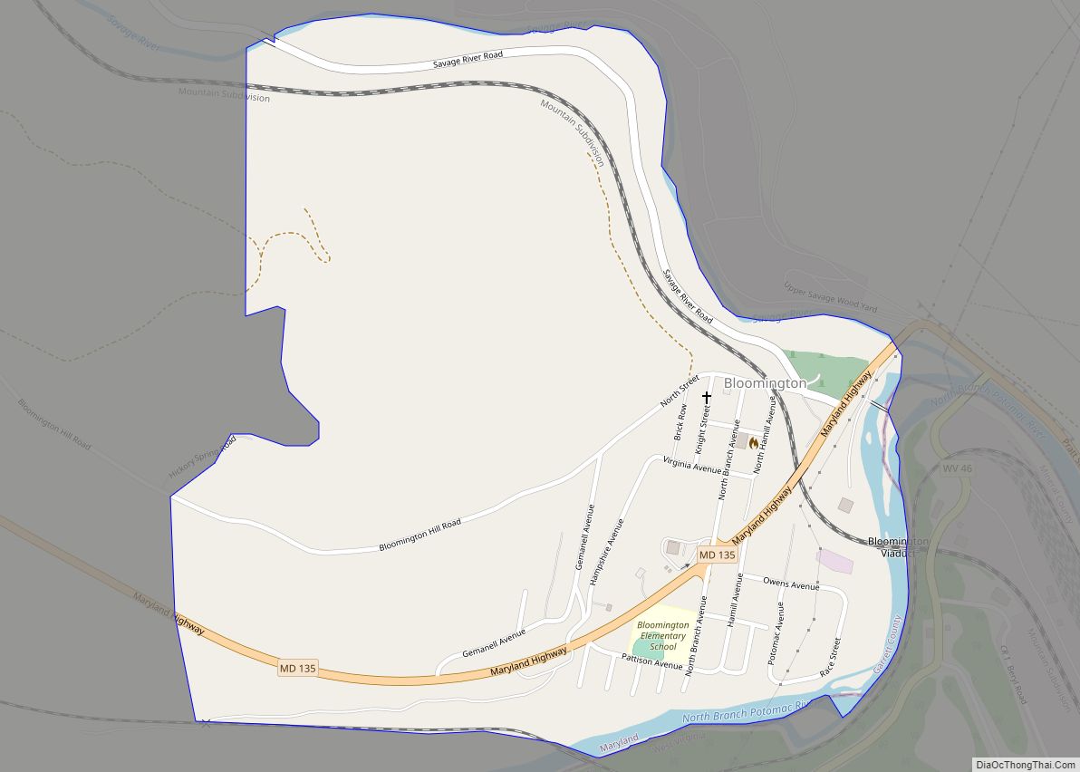
Bloomington is an unincorporated community and census-designated place (CDP) locates in southeastern Garrett County, Maryland located at the confluence of the North Branch Potomac River and Savage River. It lies to the west of Luke on Maryland Route 135 and is bounded to the northwest by Savage River State Forest. As of the 2010 census … Read more

Map of Bladensburg town

Map of Bladensburg town, Maryland

Bladensburg is a town in Prince George’s County, Maryland, United States. The population was 9,657 at the 2020 census. Areas in Bladensburg are located within ZIP code 20710. Bladensburg is 8.6 miles (13.8 km) from Washington, D.C. Bladensburg town overview: Name: Bladensburg town LSAD Code: 43 LSAD Description: town (suffix) State: Maryland County: Prince George’s County … Read more

Map of Bivalve CDP

Map of Bivalve CDP

Bivalve is an unincorporated community and census-designated place along the eastern shore of the lower Nanticoke River, near its mouth on the Chesapeake Bay, in Wicomico County, Maryland, United States. Its population was 201 as of the 2010 census. Bivalve takes its name from the oyster, upon which the town’s economy once depended. It is … Read more

Map of Boonsboro town

Map of Boonsboro town

Boonsboro is a town in Washington County, Maryland, United States, located at the foot of South Mountain. It nearly borders Frederick County and is proximate to the Antietam National Battlefield. The population was 3,336 at the 2010 census. Boonsboro town overview: Name: Boonsboro town LSAD Code: 43 LSAD Description: town (suffix) State: Maryland County: Washington … Read more

Map of Bowleys Quarters CDP

Map of Bowleys Quarters CDP

Bowleys Quarters is an unincorporated community and census-designated place in Baltimore County, Maryland, United States, with a population of 6,755 at the 2010 census. Bowleys Quarters CDP overview: Name: Bowleys Quarters CDP LSAD Code: 57 LSAD Description: CDP (suffix) State: Maryland County: Baltimore County Elevation: 46 ft (14 m) Total Area: 6.13 sq mi (15.88 km²) Land Area: 3.15 sq mi (8.15 km²) … Read more

Map of Bowie city, Maryland

Map of Bowie city, Maryland

Bowie (/ˈbuːi/) is a city in Prince George’s County, Maryland, United States. Per the 2020 census, the population was 58,329. Bowie has grown from a small railroad stop to the largest municipality in Prince George’s County, and the fifth most populous city and third largest city by area in the U.S. state of Maryland. In … Read more

Map of Braddock Heights CDP

Map of Braddock Heights CDP

Braddock Heights is an unincorporated community and census-designated place (CDP) in Frederick County, Maryland, United States. The population was 2,608 at the 2010 census. The local ZIP codes are 21714 (post office boxes only) and 21703. Braddock Heights CDP overview: Name: Braddock Heights CDP LSAD Code: 57 LSAD Description: CDP (suffix) State: Maryland County: Frederick … Read more

Map of Bowmans Addition CDP

Map of Bowmans Addition CDP

Bowmans Addition is an unincorporated community and census-designated place (CDP) in Allegany County, Maryland, United States. As of the 2020 census it had a population of 584. It is located north of Cumberland in a valley bounded by Wills Mountain to the northwest and Shriver Ridge to the southeast. Bowmans Addition CDP overview: Name: Bowmans … Read more

Map of Bowling Green CDP, Maryland

Map of Bowling Green CDP, Maryland

Bowling Green is an unincorporated community and census-designated place (CDP) in Allegany County, Maryland, United States. As of the 2010 census it had a population of 1,077. It is located along U.S. Route 220 (McMullen Highway), directly southwest of the city of Cumberland and includes the former community of Roberts. The CDP of Potomac Park … Read more

Map of Brentwood town, Maryland

Map of Brentwood town, Maryland

Brentwood is a town in Prince George’s County, Maryland, United States. Per the 2020 census, the population was 3,828. Brentwood is located within 1-mile (1.6 km) of Washington. The municipality of Brentwood is located just outside the northeast boundary of the District of Columbia and surrounded by the communities of Mount Rainier, Cottage City, North Brentwood, … Read more

Map of Breathedsville CDP

Map of Breathedsville CDP

Breathedsville is an unincorporated community and census-designated place in Washington County, Maryland, United States. Its population was 254 as of the 2010 census. Maryland Route 68 passes through the community. Breathedsville CDP overview: Name: Breathedsville CDP LSAD Code: 57 LSAD Description: CDP (suffix) State: Maryland County: Washington County Elevation: 453 ft (138 m) Total Area: 0.37 sq mi (0.96 km²) … Read more

Map of Brandywine CDP

Map of Brandywine CDP, Maryland

Brandywine is the name of an unincorporated area in Prince George’s County, Maryland, United States, that refers both to a census-designated place (CDP) and a zip code area which is much larger (20613), whose areas overlap. The population of Brandywine at the 2020 U.S. Census was 10,550 for the CDP, and the population of ZIP … Read more