Map of Middleborough Center CDP

Map of Middleborough Center CDP

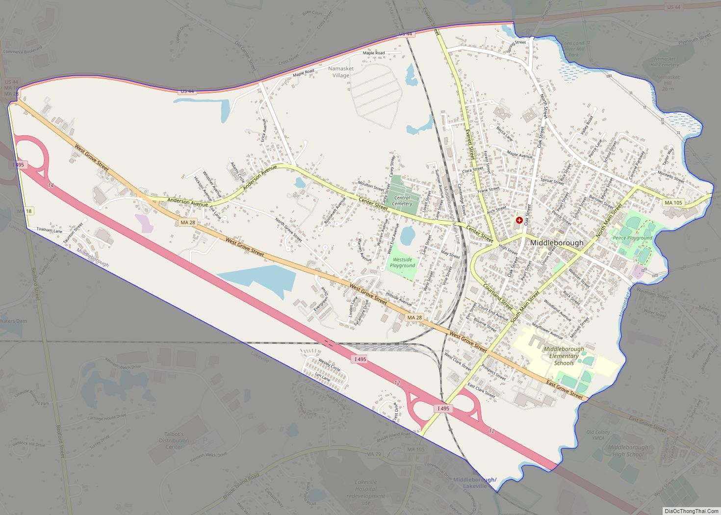
Middleborough Center is a census-designated place (CDP) in the town of Middleborough in Plymouth County, Massachusetts, United States. The population was 7,319 at the 2010 census. Middleborough Center CDP overview: Name: Middleborough Center CDP LSAD Code: 57 LSAD Description: CDP (suffix) State: Massachusetts County: Plymouth County Total Area: 4.03 sq mi (10.43 km²) Land Area: 3.93 sq mi (10.17 km²) Water … Read more

Map of Methuen Town city

Map of Methuen Town city

Methuen Town city overview: Name: Methuen Town city LSAD Code: 25 LSAD Description: city (suffix) State: Massachusetts County: Essex County FIPS code: 2540710 Online Interactive Map Methuen Town online map. Source: Basemap layers from Google Map, Open Street Map (OSM), Arcgisonline, Wmflabs. Boundary Data from Database of Global Administrative Areas. Methuen Town location map. Where … Read more

Map of Milton CDP, Massachusetts

Map of Milton CDP, Massachusetts

Milton is a town in Norfolk County, Massachusetts, United States and an affluent suburb of Boston. The population was 28,630 at the 2020 census. Milton is the birthplace of former U.S. President George H. W. Bush, and architect Buckminster Fuller. Milton was ranked by Money as the 2nd, 7th, 8th, and 17th best place to … Read more

Map of Millis-Clicquot CDP

Map of Millis-Clicquot CDP

Millis-Clicquot is a census-designated place (CDP) in the town of Millis in Norfolk County, Massachusetts, United States. The population was 4,403 at the 2010 census. The name “Clicquot” comes from the now-defunct Clicquot Club Company, a beverage manufacturer that was founded in the area in 1881. Millis-Clicquot CDP overview: Name: Millis-Clicquot CDP LSAD Code: 57 … Read more

Map of Millers Falls CDP

Map of Millers Falls CDP

Millers Falls is a census-designated place (CDP) in the towns of Montague and Erving in Franklin County, Massachusetts, United States. The population was 1,139 at the 2010 census. It is part of the Springfield, Massachusetts metropolitan statistical area. Millers Falls CDP overview: Name: Millers Falls CDP LSAD Code: 57 LSAD Description: CDP (suffix) State: Massachusetts … Read more

Map of Monument Beach CDP

Map of Monument Beach CDP

Monument Beach is a census-designated place (CDP) in the town of Bourne in Barnstable County, Massachusetts, United States. The population was 2,790 at the 2010 census. Monument Beach CDP overview: Name: Monument Beach CDP LSAD Code: 57 LSAD Description: CDP (suffix) State: Massachusetts County: Barnstable County Elevation: 66 ft (20 m) Total Area: 3.46 sq mi (8.97 km²) Land Area: … Read more

Map of Monson Center CDP

Map of Monson Center CDP

Monson Center is a census-designated place (CDP) in the town of Monson in Hampden County, Massachusetts, United States. The population was 2,107 at the 2010 census, out of a total 8,560 people in the town. It is part of the Springfield, Massachusetts Metropolitan Statistical Area. Monson Center CDP overview: Name: Monson Center CDP LSAD Code: … Read more

Map of Monomoscoy Island CDP

Map of Monomoscoy Island CDP

Monomoscoy Island is a census-designated place (CDP) in the town of Mashpee in Barnstable County, Massachusetts, United States. At the 2010 census, the CDP had a total population of 147. Monomoscoy Island CDP overview: Name: Monomoscoy Island CDP LSAD Code: 57 LSAD Description: CDP (suffix) State: Massachusetts County: Barnstable County Elevation: 7 ft (2 m) Total Area: … Read more

Map of Nantucket CDP

Map of Nantucket CDP

Nantucket is a census-designated place (CDP) in the town of Nantucket in Nantucket County, Massachusetts, United States. The population was 7,446 at the 2010 census. Nantucket CDP overview: Name: Nantucket CDP LSAD Code: 57 LSAD Description: CDP (suffix) State: Massachusetts County: Nantucket County Elevation: 43 ft (13 m) Total Area: 6.54 sq mi (16.95 km²) Land Area: 5.82 sq mi (15.08 km²) Water … Read more

Map of Nahant CDP

Map of Nahant CDP

Nahant (/nəˈhɑːnt/) is a town in Essex County, Massachusetts, United States. The population was 3,334 at the 2020 census, which makes it the smallest municipality by population in Essex County. With just 1.0 square mile (2.7 km) of land area, it is also the smallest municipality by area in the state. It is primarily a residential … Read more

Map of Needham CDP, Massachusetts

Map of Needham CDP, Massachusetts

Needham (/ˈniːdəm/ NEED-əm) is a town in Norfolk County, Massachusetts. A suburb of Boston, its population was 32,091 at the 2020 U.S. Census. It is home of Olin College. Needham CDP overview: Name: Needham CDP LSAD Code: 57 LSAD Description: CDP (suffix) State: Massachusetts County: Norfolk County Incorporated: 1711 Elevation: 49 m (162 ft) Total Area: 32.9 km² … Read more

Map of Newburyport city

Map of Newburyport city

Newburyport is a coastal city in Essex County, Massachusetts, United States, 35 miles (56 km) northeast of Boston. The population was 18,289 at the 2020 census. A historic seaport with a vibrant tourism industry, Newburyport includes part of Plum Island. The mooring, winter storage, and maintenance of recreational boats, motor and sail, still contribute a large … Read more