Monson Center is a census-designated place (CDP) in the town of Monson in Hampden County, Massachusetts, United States. The population was 2,107 at the 2010 census, out of a total 8,560 people in the town. It is part of the Springfield, Massachusetts Metropolitan Statistical Area.
| Name: | Monson Center CDP |
|---|---|
| LSAD Code: | 57 |
| LSAD Description: | CDP (suffix) |
| State: | Massachusetts |
| County: | Hampden County |
| Elevation: | 370 ft (110 m) |
| Total Area: | 3.37 sq mi (8.72 km²) |
| Land Area: | 3.35 sq mi (8.69 km²) |
| Water Area: | 0.01 sq mi (0.03 km²) |
| Total Population: | 1,952 |
| Population Density: | 581.82/sq mi (224.66/km²) |
| ZIP code: | 01057 (Monson) |
| Area code: | 413 |
| FIPS code: | 2542180 |
Online Interactive Map
Click on ![]() to view map in "full screen" mode.
to view map in "full screen" mode.
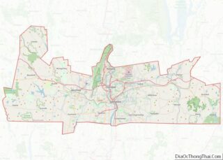
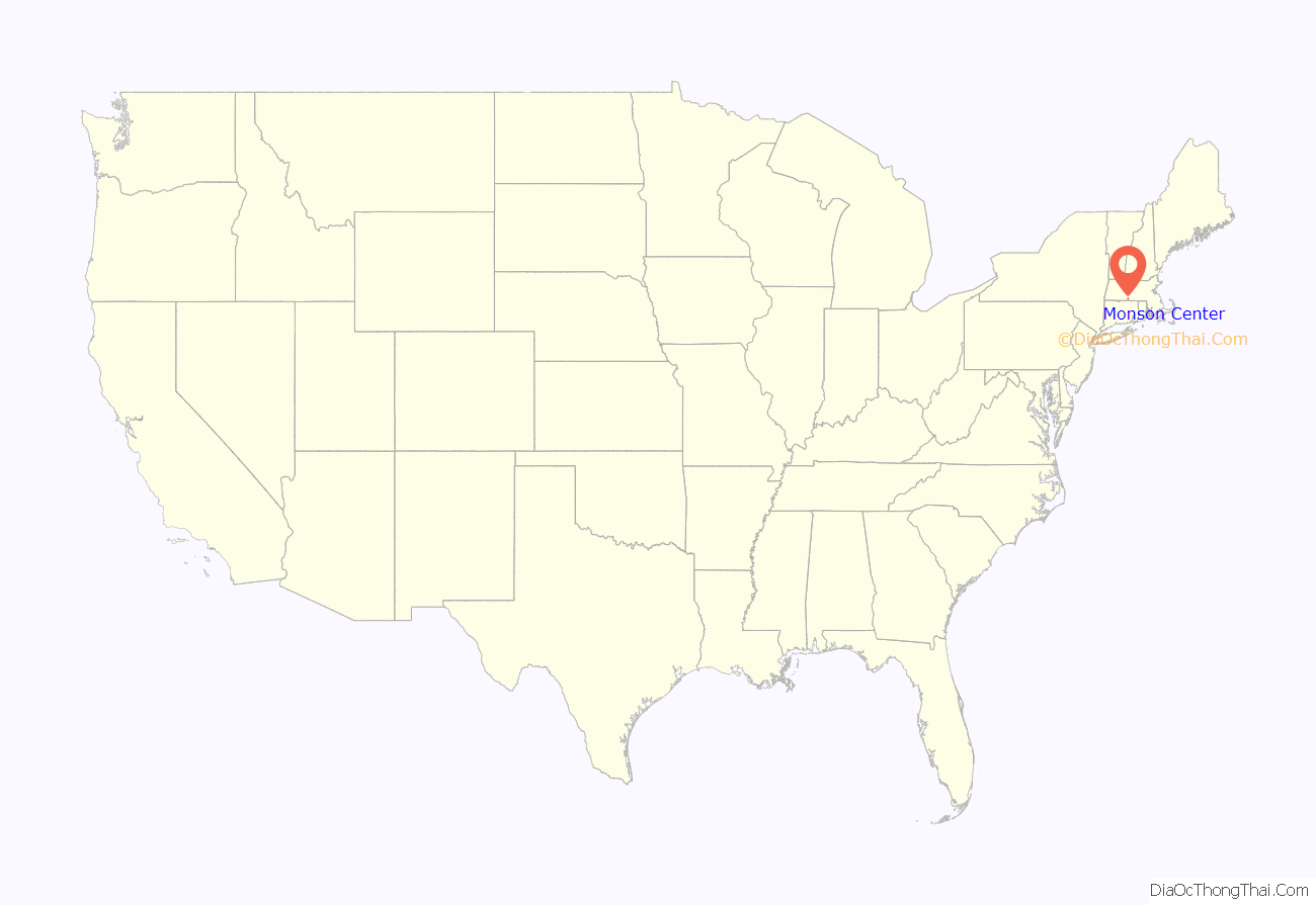
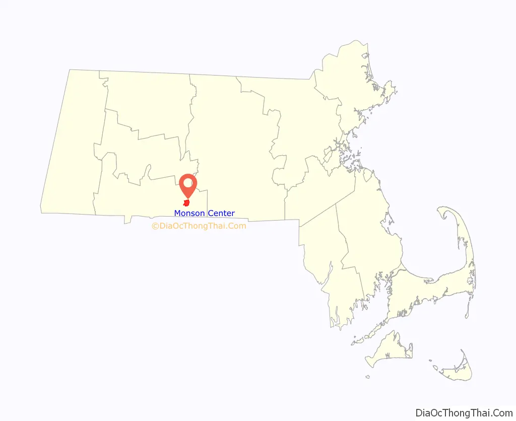
Monson Center location map. Where is Monson Center CDP?
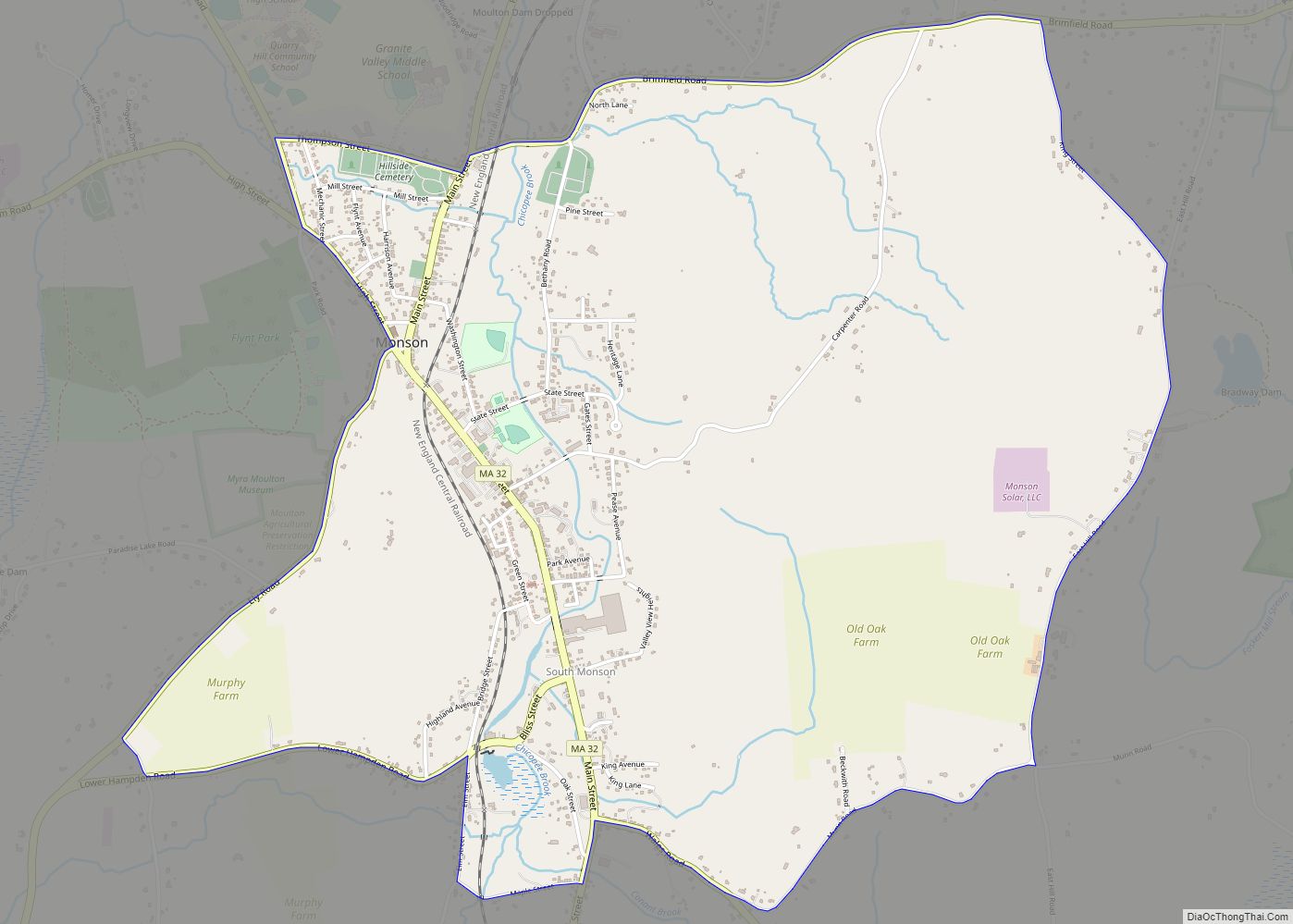
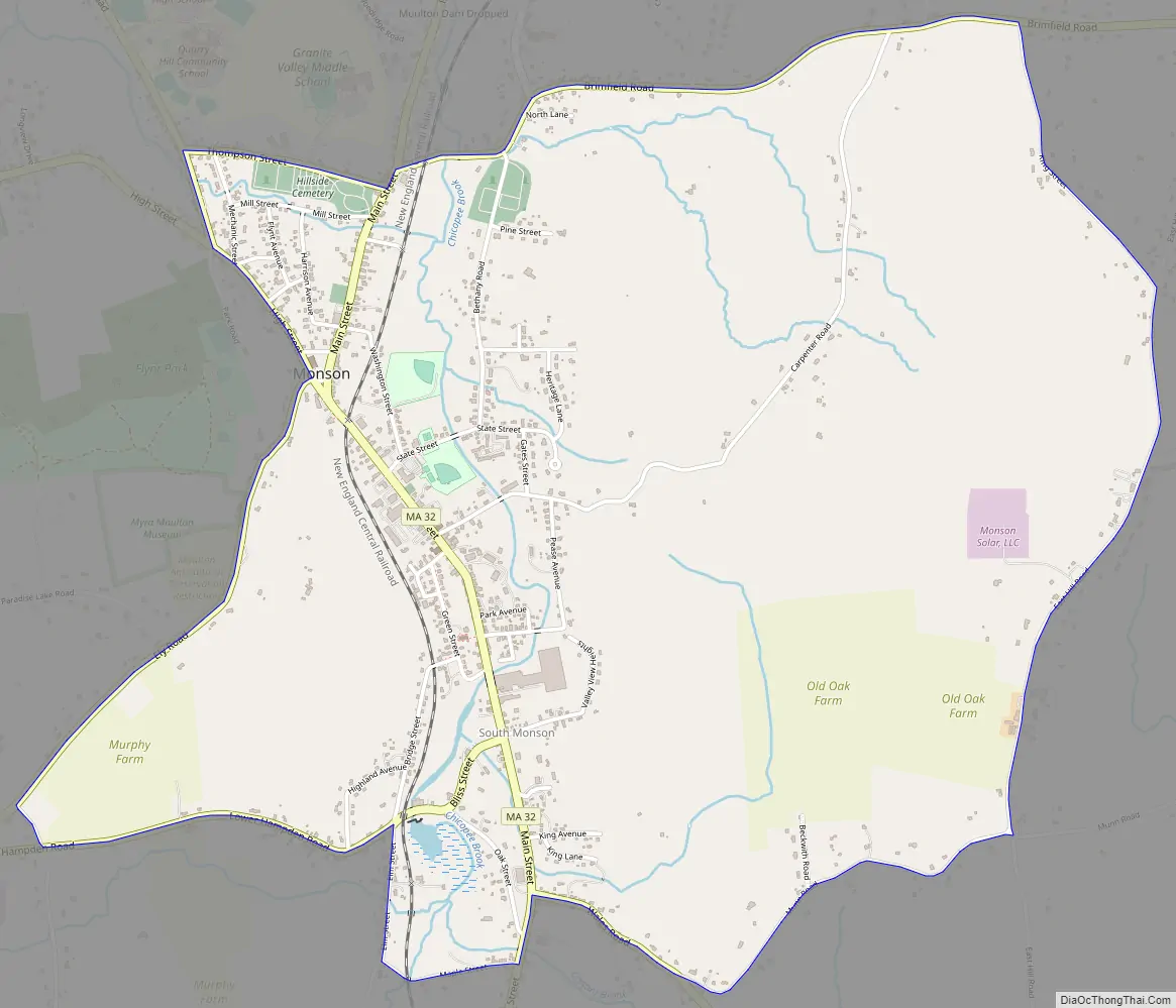
Monson Center Road Map
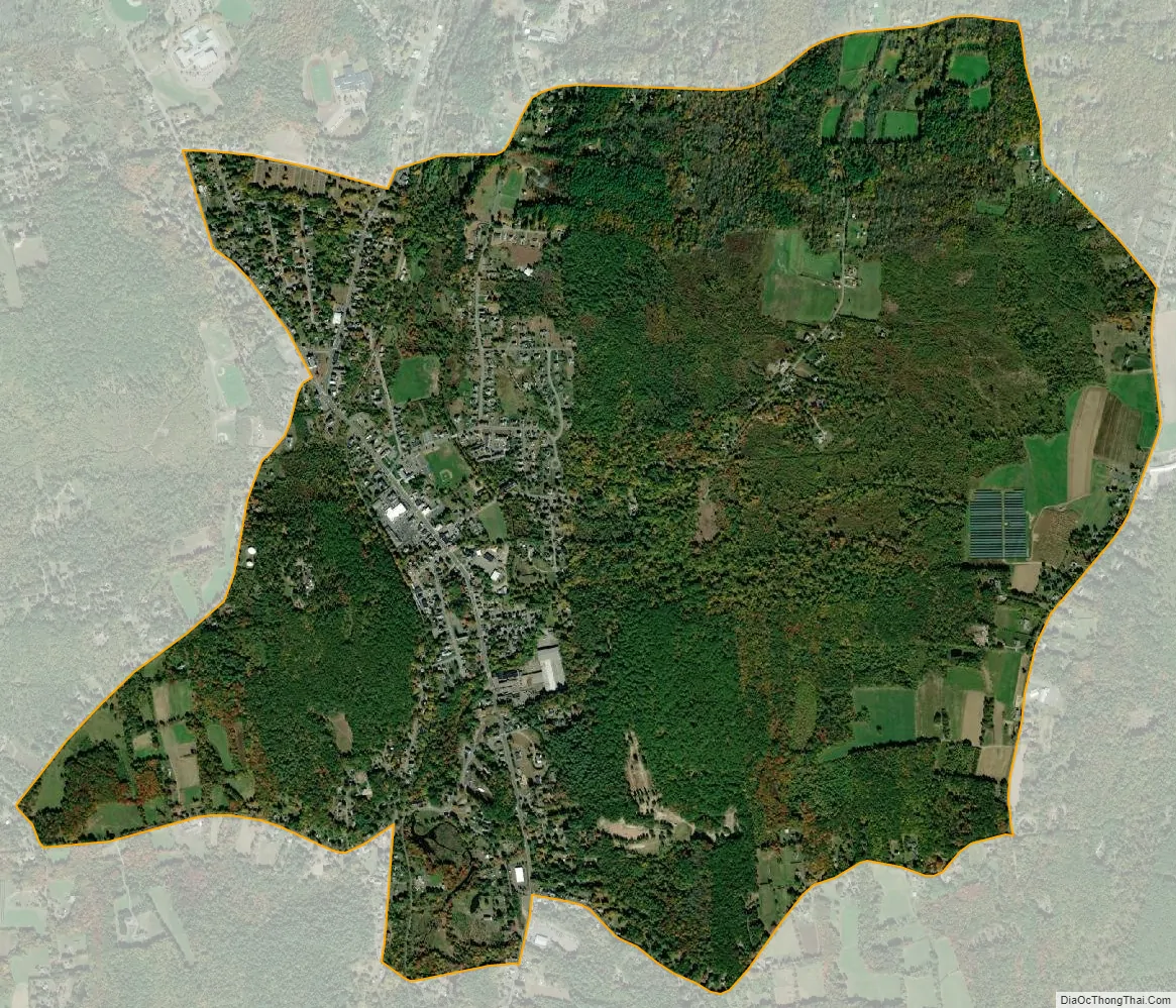
Monson Center city Satellite Map
Geography
Monson Center is in the east-central part of the town of Monson, located at 42°5′51″N 72°18′54″W / 42.09750°N 72.31500°W / 42.09750; -72.31500 (42.097633, -72.314865). The CDP includes the town center (“Monson”), the adjacent village of South Monson, and rural land to the east and west of the villages. The eastern limit of the CDP is King Street and East Hill Road; the southern limit is Munn Street, Maple Street, and Bliss Street; the western limit is Ely Road, High Street, and Margaret Street; and the northern limit is Thompson Street, Chestnut Street, and Brimfield Road. The two villages are in the valley of Chicopee Creek, a north-flowing tributary of the Quaboag River. Massachusetts Route 32 (Main Street) runs through the valley and the two villages, leading north 4 miles (6 km) to Palmer and south 11 miles (18 km) to Stafford Springs, Connecticut.
According to the United States Census Bureau, the Monson Center CDP has a total area of 3.4 square miles (8.7 km), of which 0.01 square miles (0.03 km), or 0.33%, are water.
See also
Map of Massachusetts State and its subdivision: Map of other states:- Alabama
- Alaska
- Arizona
- Arkansas
- California
- Colorado
- Connecticut
- Delaware
- District of Columbia
- Florida
- Georgia
- Hawaii
- Idaho
- Illinois
- Indiana
- Iowa
- Kansas
- Kentucky
- Louisiana
- Maine
- Maryland
- Massachusetts
- Michigan
- Minnesota
- Mississippi
- Missouri
- Montana
- Nebraska
- Nevada
- New Hampshire
- New Jersey
- New Mexico
- New York
- North Carolina
- North Dakota
- Ohio
- Oklahoma
- Oregon
- Pennsylvania
- Rhode Island
- South Carolina
- South Dakota
- Tennessee
- Texas
- Utah
- Vermont
- Virginia
- Washington
- West Virginia
- Wisconsin
- Wyoming