Map of Prudenville CDP

Map of Prudenville CDP

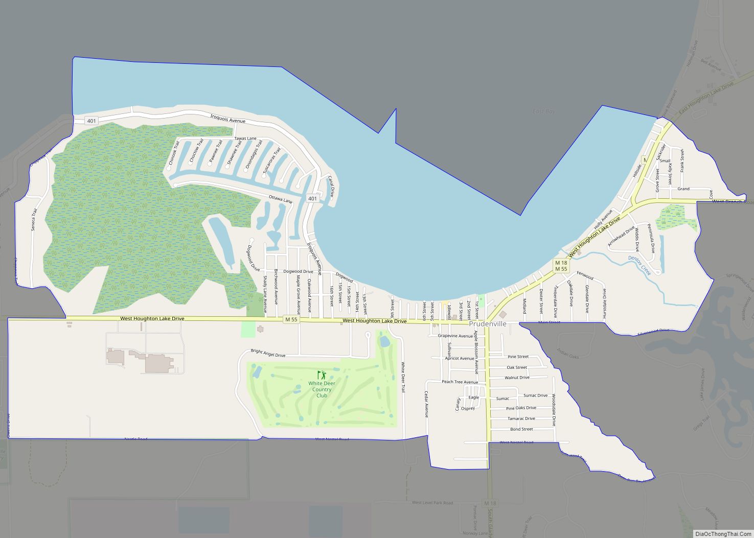
Prudenville is an unincorporated community and census-designated place (CDP) in Roscommon County in the U.S. state of Michigan. The population was 1,643 at the 2020 census. Prudenville is located within Denton Township. Prudenville CDP overview: Name: Prudenville CDP LSAD Code: 57 LSAD Description: CDP (suffix) State: Michigan County: Roscommon County Elevation: 1,145 ft (349 m) Total Area: … Read more

Map of Presque Isle Harbor CDP

Map of Presque Isle Harbor CDP

Presque Isle Harbor is an unincorporated community and census-designated place (CDP) in Presque Isle County in the U.S. state of Michigan. Its population was 600 as of the 2010 census. The CDP is located along the shores of Lake Huron within Presque Isle Township. Presque Isle Harbor CDP overview: Name: Presque Isle Harbor CDP LSAD … Read more

Map of Prescott village, Michigan

Map of Prescott village, Michigan

Prescott is a village in Ogemaw County of the U.S. state of Michigan. The population was 266 at the 2010 census. The village is located within Richland Township. Prescott village overview: Name: Prescott village LSAD Code: 47 LSAD Description: village (suffix) State: Michigan County: Ogemaw County Elevation: 797 ft (243 m) Total Area: 1.11 sq mi (2.87 km²) Land Area: … Read more

Map of Powers village

Map of Powers village, Michigan

Powers is a village in Menominee County in the U.S. state of Michigan. The population was 422 at the 2010 census. Located within Spalding Township, it is part of the Marinette micropolitan area. Powers village overview: Name: Powers village LSAD Code: 47 LSAD Description: village (suffix) State: Michigan County: Menominee County Founded: 1872 Incorporated: 1915 … Read more

Map of Potterville city

Map of Potterville city

Potterville is a city in Eaton County in the U.S. state of Michigan. The population was 2,617 at the 2010 census. Potterville city overview: Name: Potterville city LSAD Code: 25 LSAD Description: city (suffix) State: Michigan County: Eaton County Elevation: 902 ft (275 m) Total Area: 1.88 sq mi (4.87 km²) Land Area: 1.75 sq mi (4.52 km²) Water Area: 0.14 sq mi (0.35 km²) Total … Read more

Map of Reading city, Michigan

Map of Reading city, Michigan

Reading (/ˈrɛdɪŋ/ RED-ing) is a city in Hillsdale County in the U.S. state of Michigan. The population was 1,095 at the 2020 census. Located along M-49, the city is surrounded by Reading Township, but the two are administered autonomously. Reading city overview: Name: Reading city LSAD Code: 25 LSAD Description: city (suffix) State: Michigan County: … Read more

Map of Ravenna village, Michigan

Map of Ravenna village, Michigan

Ravenna is a village in Muskegon County in the U.S. state of Michigan. The population was 1,219 at the 2010 census. The village is located in Ravenna Township. Ravenna village overview: Name: Ravenna village LSAD Code: 47 LSAD Description: village (suffix) State: Michigan County: Muskegon County Elevation: 673 ft (205 m) Total Area: 1.19 sq mi (3.09 km²) Land Area: … Read more

Map of Rapid City city

Map of Rapid City CDP, Michigan

Rapid City is an unincorporated community and census-designated place (CDP) in Kalkaska County in the U.S. state of Michigan. At the 2020 census, the CDP had a population of 1,357. Rapid City is located within Clearwater Township, and is about 8 miles (13 km) northwest of Kalkaska. Rapid City CDP overview: Name: Rapid City CDP LSAD … Read more

Map of Quinnesec CDP

Map of Quinnesec CDP

Quinnesec is an unincorporated community in Dickinson County in the U.S. state of Michigan. It is a census-designated place (CDP) for statistical purposes and has no legally recognized status as a municipality. The population was 1,191 at the 2010 census. It is part of the Iron Mountain, MI–WI Micropolitan Statistical Area. Quinnesec is in Breitung … Read more

Map of Quincy village, Michigan

Map of Quincy village, Michigan

Quincy is a village in Branch County in the U.S. state of Michigan. The population was 1,652 at the 2010 census. The village is located within Quincy Township on U.S. Highway 12. Note: there is also another Quincy Township in Houghton County. Quincy village overview: Name: Quincy village LSAD Code: 47 LSAD Description: village (suffix) … Read more

Map of Reed City city

Map of Reed City

Reed City is a city in the U.S. state of Michigan. The population was 2,425 at the 2010 census. It is located in southwestern Osceola County and is the county seat. Reed City overview: Name: Reed City LSAD Code: 25 LSAD Description: city (suffix) State: Michigan County: Osceola County Elevation: 1,040 ft (317 m) Total Area: 2.13 sq mi … Read more

Map of Richmond city, Michigan

Map of Richmond city, Michigan

Richmond Township is a civil township of Macomb County, Michigan, United States. At the 2020 census, the township population was 3,544. The 2008 Census Bureau Estimate places the population at 3,784. A portion of the City of Richmond is adjacent to the township, but is administratively autonomous. Richmond city overview: Name: Richmond city LSAD Code: … Read more