Map of Wedgewood CDP

Map of Wedgewood CDP

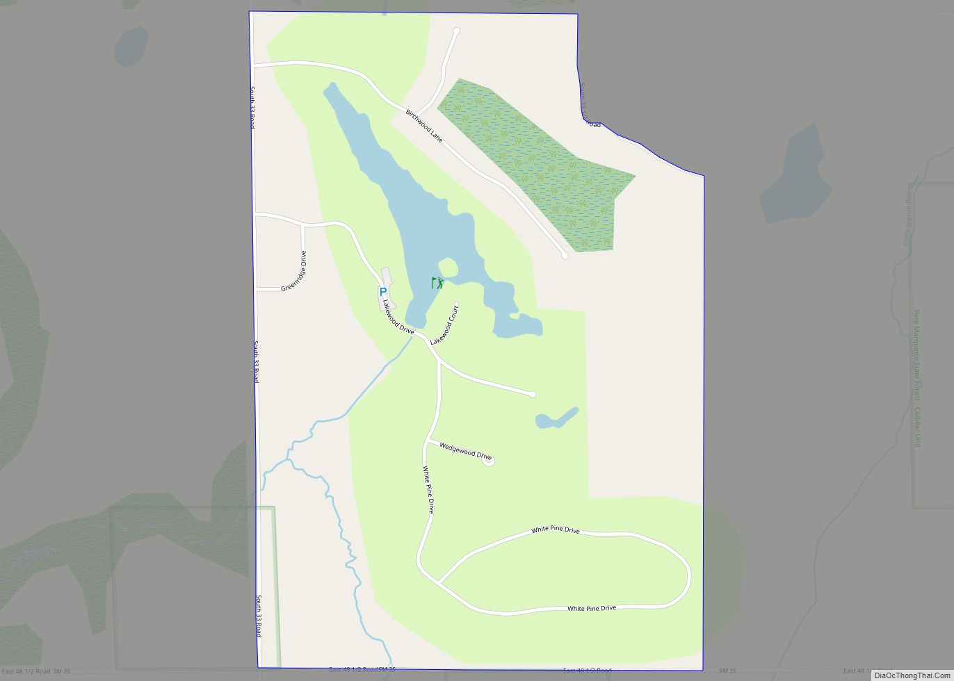
Wedgewood is an unincorporated community and census-designated place (CDP) in Wexford County in the U.S. state of Michigan. The population of the CDP was 227 at the 2020 census. Wedgewood is located within Cherry Grove Township. Wedgewood CDP overview: Name: Wedgewood CDP LSAD Code: 57 LSAD Description: CDP (suffix) State: Michigan County: Wexford County Elevation: … Read more

Map of Webberville village

Map of Webberville village, Michigan

Webberville is a village in Ingham County in the U.S. state of Michigan. It is located within Leroy Township. The population was 1,288 at the 2020 census. The village is just southeast of the junction of M-43 and M-52 with I-96. It is about 5 miles (8.0 km) southeast of Williamston and about 20 miles (32 km) … Read more

Map of Wayne city, Michigan

Map of Wayne city, Michigan

Wayne is a city in Wayne County in the U.S. state of Michigan. The population was 17,593 at the 2010 census. Wayne has a long history of automotive and transportation related manufacturing. Ford Motor Company currently has two plants in Wayne: Wayne Stamping & Assembly and the Michigan Assembly Plant, formerly known as the Michigan … Read more

Map of Westland city

Map of Westland city, Michigan

Westland is a city in Wayne County in the U.S. state of Michigan. It is located about 16 miles (26 km) west of downtown Detroit. As of the 2010 census, the city had a total population of 84,094. It is the 10th largest city and 12th largest municipality in Michigan. Westland city overview: Name: Westland city … Read more

Map of West Monroe CDP, Michigan

Map of West Monroe CDP, Michigan

West Monroe is an unincorporated community and census-designated place (CDP) in Monroe County in the U.S. state of Michigan. The population was 3,227 at the 2020 census. The CDP is located within Monroe Charter Township. West Monroe CDP overview: Name: West Monroe CDP LSAD Code: 57 LSAD Description: CDP (suffix) State: Michigan County: Monroe County … Read more

Map of West Ishpeming CDP

Map of West Ishpeming CDP

West Ishpeming is an unincorporated community in Marquette County in the U.S. state of Michigan. It is also a census-designated place (CDP) for statistical purposes and has no legal status as an incorporated municipality. The population was 2,552 at the 2020 census. The community is located mostly within Ishpeming Township with a small portion extending … Read more

Map of West Branch city, Michigan

Map of West Branch city, Michigan

West Branch is a city in the U.S. state of Michigan. As of the 2010 census, the city population was 2,139. It is the county seat of Ogemaw County. West Branch is mostly surrounded by West Branch Township, but the two are administered autonomously. West Branch city overview: Name: West Branch city LSAD Code: 25 … Read more

Map of Westphalia village, Michigan

Map of Westphalia village, Michigan

Westphalia is a village in Clinton County in the U.S. state of Michigan. The population was 924 at the time of the 2020 census. The village is in Westphalia Township, about 25 miles (40.2 km) northwest of Lansing and 55 miles (88.5 km) east of Grand Rapids. The village is known for its German and Catholic roots. … Read more

Map of Whitehall city

Map of Whitehall city, Michigan

Whitehall is a city in Muskegon County in the U.S. state of Michigan. The population was 2,706 at the 2010 census. The city is located in the southwest corner of Whitehall Township. Montague is its neighbor. It is located on White Lake (actually the mouth of the White River). Whitehall’s recorded history began circa 1859 … Read more

Map of White Pine CDP

Map of White Pine CDP, Michigan

White Pine is an unincorporated community and census-designated place (CDP) in Ontonagon County in the U.S. state of Michigan. The CDP had a population of 474 at the 2010 census. White Pine is located within Carp Lake Township. Much of White Pine was developed in the 1950s a housing community for miners at the White … Read more

Map of White Pigeon village

Map of White Pigeon village

White Pigeon is a village in St. Joseph County in the U.S. state of Michigan. The population was 1,522 at the 2010 census. The village is located within White Pigeon Township. White Pigeon village overview: Name: White Pigeon village LSAD Code: 47 LSAD Description: village (suffix) State: Michigan County: St. Joseph County Elevation: 817 ft (249 m) … Read more

Map of White Cloud city, Michigan

Map of White Cloud city, Michigan

White Cloud is a city in the U.S. state of Michigan, a small town on the bank of the White River. As of the 2020 census, the city population was 1,479. It is the county seat of Newaygo County. Being designated a trail town, the outdoors are a big part of life in White Cloud, … Read more