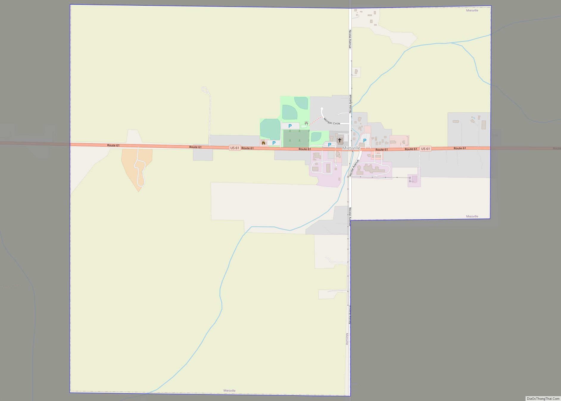
Map of Midway CDP, Minnesota
Midway is a census-designated place and unincorporated community in La Garde Township, Mahnomen County, Minnesota, United States. Its population was 26 as of the 2010 census. Midway CDP overview: Name: Midway CDP LSAD Code: 57 LSAD Description: CDP (suffix) State: Minnesota County: Mahnomen County Elevation: 1,342 ft (409 m) Total Area: 2.01 sq mi (5.21 km²) Land Area: 1.85 sq mi (4.80 km²) ... Read more
Map of Midway CDP, Minnesota
Map of Middle River city, Minnesota
Middle River is a city in Marshall County, Minnesota, United States, along the Middle River, from which the city took its name. The population was 304 at the 2020 census. Middle River city overview: Name: Middle River city LSAD Code: 25 LSAD Description: city (suffix) State: Minnesota County: Marshall County Elevation: 1,142 ft (348 m) Total Area: ... Read more
Map of Middle River city, Minnesota
Map of Merrifield CDP, Minnesota
Merrifield is an unincorporated community and census-designated place (CDP) in Lake Edward Township, Crow Wing County, Minnesota, United States, near Brainerd. It is along Crow Wing County Road 3 near County Road 127. Its population was 140 as of the 2010 census. Merrifield CDP overview: Name: Merrifield CDP LSAD Code: 57 LSAD Description: CDP (suffix) ... Read more
Map of Merrifield CDP, Minnesota
Map of Minnetonka city
Minnetonka (/ˌmɪnɪˈtɒŋkə/ MIN-i-TONG-kə) is a city in Hennepin County, Minnesota, United States. A western suburb of the Twin Cities, Minnetonka is located about 10 miles (16 km) west of downtown Minneapolis. At the 2020 census, the city’s population was 53,781. Minnetonka is the home of Cargill, the country’s largest privately owned company, and UnitedHealth Group, the ... Read more
Map of Minnetonka city
Map of Minnetonka Beach city
Minnetonka Beach is a community in Hennepin County, Minnesota, United States. The population was 539 at the 2010 census. Minnetonka Beach city overview: Name: Minnetonka Beach city LSAD Code: 25 LSAD Description: city (suffix) State: Minnesota County: Hennepin County Incorporated: 1894 Elevation: 942 ft (287 m) Total Area: 1.54 sq mi (3.98 km²) Land Area: 0.47 sq mi (1.21 km²) Water Area: 1.07 sq mi ... Read more
Map of Minnetonka Beach city
Map of Minnesota Lake city
Minnesota Lake is a city in Blue Earth and Faribault counties in the State of Minnesota. The population was 661 at the 2020 census. The bulk of the city is in Faribault County; a small part extends into Blue Earth County. Minnesota Lake city overview: Name: Minnesota Lake city LSAD Code: 25 LSAD Description: city ... Read more
Map of Minnesota Lake city
Map of Minnesota City
Minnesota City is a city in Winona County, Minnesota, United States. The population was 202 at the 2020 census. Minnesota City city overview: Name: Minnesota City city LSAD Code: 25 LSAD Description: city (suffix) State: Minnesota County: Winona County Founded: 1852 Elevation: 686 ft (209 m) Total Area: 0.25 sq mi (0.64 km²) Land Area: 0.25 sq mi (0.64 km²) Water Area: 0.00 sq mi ... Read more
Map of Minnesota City
Map of Minneota city
Minneota is a city in Lyon County, Minnesota, United States. The population was 1,392 at the 2010 census. Minneota city overview: Name: Minneota city LSAD Code: 25 LSAD Description: city (suffix) State: Minnesota County: Lyon County Elevation: 1,168 ft (356 m) Total Area: 1.45 sq mi (3.76 km²) Land Area: 1.45 sq mi (3.76 km²) Water Area: 0.00 sq mi (0.00 km²) Total Population: 1,366 Population ... Read more
Map of Minneota city
Map of Minneiska city
Minneiska is a city in Wabasha and Winona counties in the U.S. state of Minnesota. The population was 111 at the 2010 census. Minneiska city overview: Name: Minneiska city LSAD Code: 25 LSAD Description: city (suffix) State: Minnesota County: Wabasha County, Winona County Elevation: 699 ft (213 m) Total Area: 0.98 sq mi (2.55 km²) Land Area: 0.52 sq mi (1.33 km²) Water ... Read more
Map of Minneiska city
Map of Miltona city
Miltona is a city in Douglas County, Minnesota, United States. The population was 431 at the 2020 census. Miltona city overview: Name: Miltona city LSAD Code: 25 LSAD Description: city (suffix) State: Minnesota County: Douglas County Elevation: 1,404 ft (428 m) Total Area: 0.67 sq mi (1.74 km²) Land Area: 0.67 sq mi (1.74 km²) Water Area: 0.00 sq mi (0.00 km²) Total Population: 431 Population ... Read more
Map of Miltona city
Map of Milroy city, Minnesota
Milroy is a city in Redwood County, Minnesota, United States. The population was 252 at the 2010 census. It is named after Robert H. Milroy, a Union Army general in the American Civil War. Milroy city overview: Name: Milroy city LSAD Code: 25 LSAD Description: city (suffix) State: Minnesota County: Redwood County Elevation: 1,109 ft (338 m) ... Read more
Map of Milroy city, Minnesota
Map of Millville city, Minnesota
Millville is a city along the Zumbro River in Wabasha County, Minnesota, United States. The population was 182 at the 2010 census. Millville city overview: Name: Millville city LSAD Code: 25 LSAD Description: city (suffix) State: Minnesota County: Wabasha County Elevation: 830 ft (253 m) Total Area: 0.15 sq mi (0.40 km²) Land Area: 0.15 sq mi (0.39 km²) Water Area: 0.01 sq mi (0.01 km²) ... Read more
Map of Millville city, Minnesota