Map of Catron town

Map of Catron town

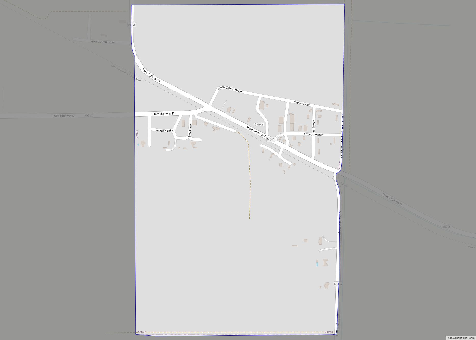
Catron is a city in New Madrid County, Missouri, United States. The population was 67 at the 2010 census. Catron town overview: Name: Catron town LSAD Code: 43 LSAD Description: town (suffix) State: Missouri County: New Madrid County Elevation: 282 ft (86 m) Total Area: 0.37 sq mi (0.96 km²) Land Area: 0.37 sq mi (0.96 km²) Water Area: 0.00 sq mi (0.00 km²) Total Population: … Read more

Map of Castle Point CDP

Map of Castle Point CDP

Castle Point is a census-designated place (CDP) in St. Louis County, Missouri, United States. The population was 3,962 at the 2010 census. Castle Point CDP overview: Name: Castle Point CDP LSAD Code: 57 LSAD Description: CDP (suffix) State: Missouri County: St. Louis County Elevation: 482 ft (147 m) Total Area: 0.61 sq mi (1.57 km²) Land Area: 0.61 sq mi (1.57 km²) Water … Read more

Map of Center city, Missouri

Map of Center city, Missouri

Center is a city in Ralls County, Missouri, United States. The population was 528 at the 2020 census. It is part of the Hannibal Micropolitan Statistical Area. Center city overview: Name: Center city LSAD Code: 25 LSAD Description: city (suffix) State: Missouri County: Ralls County Elevation: 719 ft (219 m) Total Area: 0.40 sq mi (1.03 km²) Land Area: 0.40 sq mi … Read more

Map of Cedar Hill CDP

Map of Cedar Hill CDP, Missouri

Cedar Hill is an unincorporated community and census-designated place (CDP) in northwest Jefferson County, Missouri, United States. The population was 1,721 at the 2010 census. Cedar Hill CDP overview: Name: Cedar Hill CDP LSAD Code: 57 LSAD Description: CDP (suffix) State: Missouri County: Jefferson County Elevation: 538 ft (164 m) Total Area: 2.29 sq mi (5.94 km²) Land Area: 2.29 sq mi … Read more

Map of Cedar Hill Lakes village

Map of Cedar Hill Lakes village

Cedar Hill Lakes is a village in Jefferson County, Missouri, United States. The population was 203 at the 2020 census. Cedar Hill Lakes village overview: Name: Cedar Hill Lakes village LSAD Code: 47 LSAD Description: village (suffix) State: Missouri County: Jefferson County Elevation: 630 ft (190 m) Total Area: 0.25 sq mi (0.65 km²) Land Area: 0.22 sq mi (0.56 km²) Water Area: … Read more

Map of Centerville city, Missouri

Map of Centerville city, Missouri

Centerville is a city in Reynolds County, Missouri, United States, situated along the West Fork of the Black River. The population was 167 at the 2020 census. It is the county seat of Reynolds County. Centerville city overview: Name: Centerville city LSAD Code: 25 LSAD Description: city (suffix) State: Missouri County: Reynolds County Elevation: 738 ft … Read more

Map of Centerview city

Map of Centerview city

Centerview is a village in Johnson County, Missouri, United States. The population was 267 at the 2010 census. Centerview city overview: Name: Centerview city LSAD Code: 25 LSAD Description: city (suffix) State: Missouri County: Johnson County Elevation: 873 ft (266 m) Total Area: 0.20 sq mi (0.51 km²) Land Area: 0.20 sq mi (0.51 km²) Water Area: 0.00 sq mi (0.00 km²) Total Population: 189 Population … Read more

Map of Centertown town, Missouri

Map of Centertown town, Missouri

Centertown is a village in Cole County, Missouri, United States. The population was 284 at the 2020 census. It is part of the Jefferson City, Missouri Metropolitan Statistical Area. Centertown town overview: Name: Centertown town LSAD Code: 43 LSAD Description: town (suffix) State: Missouri County: Cole County Founded: 1867 Elevation: 810 ft (250 m) Total Area: 0.95 sq mi … Read more

Map of Chain-O-Lakes village

Map of Chain-O-Lakes village

Chain-O-Lakes is a village in Roaring River Township of southeast Barry County, Missouri, United States. The population was 126 at the 2010 census. Chain-O-Lakes village overview: Name: Chain-O-Lakes village LSAD Code: 47 LSAD Description: village (suffix) State: Missouri County: Barry County Elevation: 1,024 ft (312 m) Total Area: 0.08 sq mi (0.22 km²) Land Area: 0.08 sq mi (0.22 km²) Water Area: 0.00 sq mi … Read more

Map of Chaffee city

Map of Chaffee city

Chaffee is a city in Scott County, Missouri, United States. The population was 2,955 at the 2010 census. Chaffee city overview: Name: Chaffee city LSAD Code: 25 LSAD Description: city (suffix) State: Missouri County: Scott County Elevation: 341 ft (104 m) Total Area: 1.85 sq mi (4.79 km²) Land Area: 1.79 sq mi (4.65 km²) Water Area: 0.05 sq mi (0.14 km²) Total Population: 3,057 Population … Read more

Map of Centralia city, Missouri

Map of Centralia city, Missouri

Centralia is a city in Boone County in the U.S. state of Missouri. The population was 4,541 at the 2020 census, with an estimated population of 4,244 in 2018. A very small portion of the city lies in Audrain County. The Boone County portion of Centralia (which forms the majority of the city) is part … Read more

Map of Champ village

Map of Champ village

Champ is a village in St. Louis County, Missouri, United States. The population was 10 at the 2020 census. Champ village overview: Name: Champ village LSAD Code: 47 LSAD Description: village (suffix) State: Missouri County: St. Louis County Elevation: 558 ft (170 m) Total Area: 0.80 sq mi (2.07 km²) Land Area: 0.80 sq mi (2.07 km²) Water Area: 0.00 sq mi (0.00 km²) Total Population: … Read more