Map of La Russell city

Map of La Russell city

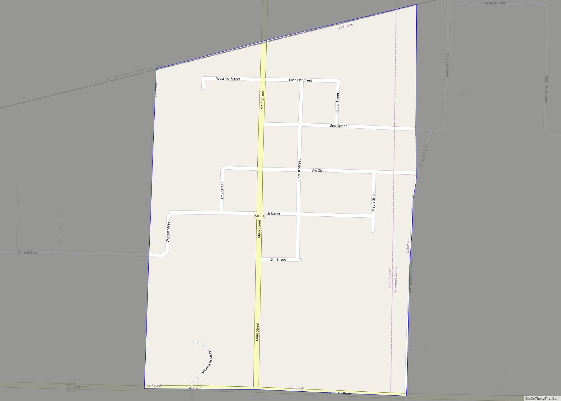
La Russell is a city in Jasper County, Missouri, United States. The population was 134 at the 2020 census. It is part of the Joplin, Missouri Metropolitan Statistical Area. La Russell city overview: Name: La Russell city LSAD Code: 25 LSAD Description: city (suffix) State: Missouri County: Jasper County Elevation: 1,079 ft (329 m) Total Area: 0.34 sq mi … Read more

Map of La Plata city, Missouri

Map of La Plata city, Missouri

La Plata is a city in Macon County, Missouri, United States. The population was 1,257 at the 2020 census. La Plata is located next to the Adair County line and is on a mainline of the BNSF Railway. The town is best known for La Plata station, which provides passenger rail service to Chicago and … Read more

Map of Laddonia city

Map of Laddonia city

Laddonia is a city in Audrain County, Missouri, United States. The population was 513 at the 2010 census. Laddonia city overview: Name: Laddonia city LSAD Code: 25 LSAD Description: city (suffix) State: Missouri County: Audrain County Elevation: 784 ft (239 m) Total Area: 0.71 sq mi (1.83 km²) Land Area: 0.70 sq mi (1.83 km²) Water Area: 0.00 sq mi (0.00 km²) Total Population: 502 Population … Read more

Map of Laclede city

Map of Laclede city

Laclede is a city in Linn County, Missouri. The population was 305 at the 2020 census, down from 345 in 2010. Laclede city overview: Name: Laclede city LSAD Code: 25 LSAD Description: city (suffix) State: Missouri County: Linn County Elevation: 797 ft (243 m) Total Area: 1.27 sq mi (3.28 km²) Land Area: 1.25 sq mi (3.24 km²) Water Area: 0.02 sq mi (0.04 km²) Total … Read more

Map of LaBarque Creek CDP

Map of LaBarque Creek CDP

LaBarque Creek is an unincorporated community and census-designated place (CDP) in Jefferson County, Missouri, United States. Its population was 1,558 as of the 2010 census. LaBarque Creek CDP overview: Name: LaBarque Creek CDP LSAD Code: 57 LSAD Description: CDP (suffix) State: Missouri County: Jefferson County Elevation: 630 ft (190 m) Total Area: 17.64 sq mi (45.68 km²) Land Area: 17.57 sq mi … Read more

Map of Lake Lafayette city

Map of Lake Lafayette city

Lake Lafayette is a city in Lafayette County, Missouri, and is part of the Kansas City metropolitan area within the United States. The population was 327 at the 2010 census. Lake Lafayette city overview: Name: Lake Lafayette city LSAD Code: 25 LSAD Description: city (suffix) State: Missouri County: Lafayette County Elevation: 856 ft (261 m) Total Area: … Read more

Map of Lake Annette city

Map of Lake Annette city

Lake Annette is a city in Cass County, Missouri, United States. The population was 100 at the 2010 census. It is part of the Kansas City metropolitan area. Lake Annette city overview: Name: Lake Annette city LSAD Code: 25 LSAD Description: city (suffix) State: Missouri County: Cass County Elevation: 846 ft (258 m) Total Area: 0.22 sq mi (0.57 km²) … Read more

Map of Ladue city

Map of Ladue city

Ladue is an inner-ring suburb of St. Louis, located in St. Louis County, Missouri. As of the 2020 census, the city had a population of 8,989. Ladue has the highest median household income of any city in Missouri with a population over 1,000. Ladue city overview: Name: Ladue city LSAD Code: 25 LSAD Description: city … Read more

Map of Lake St. Louis city

Map of Lake St. Louis city

The City of Lake St. Louis is a planned community situated around two lakes between Interstate 70 and Interstate 64 in western St. Charles County, Missouri, United States. The population was 16,707 as of the 2020 US Census. Lake St. Louis city overview: Name: Lake St. Louis city LSAD Code: 25 LSAD Description: city (suffix) … Read more

Map of Lake Ozark city

Map of Lake Ozark city

Lake Ozark is a city in Camden and Miller counties in the U.S. state of Missouri, near its namesake, the Lake of the Ozarks. The population was 2,077 at the 2020 census. Lake Ozark city overview: Name: Lake Ozark city LSAD Code: 25 LSAD Description: city (suffix) State: Missouri County: Camden County, Miller County Elevation: … Read more

Map of Lake Lotawana city

Map of Lake Lotawana city

Lake Lotawana is a city in Jackson County, Missouri, United States and is located 35 miles southeast of downtown Kansas City bordering Blue Springs and Lee’s Summit. The population was 2,310 as of the 2020 census. It is part of the Kansas City metropolitan area. The city derives its name from the lake that takes … Read more

Map of Lake Viking CDP

Map of Lake Viking CDP

Lake Viking is an unincorporated community and census-designated place (CDP) in Daviess County, Missouri, United States. The population was 486 at the 2020 census. Lake Viking CDP overview: Name: Lake Viking CDP LSAD Code: 57 LSAD Description: CDP (suffix) State: Missouri County: Daviess County Elevation: 866 ft (264 m) Total Area: 8.75 sq mi (22.66 km²) Land Area: 7.88 sq mi (20.40 km²) … Read more