The City of Lake St. Louis is a planned community situated around two lakes between Interstate 70 and Interstate 64 in western St. Charles County, Missouri, United States. The population was 16,707 as of the 2020 US Census.
| Name: | Lake St. Louis city |
|---|---|
| LSAD Code: | 25 |
| LSAD Description: | city (suffix) |
| State: | Missouri |
| County: | St. Charles County |
| Elevation: | 564 ft (172 m) |
| Total Area: | 9.35 sq mi (24.22 km²) |
| Land Area: | 8.54 sq mi (22.12 km²) |
| Water Area: | 0.81 sq mi (2.10 km²) |
| Total Population: | 16,707 |
| Population Density: | 1,956.32/sq mi (755.32/km²) |
| ZIP code: | 63367 |
| Area code: | 636 |
| FIPS code: | 2940043 |
| GNISfeature ID: | 1669602 |
| Website: | http://www.lakesaintlouis.com/ |
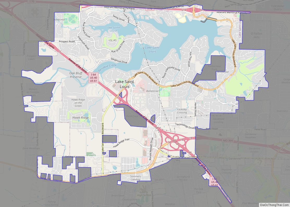
Online Interactive Map
Click on ![]() to view map in "full screen" mode.
to view map in "full screen" mode.
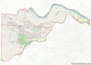
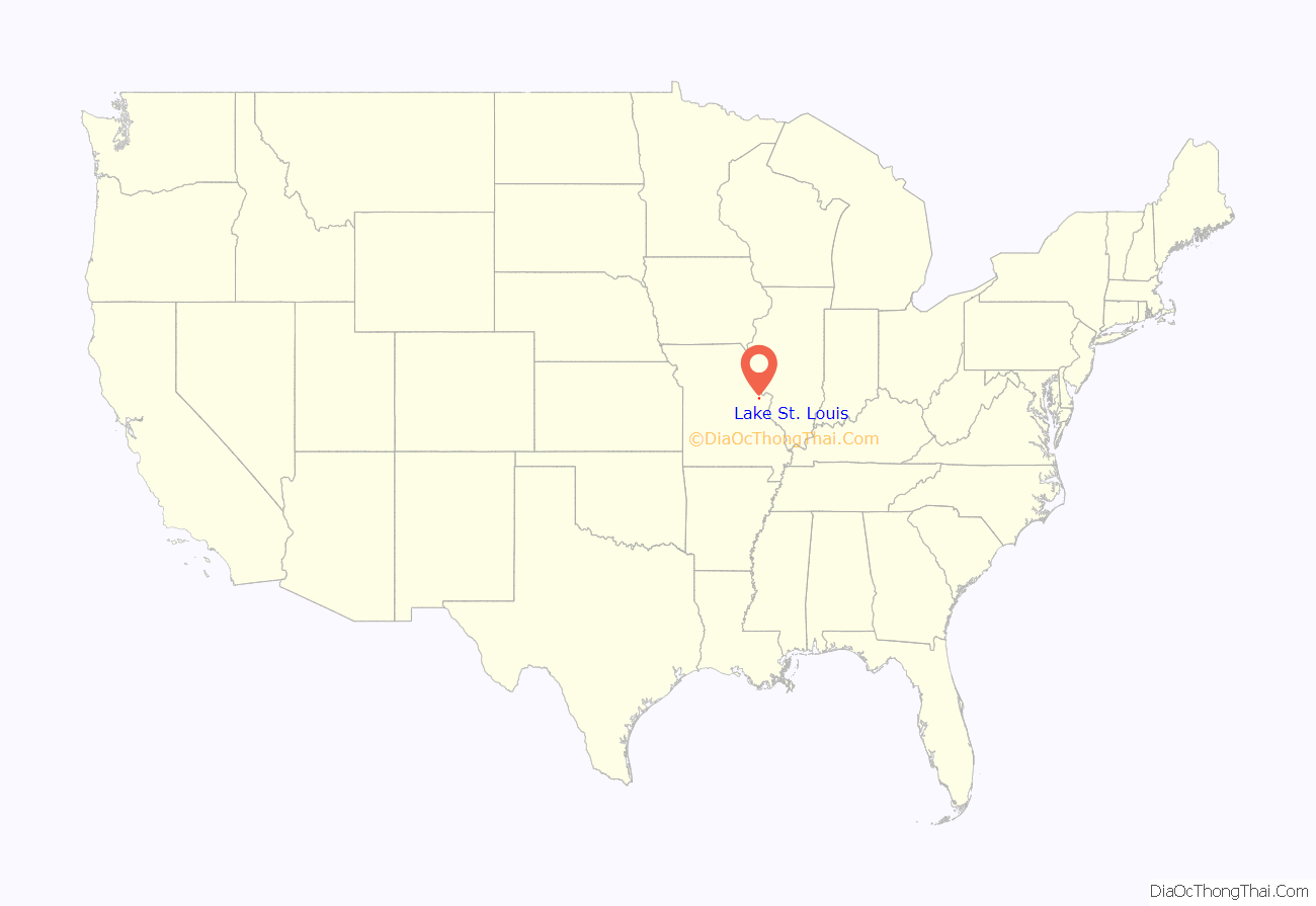
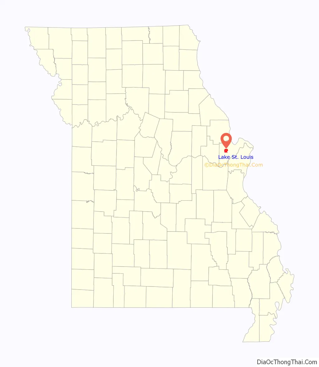
Lake St. Louis location map. Where is Lake St. Louis city?
History
In January 1961, Ellis Ellerman and Ira Nathan begin developing plans for a private resort community, a popular concept in the 1960s in the St. Louis region. The vision was for a weekend resort with a lake large enough for recreation and a location close to St. Louis. Ellerman and Nathan hired engineers to begin the initial planning of the lake and community, and Nathan named the project “Lake St. Louis” in 1961.
Ellerman and Nathan formed Trails Lake Development Corp. in 1962, and by August 31 of that year, 10 lots had already been sold in the project, which was to feature a 625 lake (PD article 8-25-63). Ellerman and Nathan lacked adequate financing and business experience, and they soon found themselves in over their heads on the project. Ellerman and Nathan were soon joined by several other investors to keep the project afloat, including R. T. Crow. The financial troubles continued for Ellerman and Nathan, and The Healey Discount Corp., owned by Crow and the three other investors, foreclosed on Ellerman and Nathan’s Trails Lake Development Corp. in June 1966.
R. T. Crow felt the location of “Lake St. Louis” (indicating a change of ownership and the “planned community” concept), between two major highways, I-70 and Rt. 61, and the westward growth of St. Louis justified building a new town, rather than just the weekend community envisioned by Ellerman and Nathan. He investigated the idea of new towns, including visiting many others in the east. In the end, Crow bought out the other three investors who were part of The Healey Discount Corp., and he became the sole developer of the Lake St. Louis development. St. Charles County approved the preliminary plan for Lake St. Louis in April 1967. People who had purchased lots from the first developers were given credits for lots in the new Lake St. Louis project.
The first residents of Lake St. Louis were the Neal family, who moved to an existing home on the property in January, 1968. Gene Neal later became a vice president of one of Crow’s companies, his wife Hazel managed the Lake St. Louis Country Club. Son Mike played the “boy” of various mythical families in the development’s television and print advertising, and later was a founding member of the community’s water ski club.
By 1969, the 85-acre (34 ha) Lake Ste. Louise, the 9-hole, 3-par golf course, tennis courts, clubhouse and pool were open. Construction on the dam for the 600-acre (2.4 km) Lake St. Louis, the larger of the two lakes in the community, began in 1968. It was completed in 1972, and Crow filed for Chapter 11 Bankruptcy in 1974 – an action brought on in part by the energy crisis. Interstate highway speeds were reduced from 70 to 55 mph (113 to 89 km/h). Also, the I-70 bridge over the Missouri River was closed partially while the second bridge was added. The combination of events suddenly made Lake St. Louis too far away from employment and retail centers.
With Crow out of the picture, and the looming threat of annexation from O’Fallon on the East and Wentzville on the West, the residents of the Harbor Town area of the community petitioned St. Charles County Circuit Court for incorporation of the Town of Harbor Town. The Court granted the petition in June, 1975, and with the approval of the incorporation, the Circuit Court appointed a Board of Trustees: George Heidelbaugh, Charles Bailey, David Spitznagel, Betty Patton and Howard Haddock as Chairman. In December 1975, the town boundaries were expanded to include what was known as Phase A, the westernmost portion of the city. In 1976, a special census was conducted that counted 2,445 residents. Residents voted in 1977 to change the name to Lake St. Louis and become a 4th Class City under the Revised Statutes of Missouri. Howard Haddock was elected as the first mayor of the city.
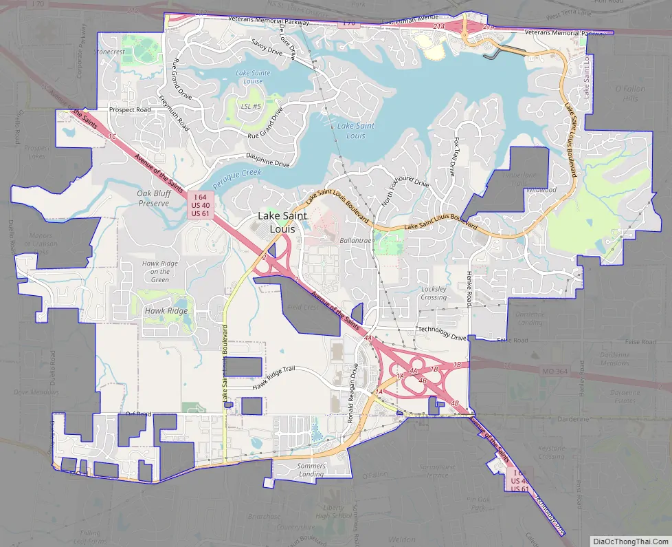
Lake St. Louis Road Map
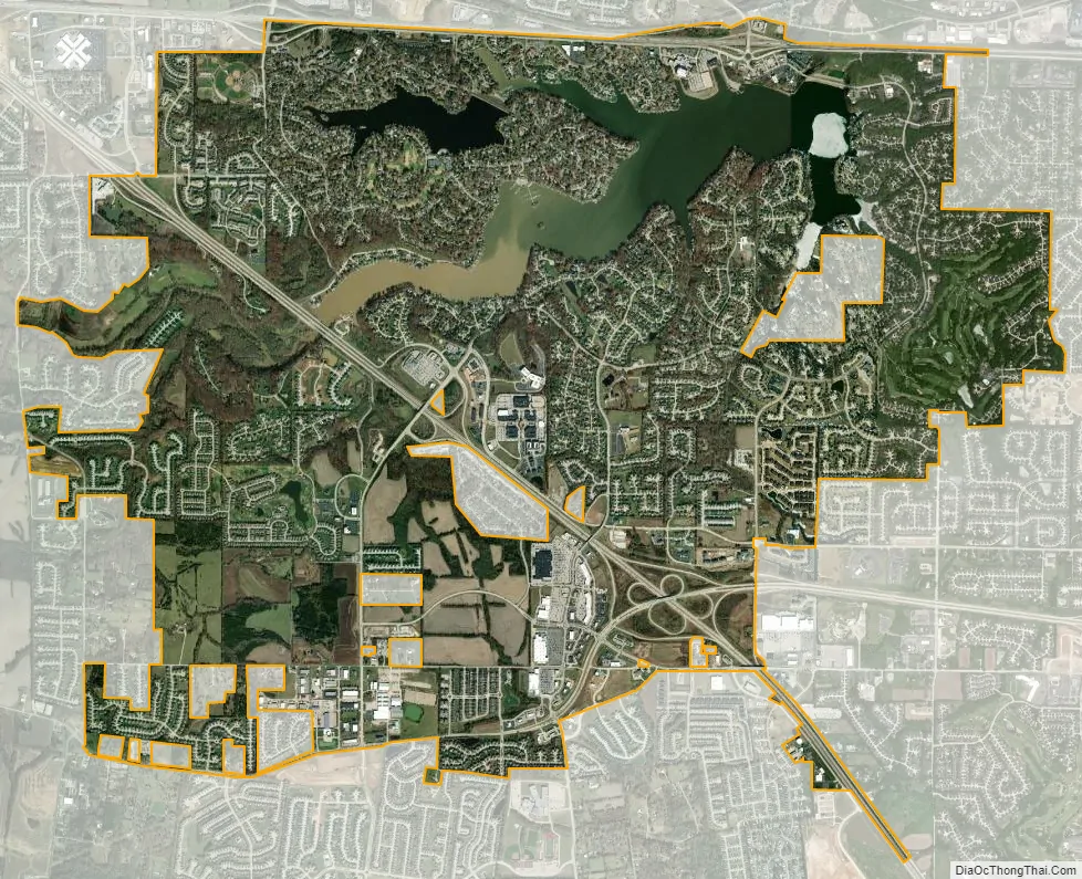
Lake St. Louis city Satellite Map
Geography
Lake St. Louis is located at 38°47′8″N 90°47′1″W / 38.78556°N 90.78361°W / 38.78556; -90.78361 (38.785620, -90.783610). According to the United States Census Bureau, the city has a total area of 8.72 square miles (22.58 km), of which 7.91 square miles (20.49 km) is land and 0.81 square miles (2.10 km) is water.
See also
Map of Missouri State and its subdivision:- Adair
- Andrew
- Atchison
- Audrain
- Barry
- Barton
- Bates
- Benton
- Bollinger
- Boone
- Buchanan
- Butler
- Caldwell
- Callaway
- Camden
- Cape Girardeau
- Carroll
- Carter
- Cass
- Cedar
- Chariton
- Christian
- Clark
- Clay
- Clinton
- Cole
- Cooper
- Crawford
- Dade
- Dallas
- Daviess
- De Kalb
- Dent
- Douglas
- Dunklin
- Franklin
- Gasconade
- Gentry
- Greene
- Grundy
- Harrison
- Henry
- Hickory
- Holt
- Howard
- Howell
- Iron
- Jackson
- Jasper
- Jefferson
- Johnson
- Knox
- Laclede
- Lafayette
- Lawrence
- Lewis
- Lincoln
- Linn
- Livingston
- Macon
- Madison
- Maries
- Marion
- McDonald
- Mercer
- Miller
- Mississippi
- Moniteau
- Monroe
- Montgomery
- Morgan
- New Madrid
- Newton
- Nodaway
- Oregon
- Osage
- Ozark
- Pemiscot
- Perry
- Pettis
- Phelps
- Pike
- Platte
- Polk
- Pulaski
- Putnam
- Ralls
- Randolph
- Ray
- Reynolds
- Ripley
- Saint Charles
- Saint Clair
- Saint Francois
- Saint Louis
- Sainte Genevieve
- Saline
- Schuyler
- Scotland
- Scott
- Shannon
- Shelby
- Stoddard
- Stone
- Sullivan
- Taney
- Texas
- Vernon
- Warren
- Washington
- Wayne
- Webster
- Worth
- Wright
- Alabama
- Alaska
- Arizona
- Arkansas
- California
- Colorado
- Connecticut
- Delaware
- District of Columbia
- Florida
- Georgia
- Hawaii
- Idaho
- Illinois
- Indiana
- Iowa
- Kansas
- Kentucky
- Louisiana
- Maine
- Maryland
- Massachusetts
- Michigan
- Minnesota
- Mississippi
- Missouri
- Montana
- Nebraska
- Nevada
- New Hampshire
- New Jersey
- New Mexico
- New York
- North Carolina
- North Dakota
- Ohio
- Oklahoma
- Oregon
- Pennsylvania
- Rhode Island
- South Carolina
- South Dakota
- Tennessee
- Texas
- Utah
- Vermont
- Virginia
- Washington
- West Virginia
- Wisconsin
- Wyoming